
Okanogan Highlands | Priest Lake Selkirks
Colville National Forest
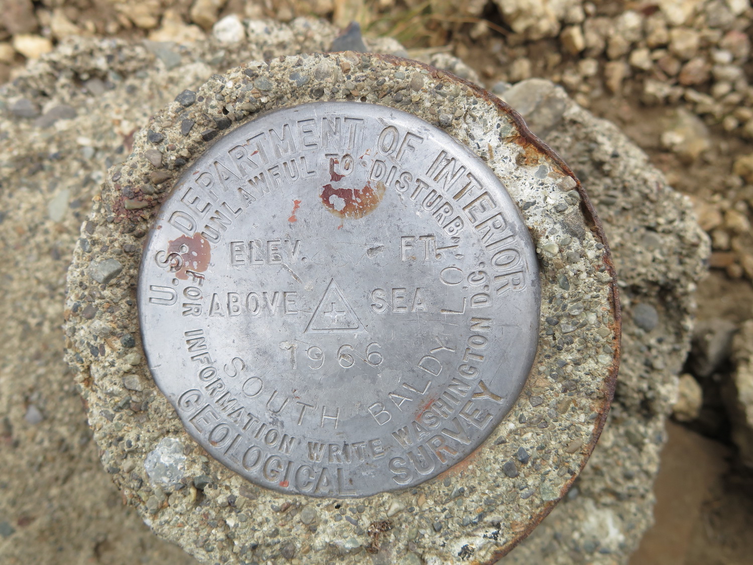
Location: 48.423448, -117.137496
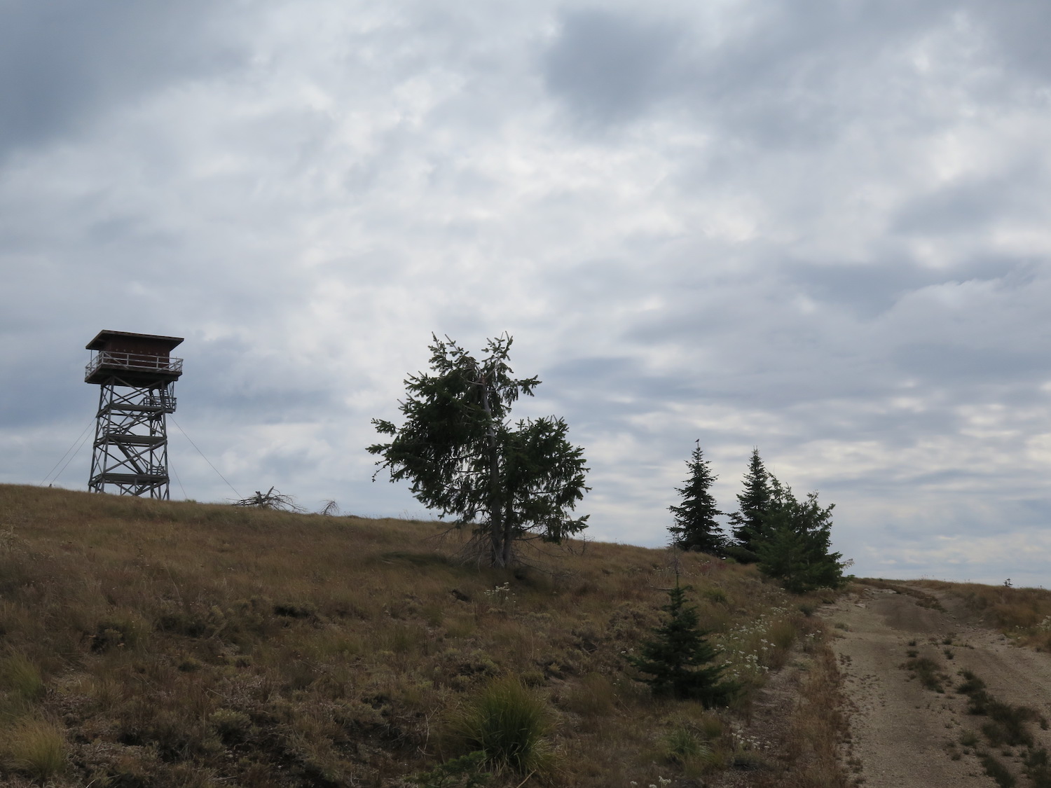
Summit Elevation: 5,961′
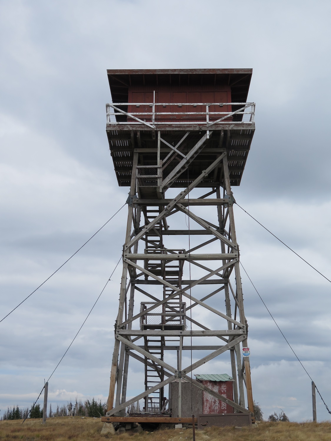
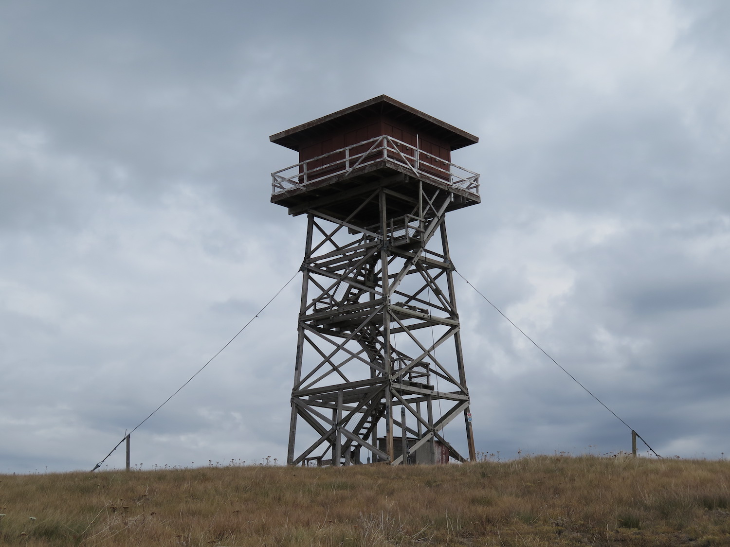
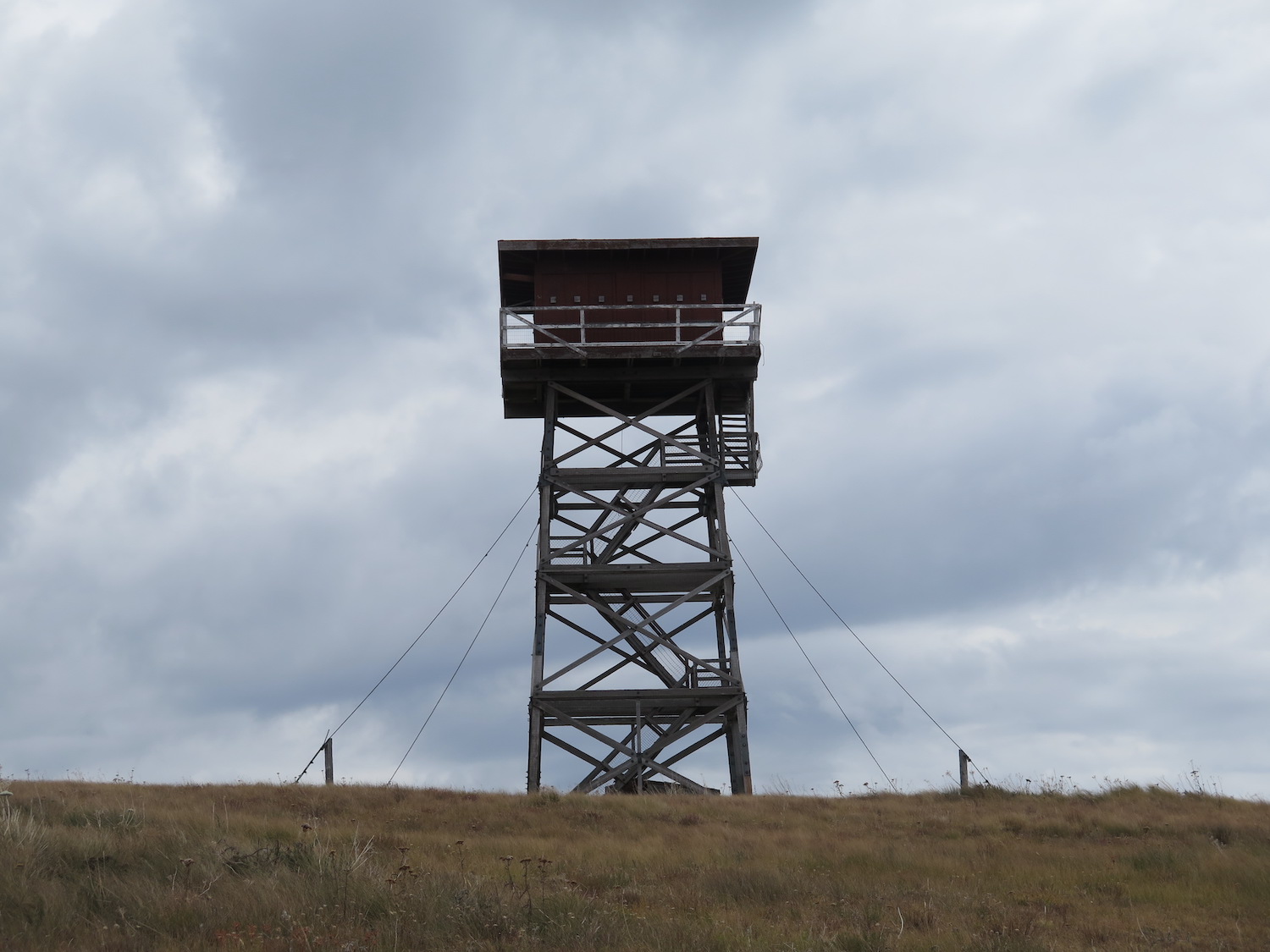
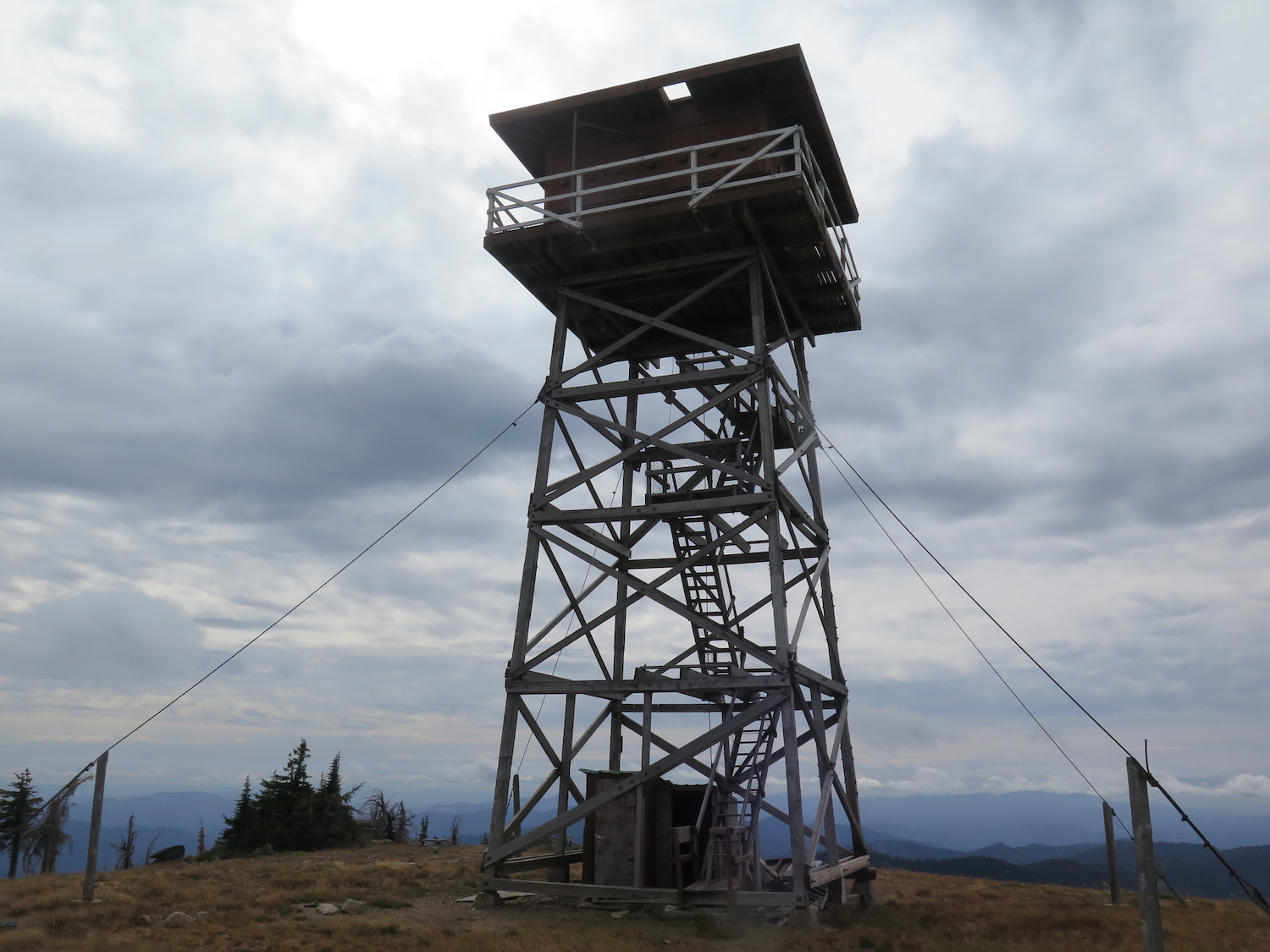
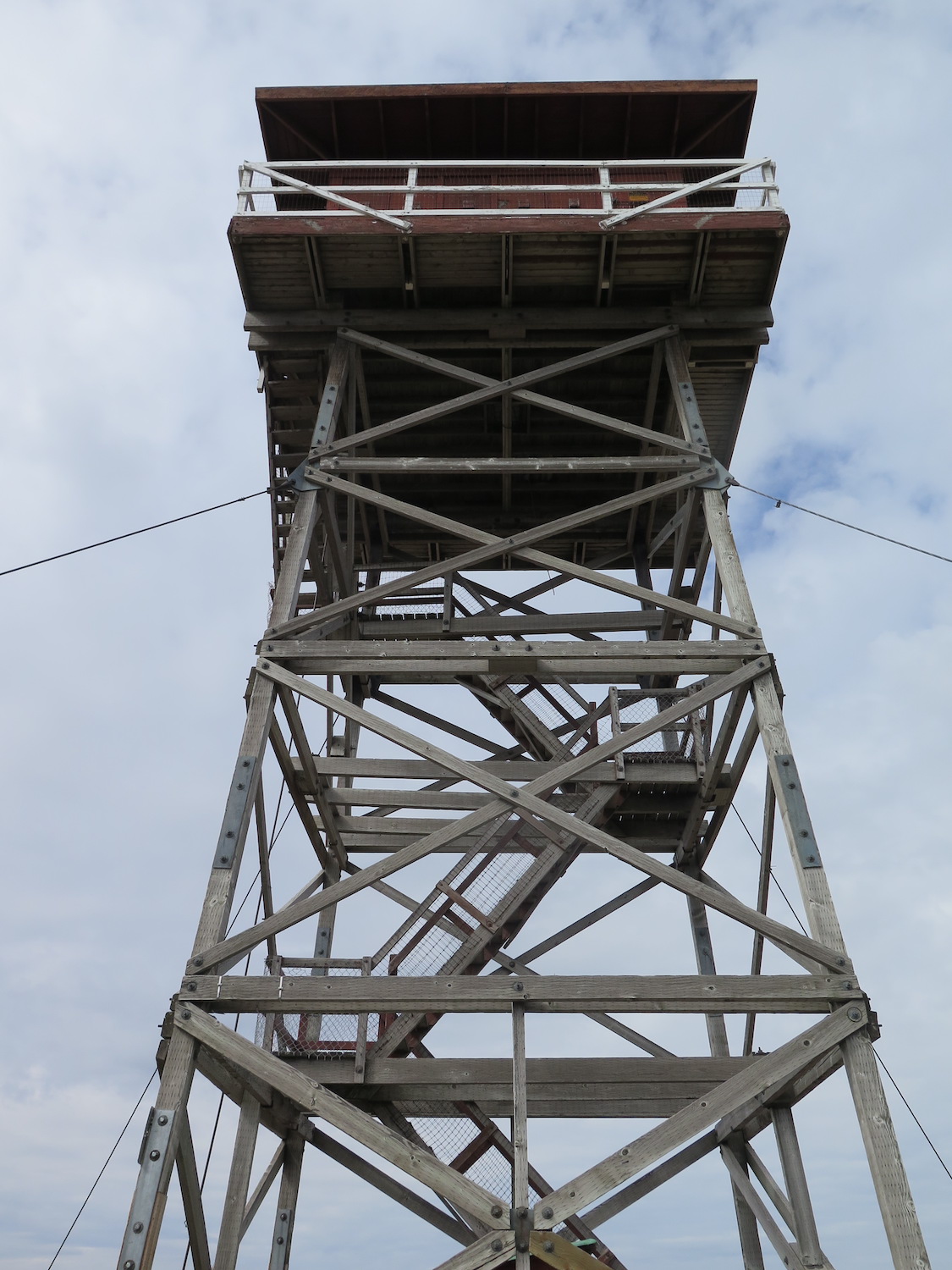
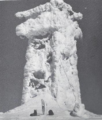
Lookout Type: 41′ tower with R-6 cab
Site Established: 1909
Current Structure Built: 1960
Date Visited: 9/11/18
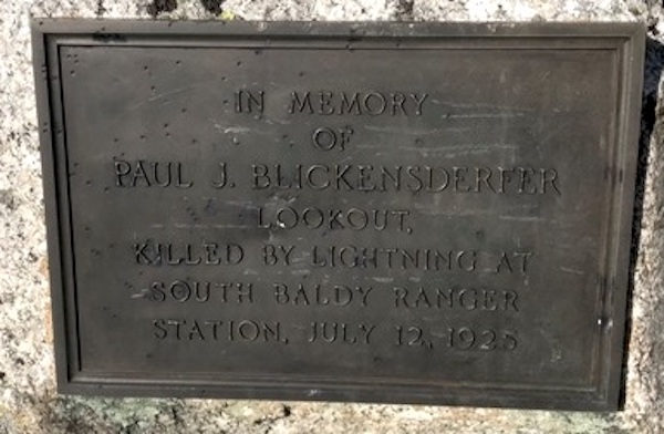
South Baldy was staffed seasonally until 2010 and was threatened by the 2015 Baldy Fire. In 1925 a lookout on staff, Paul Blickensderfer, was struck and killed by lightning. A memorial for him is present on the summit.
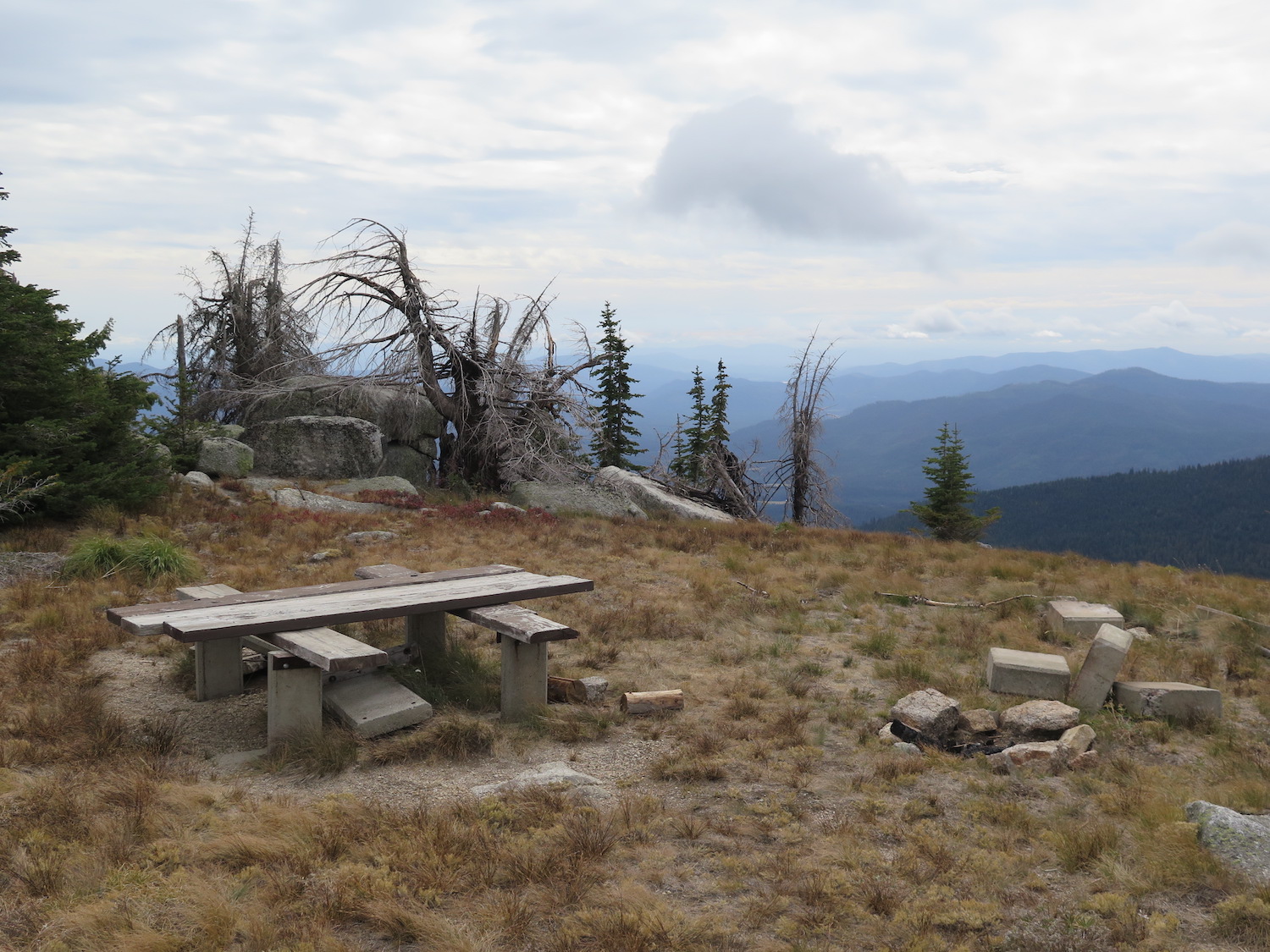

Photos from 2018.
History.
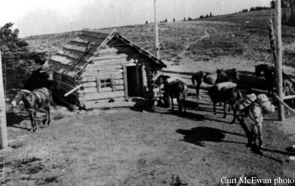
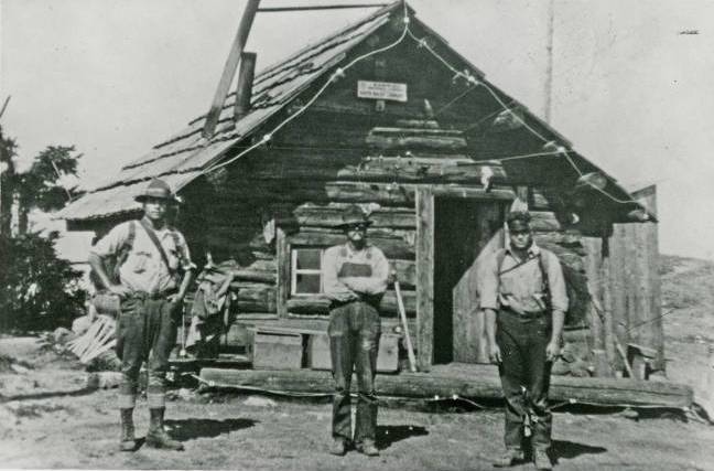
Four lookouts have sat atop South Baldy, the first a small one-room log cabin built in July 1909. This lookout station partnered with two others on White Tail Butte and Mount Greeley to test and experiment with a US Army heliograph as a means to communicate with distant and difficult to access points. (The Newport Miner).
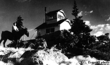
A log cabin lookout was built in 1915, followed by an R-3 cupola cabin in 1929, then finally the present 41′ treated timber tower with R-6 flat cab in 1960.
South Baldy was regularly staffed in summers until thieves vandalized the copper lightning protection in 2010. In 2015, the tower was completely surrounded by the Baldy Fire but managed to survive.
On July 12, 1925, lookout Paul Blickensderfer was killed by lightning while on staff. An excerpt from an article, Early Day Ranger in the Priest Lake Country, written by Henry A. Peterson details the incident:
During 1925 while I was on Cuban Hill, the upper part of the Upper Westbranch drainage was burned over by a series of fires set by a dry lightning storm. On the day prior to this storm, District Ranger Murray and Assistant Forest Supervisor Francis Carroll were locating trail in the vicinity of South Baldy lookout and decided to spend the night at the lookout. A forestry student by the name of Blickensderfer was the lookout and Bill Blake, a native in the Bear Paw country, was the smokechaser. Since Murray and Carroll had hiked all day, Blickensderfer and Blake insisted that they sleep on the regular bunks. Blickensderfer and Blake slept on the floor with Blickensderfer next to and in front of the stove. Lookout buildings had no lightning protection those days. During the night a bolt of lightning came down the stovepipe, jumped to the floor under where Blickensderfer was sleeping, killing him instantly. Murray and Carroll gave artificial respiration instantly and worked over him until it was evident that nothing could revive him. Blake was not hurt and immediately grabbed his pack and controlled three fires before returning to the lookout. A bronze plaque was later cemented to a rock near the lookout building and the present Blickensderfer Creek was named in his honor. This storm was also the cause of the fires, which burned over the upper part of the Upper Westbranch drainage. Also caused the death of two other men.
One afternoon on a steep south slope, south of the present Gleason Mountain, the fire picked up in fury. The overhead, fearing a crown fire, decided to remove the crew to safety and ordered all the men to follow.
Two men, Jackson and Gleason, decided there was a safer way out and refused to follow. Their bodies were later found where they had been trapped by the crown fire while trying to gain the ridge top.
The present Gleason Mountain and Jackson Mountain were named in honor of these men. As I recall, both were transient firefighters. I believe both were laid to rest in the Priest River Cemetery.
The route.
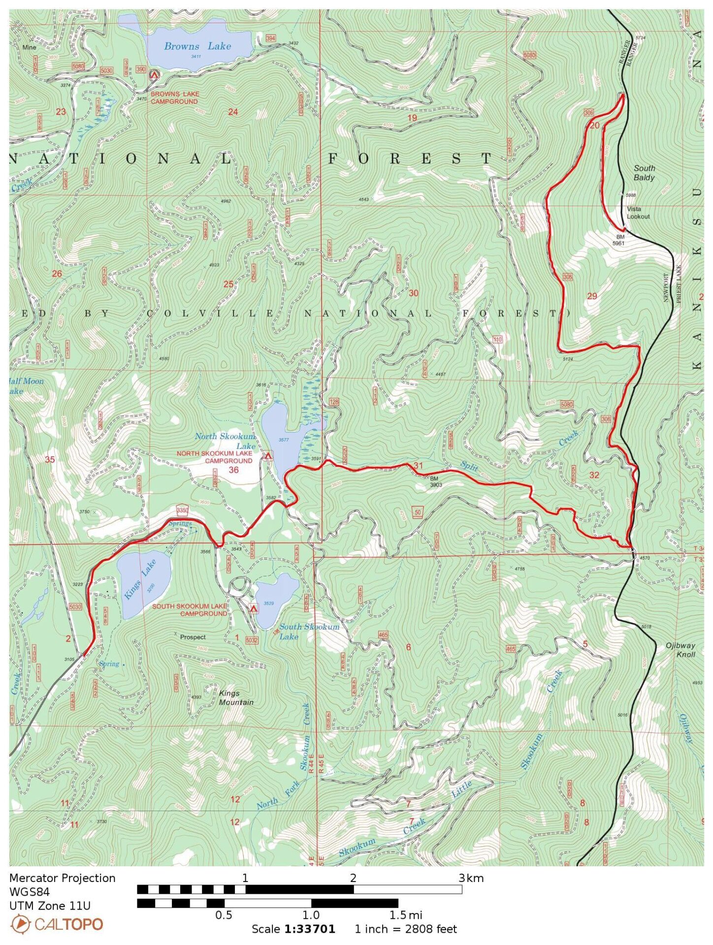
Distance (RT): 6.2 miles*
*If walking the road
Elevation Gain: 1,000′
The main approach to South Baldy is from the south but the rough and rocky road certainly requires a high clearance 4WD. There is a gate a mile below the lookout that may or may not be open. I chose to park below at a bend in the road around 5,000′ and enjoyed a nice 3 mile road walk to the summit.
In 2018 I tried to access South Baldy from Browns Lake to the northeast but found the road washed out about 6 miles from the lookout. I didn’t have enough time in the day to walk up so I drove around to the south approach.


Directions.
From Usk, follow Kings Lake Road (NF-50) across the Pend Oreille River and bend to the left. In about 5-6 miles continue past the North and South Skookum Lake campgrounds. About 12 miles from Usk, the road splits. Continue straight onto NF-306, which turns to the west at Split Creek. From this point the road continues to deteriorate. Split Creek makes a good parking spot to walk up, or continue to the seasonal gate a mile below the lookout.