Southern Cascades | Mount Adams Area
Gifford Pinchot National Forest/Yakima Indian Reservation | Mount Adams Wilderness
Location: 46.202494, -121.490746
Summit Elevation: 12,276′
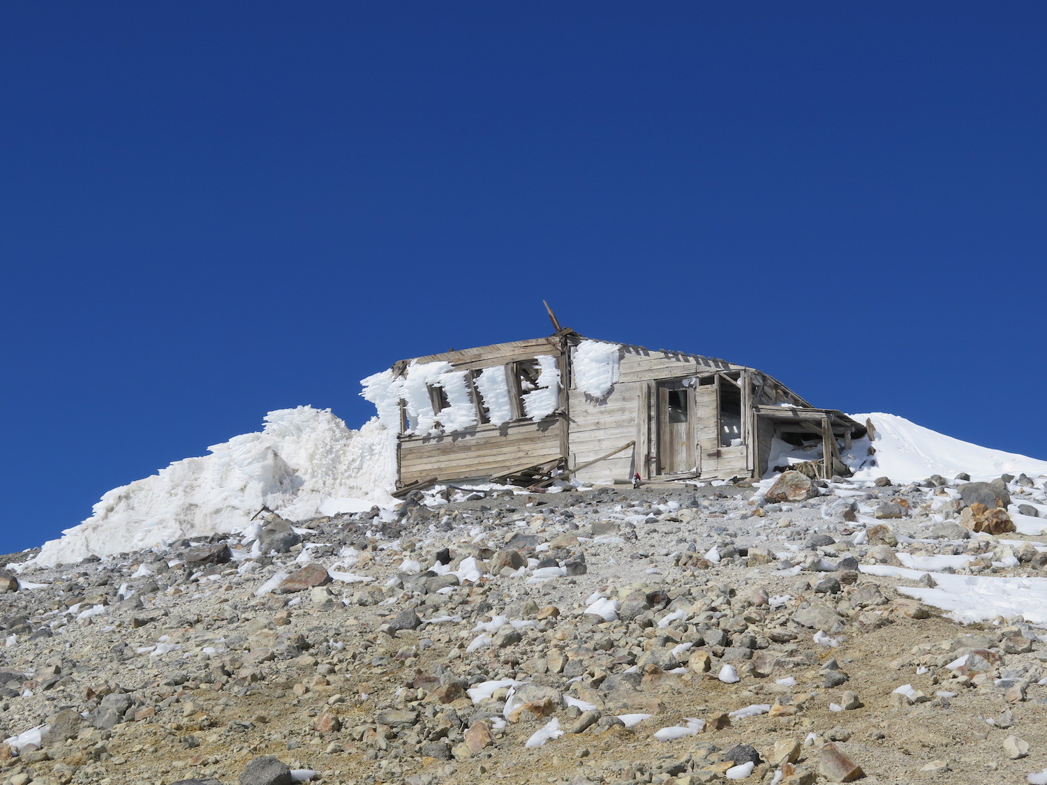
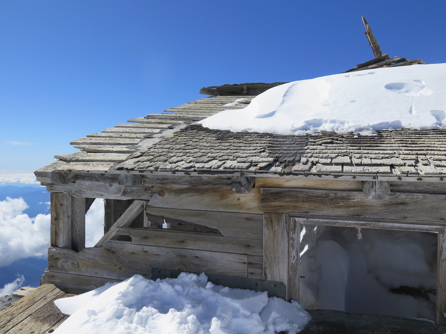
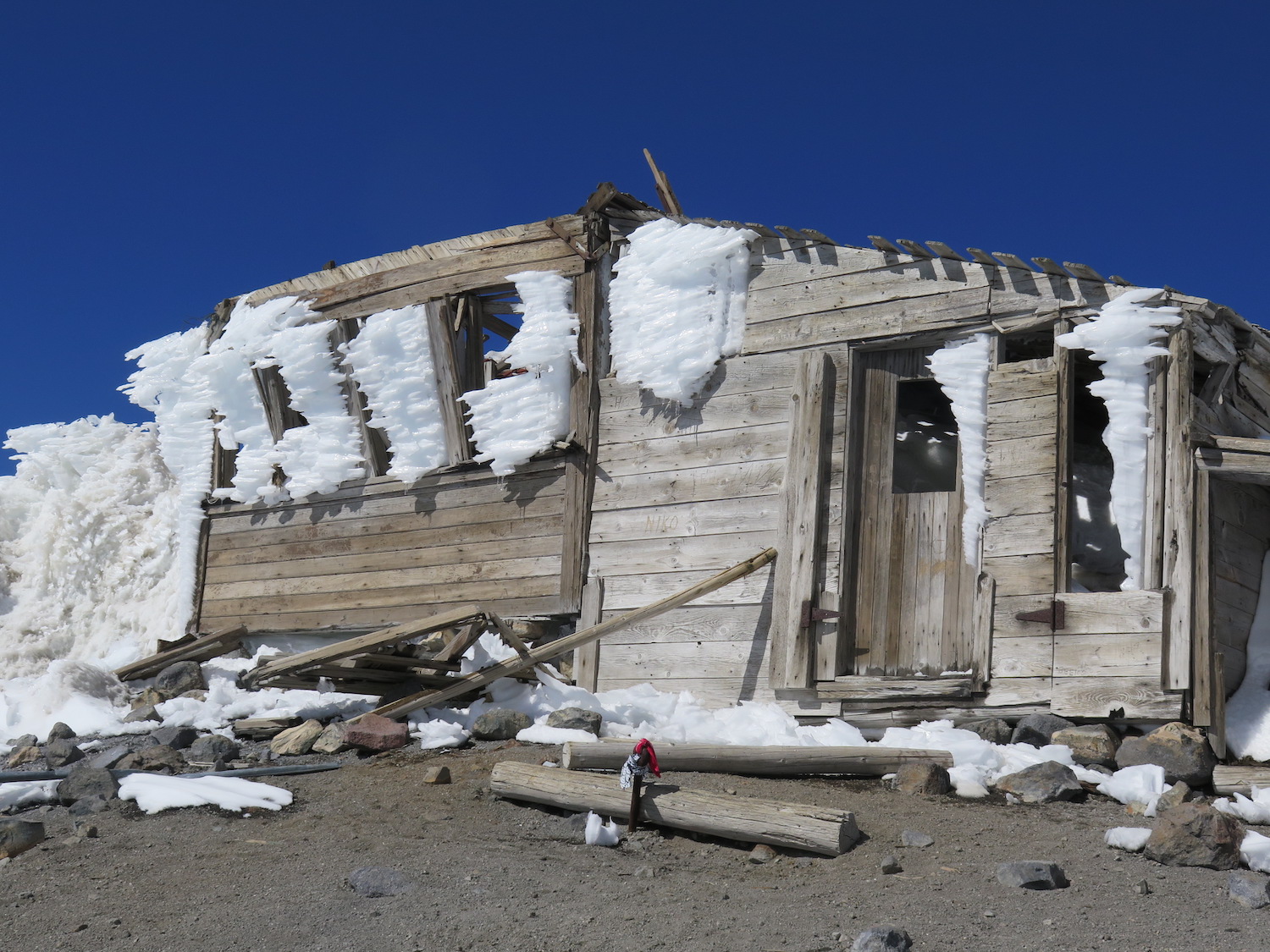
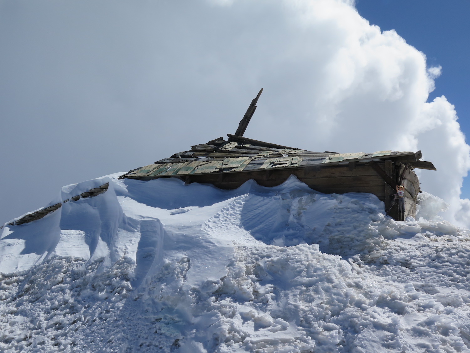
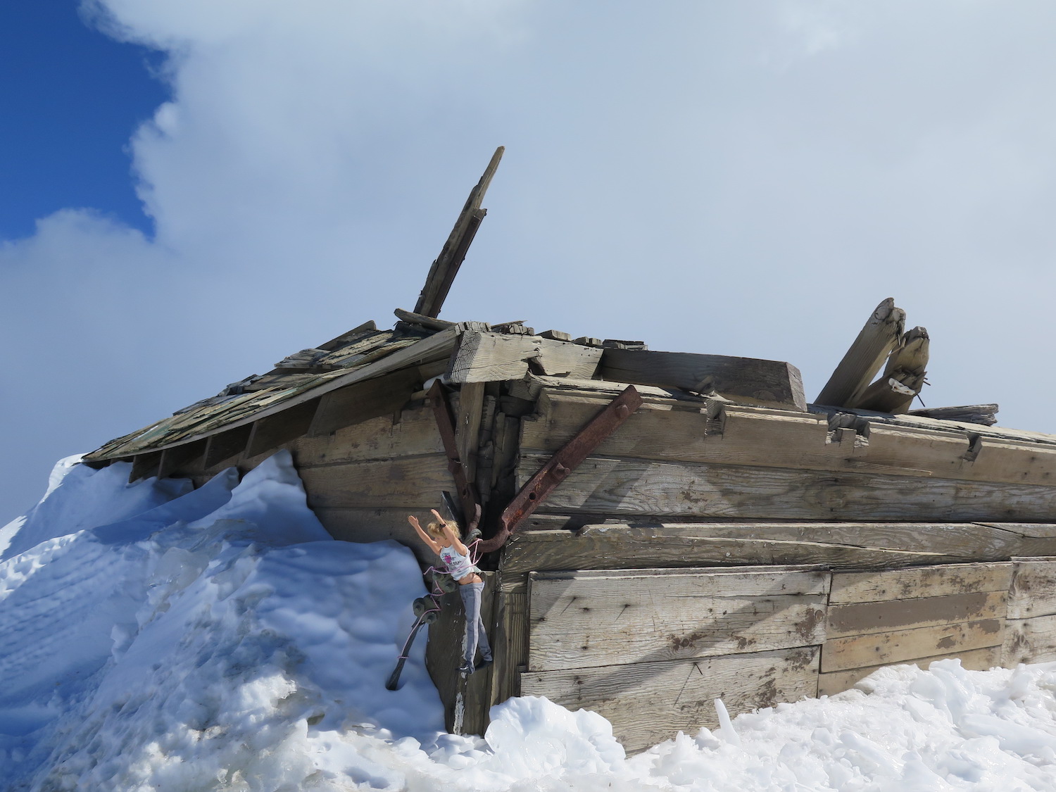
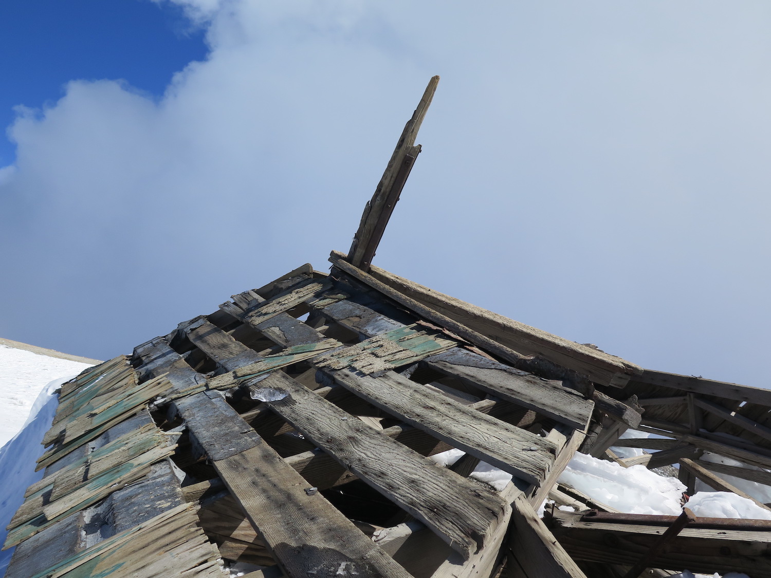
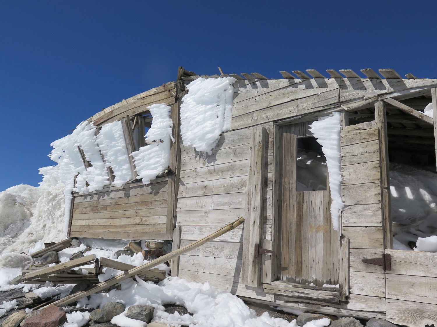
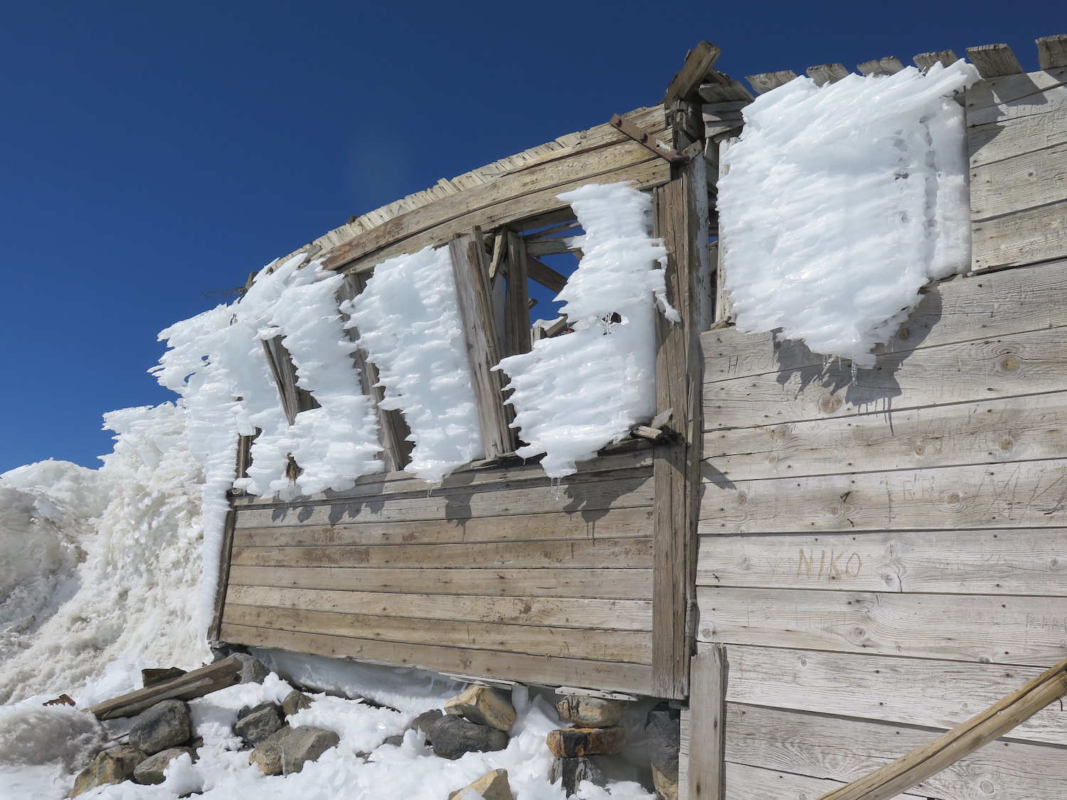
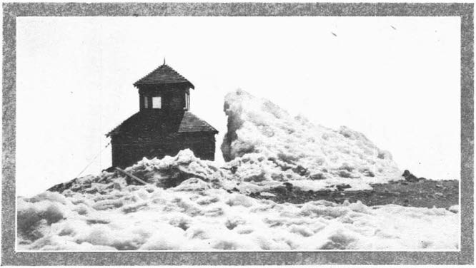
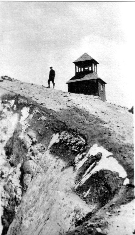
Lookout Type: D-6 cupola/mining shack
Site Established: 1918
Current Structure Built: 1918
Date Visited: 9/22/18
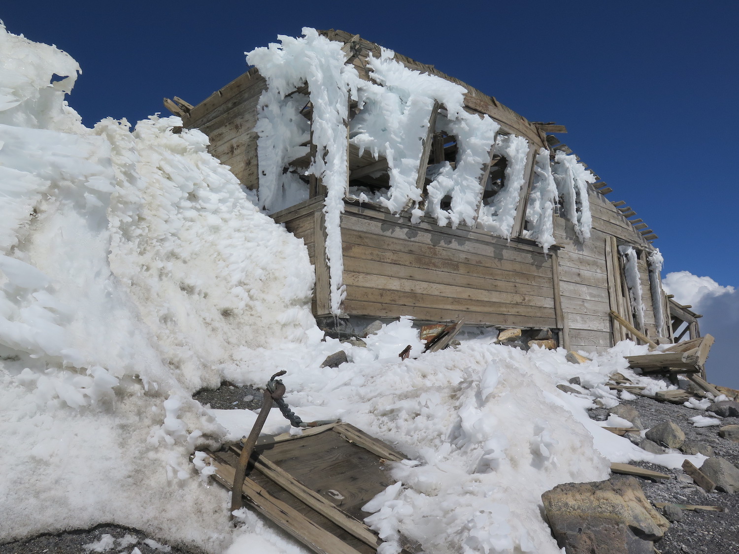
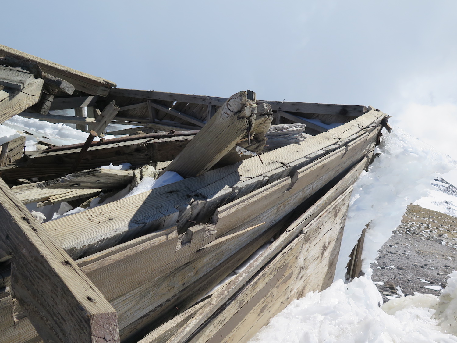
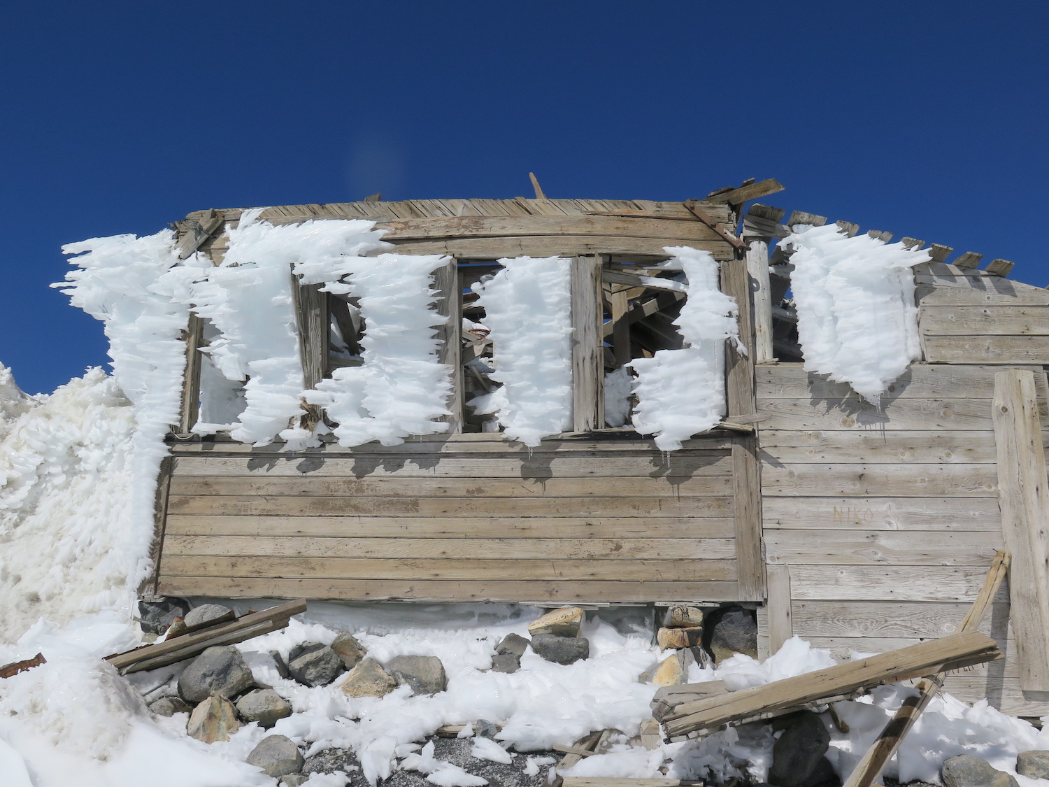
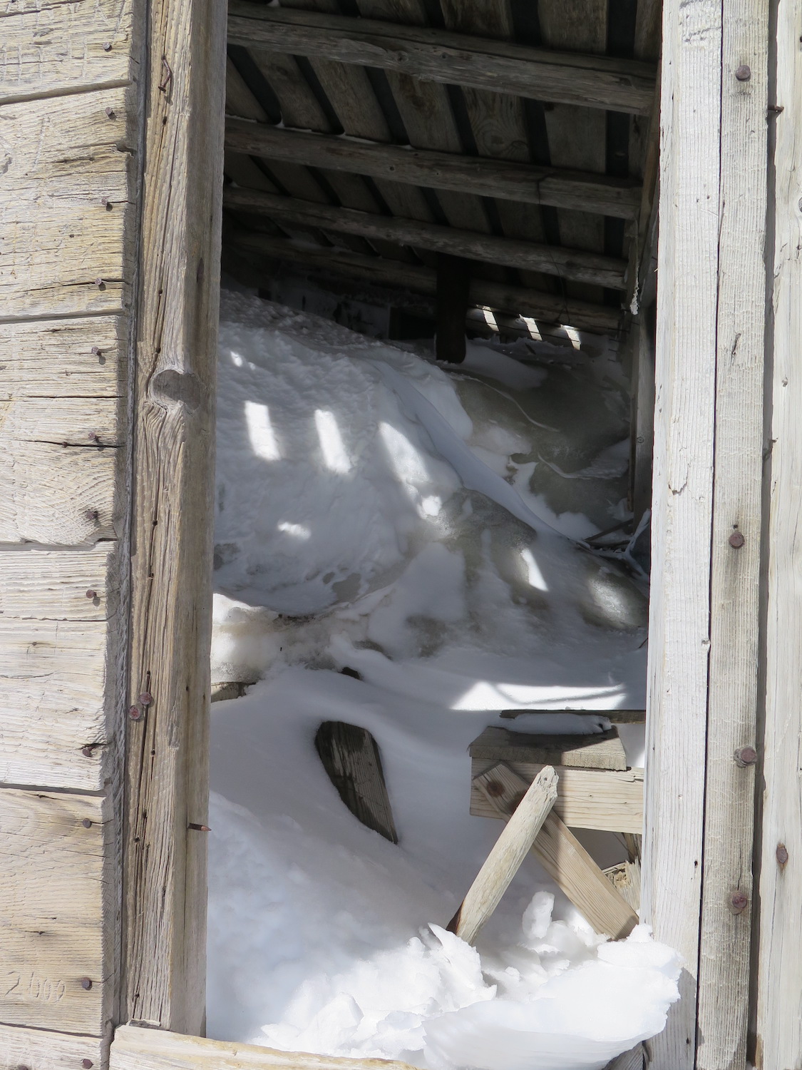
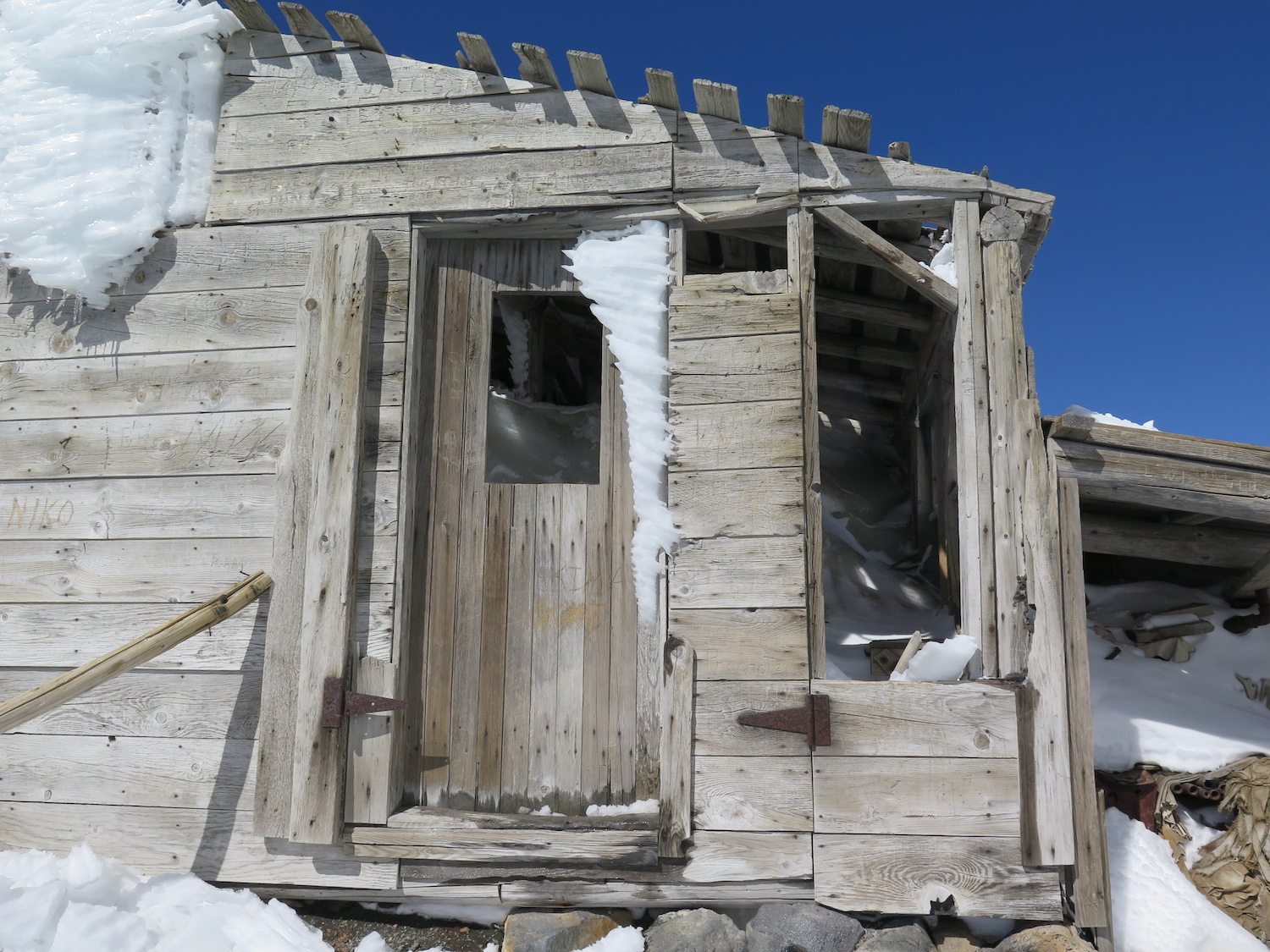
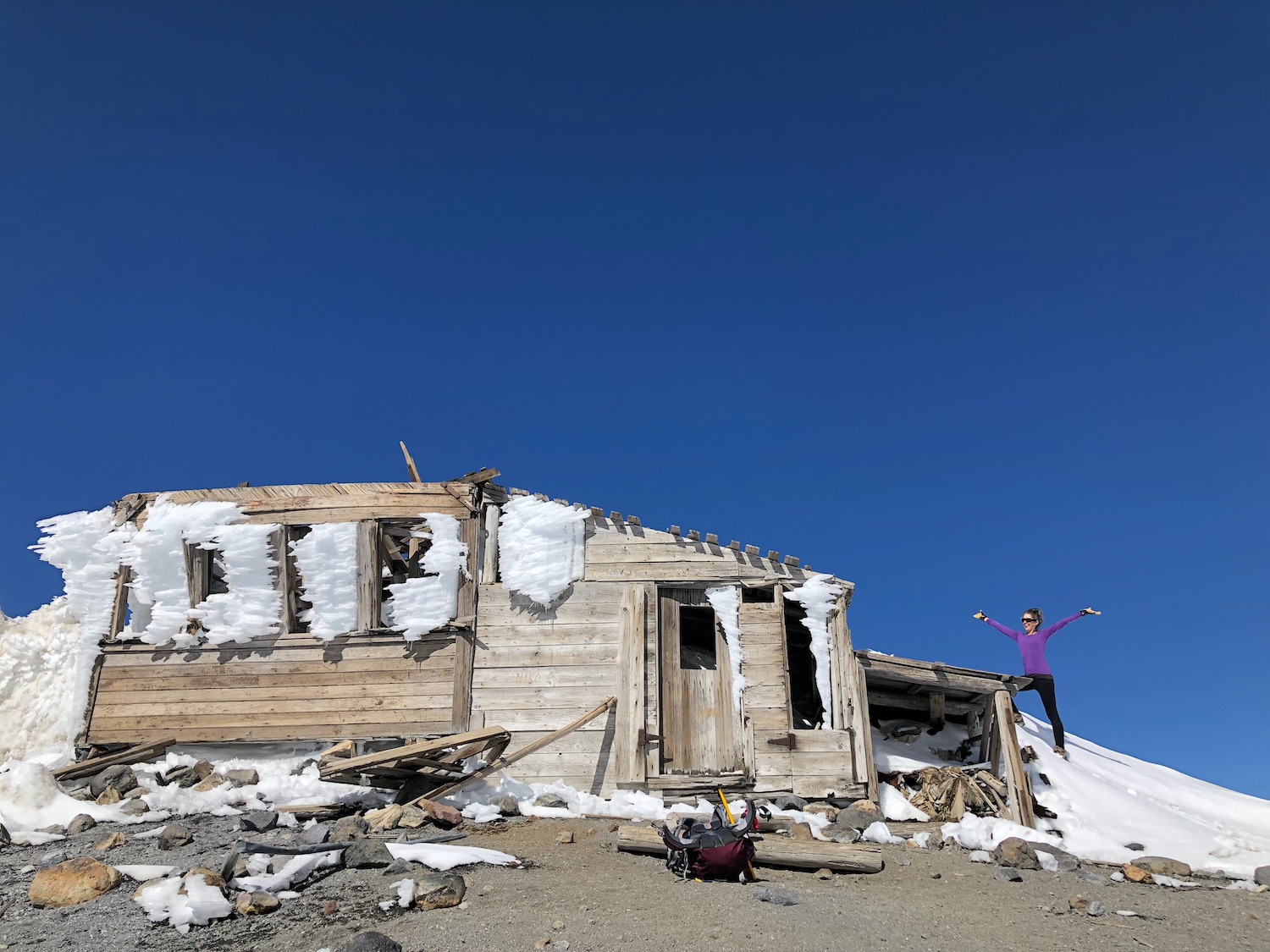
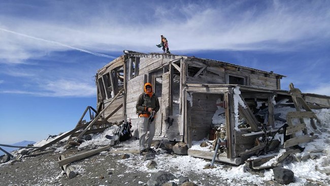
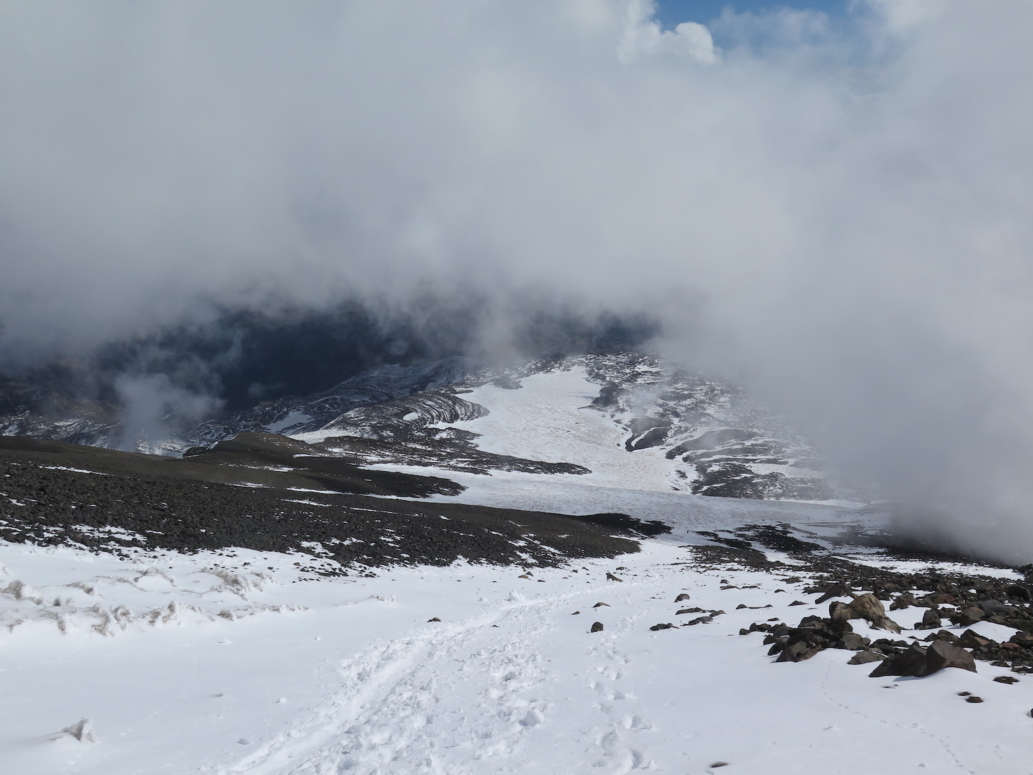
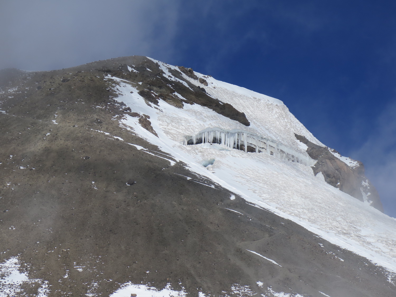
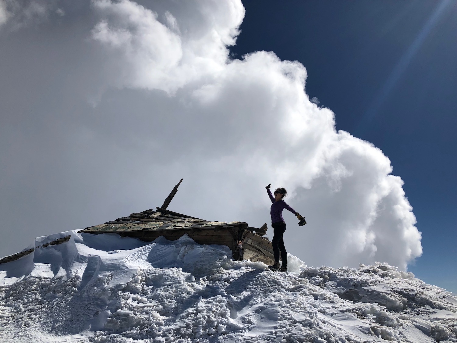
Did you know there is a still standing fire lookout on the summit of Mount Adams? Sure enough, the tattered remains of a 100+ year-old D-6 cupola lookout remain today, making the structure the highest elevation lookout in Washington State. Many have climbed Adams, unaware of its existence. The old lookout spends much of its time entombed in deep snow and ice, only visible for a few weeks in late summer or early fall during dry years.


Photos from 2018.
History.
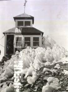
The Forest Service first began moving materials to the summit of Adams in 1917 with the plan to construct a D-6 cupola. This was certainly one of the tougher lookouts to reach in the United States. In fact, it took nearly four years to successfully haul all the materials to the summit due to snow drifts that continually buried the frame and structure. Mules were used to carry supplies as far as Crescent Glacier, roughly 3,000-4,000′ below the summit, then Forest Service crews used ropes and sleds to pull materials the rest of the way.
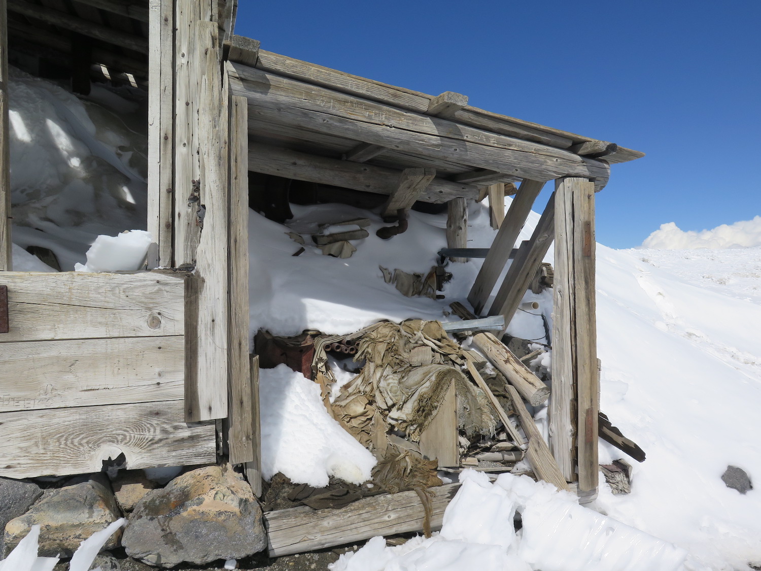
The lookout was finally completed in 1922, though only remained in service only a short time between 1921 to 1924 before being retired in 1925. Not surprisingly, lookouts had issues with visibility thanks to blinding snow storms and cloud cover. In 1932, miners began extracting sulfur from a summit vent on Adams and while living in the cupola, they added a rustic shack and lean-to, which remain today.
The structure spends much of its time entombed in deep snow and ice, only visible for a few weeks in late summer or early fall during dry years.
The route.
Distance (RT): 12 miles
Elevation Gain: 6,700′
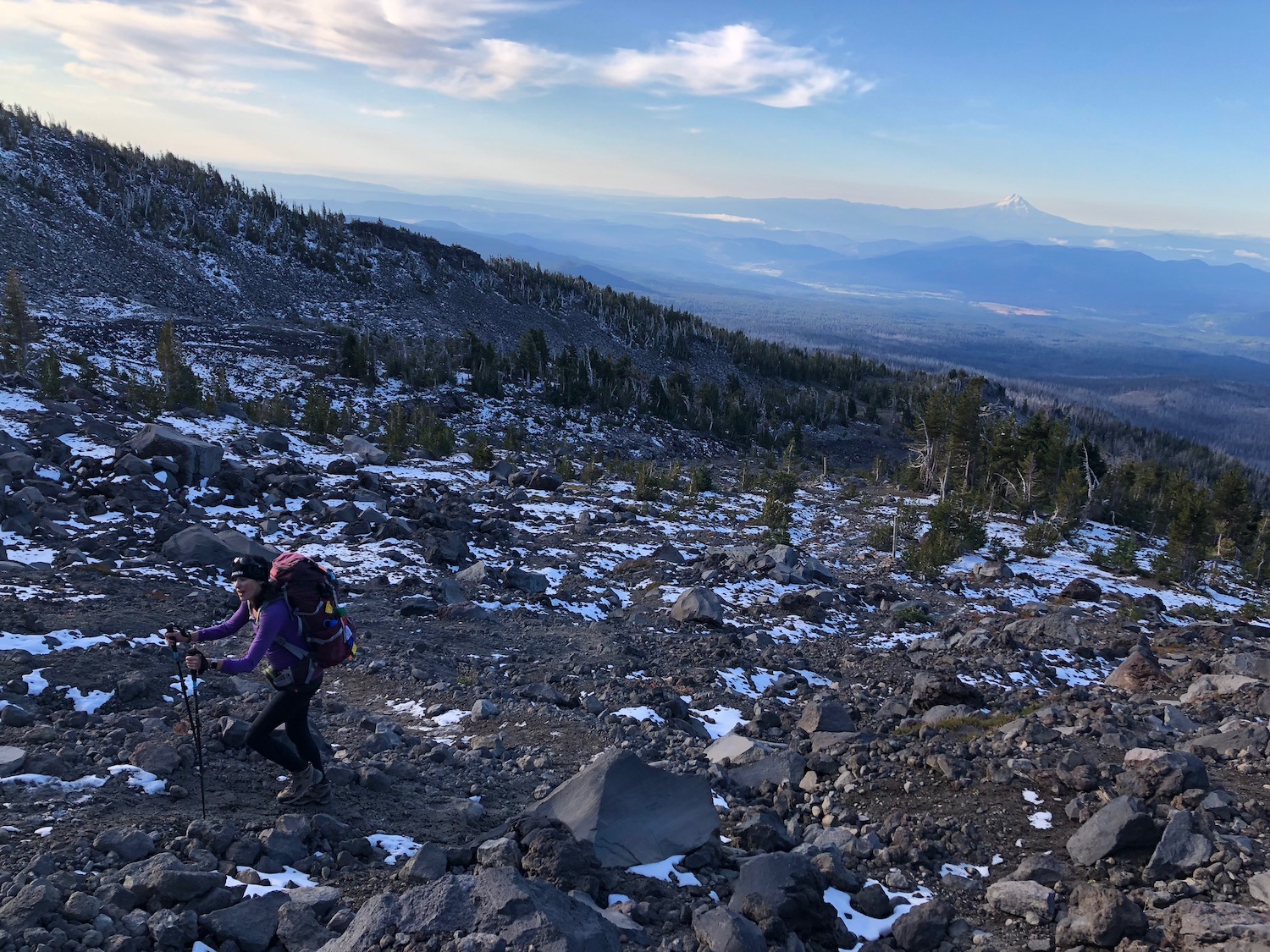
The least technical approach to the summit of Adams is using the South Climb (aka Lunch Counter) route, starting at the South Climb Trailhead. Although this climb is considered by many to be non-technical, it can still require an ice axe, crampons, and appropriate mountaineering gear. This is a 12,000′ volcano in the Cascades and weather and conditions can change rapidly.
Most climbers summit Adams in two days with an overnight stop at the popular Lunch Counter rock outcropping but the route can be climbed in a long day, which I did in 2018.
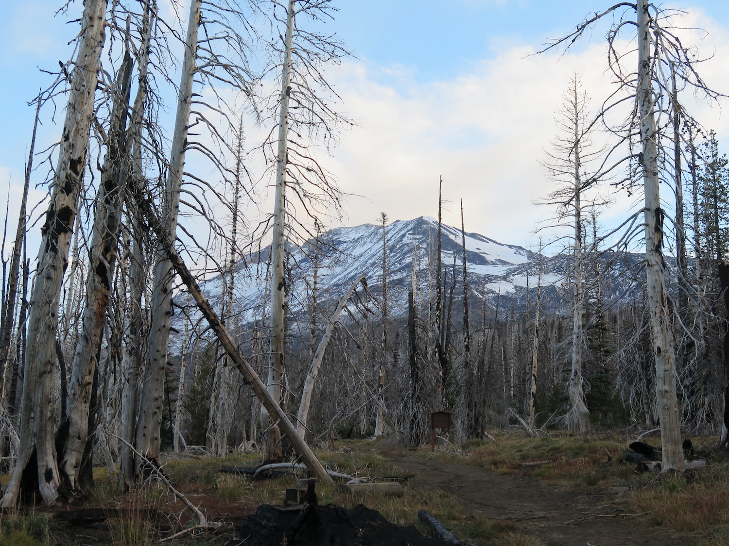
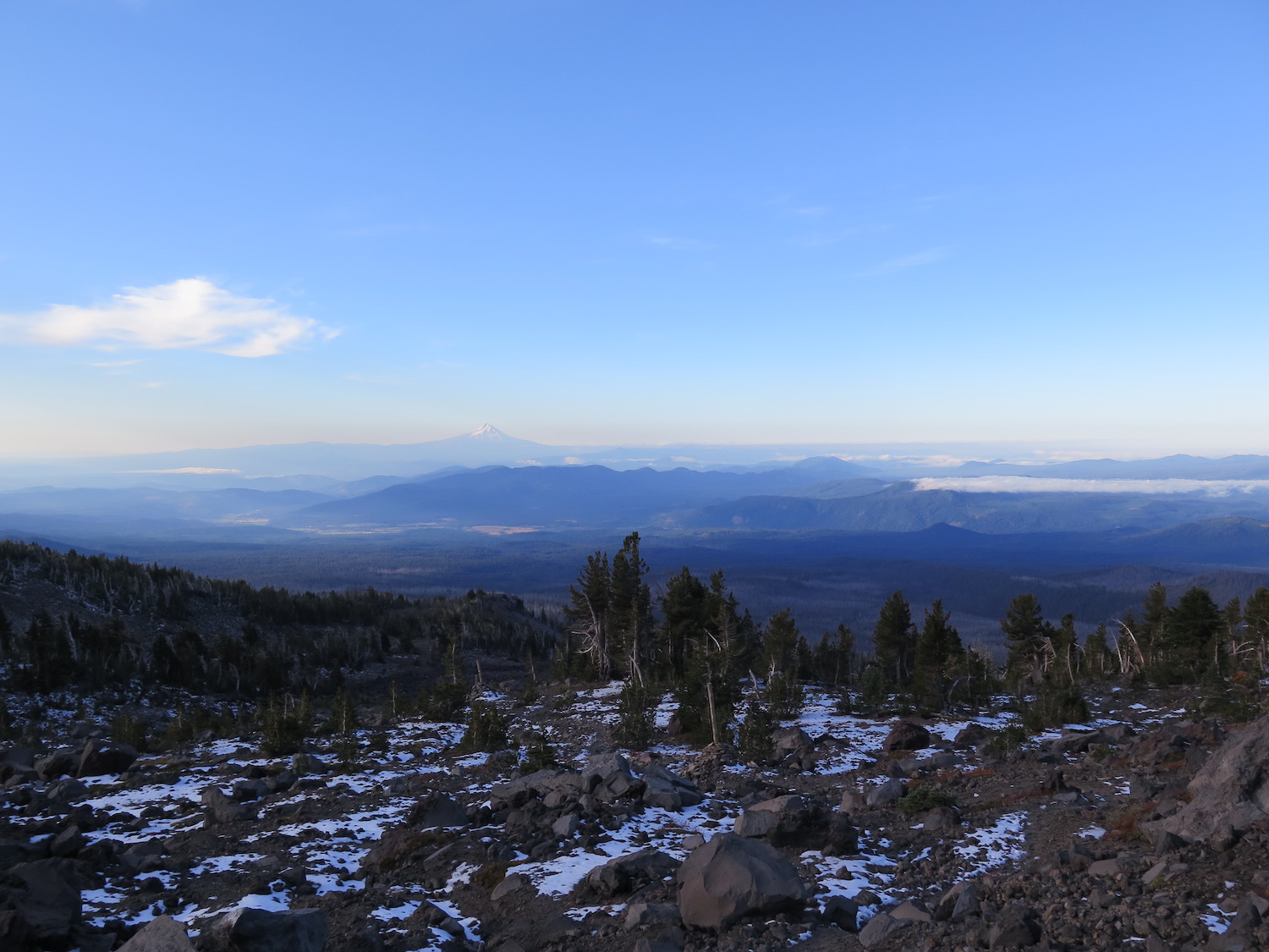
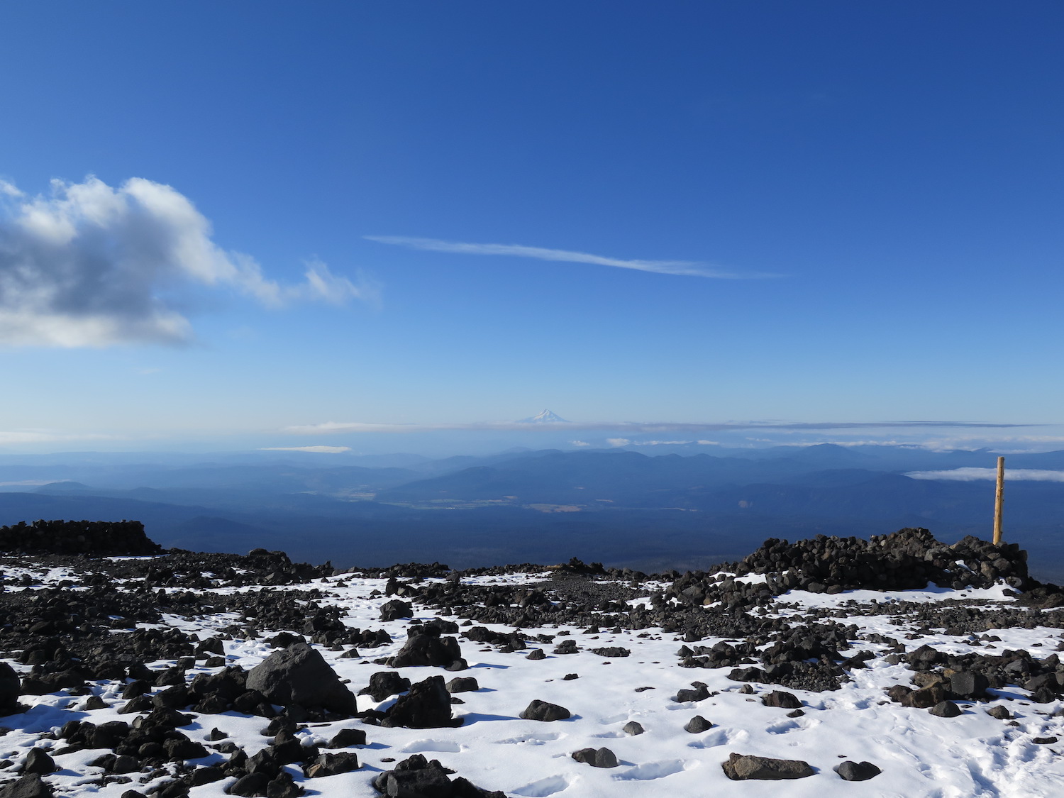
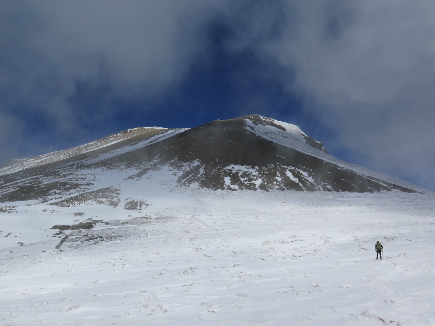
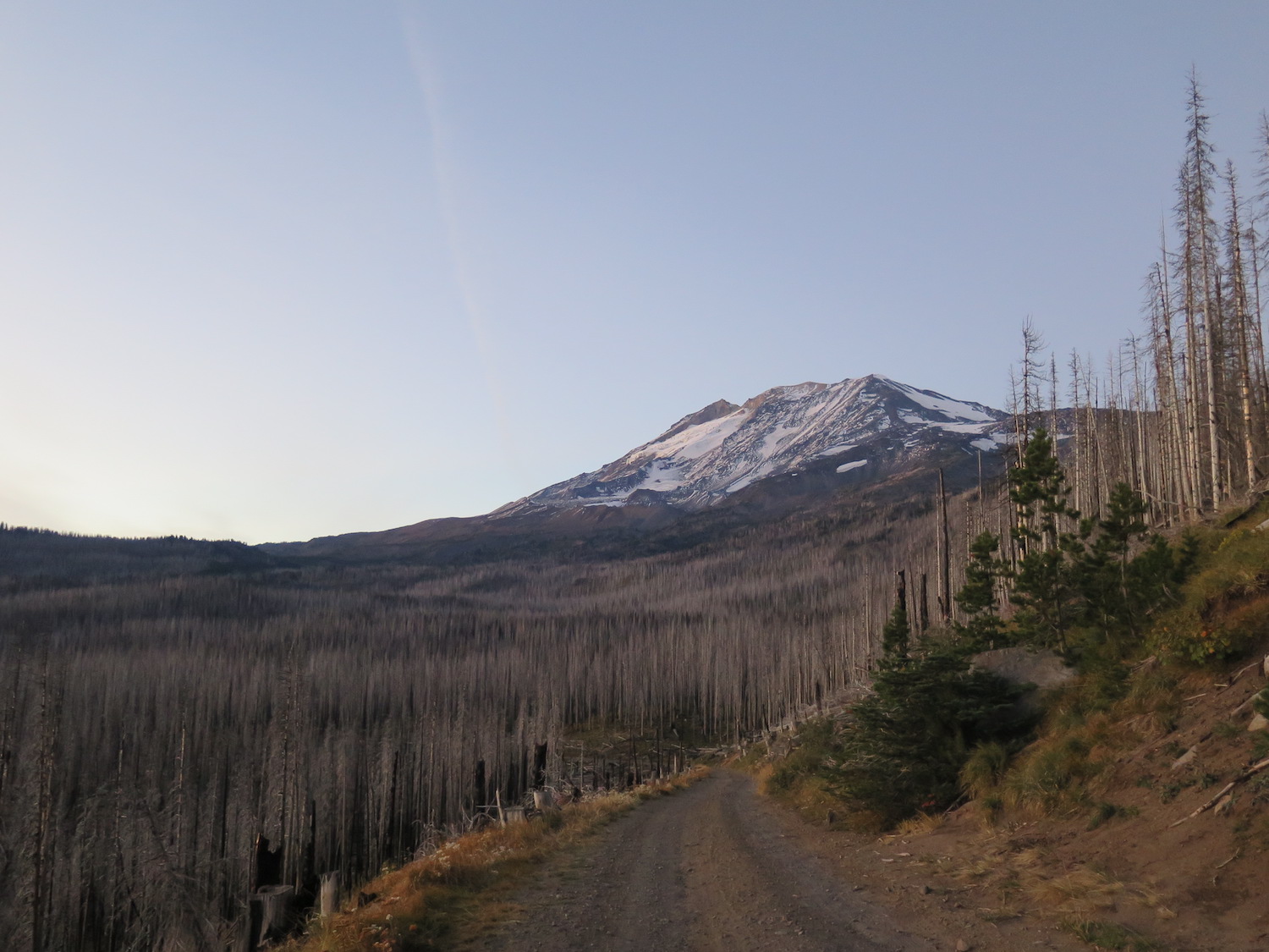
The trail starts at 5,550′, climbing gently for a mile or so on an old road bed through the burn scar of the 2012 Cascade Creek fire before reaching the junction of the Round the Mountain trail. The route continues up, steepening around the two mile mark and climbing steadily to the Lunch Counter at 9,000′. A little more than halfway, this makes a good break or overnight spot before continuing up the route.
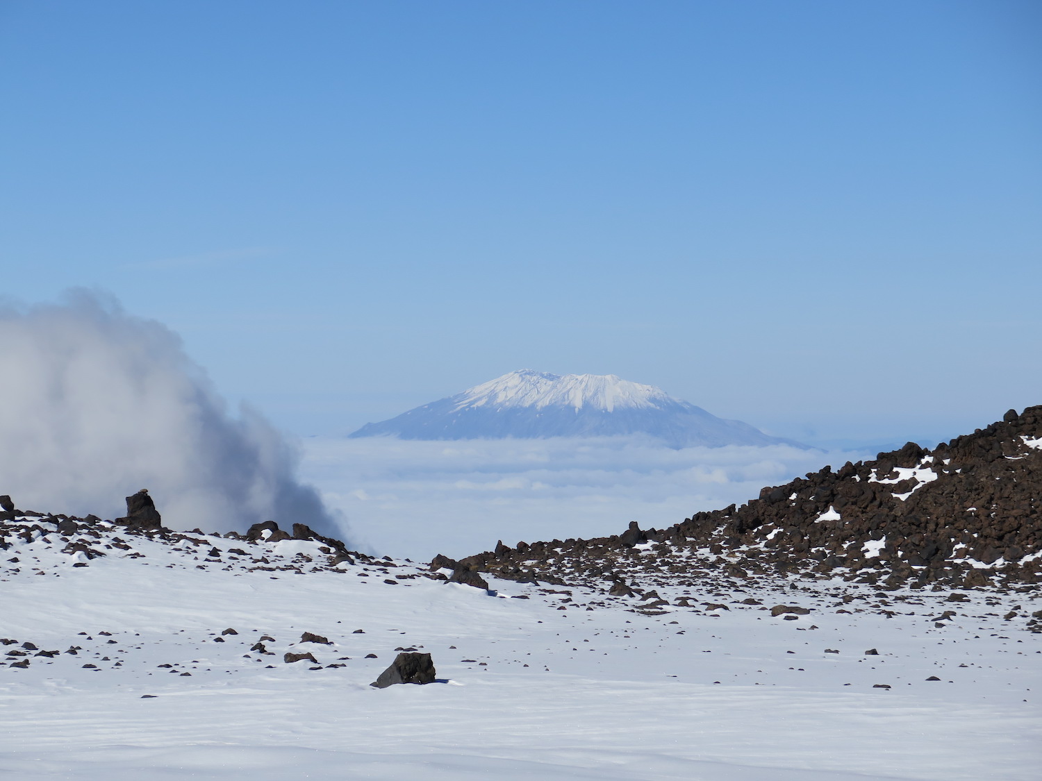
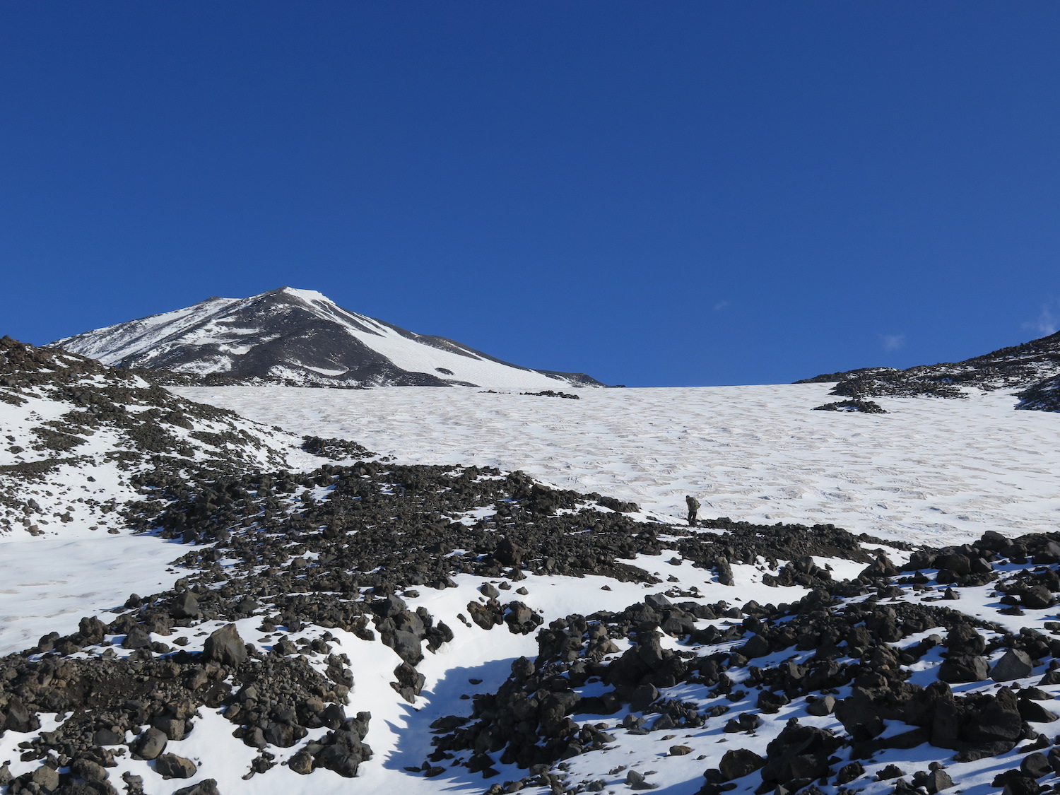
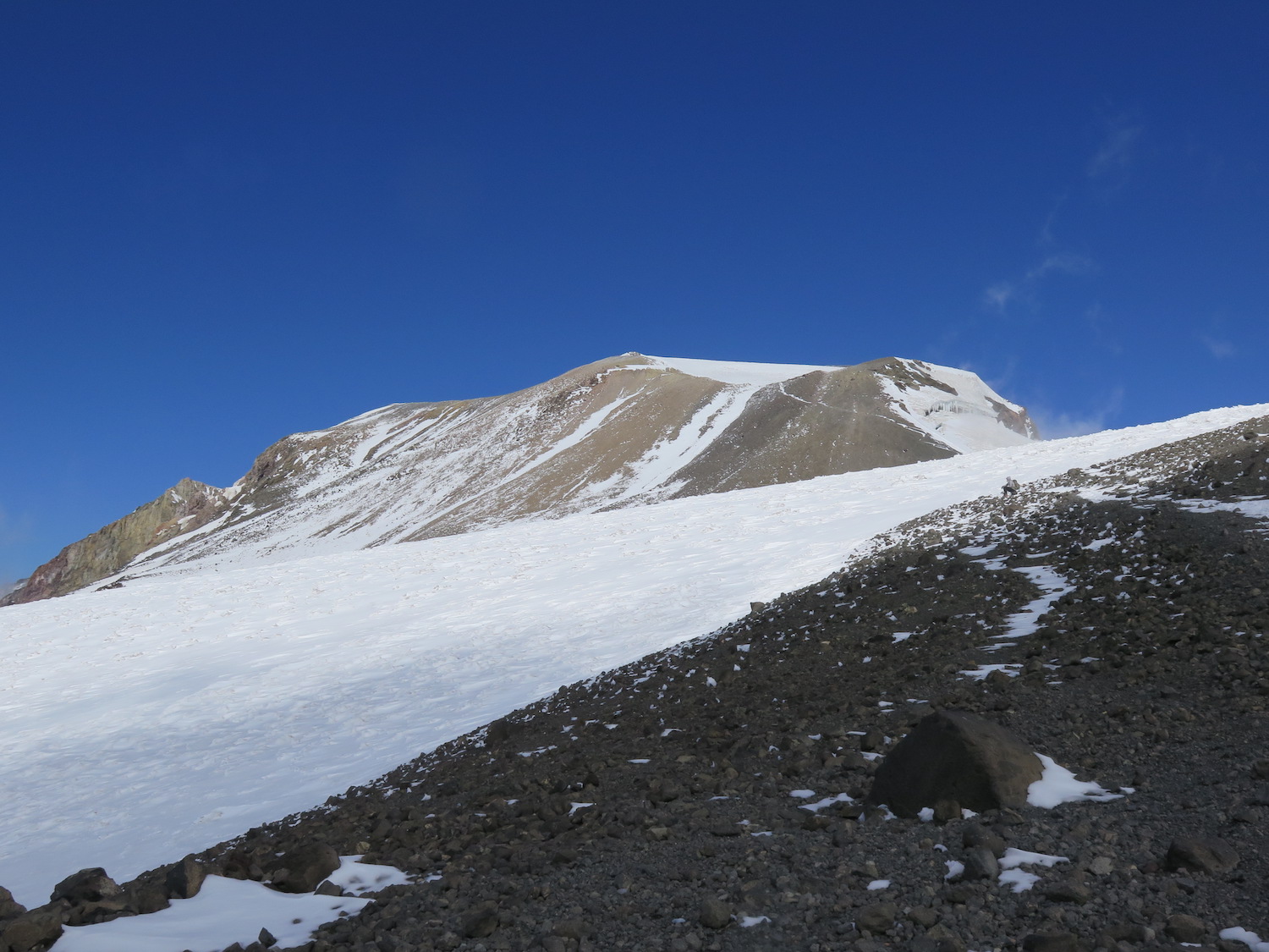
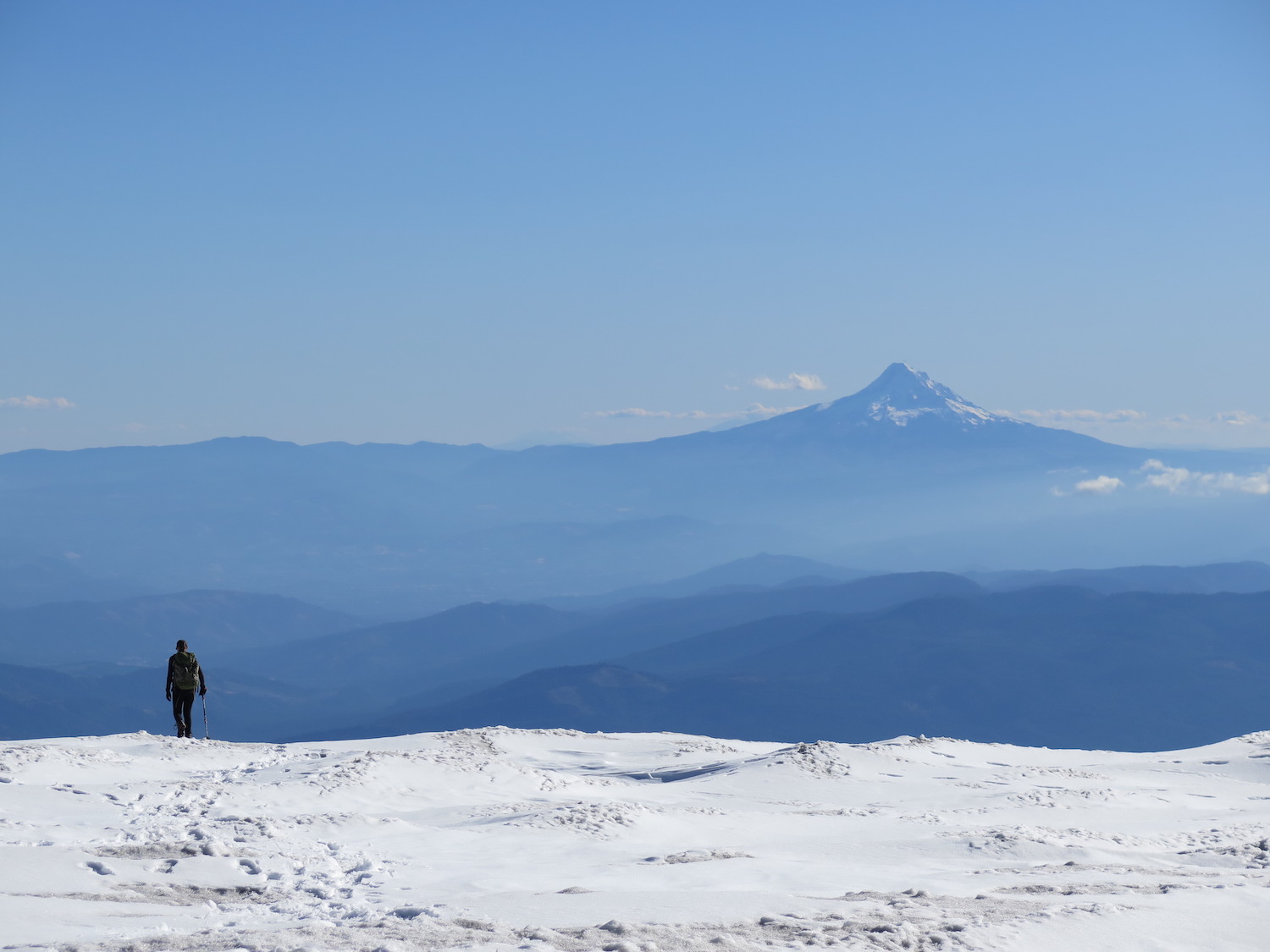
From the Lunch Counter, the summit above you is not the true summit of Adams, but the false summit of Pikers Peak. The route steepens again to Pikers Peak before traversing easily for about a half mile and turning upward for the last 670′ to the summit.
A grueling late summer climb in 2018.
The lookout on Mount Adams was one of the few I didn’t visit solo. My accomplished rock climber and mountaineering friend Annette, who has solo climbed Rainier and has an impressive resume of other adventures, joined me to finally tag Adams and see this elusive lookout for herself. She was also one of the few people willing to join me for what many people completely crappy, rocky climbing conditions.
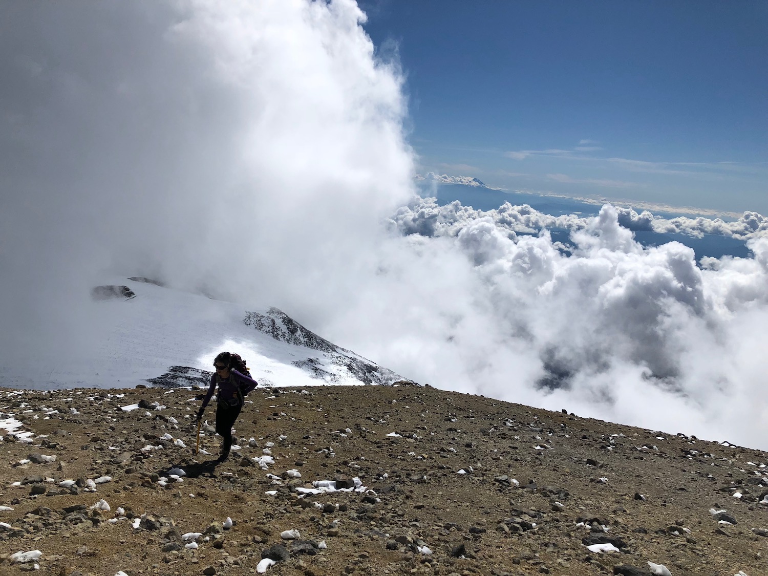
We waited until late in September in 2018, when snow was mostly melted off the summit, to do a one day summit climb during a short favorable weather window. Climbing Adams in a day remains one of the toughest outings I’ve ever done, especially late in season thanks to all of the melted out volcanic rock and scree. It’s possible my knees only recently forgave me, if they did at all!
I told my friend that I will never forget the feeling of deflation when I rounded Pikers Peak and saw the real summit of Mount Adams looming far in the distance, another 670′ up. If there’s one thing I can count on with my friend Annette though, she will always inspire you to keep moving and so she kept on heading right up, knowing I would follow. That last climb to the summit was completely melted out and especially tough thanks to the volcanic scree that required two steps forward to gain one.
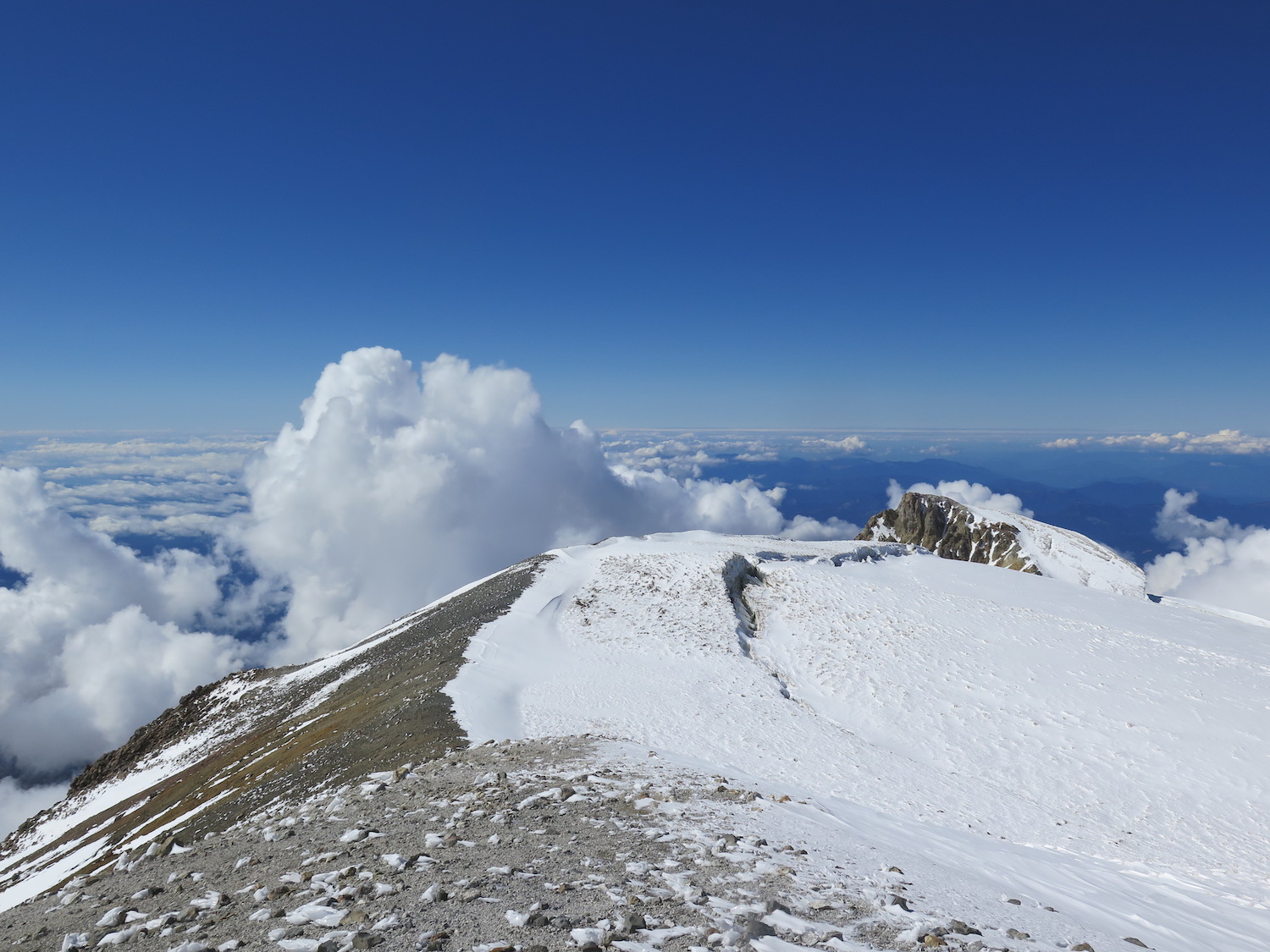
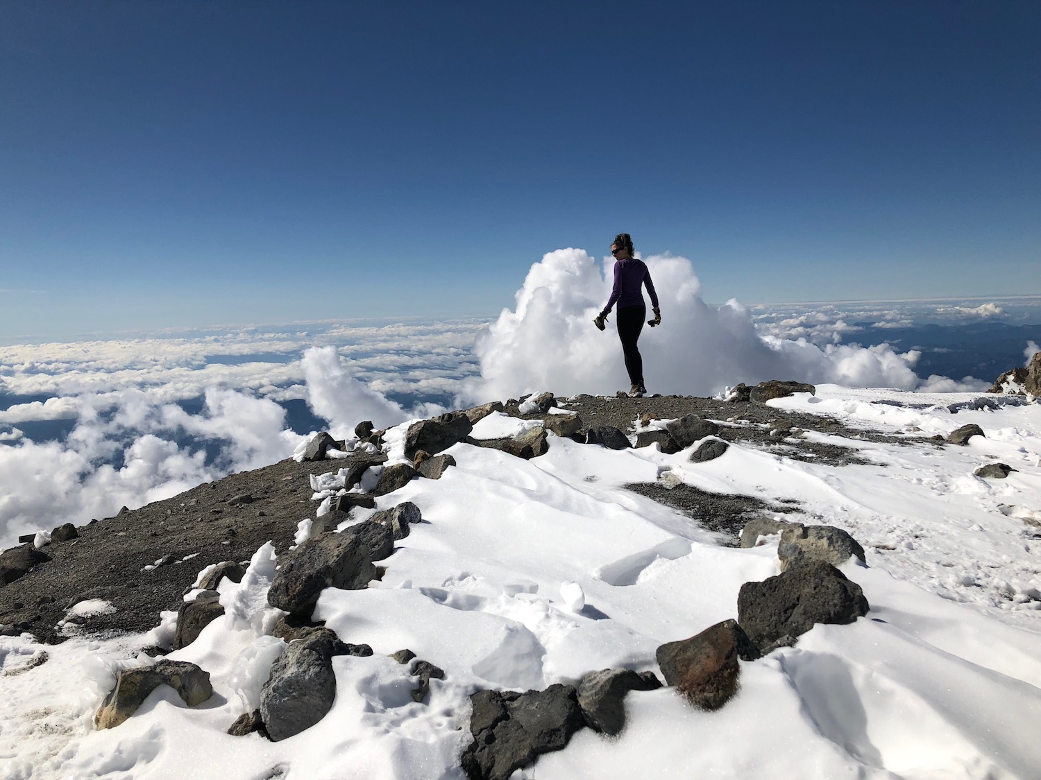
Once I finally saw the old D-6 cupola on the summit and stood atop Adams’ lofty summit, it was well worth every step! Climbing late in the season also meant we avoided most of the crowds. We shared the summit with only two other climbers and gazed out at nature’s splendor all around us from what seemed like the top of the world.
Adams is known to be a fantastic glissade but unfortunately, climbing the summit when you can see the lookout means there isn’t enough snow to glissade! The rocky descent was murder on my arthritic knees and I swear the one mile road walk back to the trailhead seemed like miles. But, we did it and got to see this impressive historic structure that many are unaware exists on the summit.
Directions.
Getting to the Mount Adams South Climb trailhead is an effort in and of itself and takes about four hours from the Seattle area. From Trout Lake, follow the Mount Adams Road north to an intersection with Forest Road 23. Continue right one mile to Forest Road 80, signed “South Climb”, and take a left. The road ends at an intersection with Forest Road 8040 and 8031. Turn right to follow Forest Road 8040 and continue past the Morrison Creek Campground to a trailhead located in the old Cold Springs Camp area. The road can be rough, so a high clearance 4WD is recommended.
The trailhead can be overflowing during the climbing season, so plan accordingly and park wisely. A bonus to climbing late in the season to visit the summit lookout is usually less crowds.