I’ve often borrowed a famous movie line to describe peakbagging and joke that “it’s like a box of chocolates. You never know what you’re gonna get.”
Sometimes I enjoy fantastic cross country outings like Doe and Fawn Peaks, full of wildflowers and peaceful summits with stunning 360° views. Pretty much like feasting on tasty vanilla cream chocolates!
Other times I end up with outings like Ramsey Peak.
Unlike terrible chocolates though, I’m never smart enough to take a bite and then toss it aside when it comes to less than ideal peaks. I stubbornly keep going, even when the possibility of reward seems very, very unlikely.
I still stand by the belief though, that a day spent outside in solitude, discovering new places, is never bad. Even when it’s bad.
Usually I find my peakbagging targets by looking at former fire lookout sites, prominent peak lists, or simply looking at maps and picking something that looks interesting. Ramsey was the latter. My first week back in the Methow I was choosing outings close to home to reduce my driving and the Methow Wildfire Area outside Winthrop is a quiet area with a number of relatively obscure, unknown peaks.
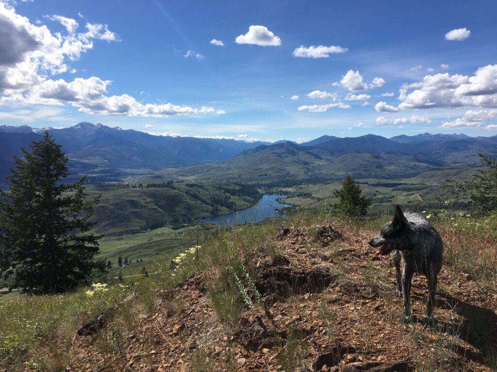
Bowen Mountain in the Wildlife Area is a fantastic cross country peak with gorgeous views of the Sawtooths and North Cascades as well as beautiful Pearrygin Lake and the town of Winthrop below. I figured I’d drive a bit further into the wildlife area and go check out Ramsey.


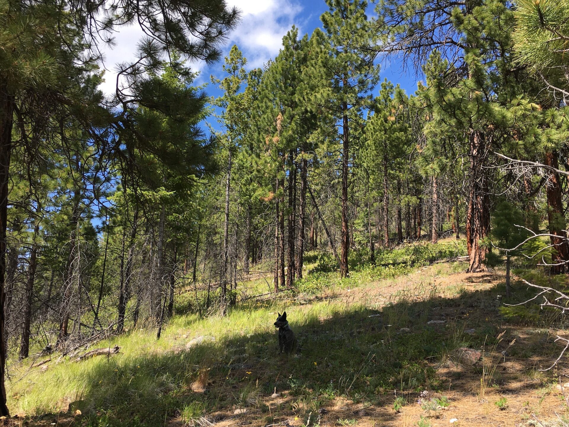
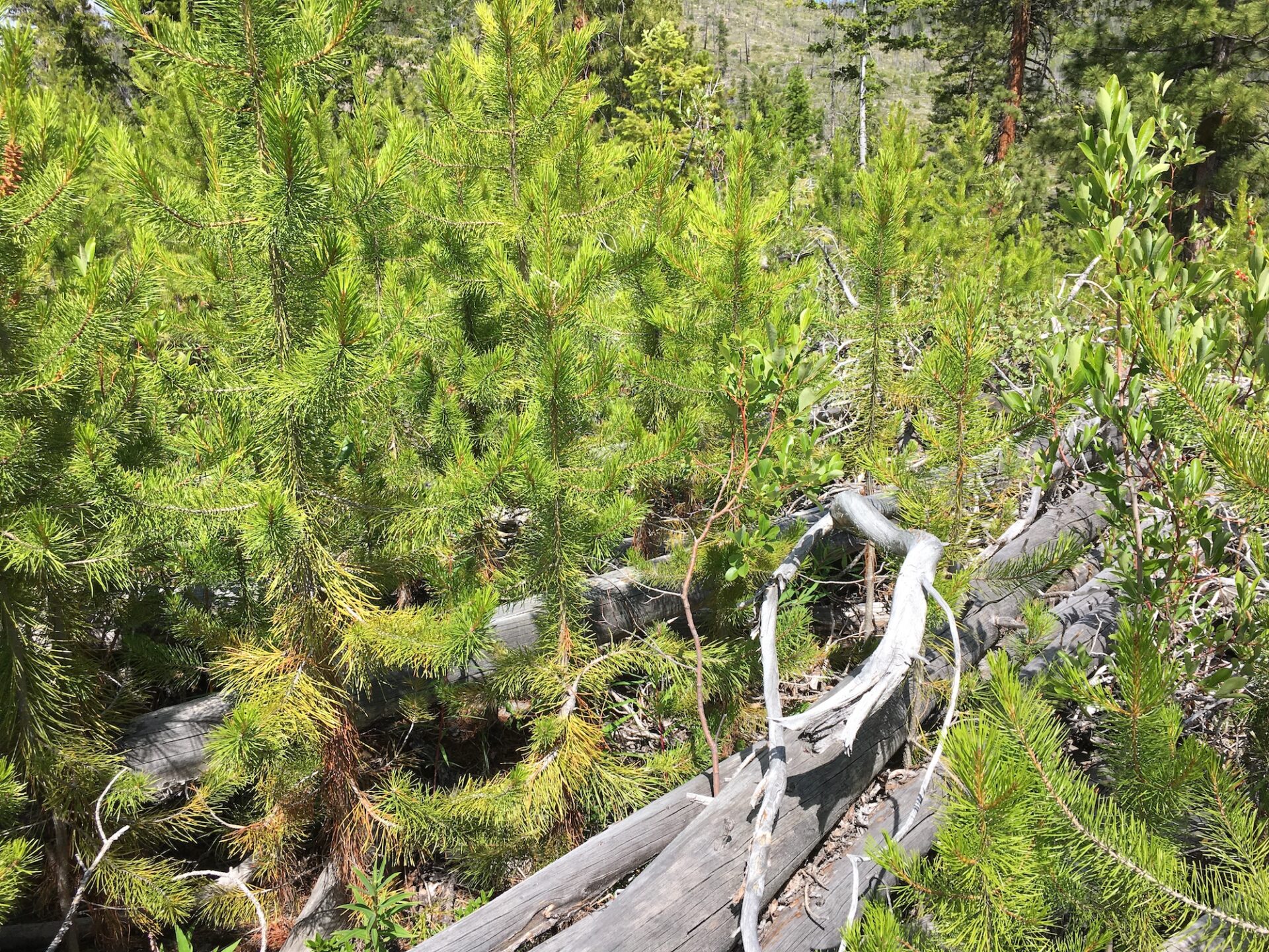
16,000 acres of the Methow Wildlife Area burned during 2014’s Carlton Complex Fire and then more burned in the 2015 Okanogan Complex fire, so I wasn’t sure at all about the condition of trails marked on maps. Well, the short story is that there really aren’t any trails anymore in a lot of places. Anything that existed prior to the fires has either been completely erased or is buried under tons of burned out blowdown.
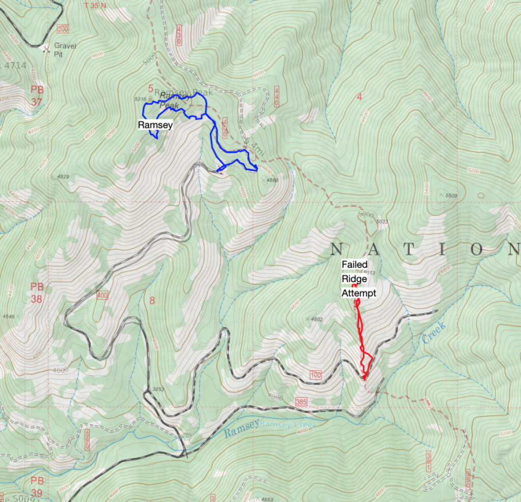
From Winthrop, I drove into the Methow Wildlife Area from Forest Road 100 all the way past FR-400 to a parking place where old maps indicated a trail heading up a long ridge all the way to Ramsey. I figured I’d take the longer scenic route.
I did indeed find the remnants of an old trail but didn’t even make it a mile before I hit an area where deadfall was so thick there was simply no way to get around it. Even Hudson, who is incredibly agile, was struggling to navigate the gauntlet. Everything was 5-10″ off the ground, a perfect kind of torture, so for once I admitted defeat and backtracked to the truck.
I decided instead to drive higher up FR-400 to Ramsey’s southeast ridge approximately 700′ and less than a mile to the summit. I thought that would make it a much easier objective despite the conditions.
I was wrong.
Initially I followed a fire road, which quickly became blocked by deadfall. Ramsey’s south side was quite steep, 30-45° in places and very slippery with deadfall and ground cover so I opted to head cross country up its east flank.
At the point where I turned off the forest road, I had only 400′ and roughly a half mile to the summit. The first quarter mile or so had so much ankle-biting deadfall hidden by small trees that it was excruciatingly slow progress, like wrestling through trees with your ankles tied together. At one point I almost turned around in defeat, except I had no desire to go back the way I had come up. I was convinced once at the summit there would be a better way down and this is a prime example of when rampant optimism is not always a positive trait!
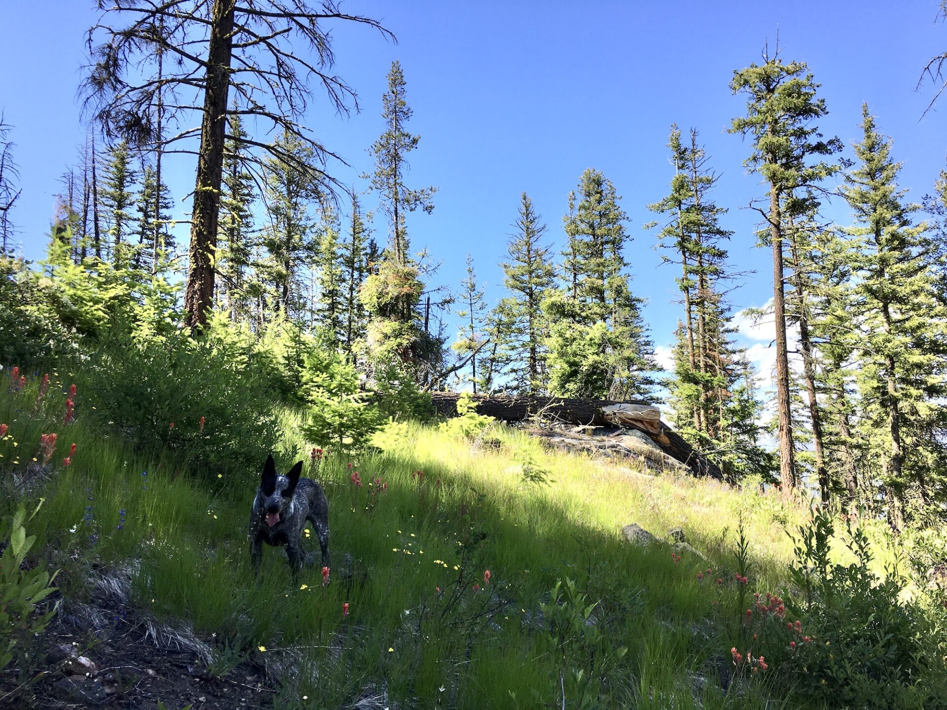
Trying to channel my inner American Ninja Warrior, I pushed through the trees and finally popped out into clearer terrain and onto what looked like a very faint, barely visible old trail. According to my GPS yes, there once was a trail here heading close to Ramsey’s summit and north all the way to Boulder Creek.
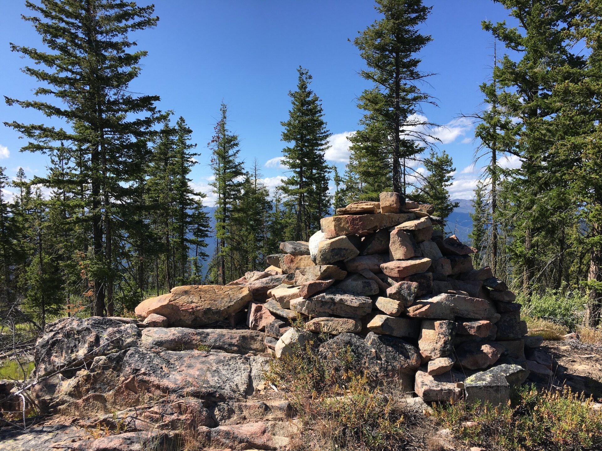
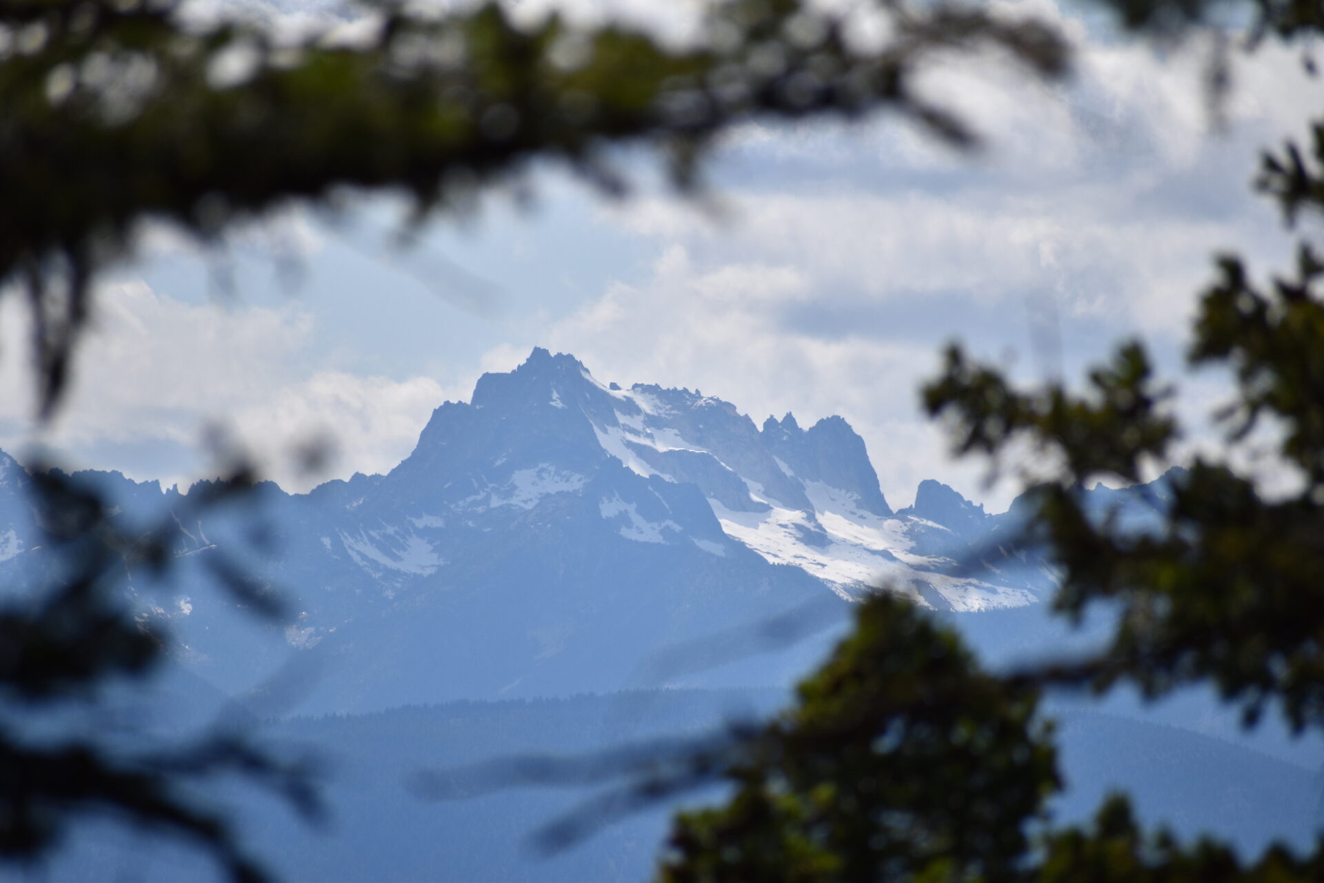
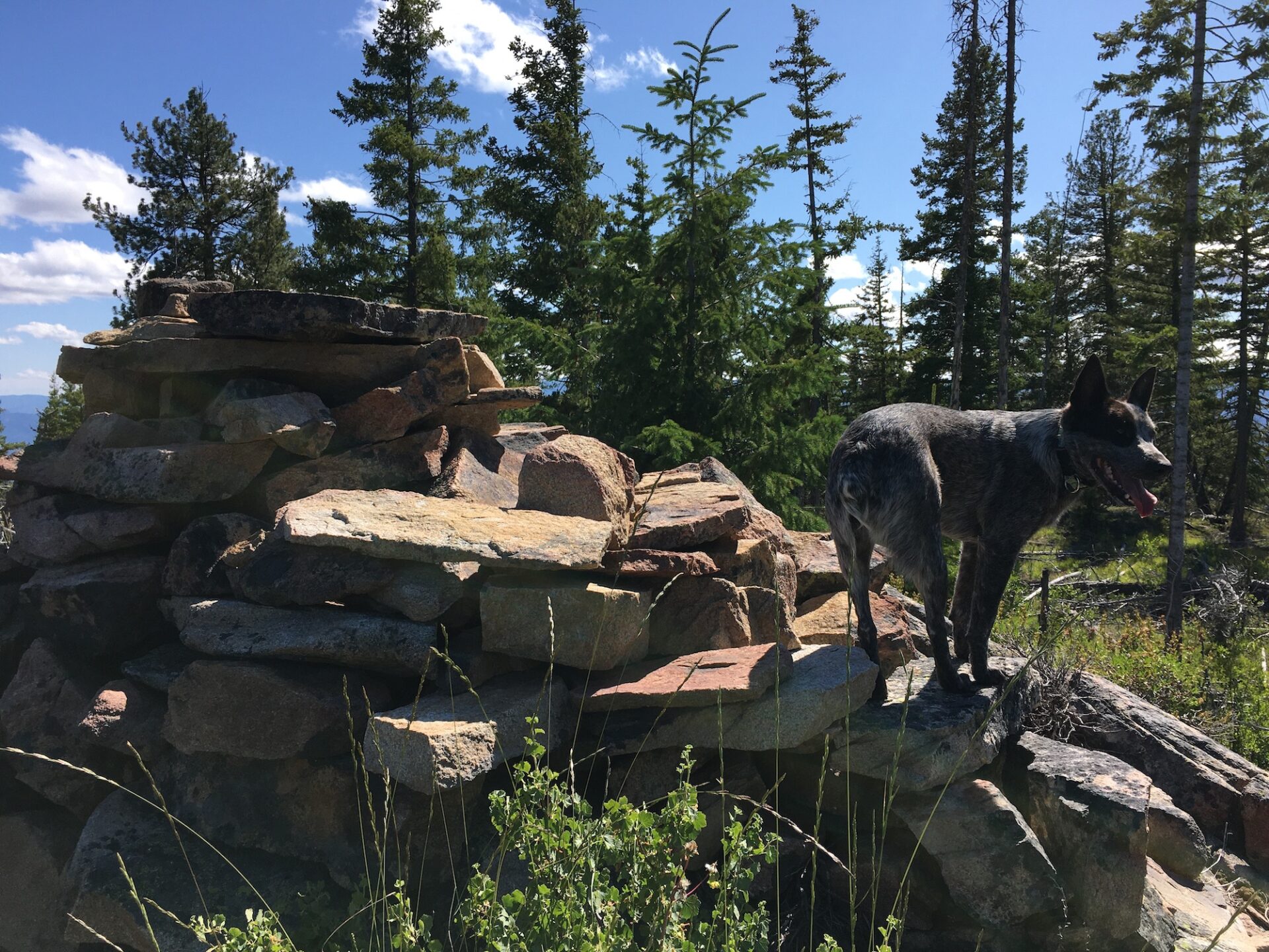
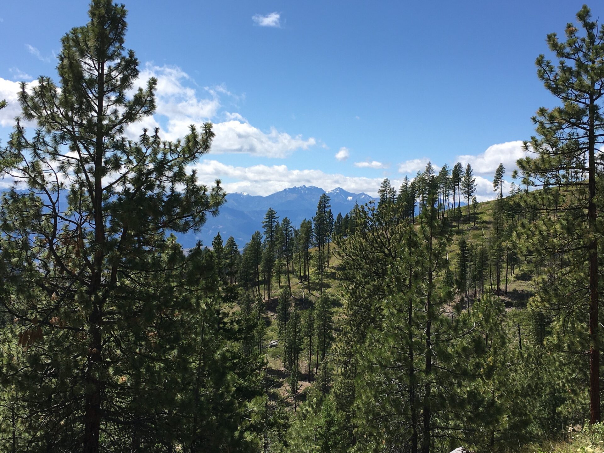
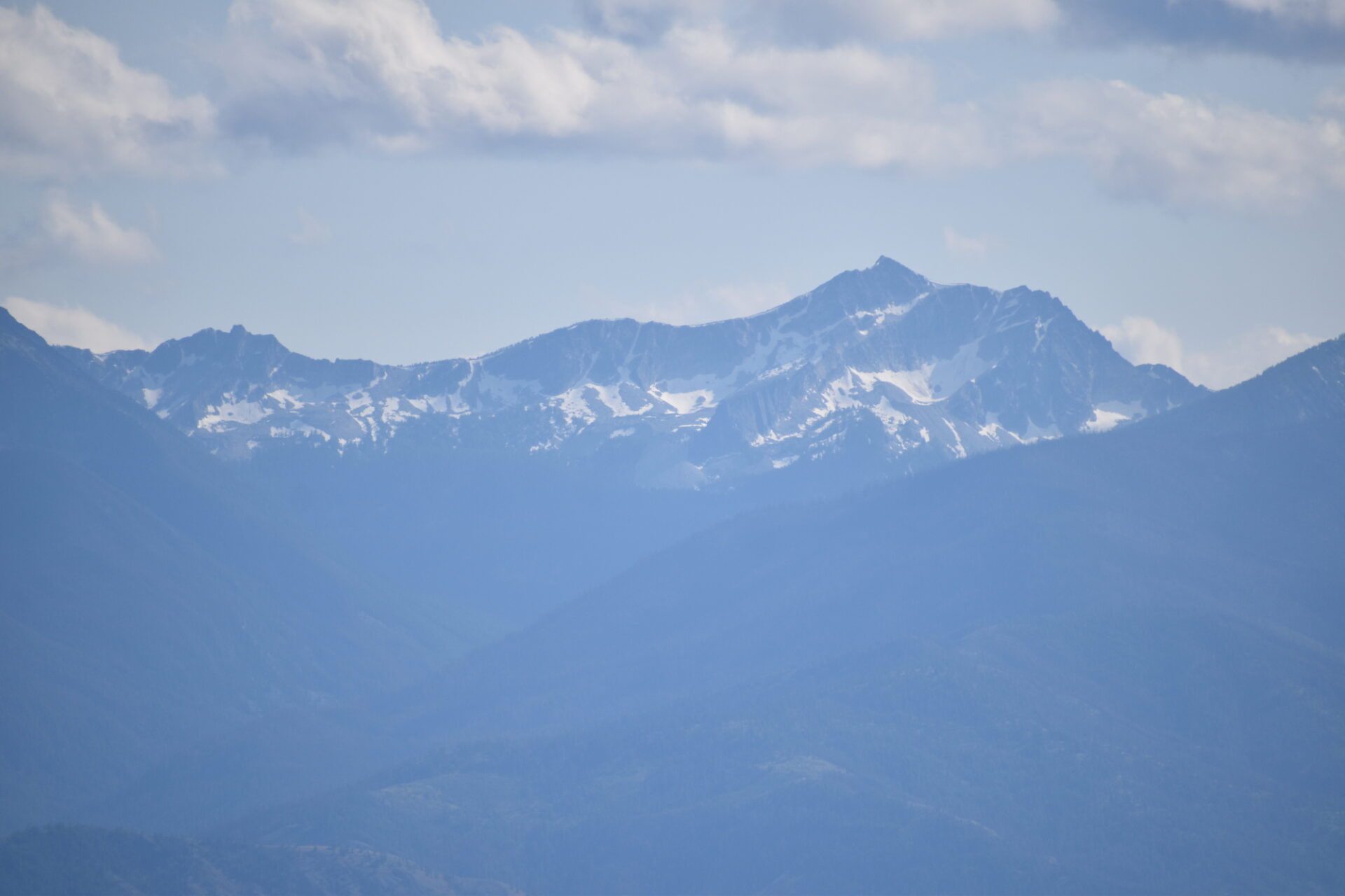
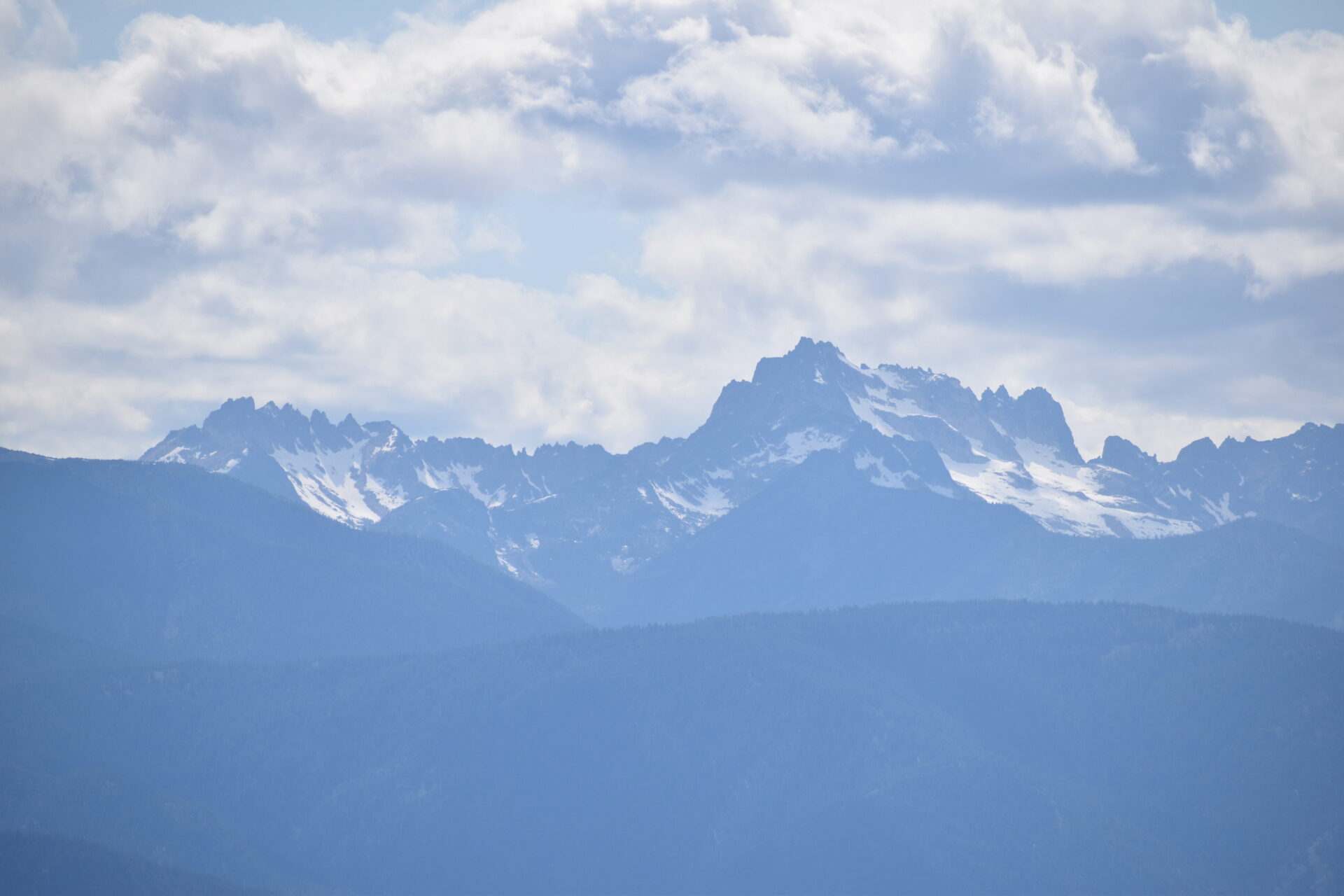
Sadly, Ramsey’s summit is mostly treed with only peek-a-boo views of the huge North Cascades peaks to the west, but there is a really cool rock cairn and some nice views from lower down on Ramsey’s west side. As I headed west across the summit I convinced myself I could find a better way down and tried angling down the steep south side. All the deadfall and debris wasn’t unlike walking on ball bearings and after getting trapped in yet another area of blowdown, I ended up traversing all the way back to nearly the place I came from before dropping down to the fire road a bit higher up. Turns out the best views from Ramsey were on the walk back to the truck!
At one time there was a trail west of Blue Buck, that traversed north-south across the entire Methow Wildlife Area, over the summit of Ramsey, all the way to Boulder Creek. This stretch over Ramsey at least for now is long gone.
The not even 2.5 mile route to Ramsey might classify as my longest 2.5 mile outing ever. While I might not recommend a visit to Ramsey, it does have a really cool summit cairn and the Methow Wildlife Area is a peaceful place to get away. I hope at some point trails here can be restored because it’s a beautiful place to explore.
Date Climbed: 7/12/20
Distance (RT): 2.3 miles
Elevation Gain: 700′
Summit Elevation: 5,316′