For a few weeks I’ve been eyeballing conditions up the Twisp River Road, waiting for enough snow to melt out around 6,000′ to hike up to the former fire lookout site on War Creek Ridge.
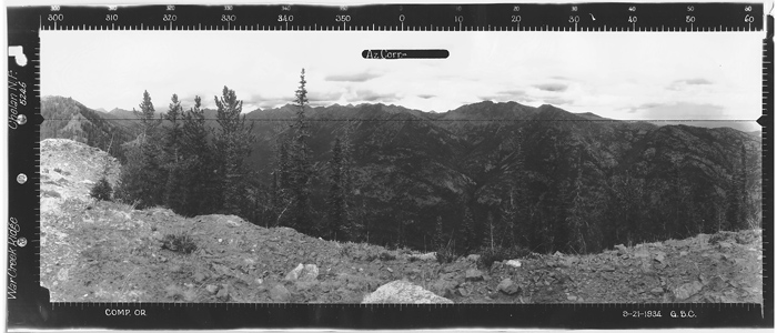
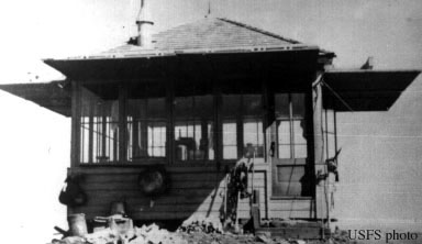
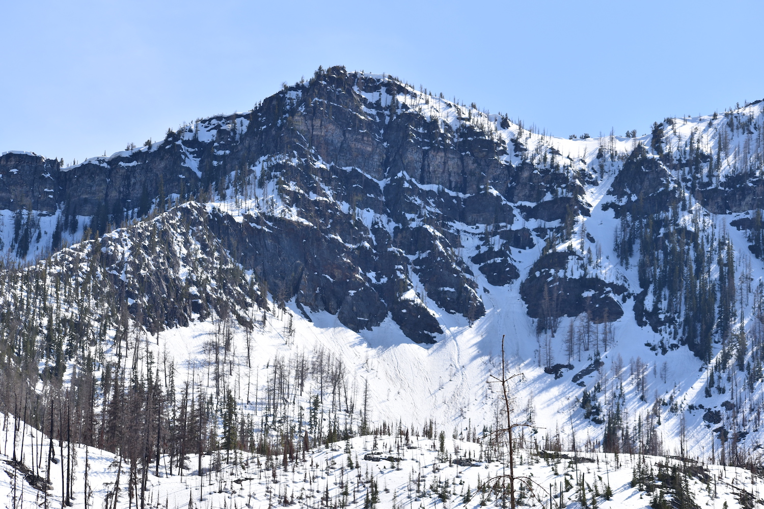
War Creek Ridge is a prominent ridge west of Twisp River Road near the Williams Lake area that stretches for miles across Williams Butte all the way over to Camels Hump near Reynolds Peak. An L-4 cab fire lookout was built at 6,080′ on the ridge in 1940, then used in World War II by the AWS to spot enemy aircraft. An old guard station along War Creek was also used by the AWS as sleeping quarters for spotters. The lookout site was decommissioned sometime in the 1950s.
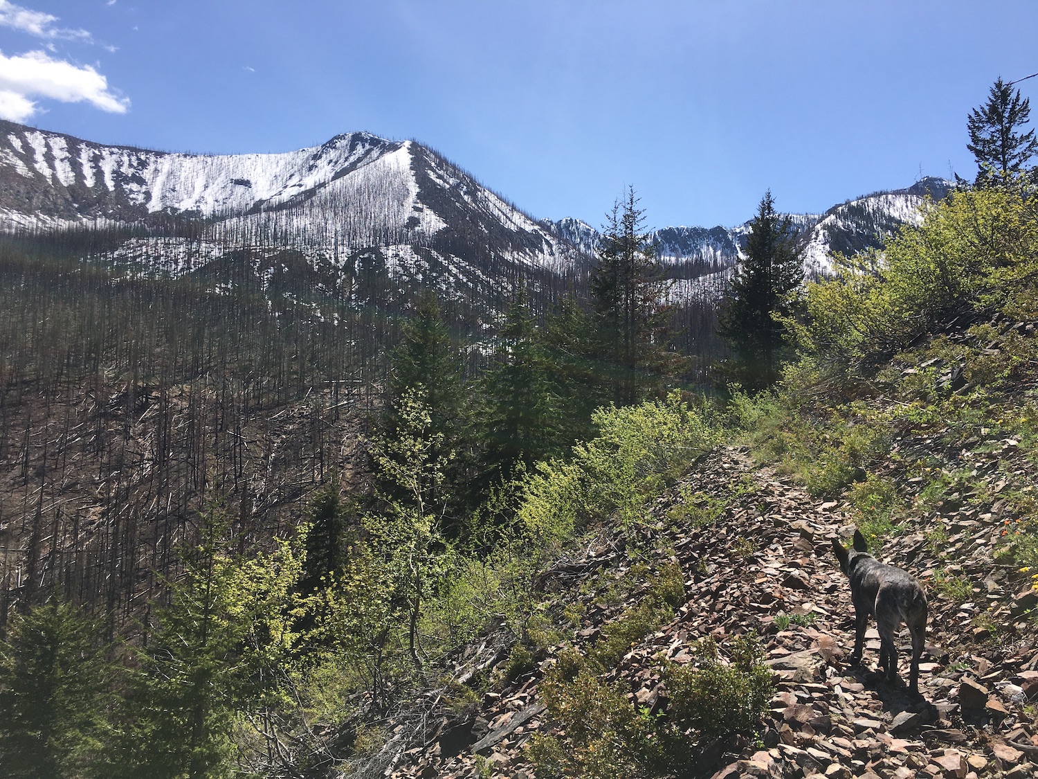
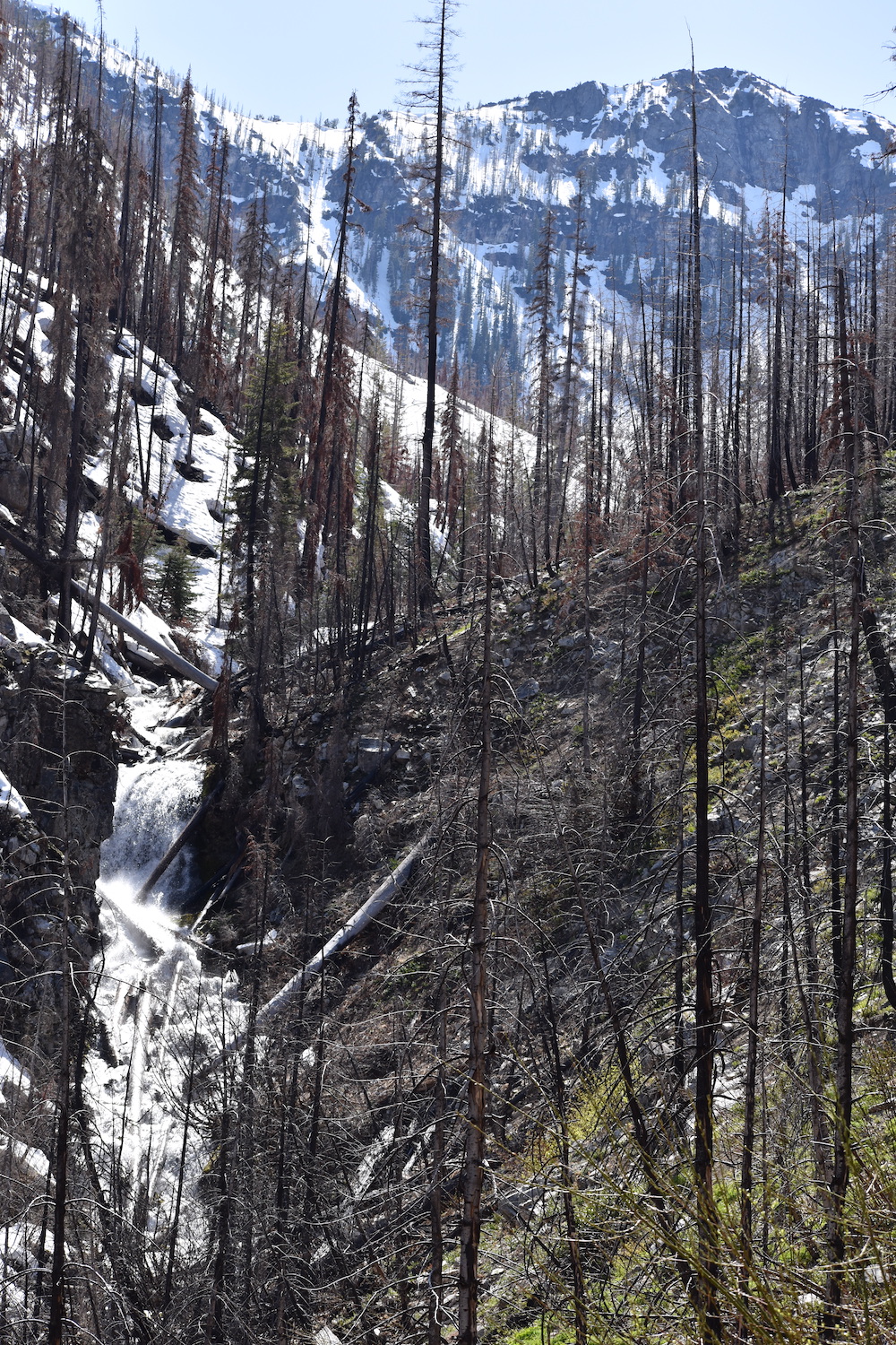
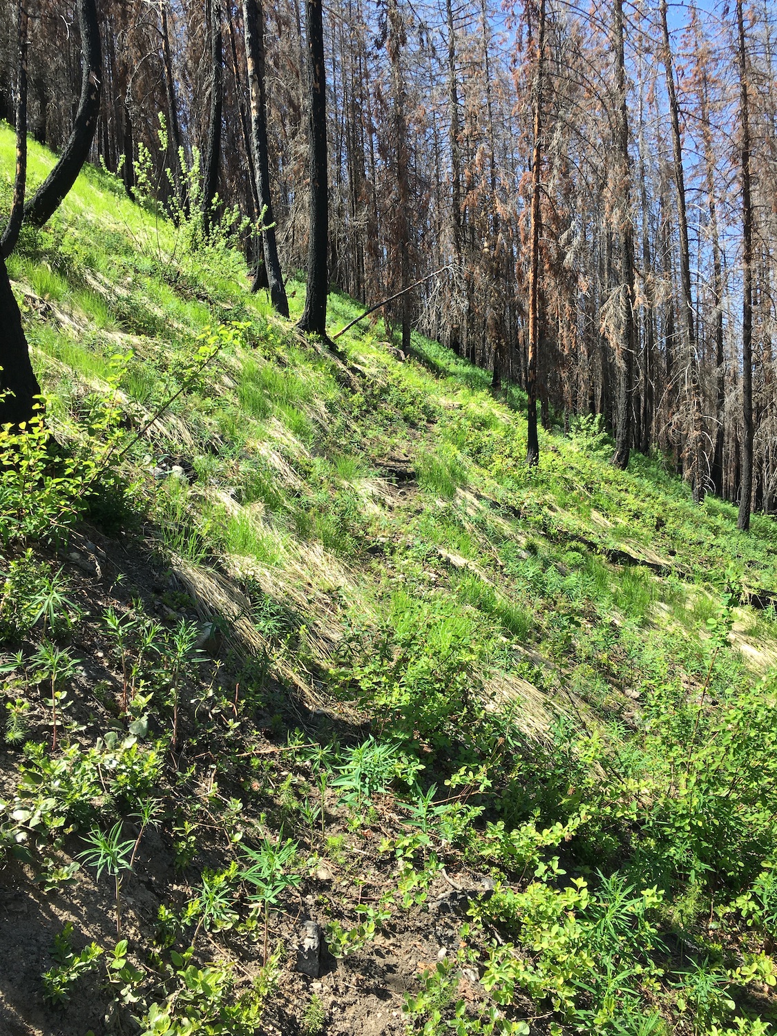
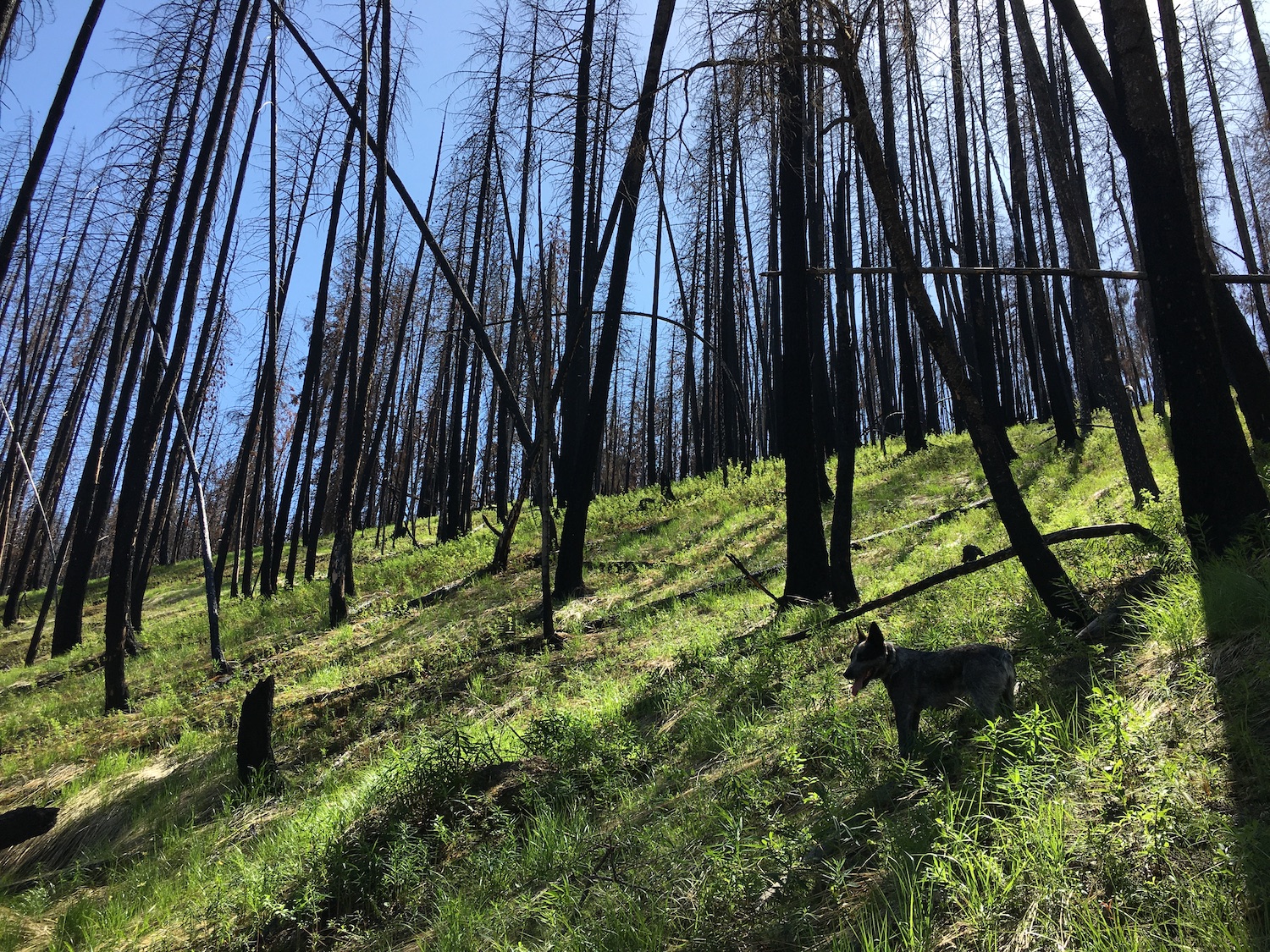
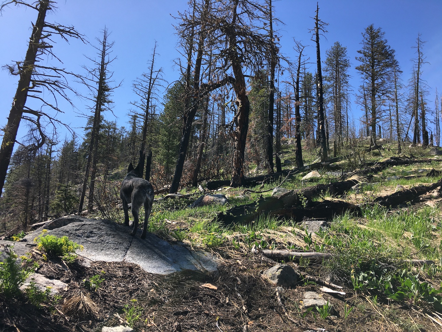
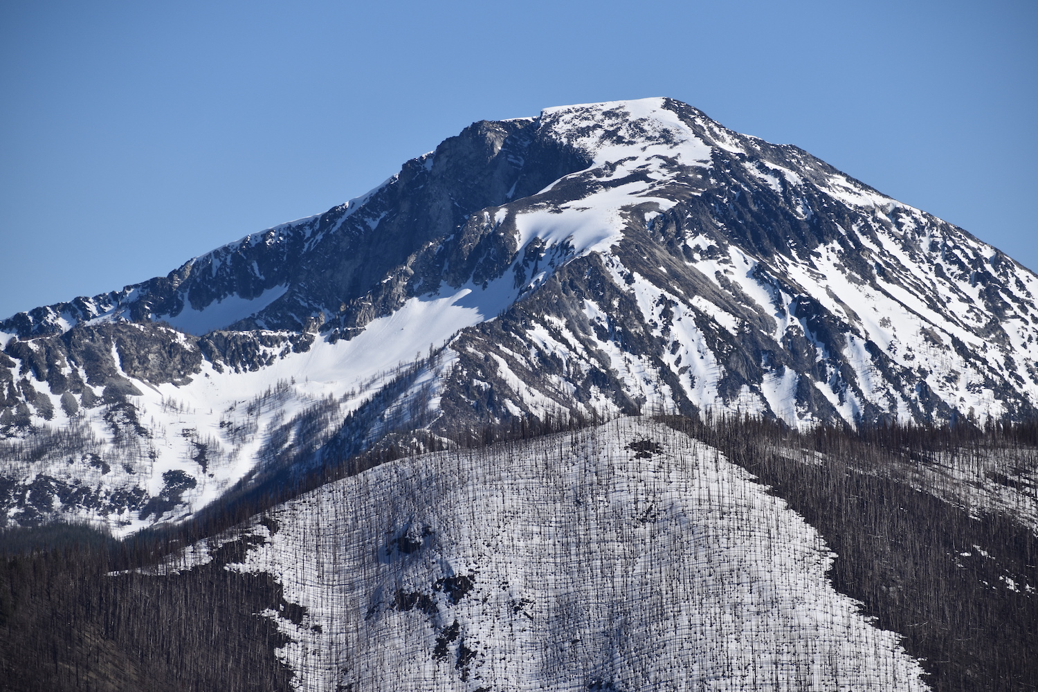
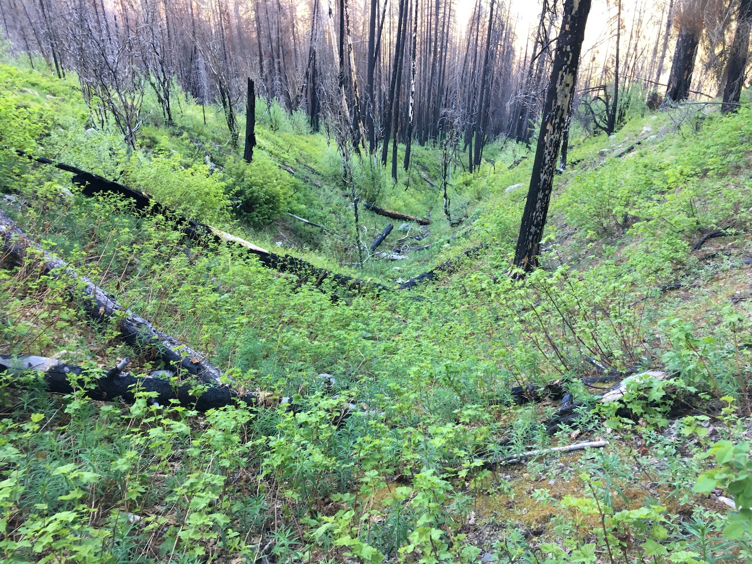
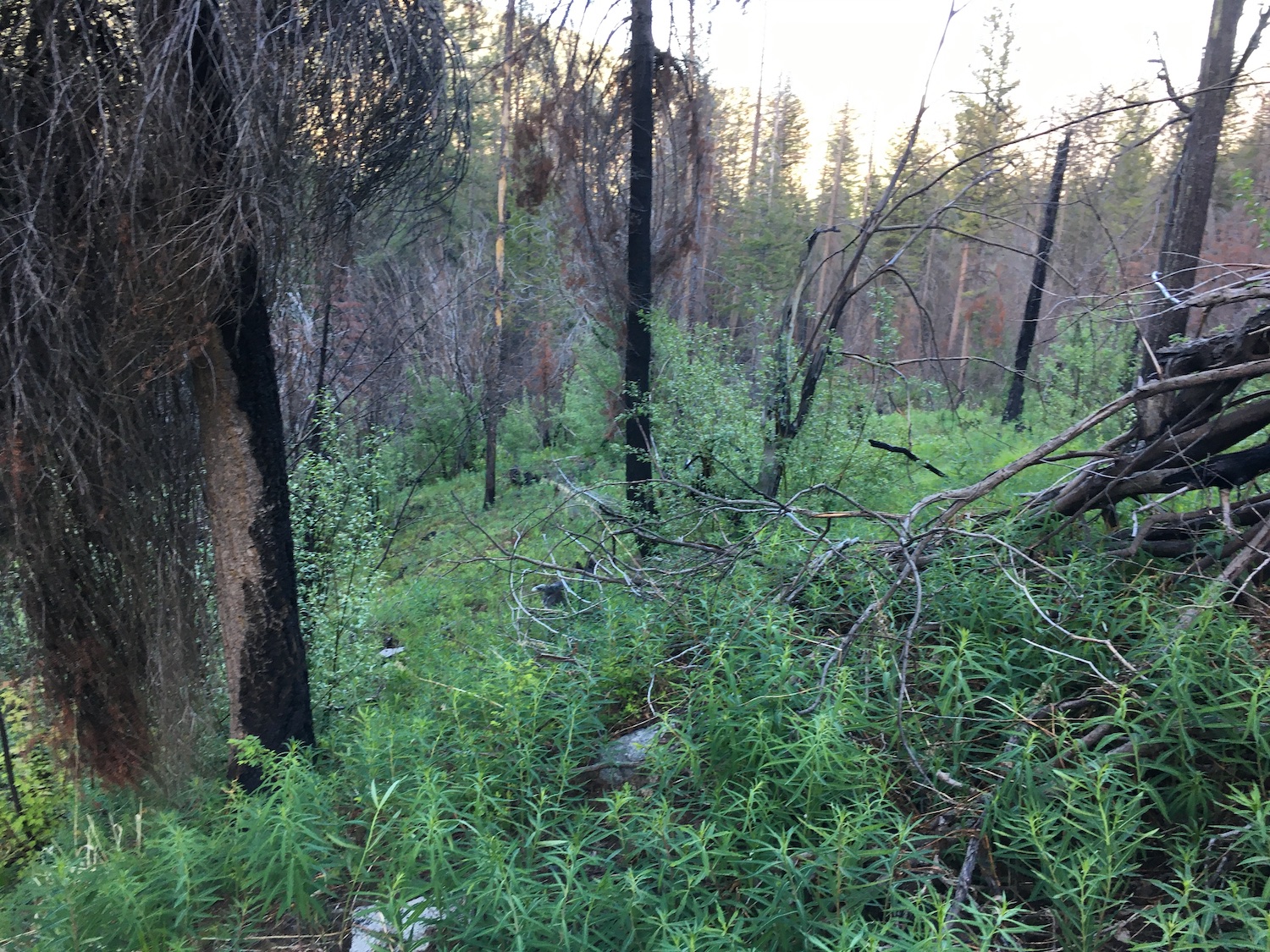
The 2018 Crescent Mountain fire burned hot through this area and the old War Creek Ridge trail has been nearly erased. The route to the old lookout site is now almost entirely a cross-country hike up steep slopes and through thick brush. It may be tough in another few years to even reach this site.
I actually set out to do this route on Saturday but turned back when I quickly realized I’d be marching right through prime tick habitat without any repellent. Instead, I spent the day hiking on an actual trail to nearby Williams Lake to see War Creek Ridge from a different perspective and see how far I could get before hitting snow. I’m honestly not sure I avoided the ticks any better. The Williams Lake trail had quite a lot of overgrowth and I found a number of ticks in the foliage and on the ground. Luckily only one hitched a ride back to the truck with us and I was able to dispatch it. Ugh.
If you’re curious, I was able to get within a mile of Williams Lake before hitting punchy snow in the boulder field and calling it done. I bet in another two weeks or so it’ll be easily passable. There are a few large trees down on the trail but nothing too tricky to navigate around. I’m actually glad I spent the day here because I found out first hand how much brush, soot, and ticks I’d be facing bushwhacking up War Creek Ridge.
When I returned on Sunday for War Creek Ridge, I was much better prepared! This time I wore pants tucked into bright yellow gaiters so I could easily see ticks and had coated myself and Hudson in a heavy coat of Picaridin. It was a wise move!
Starting from the War Creek Trailhead, I scouted up and down the trail attempting to find any remnants of the old ridge trail but there’s nothing but overgrowth and deadfall. A steep cliff band on the southeast side of the ridge makes going straight up tough so I backtracked to near the start of the trailhead and took off north through the burned out forest.
I slowly made my way up the steep grade moving northerly around the cliff band. About 300′ up around 3,300′ I stumbled across what I first thought was a game trail. As I followed it I quickly realized it was the remnants of the old ridge trail. It was about 400-500′ lower than my GPS forest service map layer was showing but there’s no question it was the old trail. It seemed the deer had been keeping it alive.

As I wrapped around the ridge, the trail tread was surprisingly obvious in spots, and in others it threatened to erode completely from the steep hillside. The side of War Creek Ridge is undulating with small drainages and fingers. Somewhere around 3,600′ the trail disappeared in a steep draw and I saw no sign of it anywhere on the other side.
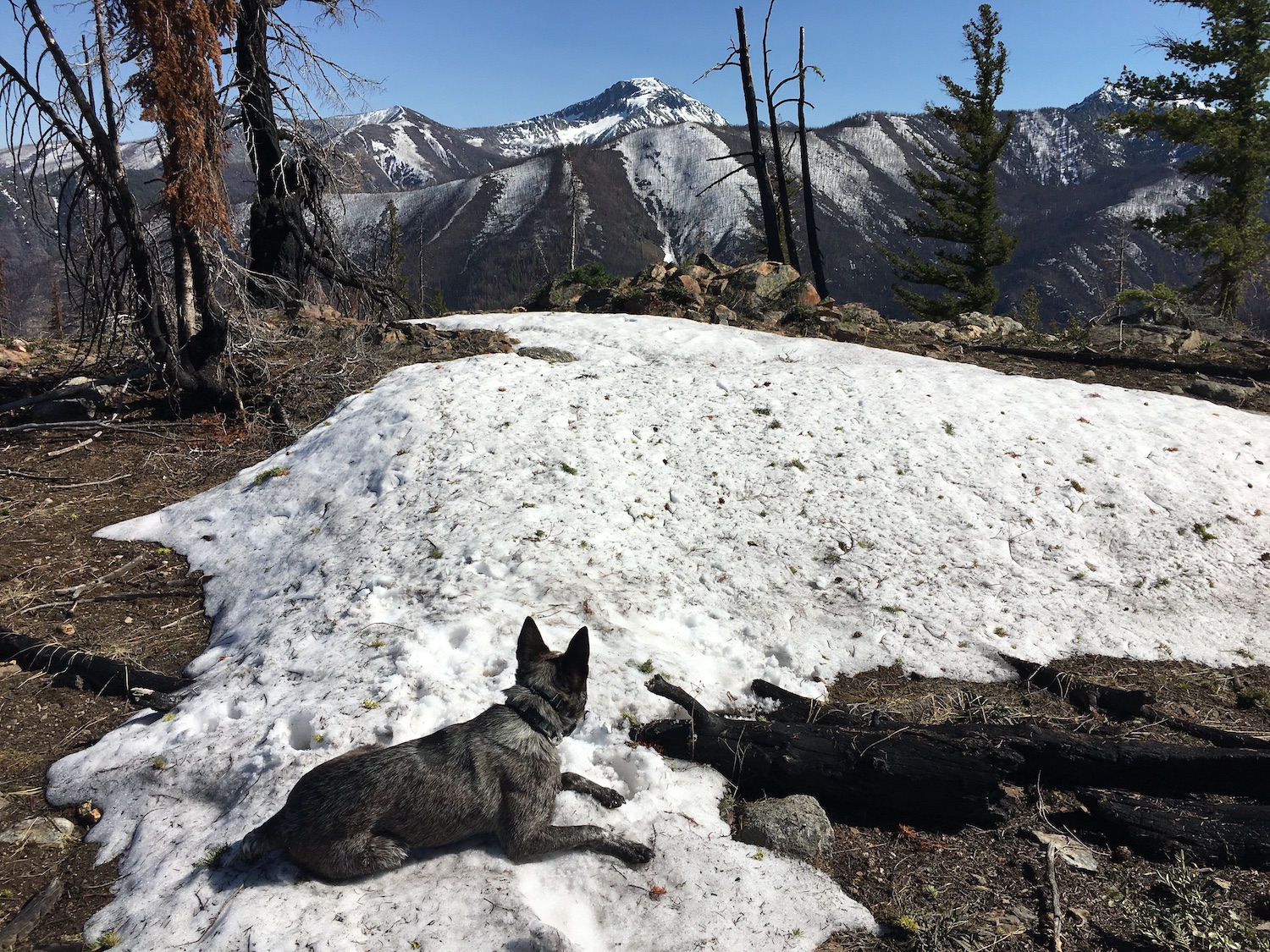
At this point, the best way to the ridge was up so I turned upwards and climbed about 1,000′ in less than a half mile through thick fireweed before I finally gained the ridge. Whew. That was fun! I picked the warmest day of the year for this ascent so I was happy the burned out trees were still managing to provide a bit of shade relief on this warm 85-degree day.
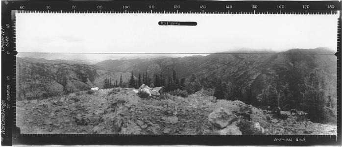
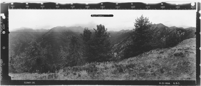
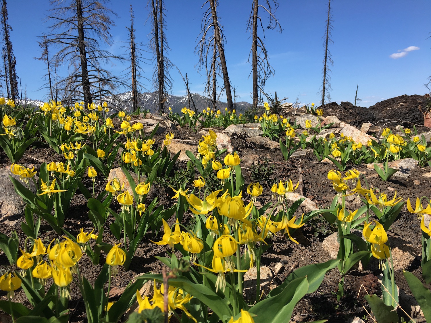
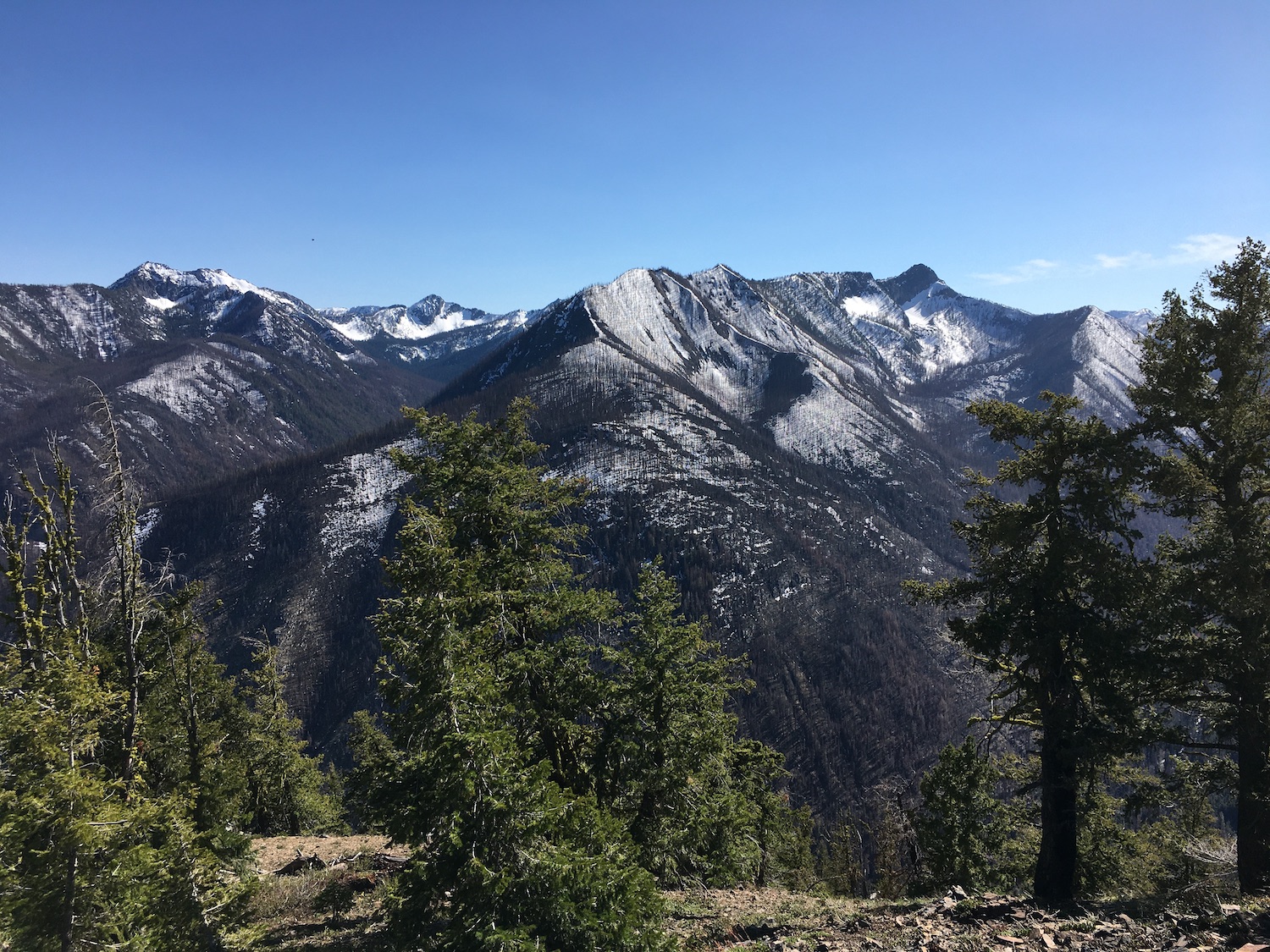
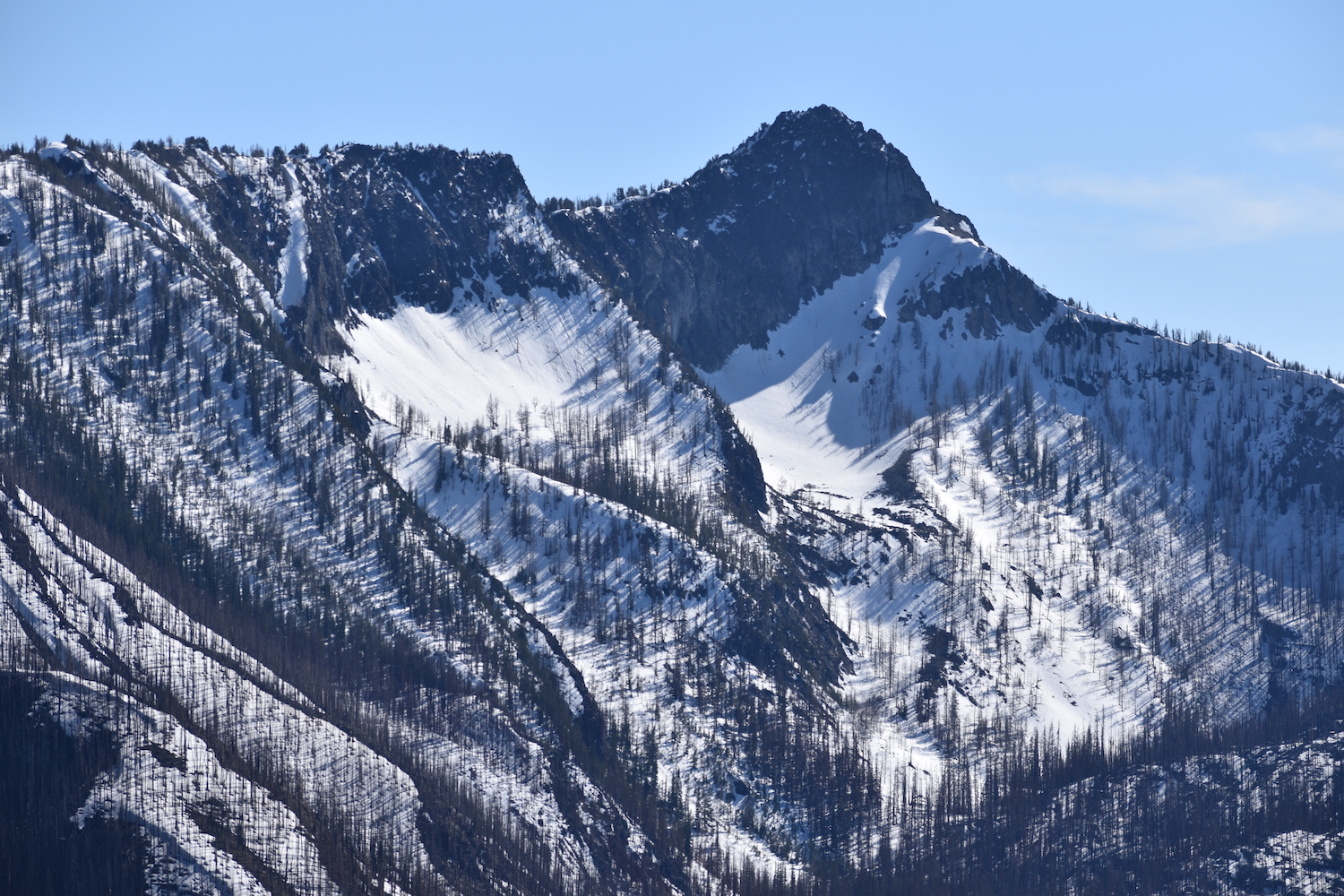
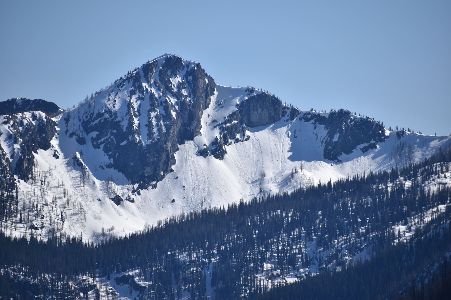
Once I gained the ridge I took a break on some rocks, enjoying the big view over to Reynolds Peak and up the South Fork of Williams Creek. From here, getting to the old lookout site would still require a 1.5 mile ridgeline ramble gaining 1,600′.


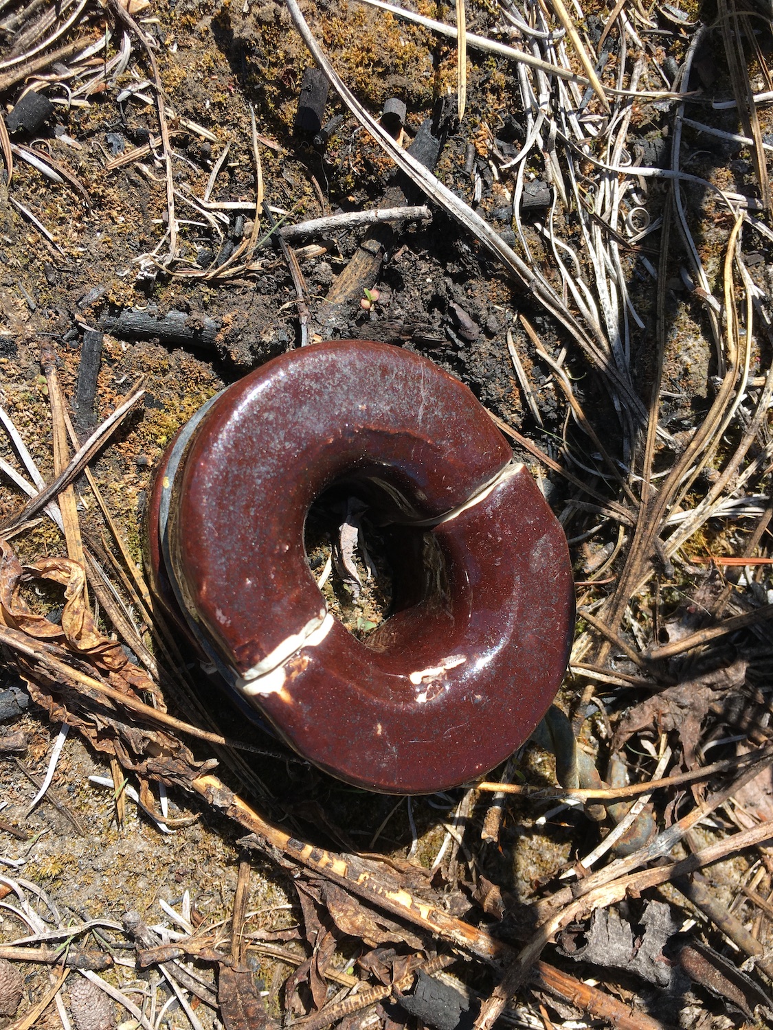
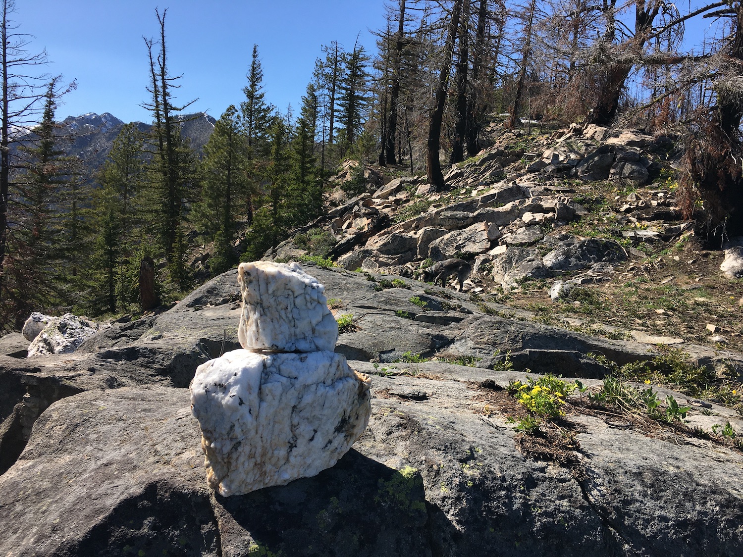
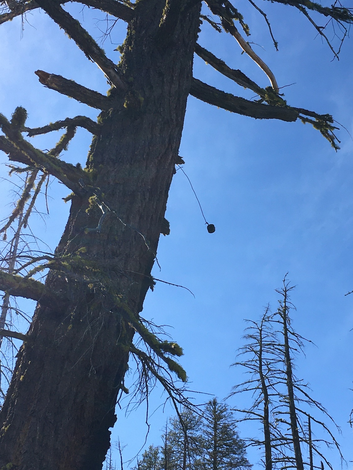
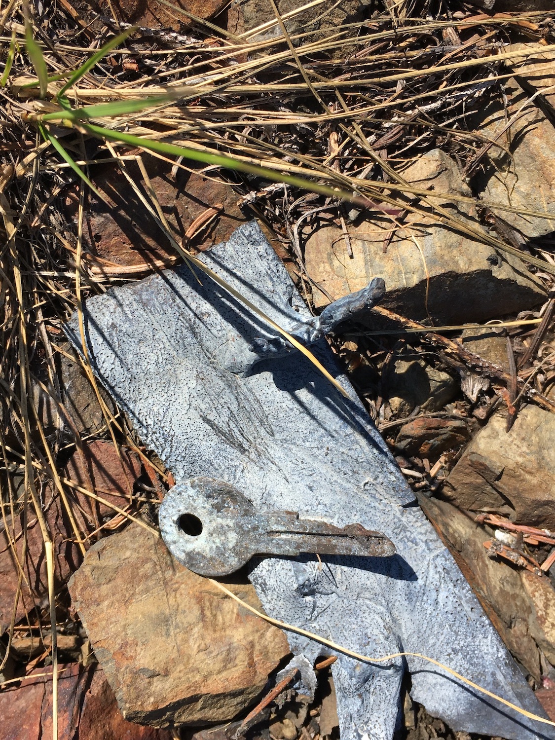
Brush and blowdowns along the ridge are easy to get around and the route is straightforward. I was surprised to find sections of the ridge trail still in relatively good shape. In other places the trail is lost completely but there are still plenty of old insulators hanging from the trees which help point the way. It was fun to try to spot them all and I found a dozen still attached to trees or deadfall. Also fun to find? Tons and tons of huge quartz rocks all over the ridge. War Creek is famous for them.

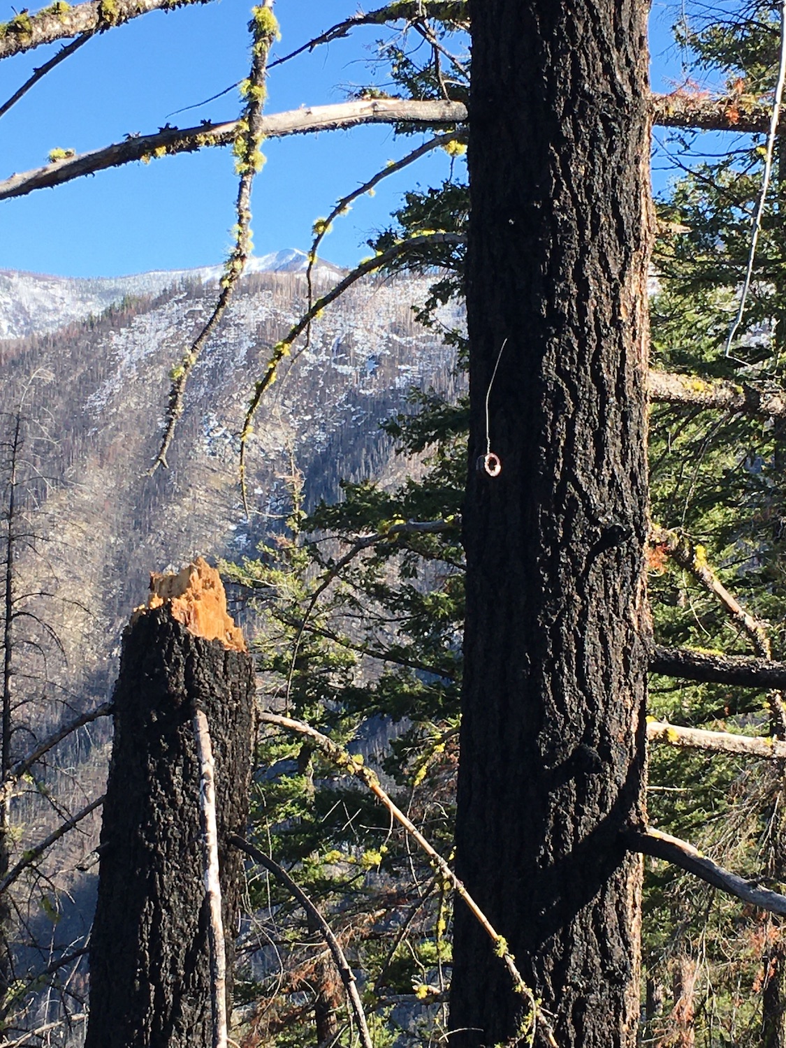
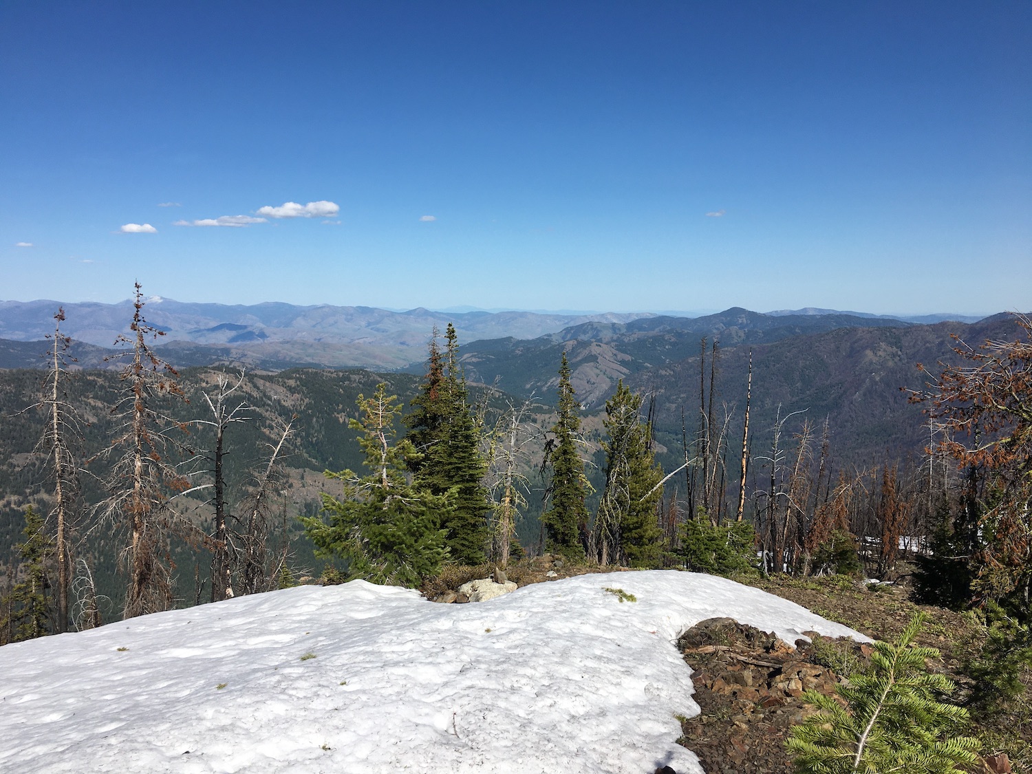
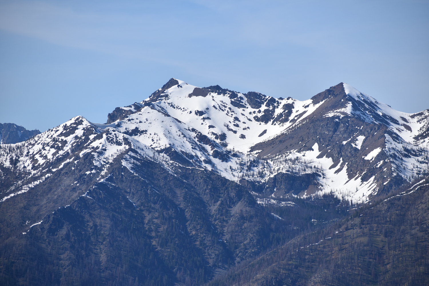
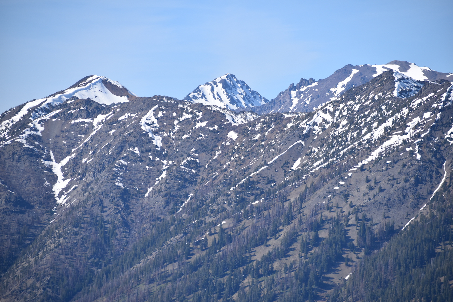
It took me a bit over 3 hours to hike the 2.75 miles to the lookout site, gaining about 3,100′ along the way. Once there, the views certainly did not disappoint! From the top I could look north over to Midnight Mountain, northwest to Cutthroat and the Early Winters Spires, then south-southwest to Courtney, Star, Battle, Sun Mountain, and down the Twisp River Valley all the way to Winthrop and beyond. From the summit I marveled at a new impressive perspective of Oval Peak.
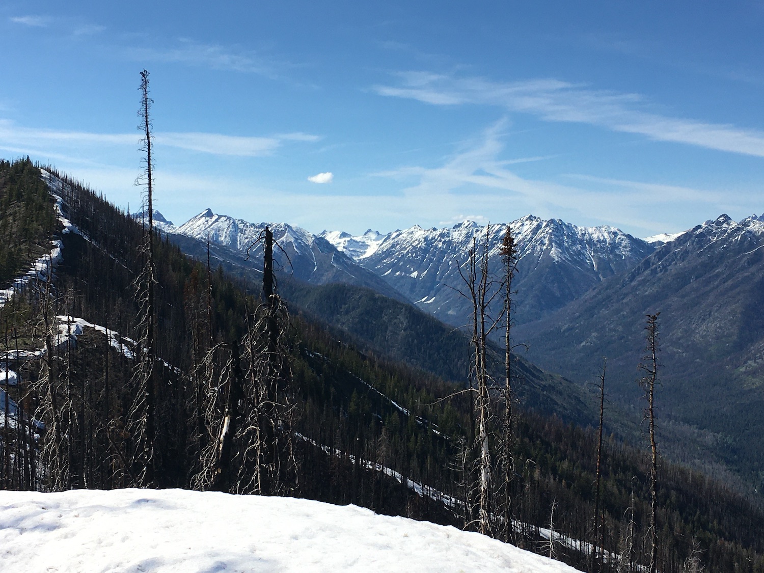
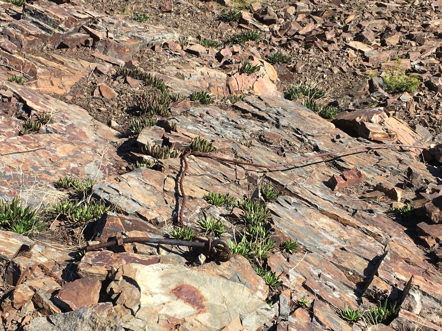
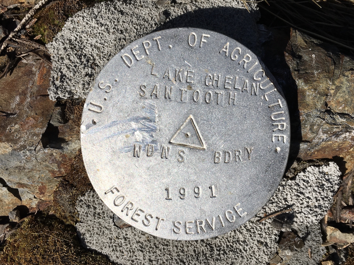
War Creek ridge was a mighty fine spot to sit back and enjoy the sun and the views. There are also old lookout footings on the summit as well as old anchor bolts, a benchmark, and a few other artifacts. Snow was still lingering on the top and since War Creek is a steep knife-edge ridge, it wasn’t possible to safely continue. I’d certainly consider going back sometime to run the ridge at least over to another high point around 6,400′ and maybe even further.
After a nice break to soak up both the sun and the views, Hudson and I made our way back down, most of the ridge traverse going very quickly this time. My only mistake? I reset my tracking GPS on the way down and could no longer access the exact track I had taken on the way up.
No bother, I thought. I dropped off the ridge through the steepest part of the descent, trying my best to pick the same spot I had come up. I knew the descent would slowly flatten out the further down I got so if I missed the old ridge trail my plan B was to just keep going down straight to the road. It would then be a short road hike back to the trailhead.
As I descended, it didn’t take long to realize I was much further west than I had ascended and I saw no sign of the trail around 3,300′ anywhere. Rather than traversing to try to find it, I went with Plan B and continued down the ridge towards the road. Unfortunately though the finger I was hiking along was rapidly narrowing. Pretty soon I was forced to drop down into a steep wash full of loose rock and thorny plants so I could traverse over to wider terrain. It was about this time I was thinking “girl, why oh why do you do these things!?” Well, it is kind of fun in a type 2 kind of way.
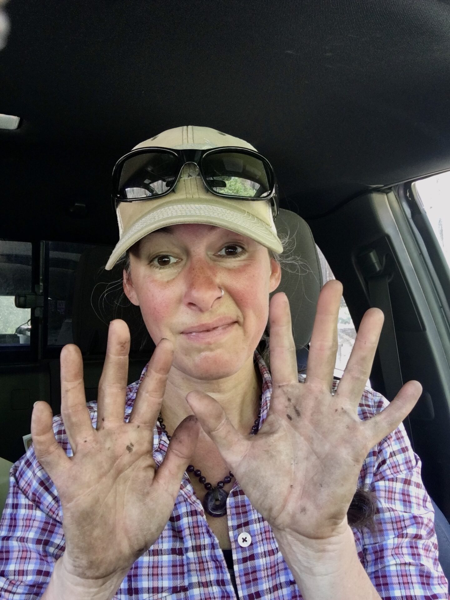
Eventually the ridge did flatten out and aside from navigating a few pockets of dense brush, this route wasn’t a bad exit route. In fact, it might even be a more straightforward way to climb up to the ridge. I finally stumbled into the road, brushing off dirt and soot from my clothes and face right as a pickup truck came by. The driver stopped, looking a little surprised.
“Where’d you come from? Are you ok?” the gentleman asked.
I pointed up to War Creek Ridge. “Up there” I said. I realized I was probably a filthy mess.
“Are you shittin’ me?” he asked.
“Nope. I’m not. There’s an old lookout site up there” I said.
“Are you shittin’ me?” he asked again.
“Nope,” I said. “It’s a pretty cool spot but a real bitch to get to!”
The gentleman shook his head and asked if I needed a ride back to the trailhead. I thanked him but declined. It was only a half mile and the road walk would be a nice wind down. He tipped his hat and drove off, likely thinking I was crazy. Sometimes I think I am too.
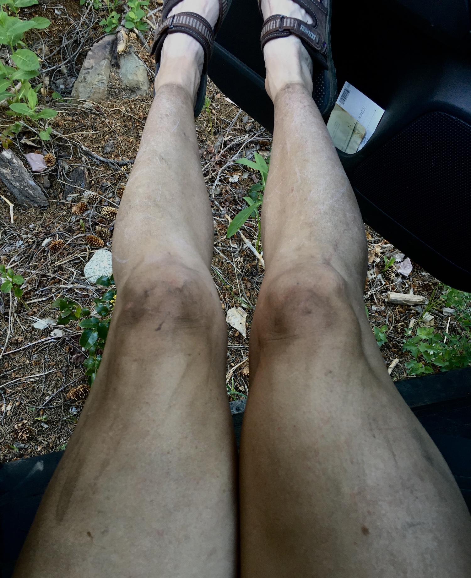
Once back at my truck I did another thorough tick check, discovering only one little bastard that had hitched a ride on Hudson. I’m glad we came back coated in Sawyer’s Picaridin, that’s for sure! This trip was certainly a good reminder of why I study maps and terrain before I set out on these crazy adventures and why I always have a paper map, a GPS route, and an extra charger. I’ve found the Caltopo slope shading to be invaluable in situations like this and thanks to using it, I was able to pick my way down the less steep areas of the ridge.
The War Creek Ridge lookout site is a beast of a climb but a fantastic spot. Nothing quite like 5.5 mile round trip hikes that take 6 hours to complete!
Date Climbed: 5/16/21
Distance (RT): 5.5 miles
Elevation Gain: 3,100′
Summit Elevation: 6,080′
My ascent route in blue, descent route in red.
