Southern Cascades | Alpine Lakes Area
Okanogan-Wenatchee National Forest | Alpine Lakes Wilderness
Location: 47.3708115, -121.209505
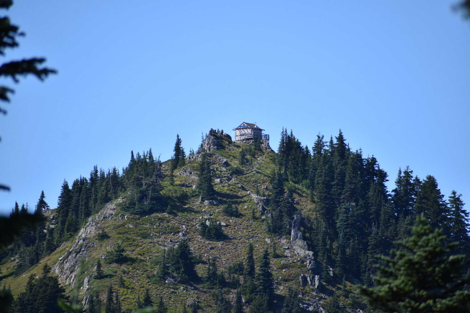
Summit Elevation: 5,854′
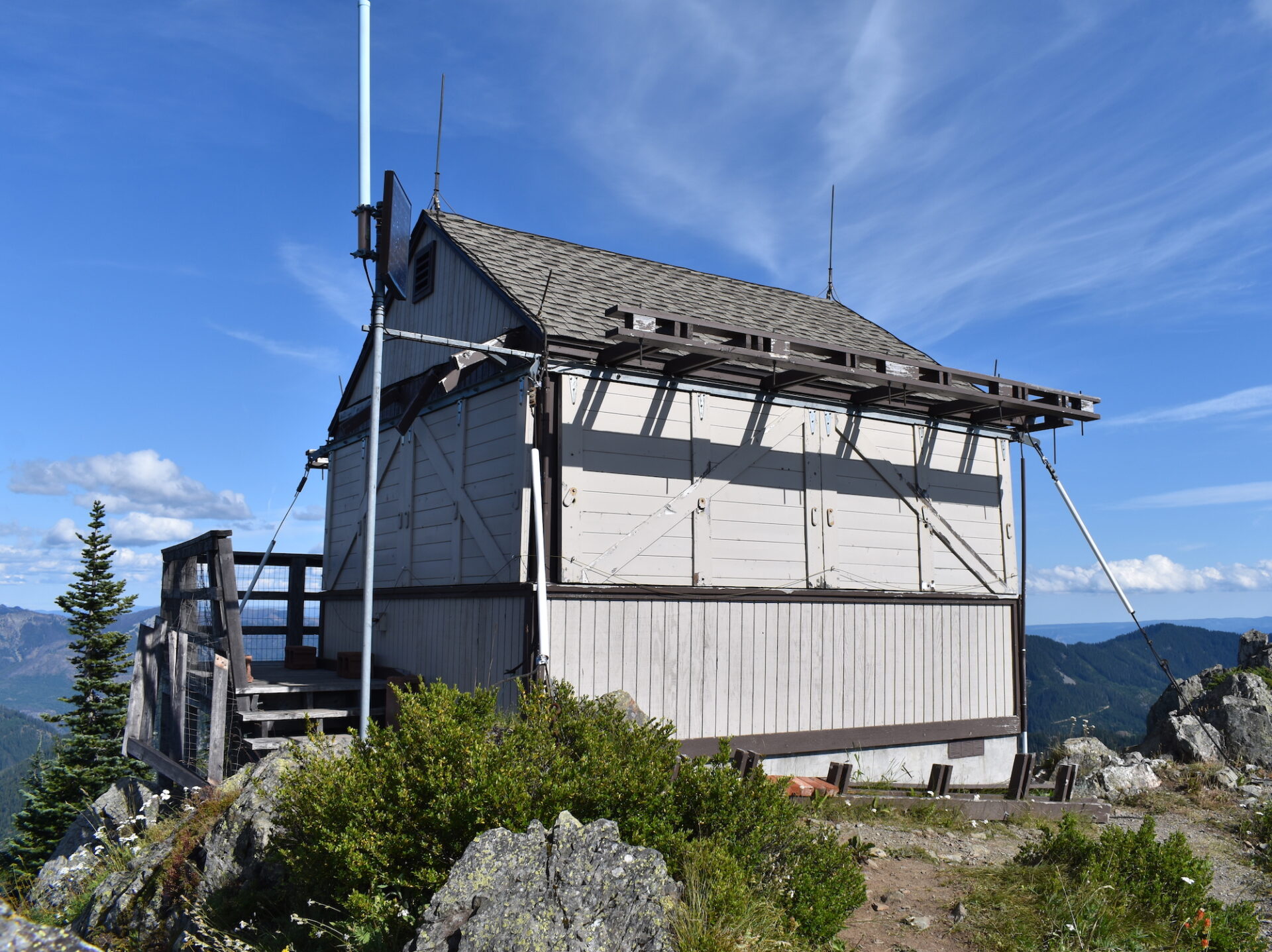
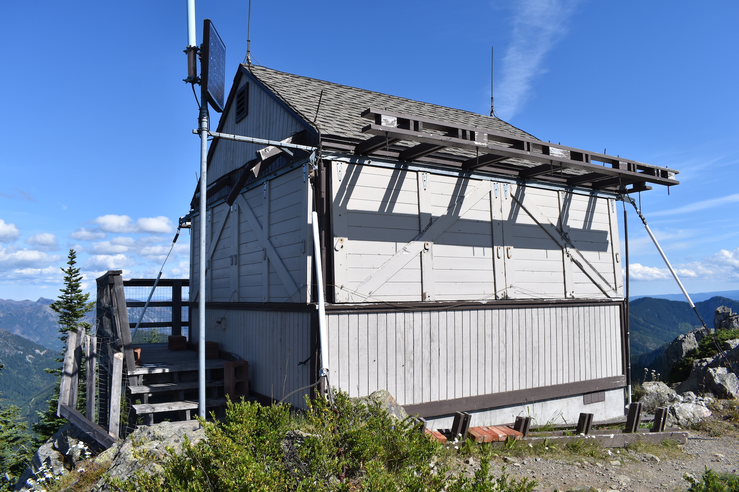
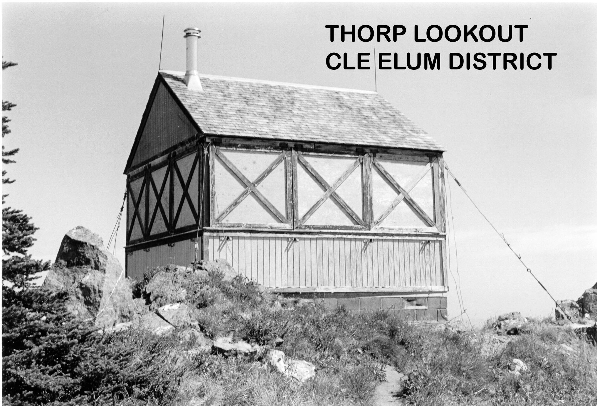
Lookout Type: 14’x14′ L-4 gable ground house
Site Established: 1930
Current Structure Built: 1930
Dates Visited: 10/17/13, 8/13/19
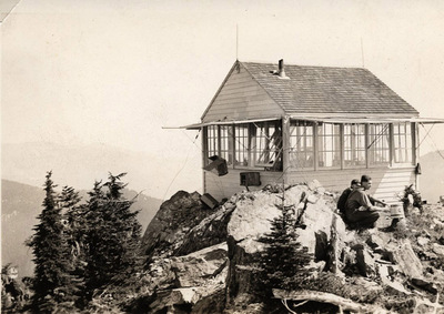
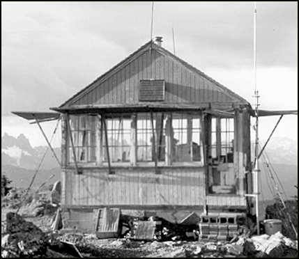
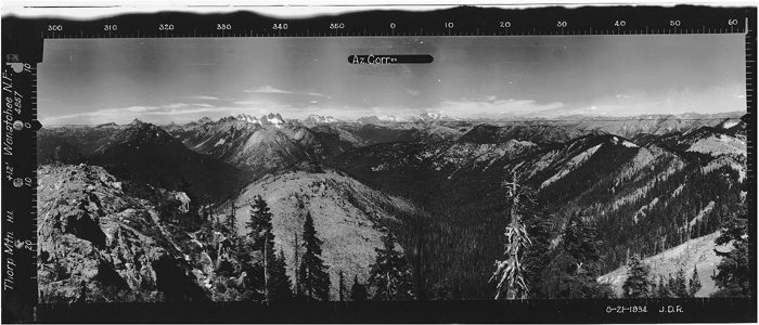
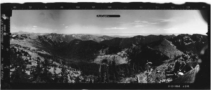
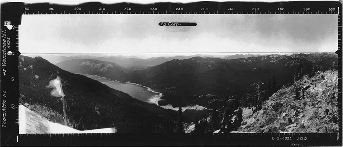
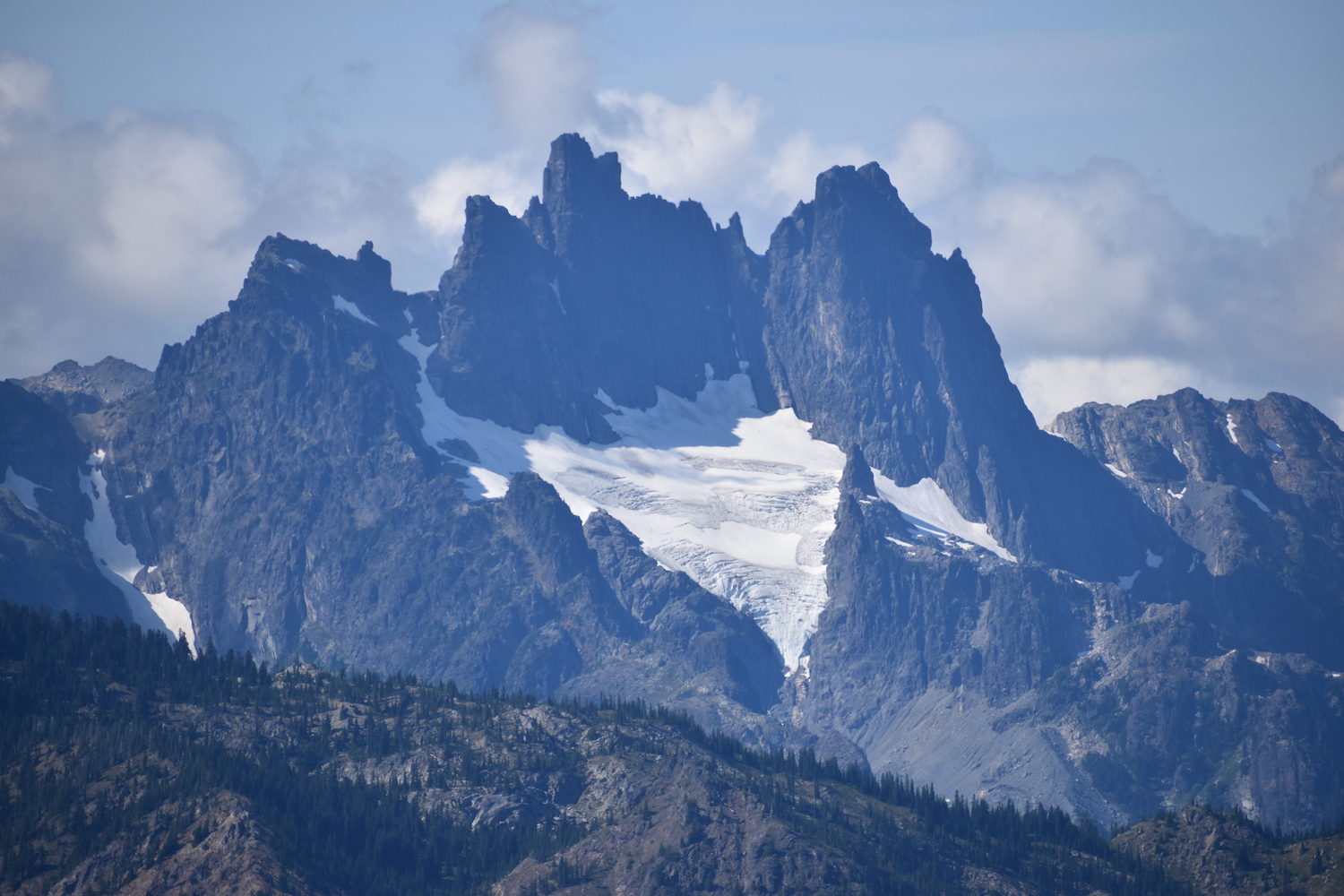
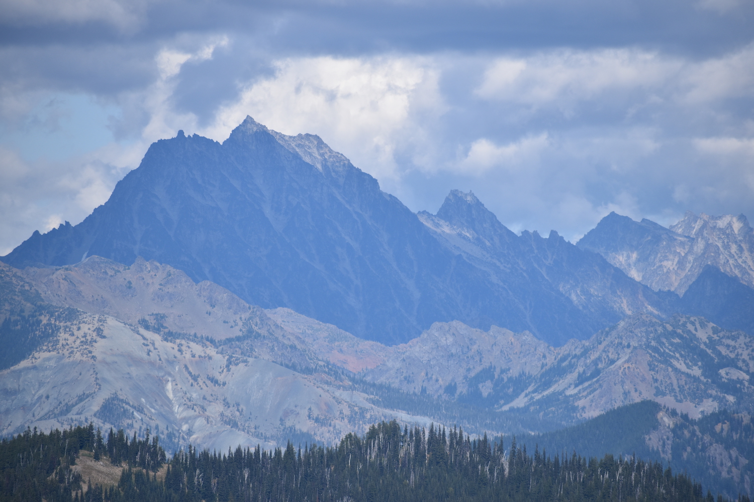
Located on the western side of the Teanaway, Thorp is one of few remaining gable-roofed L-4 cab lookouts, sometimes called a Grange hall, in the Northwest. It provides stunning, 360° views of Rainier and the Stuart Range as well as the big peaks of the Alpine Lakes Wilderness including Mount Daniel and Summit Chief.

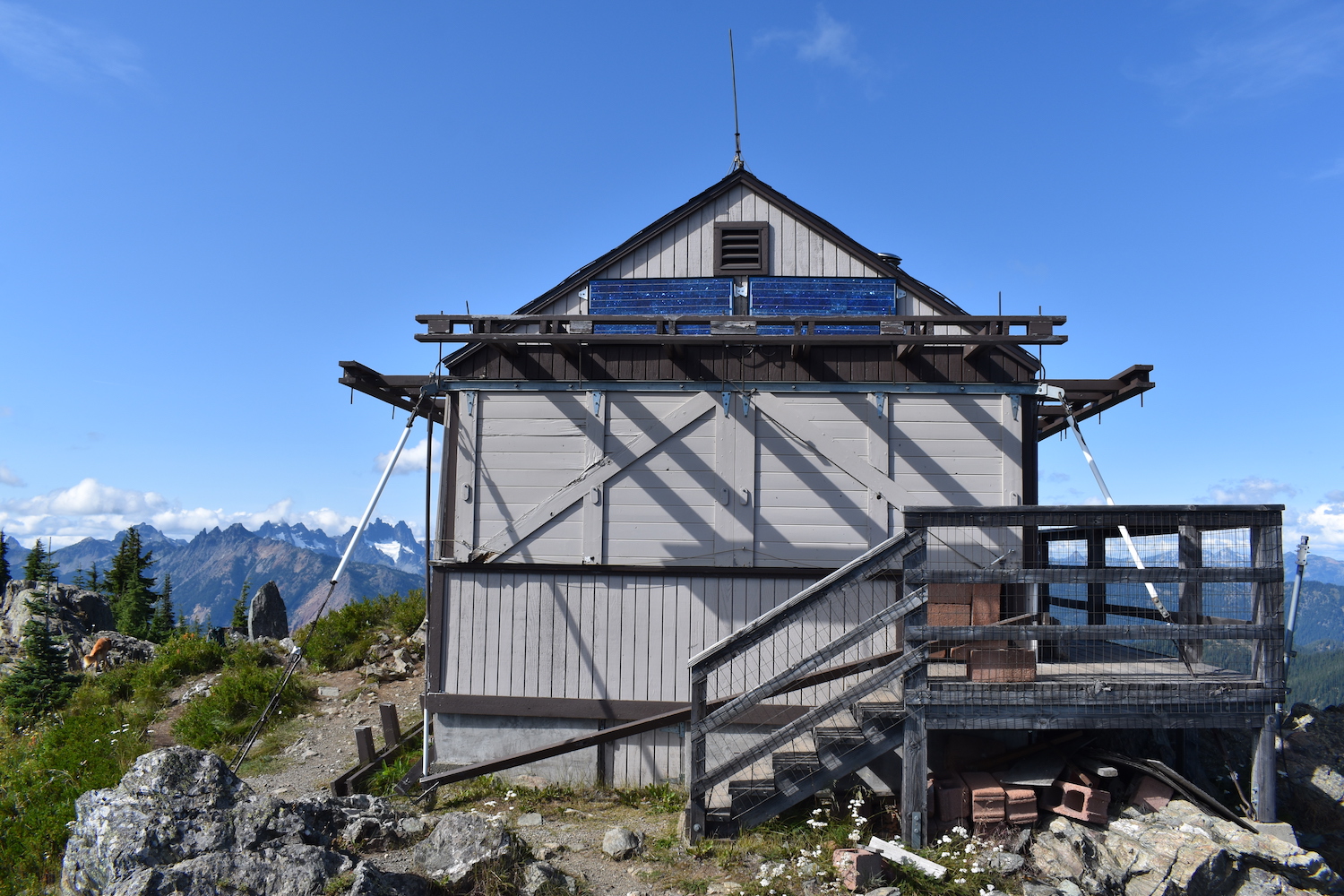
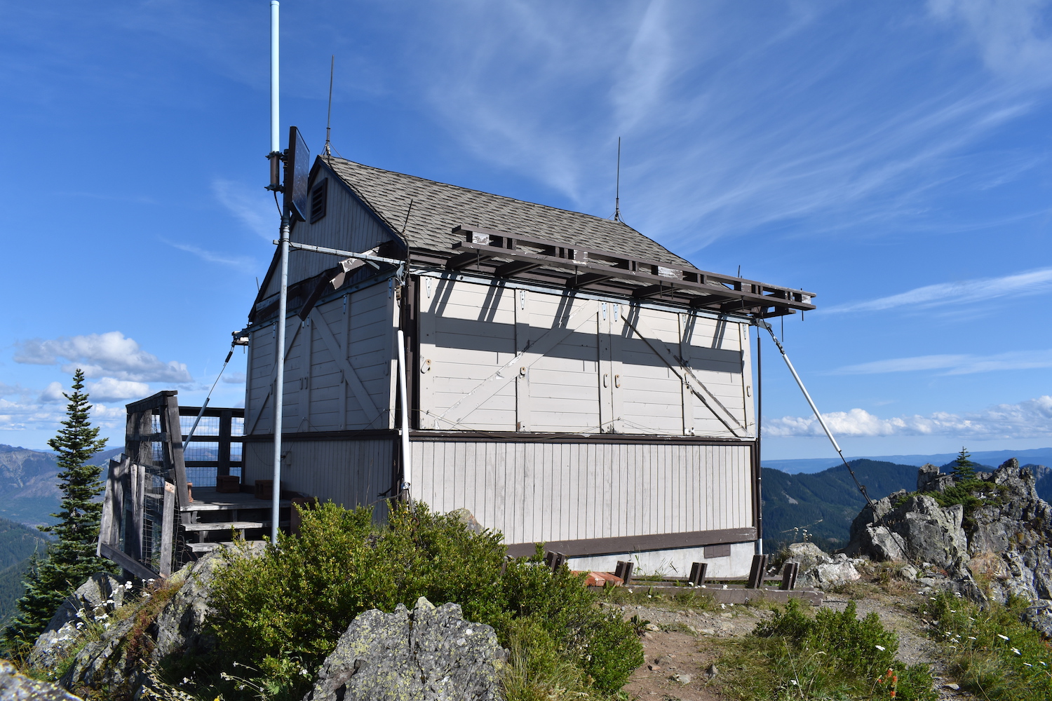

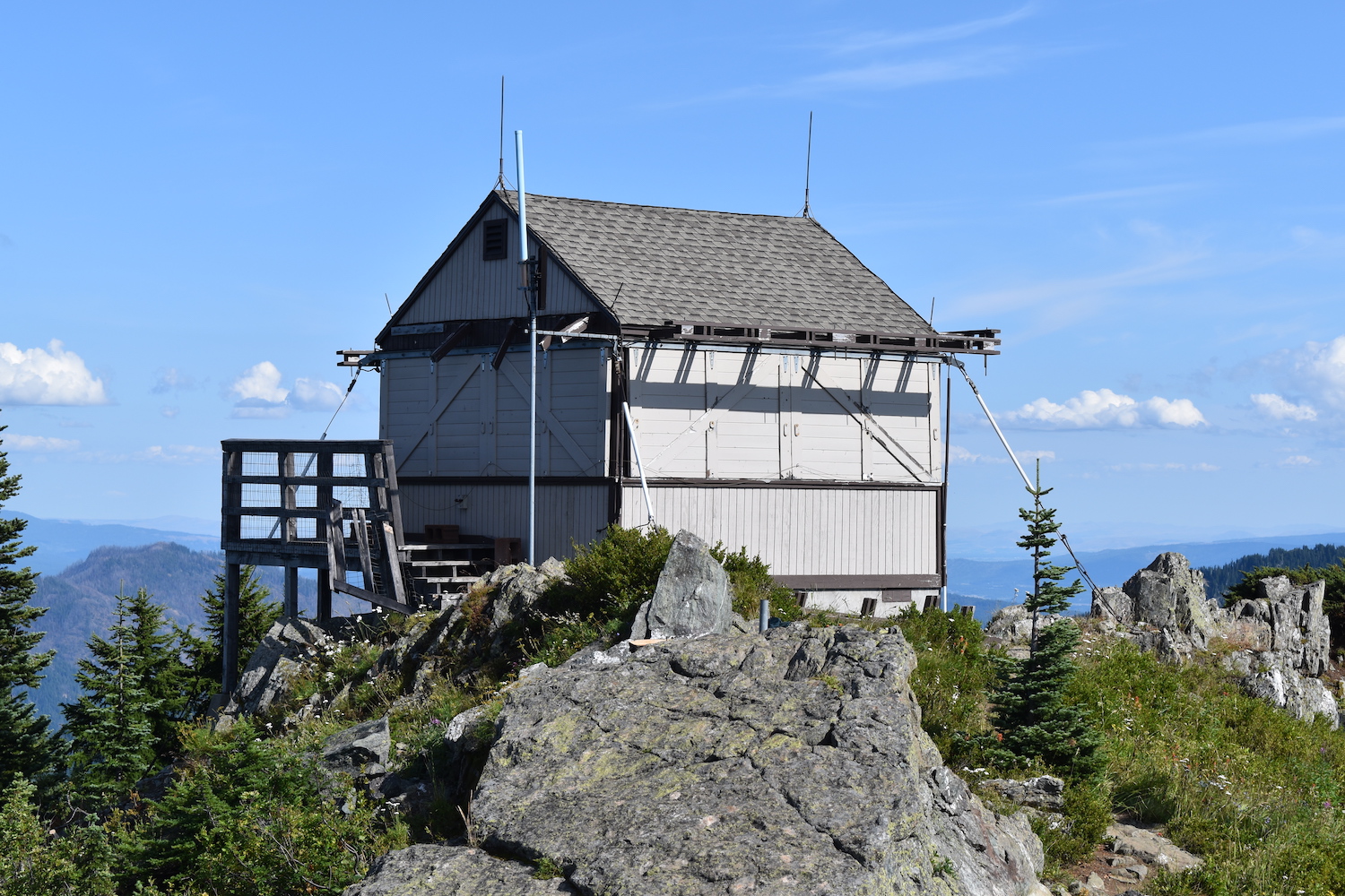
Photos from 2019 visit.
History.
Thorp was built in 1930 and has been staffed occasionally in the years since. It is no longer volunteer staffed due to carbon monoxide issues with the existing stove. The Forest Services does still utilize Thorp during periods of high fire danger.
The lookout is on the National Historic Lookout Register and underwent renovations in 2008, though the restorations did not necessarily follow the original design.
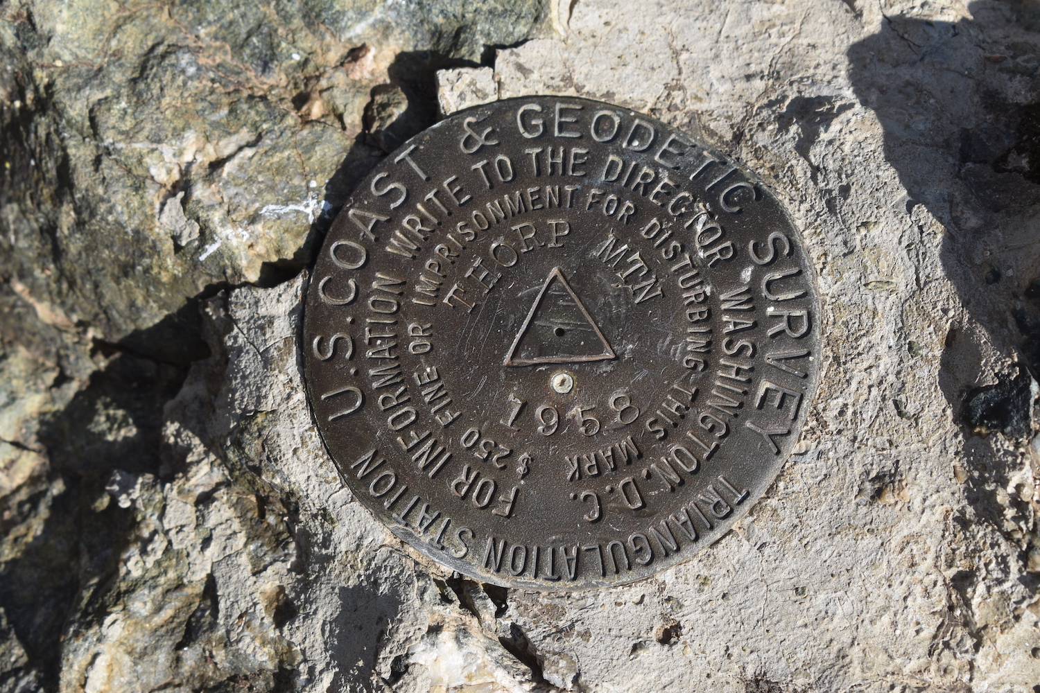
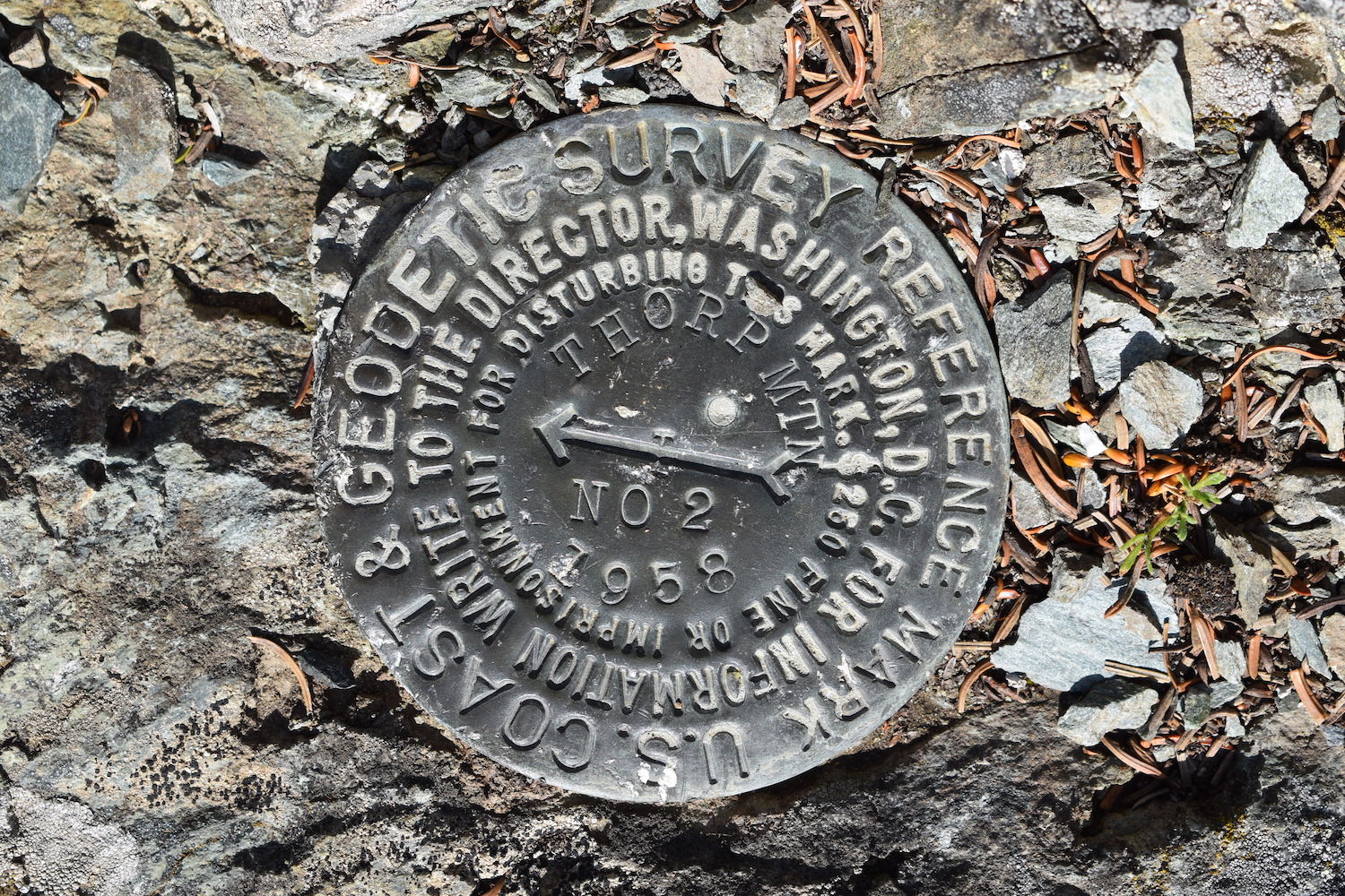
Katherine Bohnet sent me a story that in 1958 at the age of seventeen, she led three pack horses to Thorp Mountain lookout loaded with supplies for the geodesic survey team. “They hiked in later. I’d never been there. I was working at the lodge at Salmon La Sac and started there at five am after we loaded the horses. When I left the road at the bridge at Lake Cle Elum and started up the trail, which hadn’t been cleared, as it was the first of June, I encountered downed trees and snow banks all along the trail. I had to drag the horses around thru the brush. It took a long time. I made it to the lookout and unloaded the horses and tied everything back down and headed home. It got dark and I had to let the horses pick their way around all the obstacles. I first went hiking with our neighbor Louise Ulrich, a Swiss mountaineer of some note, from Yakima where I grew up. I started Going to Salmon La Sac with my friend Judy when I was in seventh grade. We rode all over that area on horseback until I went to college then married and had a family.”
The route.
There are numerous ways to access Thorp, so it can be a fun “make your own adventure” outing. The most popular route seems to be from the Thorp Creek trailhead, though Knox Creek provides the shortest approach. You could also do a long traverse of the entire Kachess Ridge or even make a loop over to Little Joe Lake. I’ve ascended from both the Thorp Creek and Knox Creek trailheads and would recommend either, though I preferred the direct, steeper approach of Knox Creek.
I would highly recommend bringing a map or GPS. Though Thorp seems straight-forward, there is a criss-cross of trails on Kachess Ridge and it’s easy to get confused and tangled on some of the junctions. Pay attention which way you go up!
Thorp Creek Trailhead
Distance (RT): 6.5 miles
Elevation Gain: 2,300′
The trail climbs steadily along Thorp Creek, passing a spur trail around 2.5 mile in that leads to Thorp Lake. The Lake is a scant 0.2 mile detour with some camp spots, a great detour for summer. Though Thorp Mountain is visible from the lake, the lookout is not.
From the Lake, the trail climbs steeper and in 0.4 miles, you’ll reach a junction with the Kachess/No Name Ridge trail. Take a left. I think many go the wrong way here. In another 0.4 miles, you’ll reach a junction with the Knox Creek trail. Take a right and complete the final climb to the summit.
Knox Creek Trailhead
Distance (RT): 4.7 miles
Elevation Gain: 1,870′
Reading trip reports on the WTA, you’d think the Knox Creek approach to Thorp is worse than Mailbox! It’s not. It’s only 2 miles up and most of the climbing is in the first mile and last half mile. There’s a nice flat section in the middle to catch your breath.
The trail climbs up to Kachess Ridge, sometimes a bit narrow and steep in places, but gains views quickly. Once you crest the ridge you’ll see Thorp in the distance.
This is a perfect approach for a quick after work hike or when you don’t have time for a full day.
Visiting Thorp.
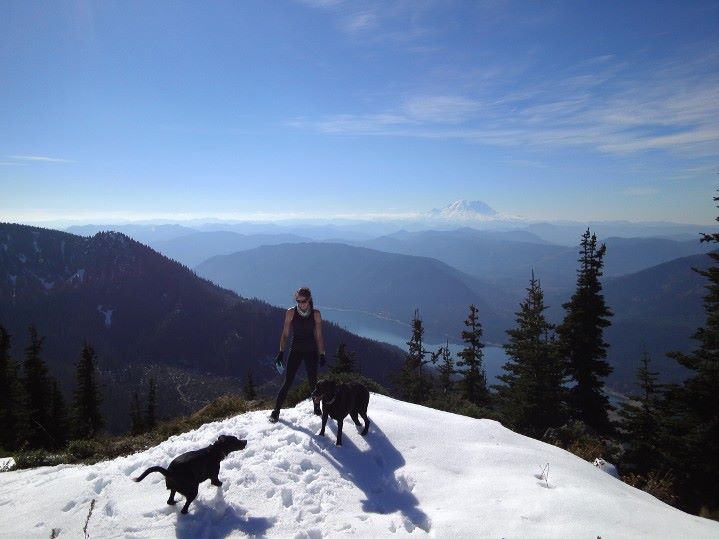
I first visited Thorp with a friend and our dogs in October 2013. We were participating in a fun peakbagging challenge in the Cle Elum Ranger District and ventured up on the Thorp Creek trail after a recent dusting of early season snow.
I returned to Thorp again twice in 2019, both times using different routes and somehow scoring the summit all to myself. The beauty of Thorp is that you can engineer a new route nearly every visit!
Directions.
From Roslyn, proceed on Highway 903 approximately 11 miles to the north side of Lake Cle Elum. Take a left on French Cabin Road, Forest Service Road 4308.
For Thorp Creek, drive 3.2 miles on French Cabin Road (Forest Road 4308), then turn right onto Forest Road 4312. Drive another 1.5 miles and park at the gate, but do not block it. Walk past the road gate and cross the bridge over Thorp Creek. Turn left and the trail starts approximately a quarter mile up the road on the left.
For Knox Creek, continue on French Cabin Road (Forest Road 4308) 4.9 miles, take a right onto Forest Service Road 120, and follow the road 2 miles to a small parking area with a sign for Knox Creek on the right side. The sign is small, up high in a tree, and really easy to miss. If you end up at the end of the road, you’ve gone too far. Back up about a half mile. Though the WTA says the road is in terrible shape, it’s not. It’s rough but only one section required some care when I visited in August 2019.