Okanogan Highlands | South Okanogan Highlands
Colville Indian Reservation
Location: 48.451669, -118.937457
Summit Elevation: 5,863′
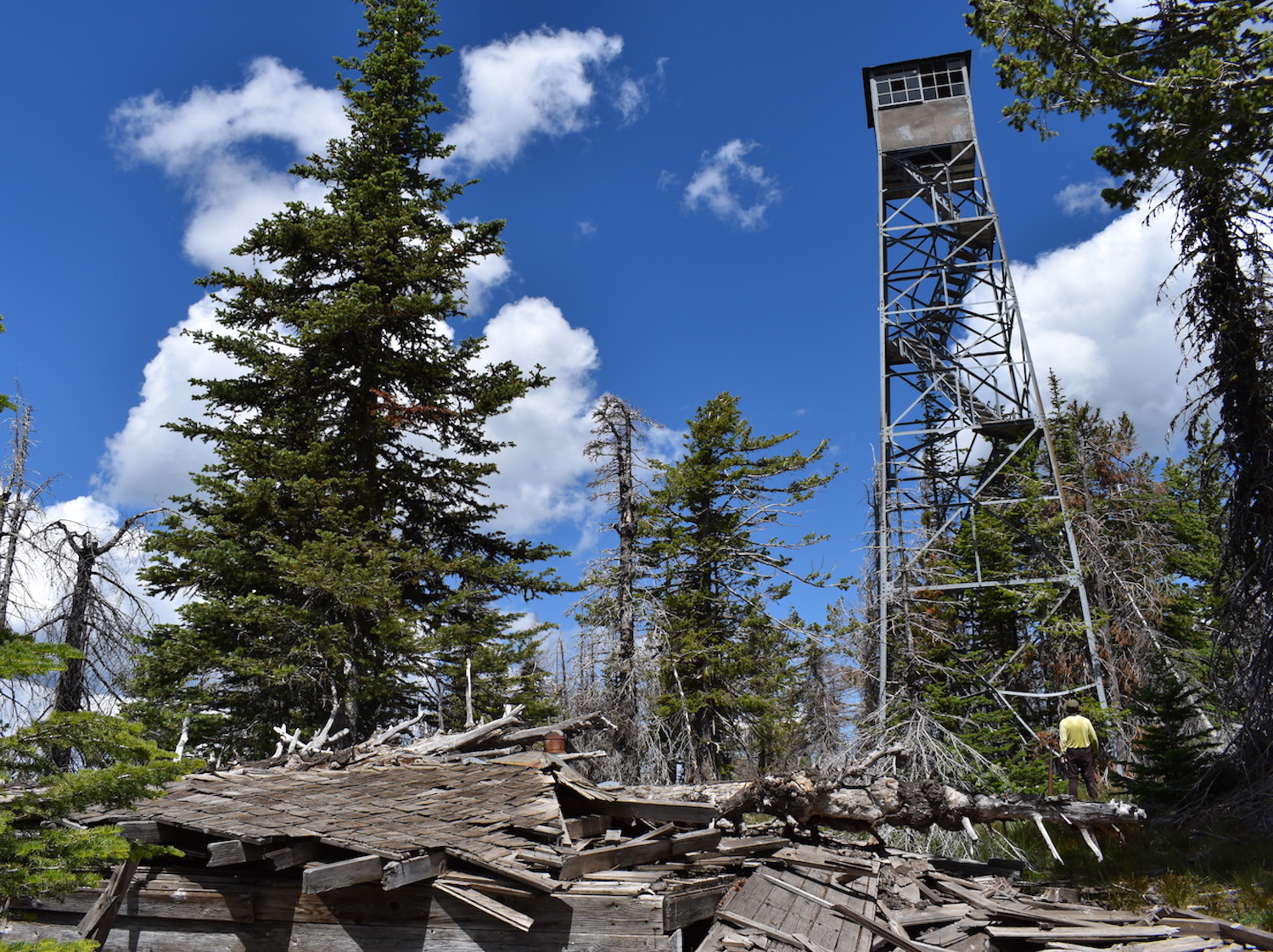
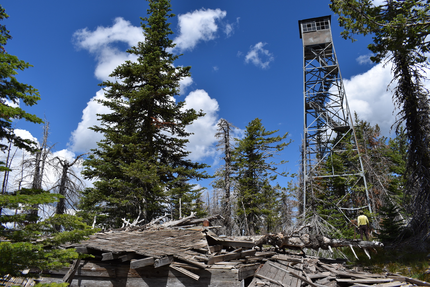
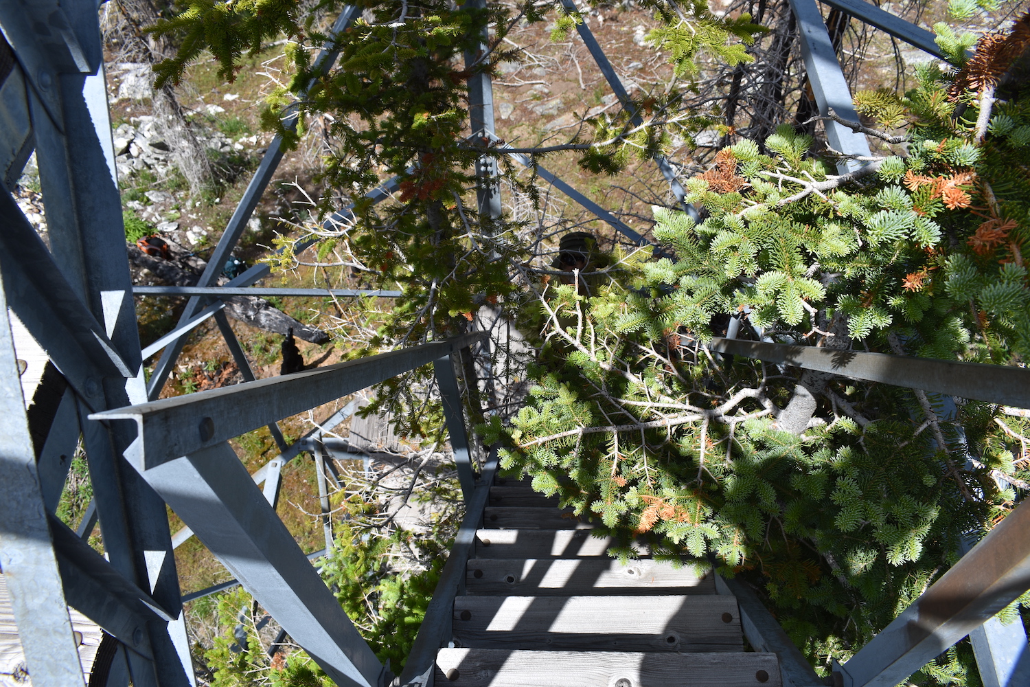
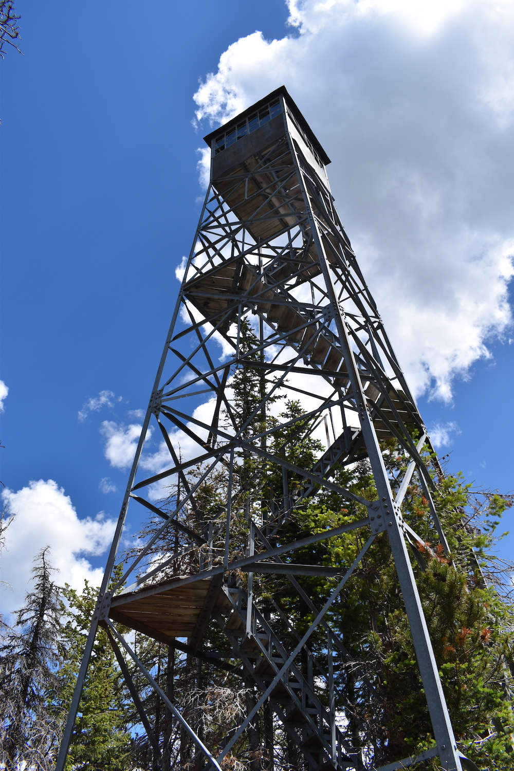
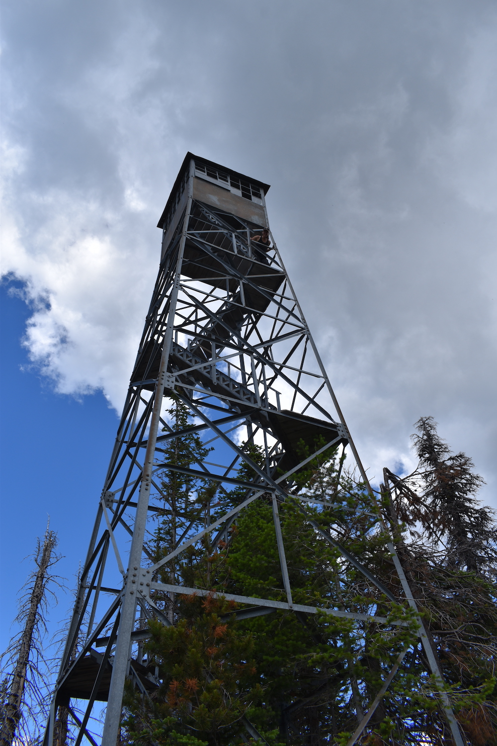
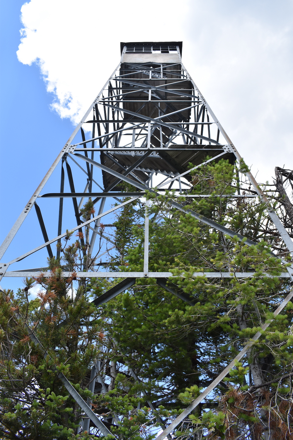
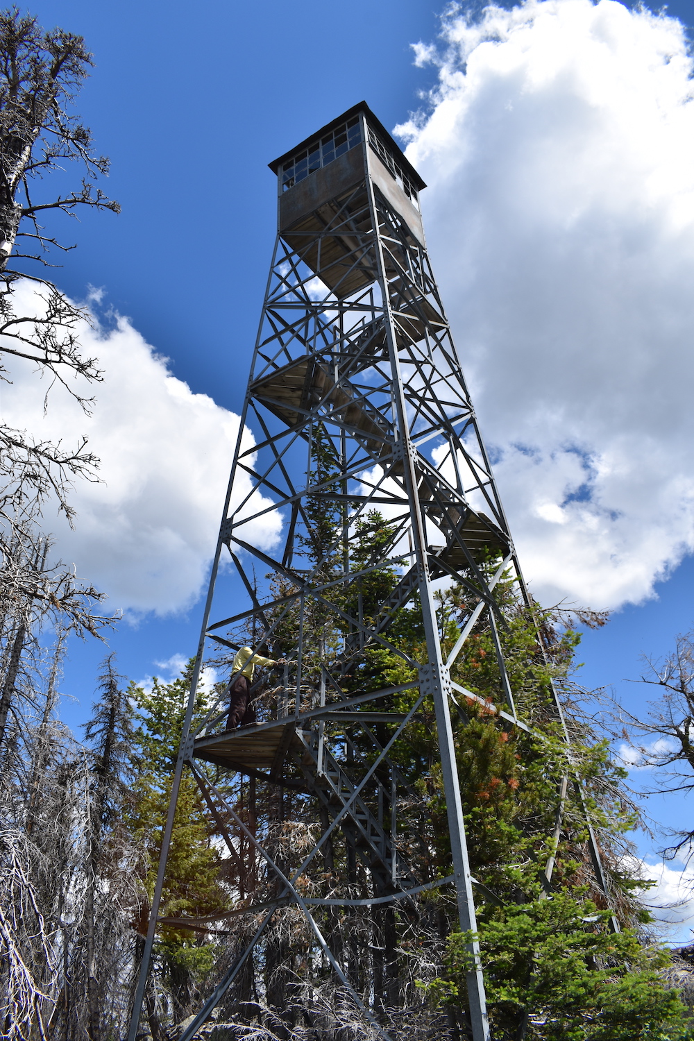
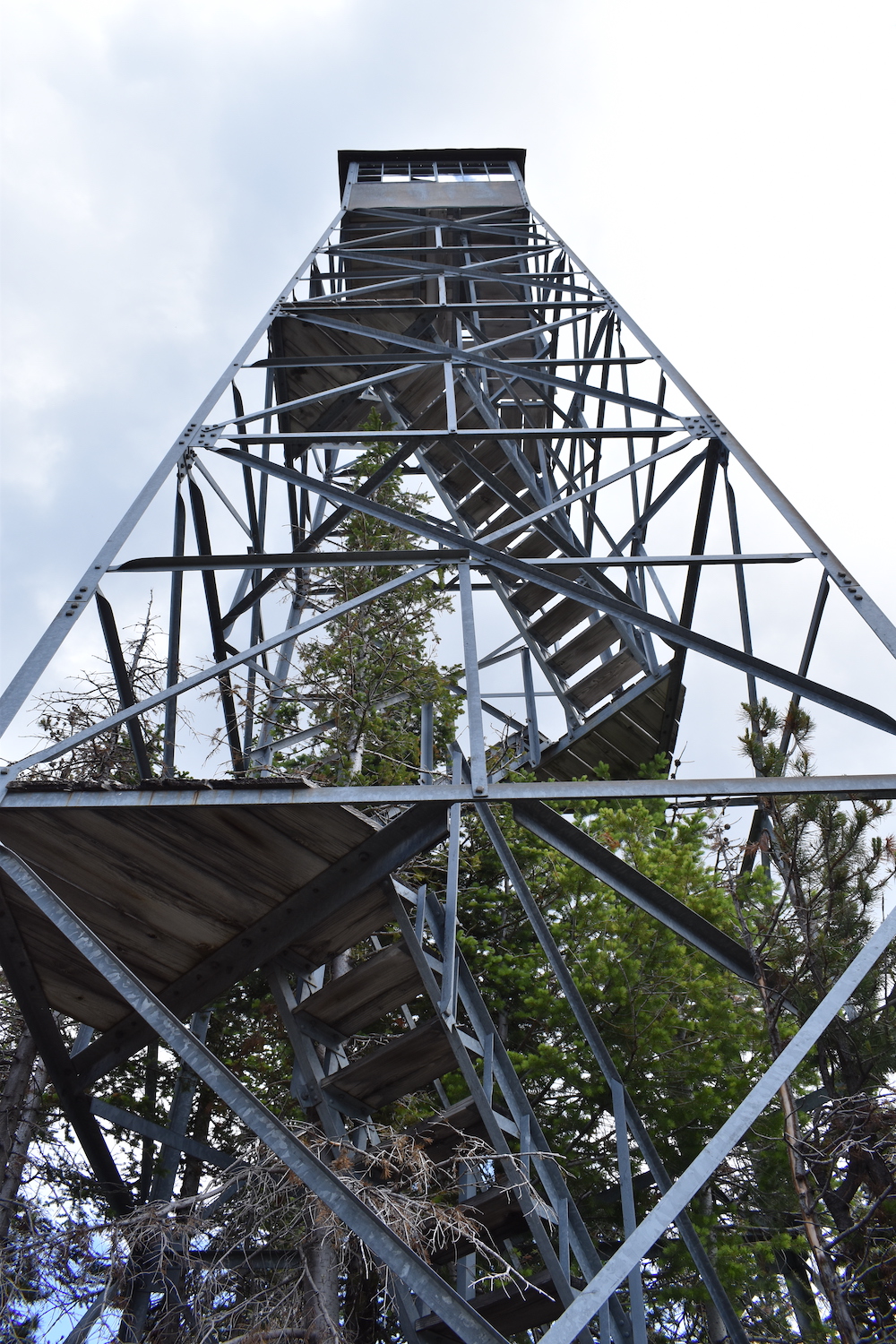
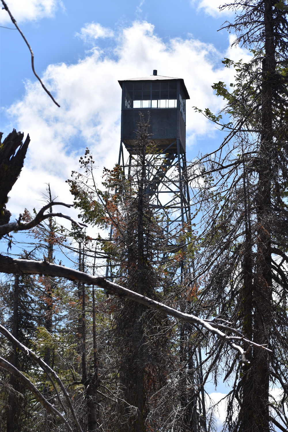
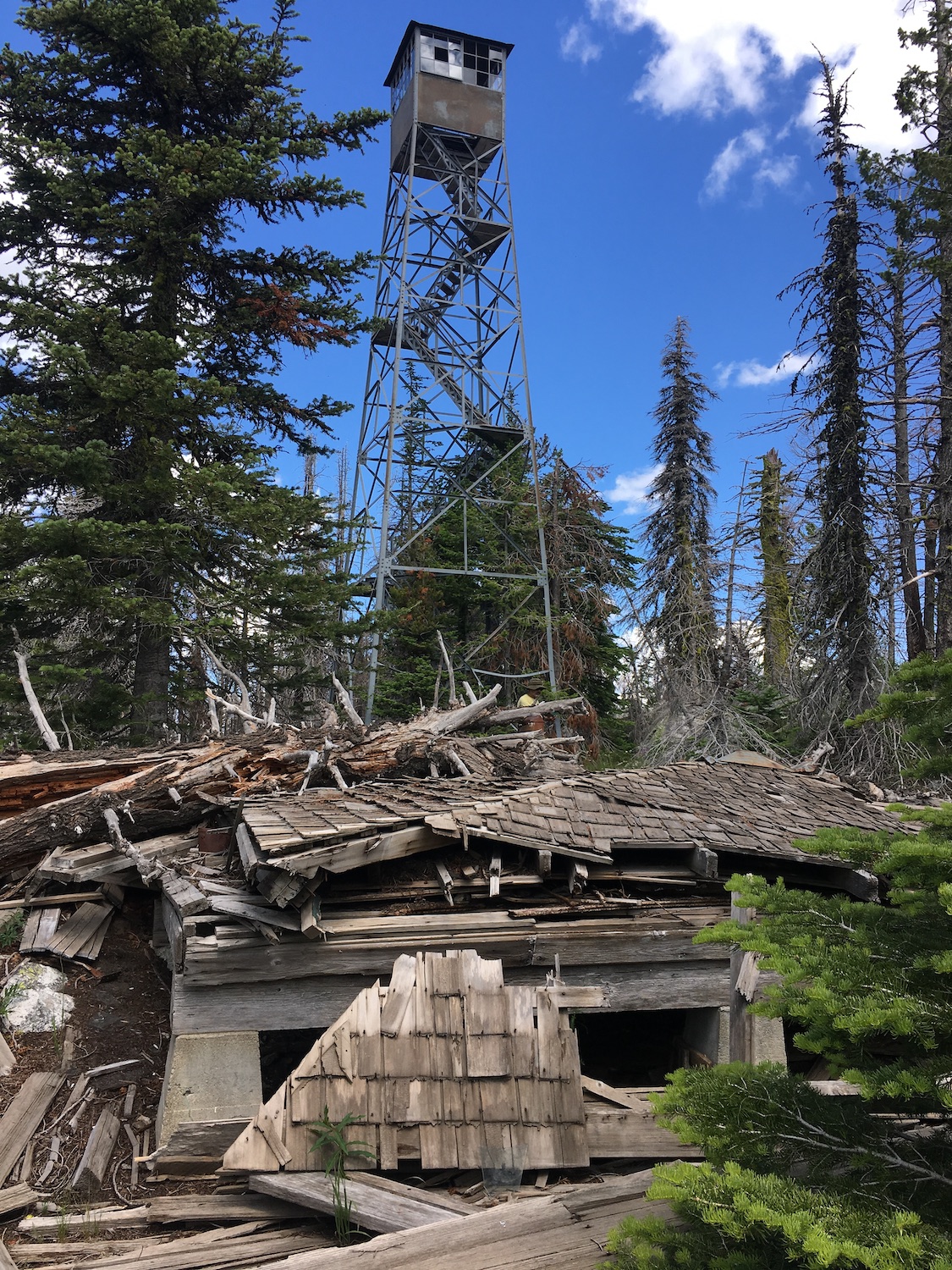
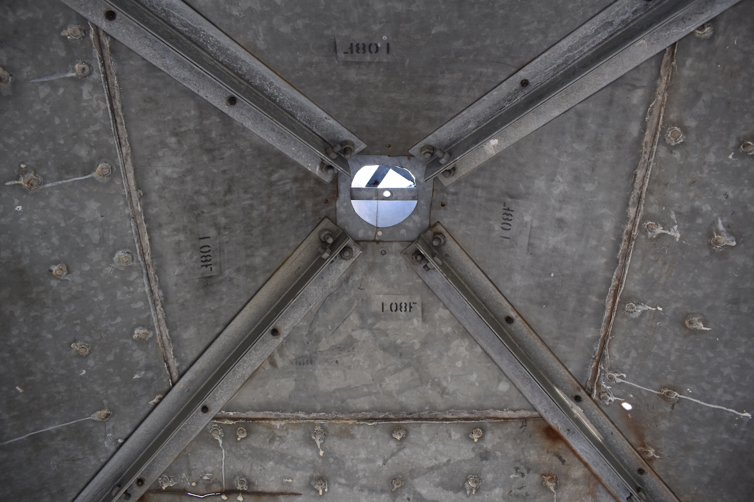
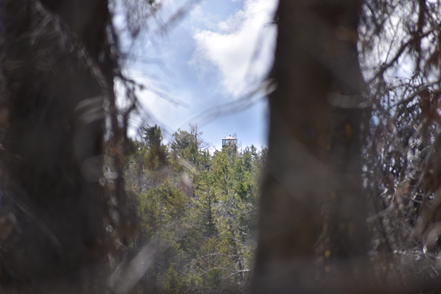
Lookout Type: 54′ steel International Derrick tower
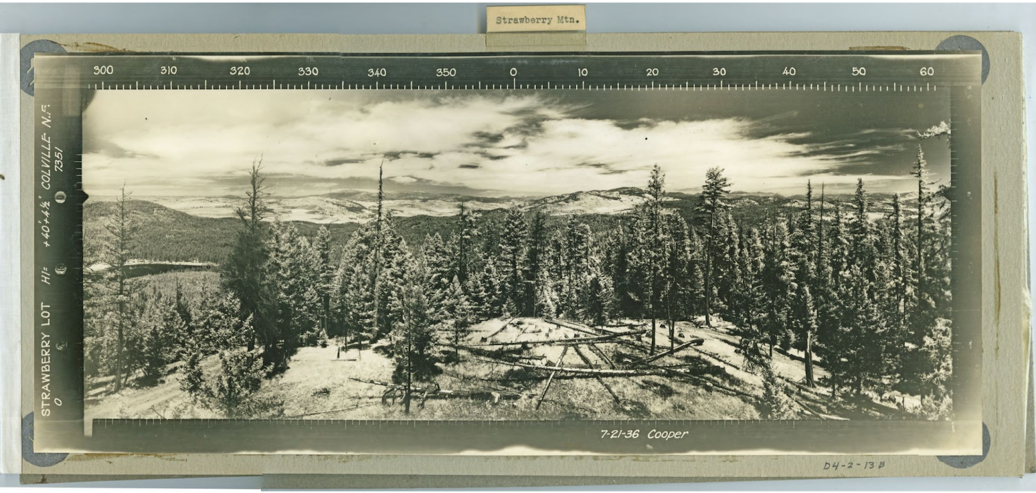
Site Established: 1936
Current Structure Built: 1936
Date Visited: 6/30/19
Strawberry is considered one of the tougher lookouts to reach thanks to its remoteness and lack of trail or road access. I’ve seen four or more different routes to this lookouts, so it’s a fantastic make your own cross country adventure.
Photos from 2019.
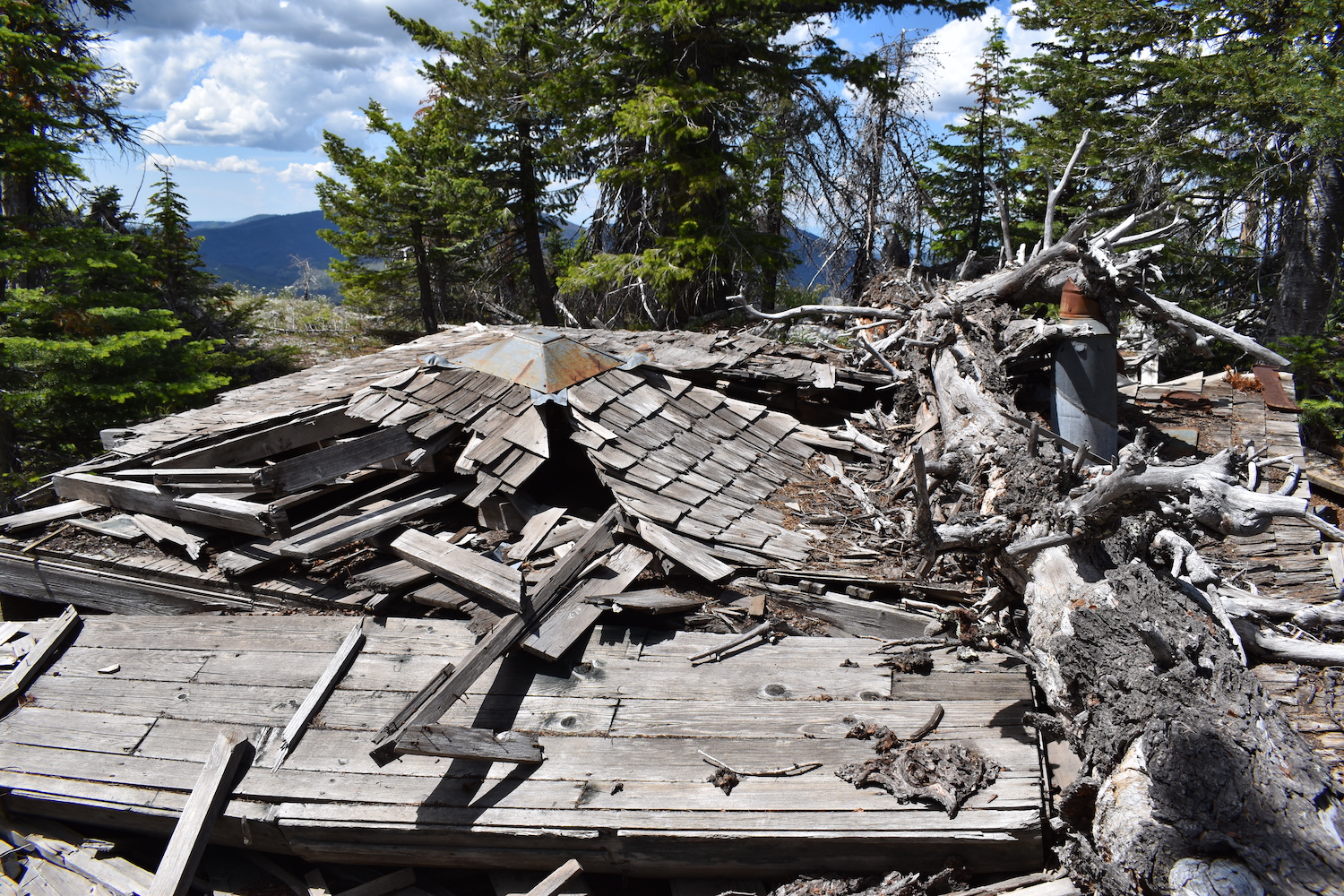
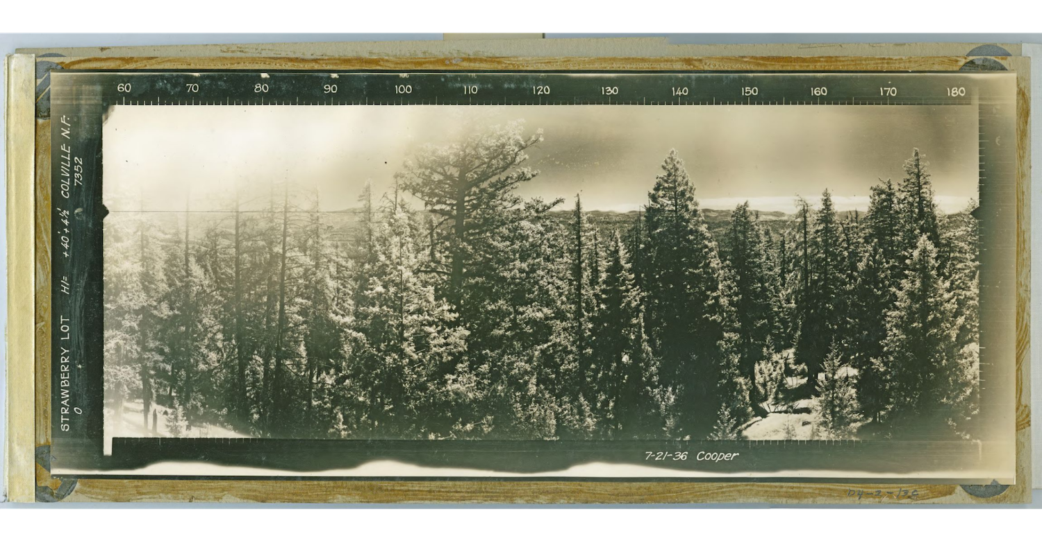
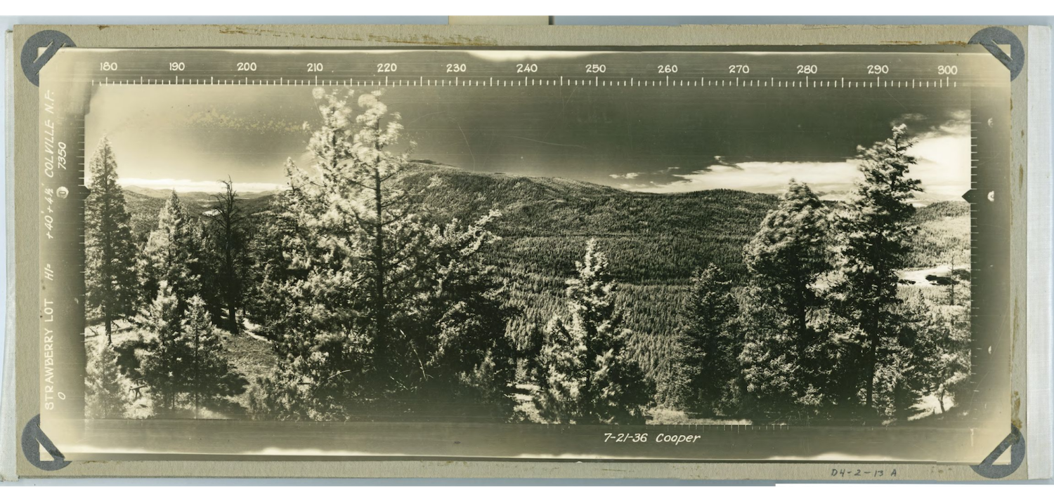
History.
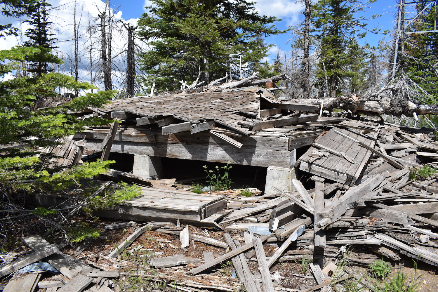
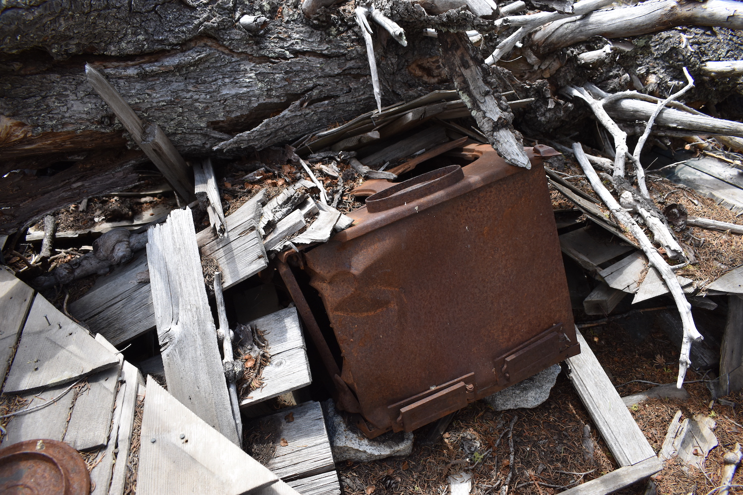
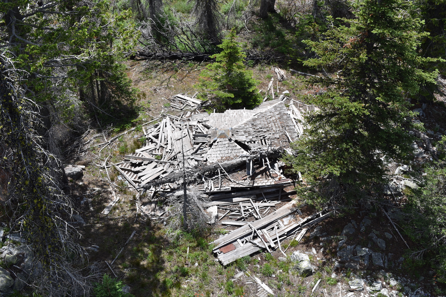
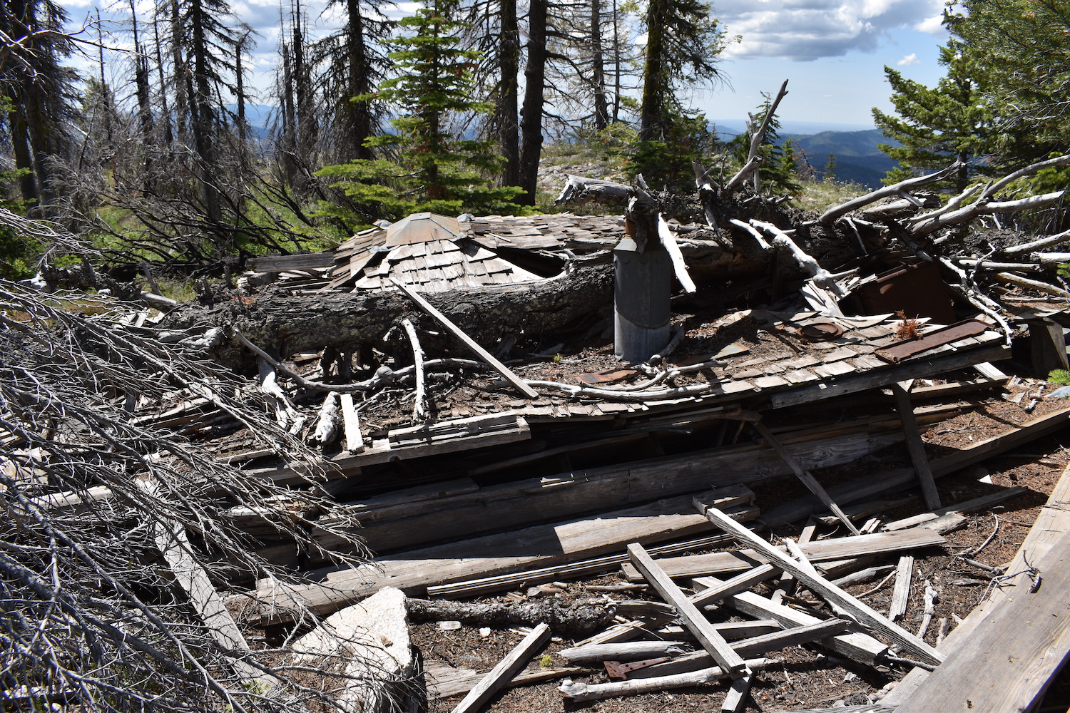
The existing 54′ steel International Derrick tower was built in 1936 and had an accompanying L-4 cab for living quarters. The cab was destroyed by a fallen tree years ago. Strawberry was staffed into 1938, then abandoned.
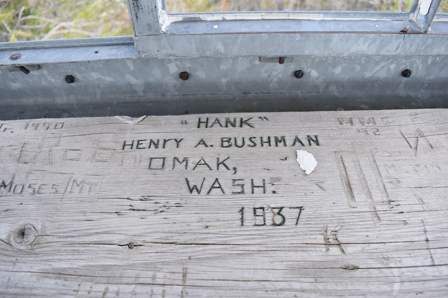
There are many names carved into Strawberry’s tower and one of them is “Hank” Henry A. Bushman. I did some research and it turns out Hank has some interesting history!
Henry “Hank” Alfred Bushman was born in 1918 in Omak and was one of the first five Native Americans to receive a college scholarship for the State of Washington. After college graduation, Hank signed a contract to play professional baseball with the Seattle Rainiers (now Mariners) in 1944. A year later he was drafted into the US Army during World War II, serving as a sergeant stationed in Germany. At the time of his death in 2014, Hank was the eldest member of the Confederated Tribes of the Umatilla Indian Reservation.
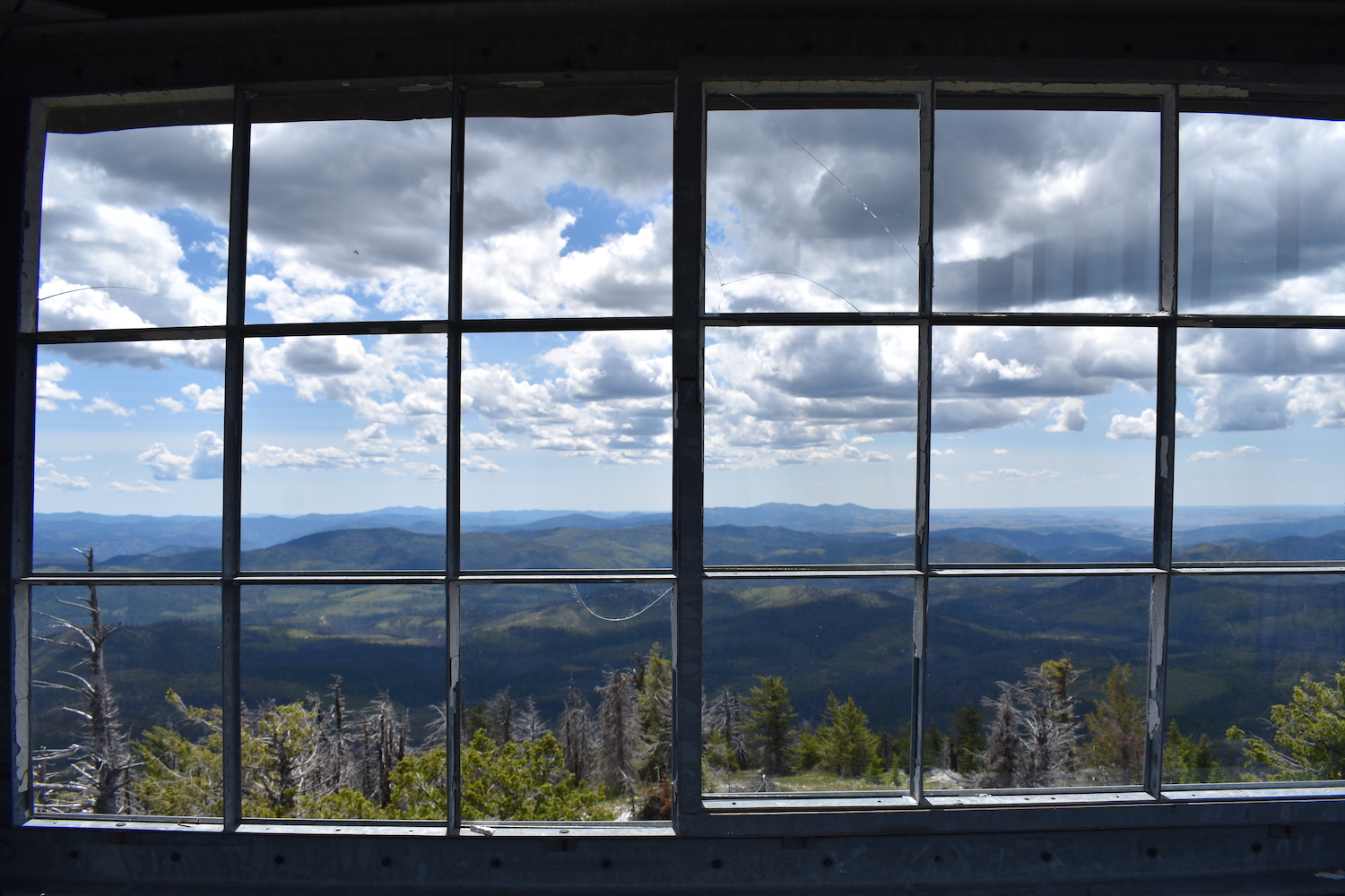
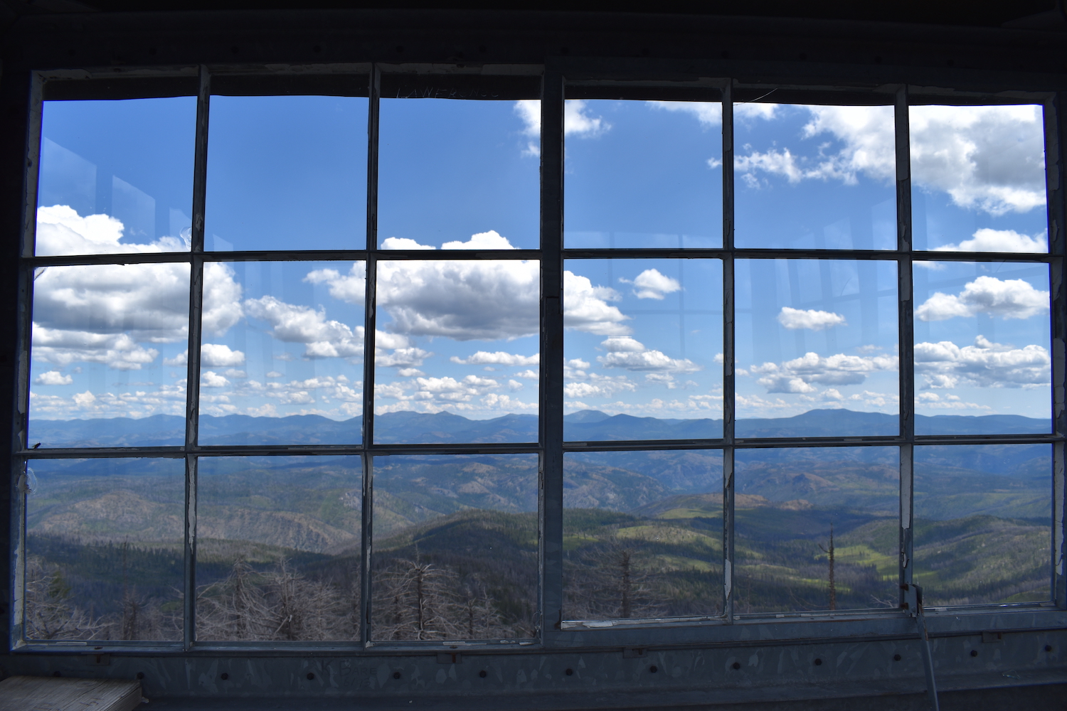
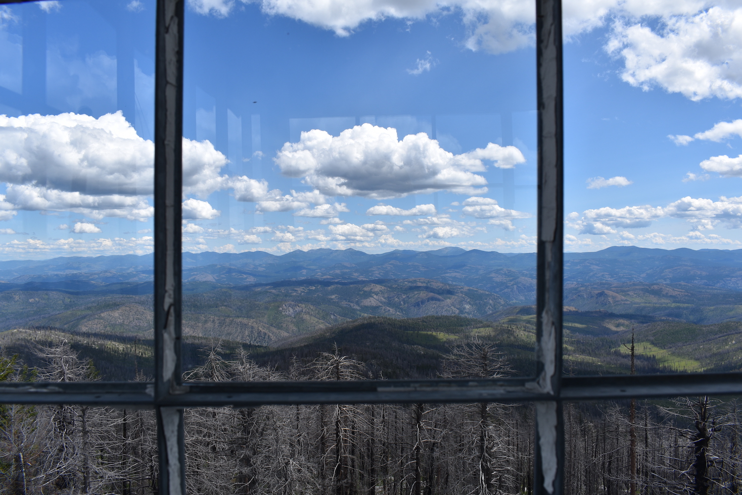
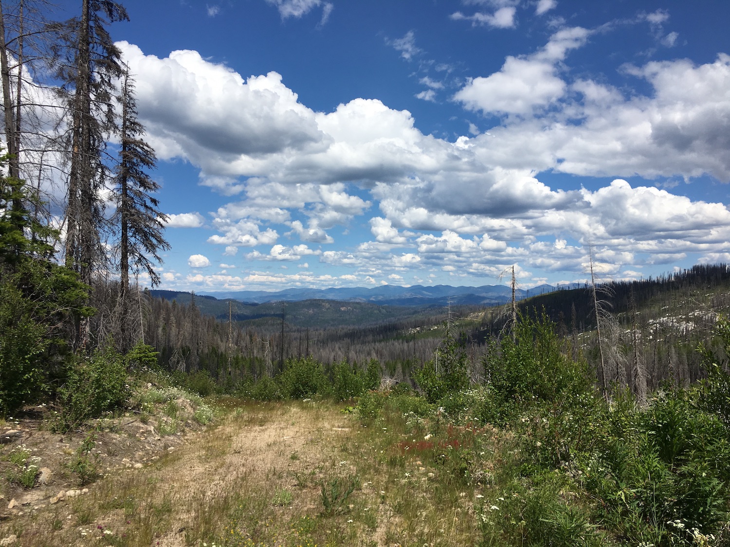
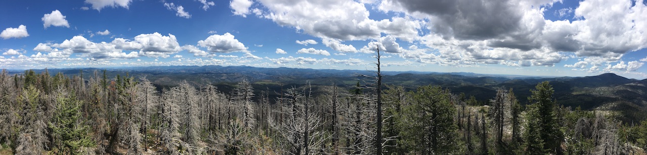
The views.
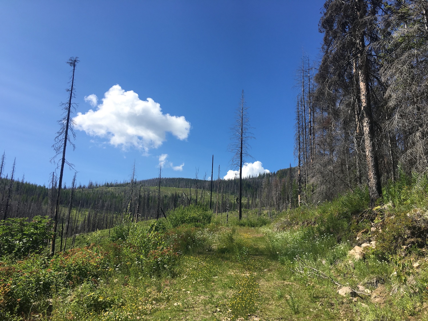
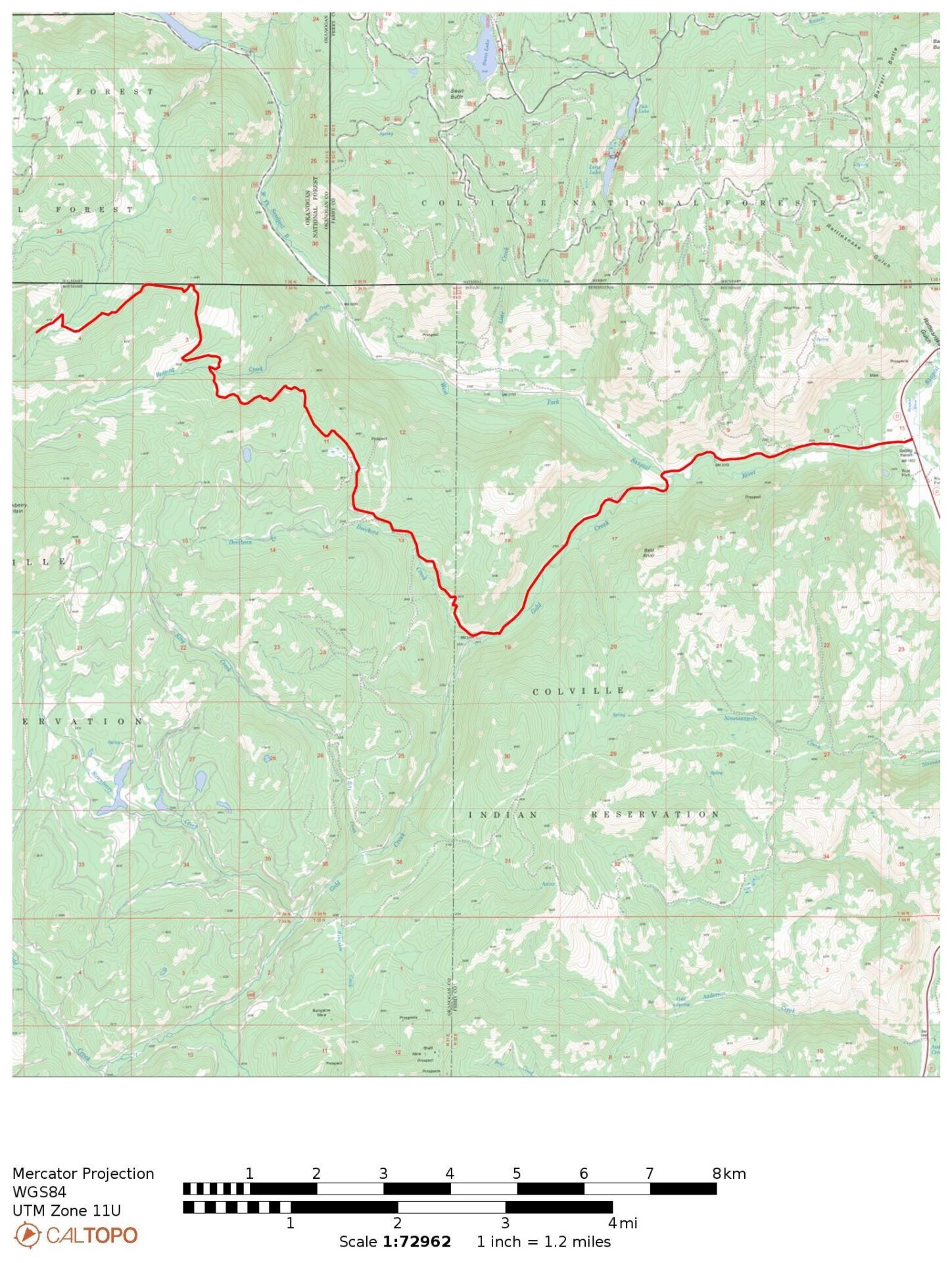
The route.
Distance (RT): 5.6 miles
Elevation Gain: 1,700′
I loved Strawberry Mountain because it requires you to make your own adventure. There are no trails or roads that go directly to this lookout. I know of at least four different approaches that have been taken from almost every side.
I approached Strawberry from the north side, driving in from the east off Highway 21 using West Gold Creek Road. From West Gold Creek Road, I turned northwest on BIA 70, following the road around to the northwest and eventually to BIA 1004 to the north side of Strawberry Mountain. The road was very rough and washed out in places but with a Jeep I had no trouble.
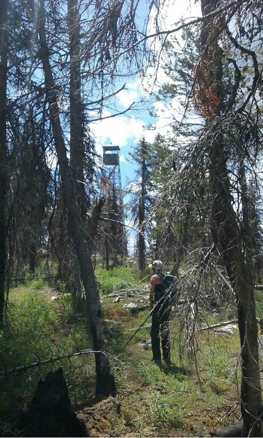
Getting to the summit involved road walking, route-finding, and cross country travel through steep slopes of fireweed. My dad joined me on this outing and we hiked up to the high point on the ridge to the northwest of Strawberry, then hiked the ridge across a saddle and up to Strawberry. The route was fairly straight-forward and relatively easy going despite the fireweed bushwhack.
There is no one single way to get to Strawberry and road conditions could be highly variable in this area. If you venture to Strawberry, I would highly suggest a map and/or GPS. Travel prepared and know that it may take you a few different tries on different routes.
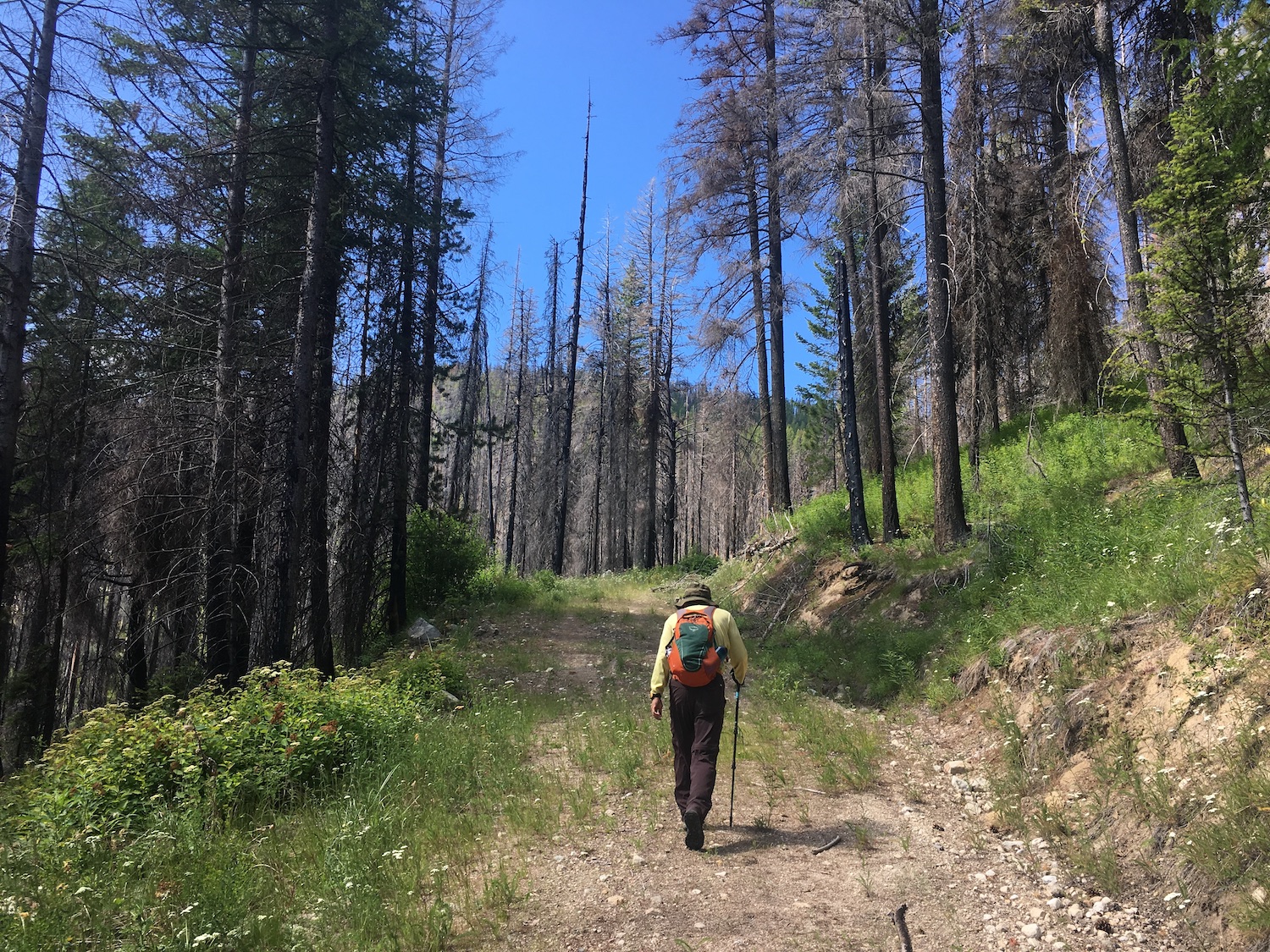
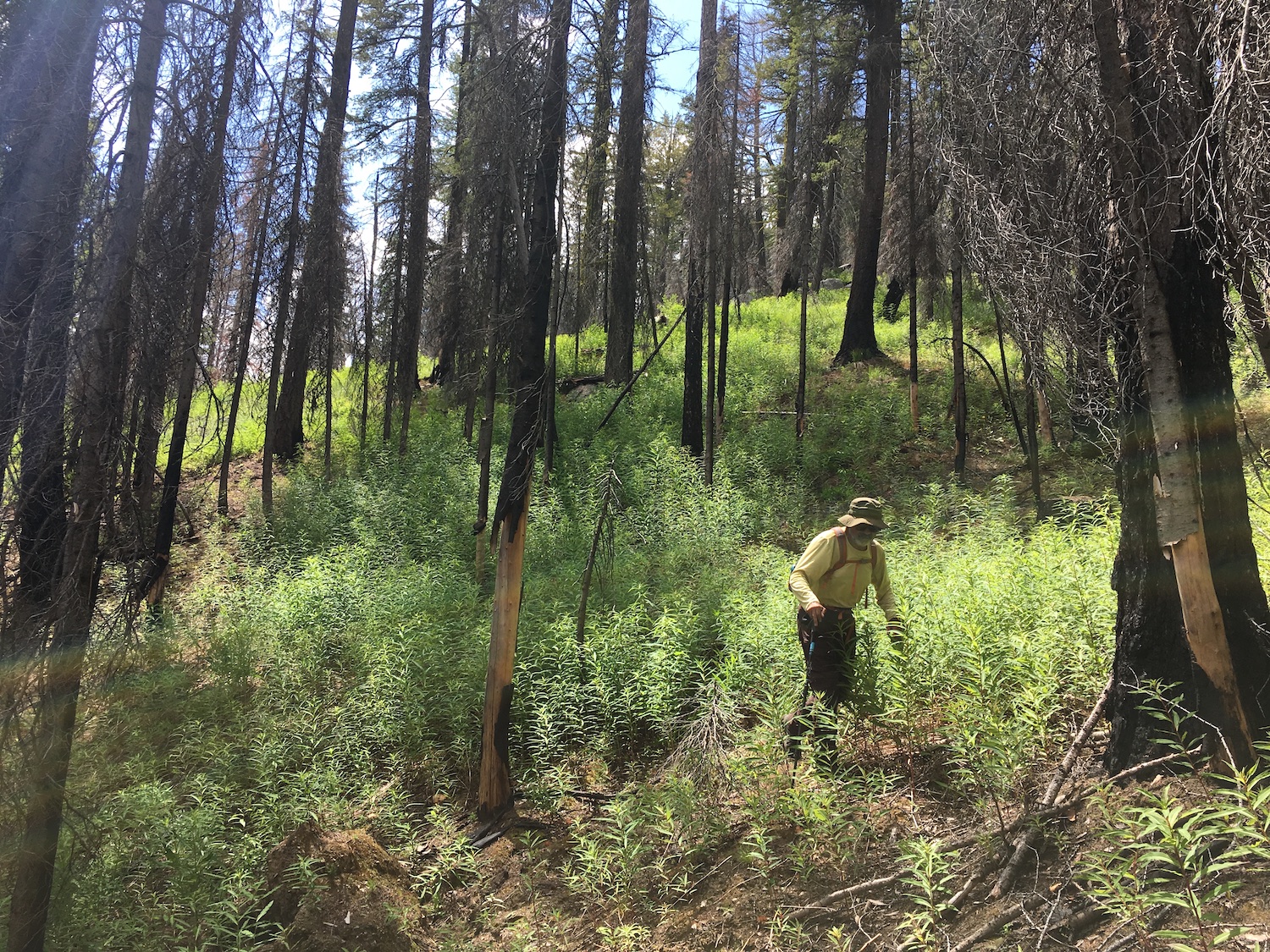
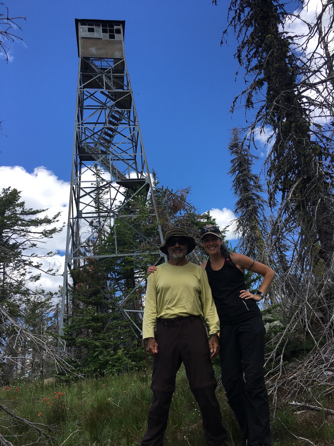
Visiting Strawberry with my dad.
Strawberry is high on my list of memorable and favorite lookouts. By late June 2019 I had only seven fire lookouts remaining to visit, six of which were located on the Colville Reservation. I was purposefully leaving Mount Pilchuck as my last fire lookout to visit. I thought it would be a certain irony to leave what’s likely the most visited fire lookout in the state as my very last one.
My dad came out in late June 2019 and joined me on my last fire lookouts to complete my long journey. As an avid peakbagger, he was pretty excited to see me finish! I knew Strawberry would be the toughest lookout yet to visit, so we left it for #92/93 and on June 30th, we successfully reached the summit. Even though I would celebrate the official end of the journey the very next day at Mount Pilchuck, because Strawberry was the last tough lookout I had left to reach, it was especially sweet standing on the summit. It’s a memory I won’t soon forget, made even sweeter by being able to enjoy it with my awesome 71-year-old peakbagging dad.
Directions.
As mentioned, there are numerous ways to access Strawberry, but I approached from the east off Highway 21 near West Fork, about 15 miles south of Republic. I turned onto West Gold Creek Road, then in approximately 5 miles turned onto BIA 70. BIA 70 eventually turns into 1004, which slowly makes its way northwest to the north side of Strawberry Mountain. The road was very rough and washed out in places but with a Jeep I had no trouble.
There are many logging and spur roads in this area that are unsigned, so I highly suggest bringing a map and/or GPS. Road conditions could likely change drastically from one year to the next so there’s no guarantee this route is passable.
Note: To visit Colville Confederated Tribal land, non-tribal members must now purchase a recreation permit for $80/annually. Passes may be purchased online.