Southern Cascades | Columbia Gorge North
Gifford Pinchot National Forest
Location: 45.93488, -121.820922
Summit Elevation: 4,965′
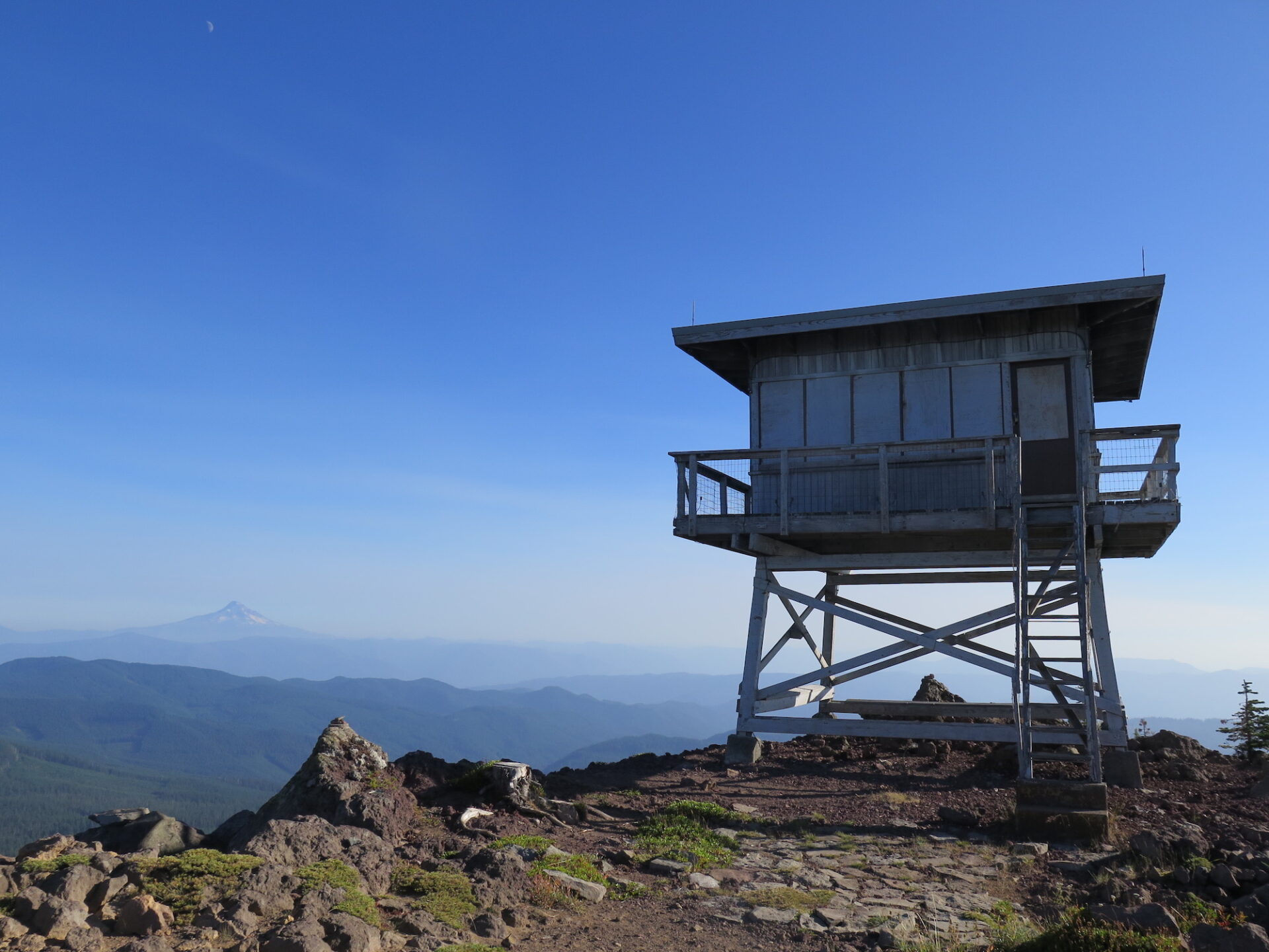
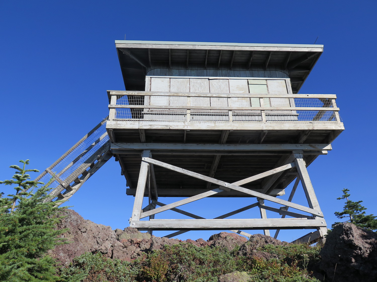
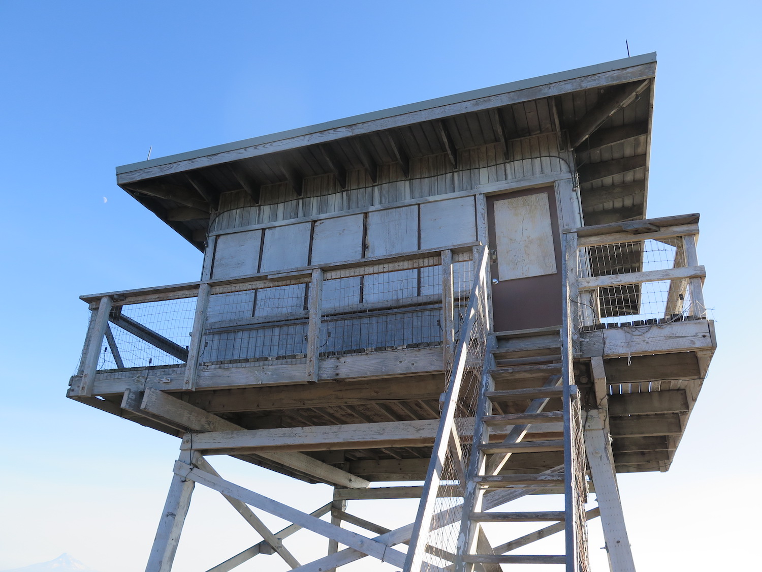
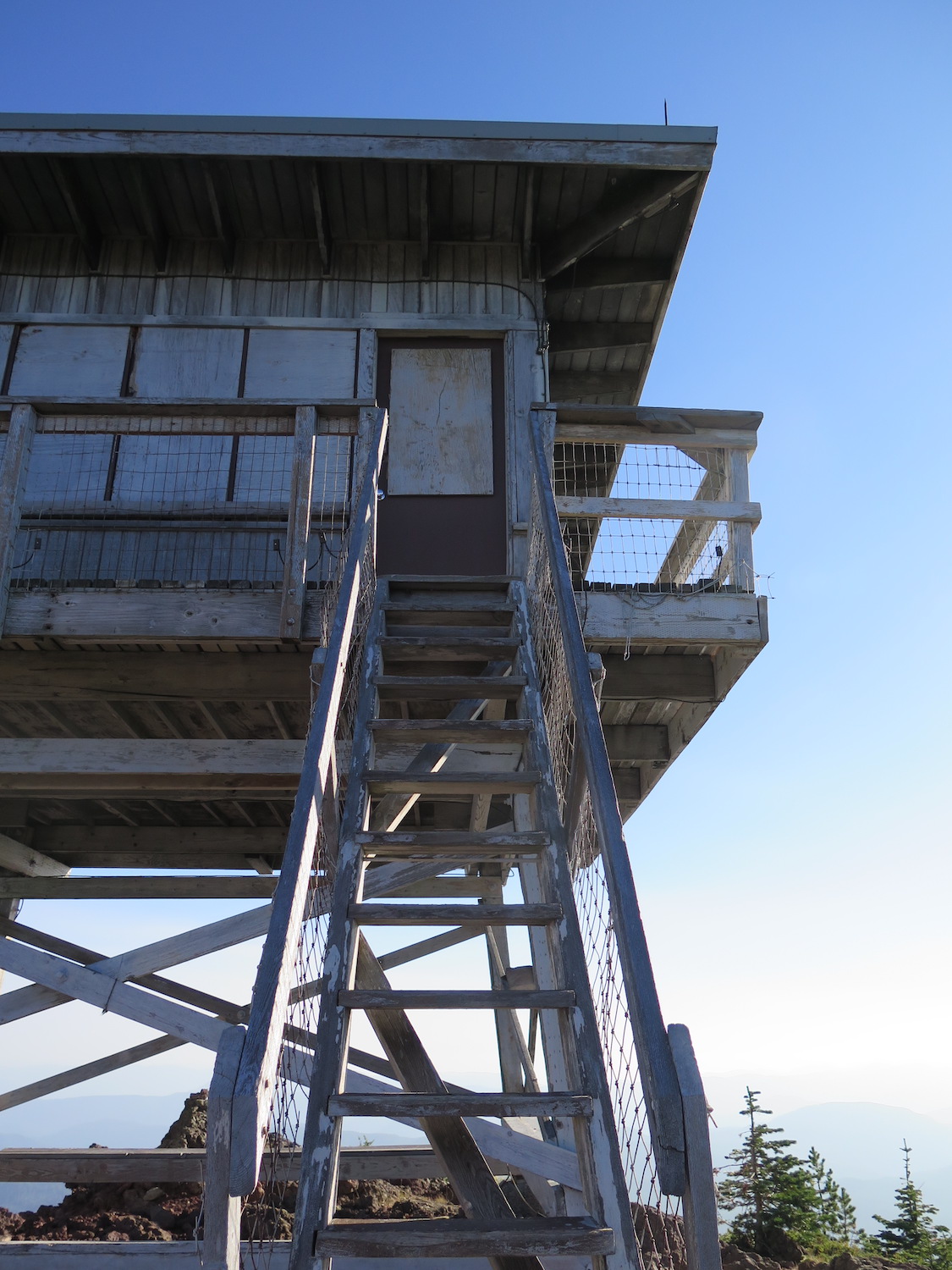
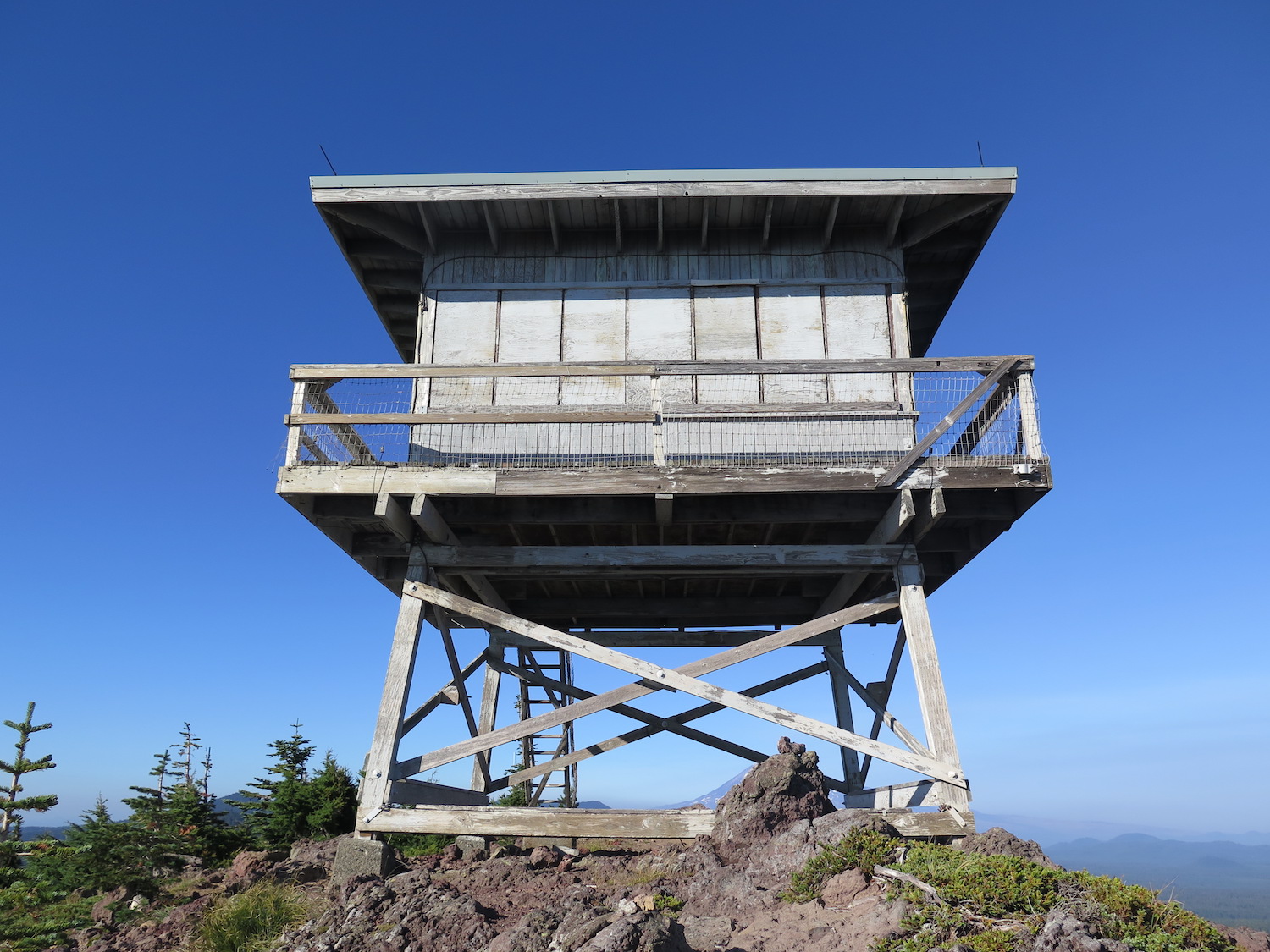
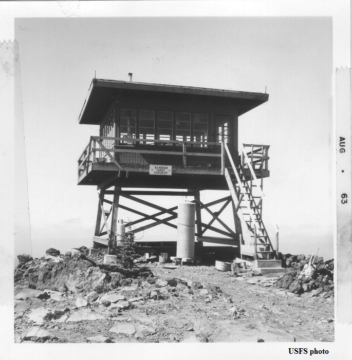
Lookout Type: 10′ tower with R-6 cab
Site Established: 1910
Current Structure Built: 1959
Date Visited: 8/17/18
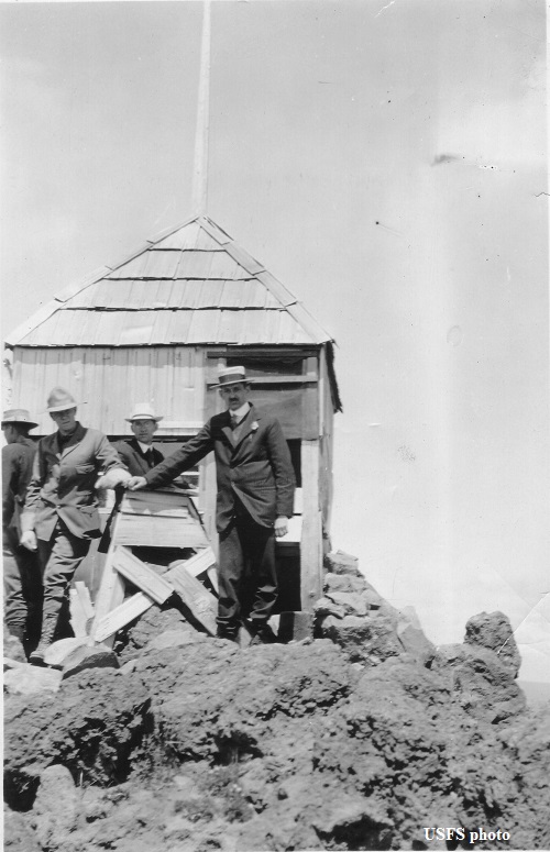
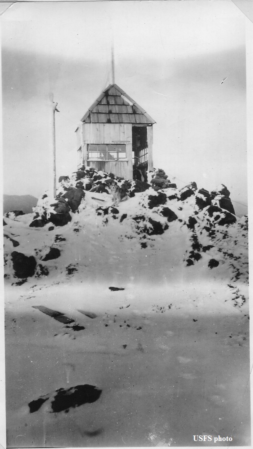
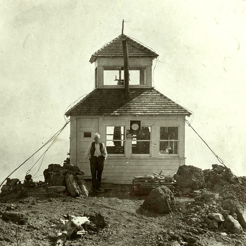
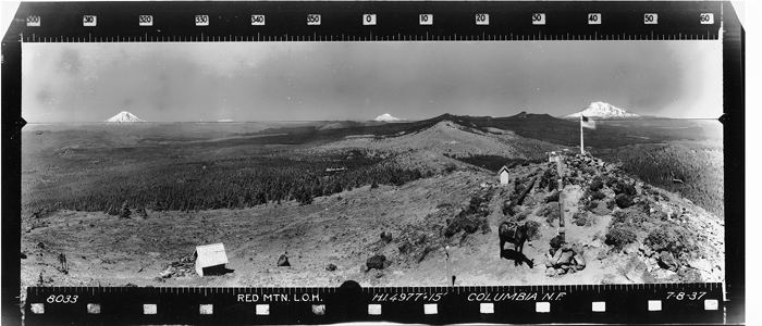
The current fire lookout on Red Mountain is the fourth fire lookout that has stood on the summit, the first built back in the early 1900s. Red Mountain is the last standing fire lookout in both Skamania County and the Mount Adams Ranger District.

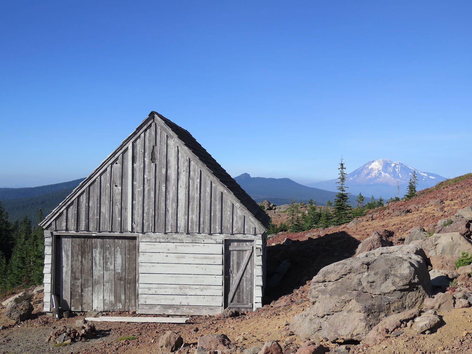
Photos from 2018.
History.
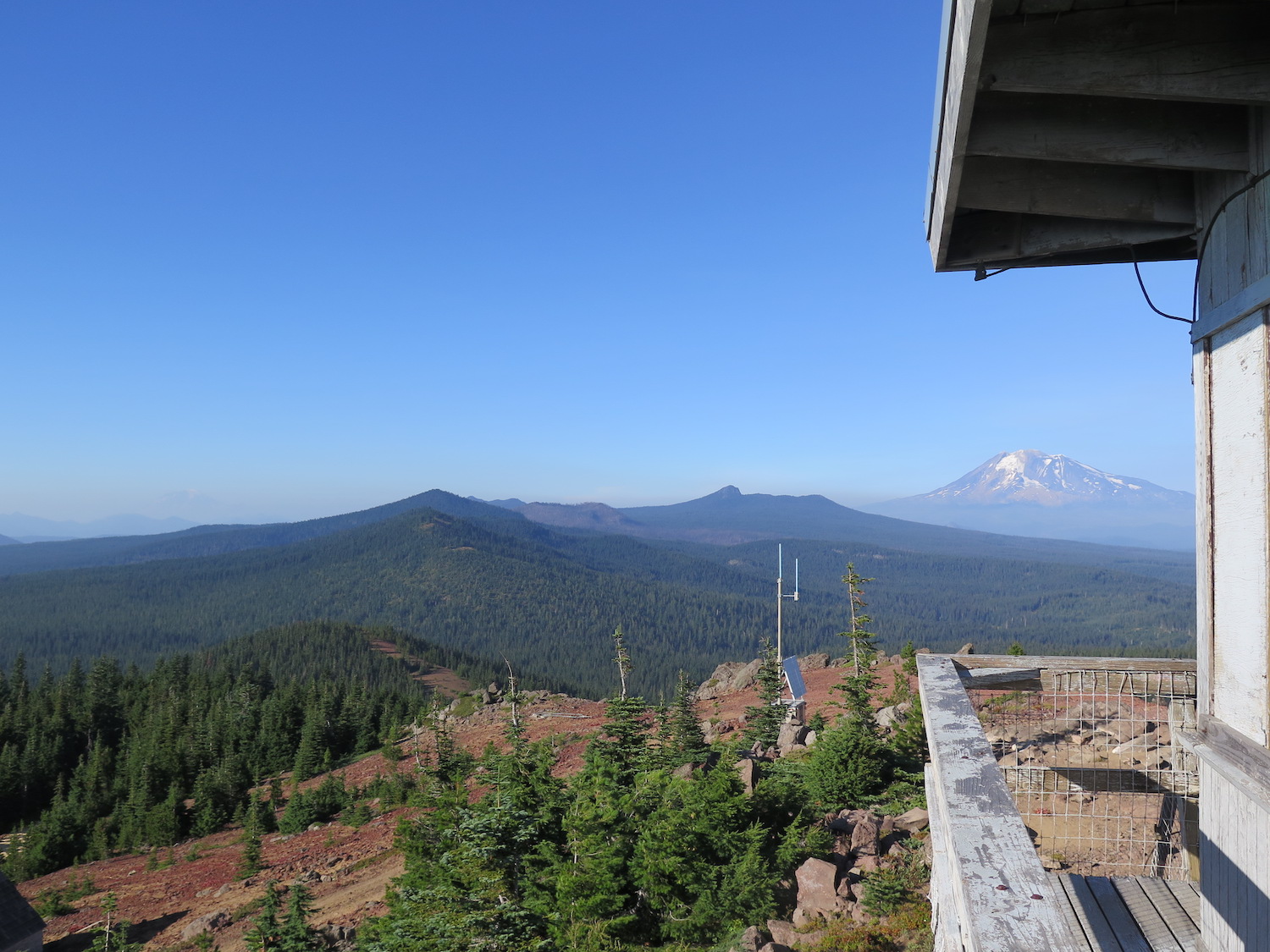
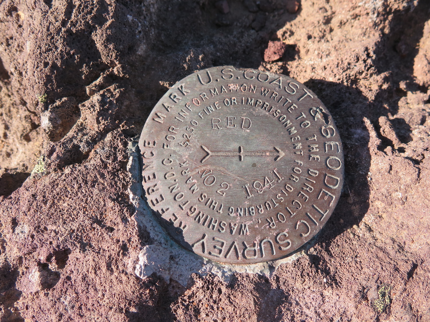
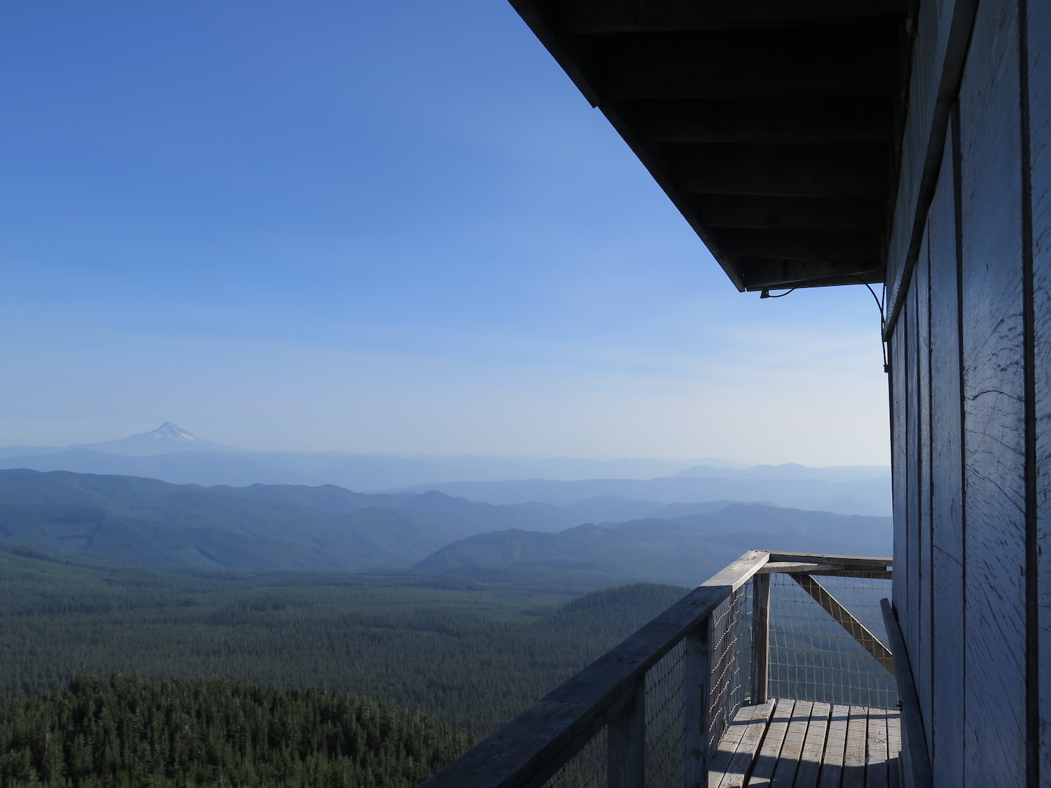
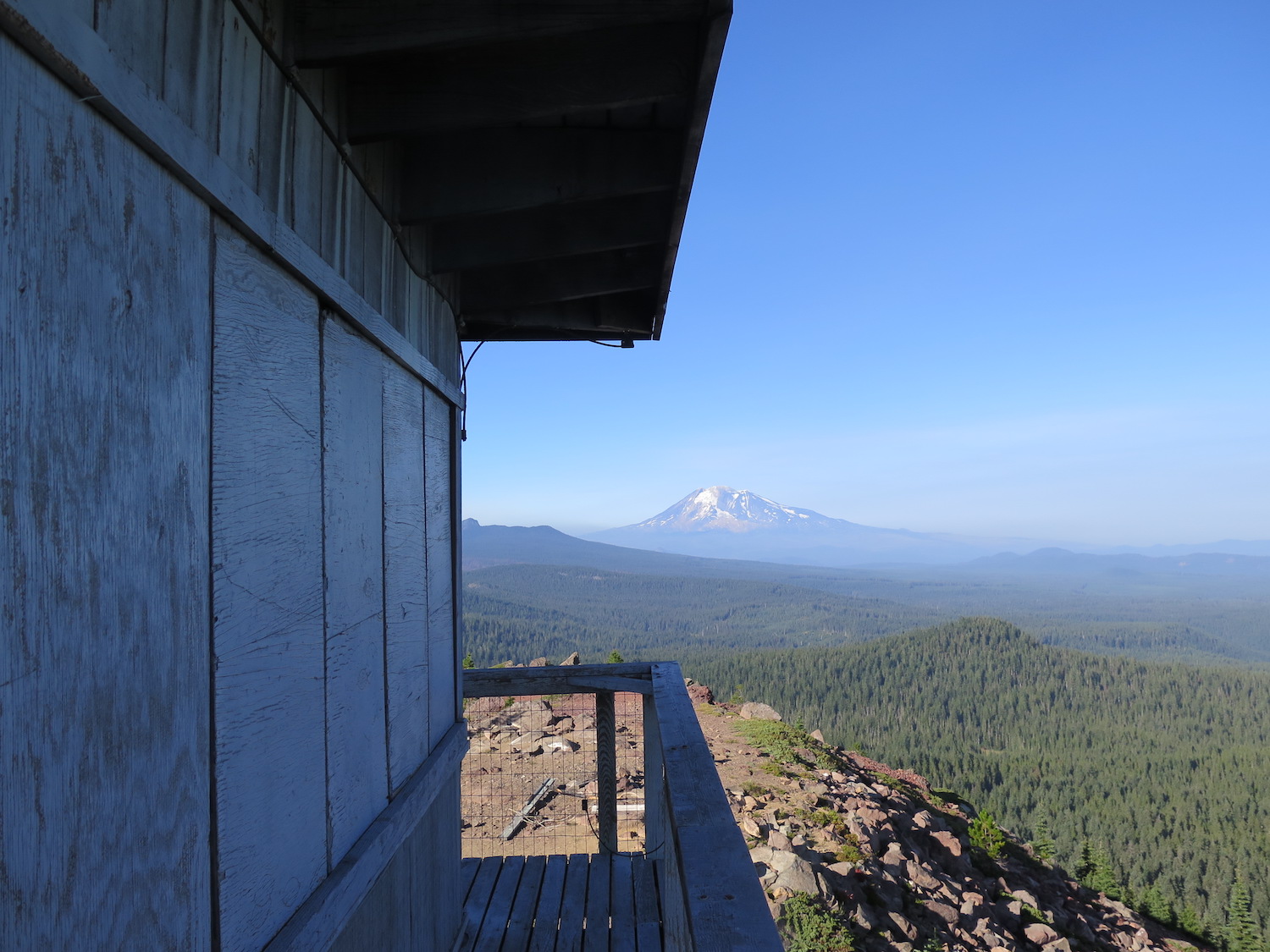
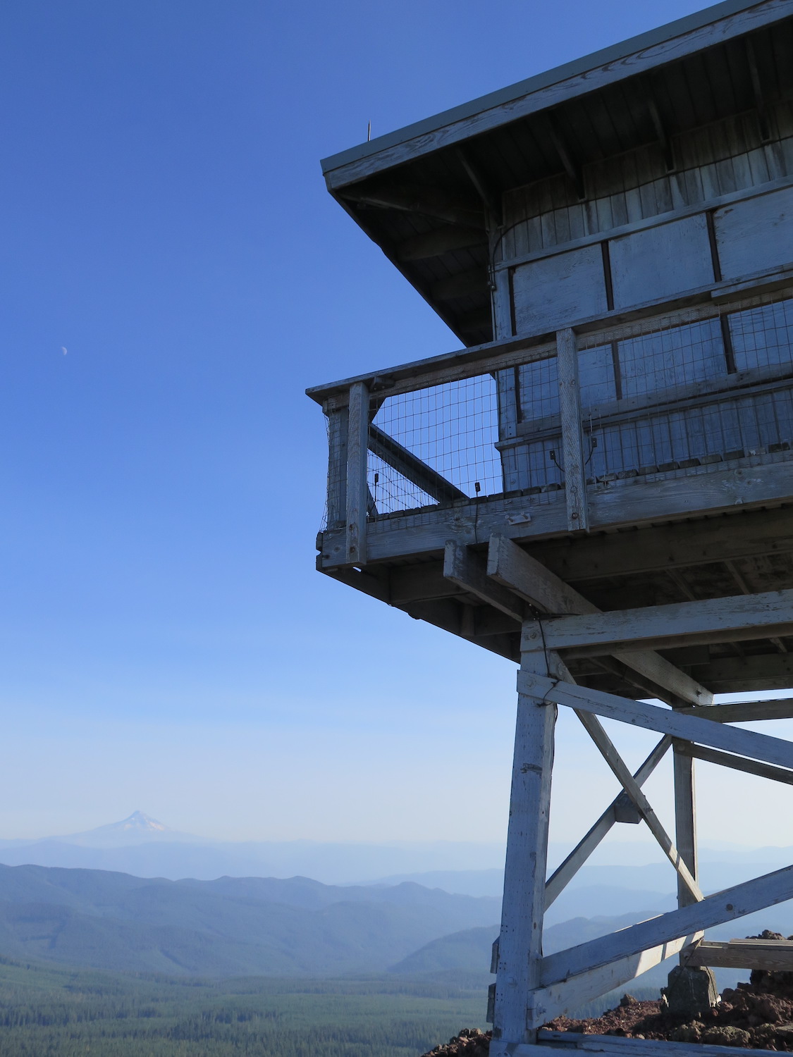
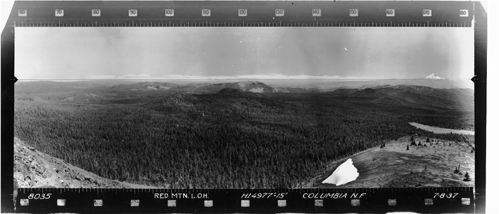
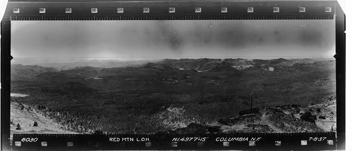
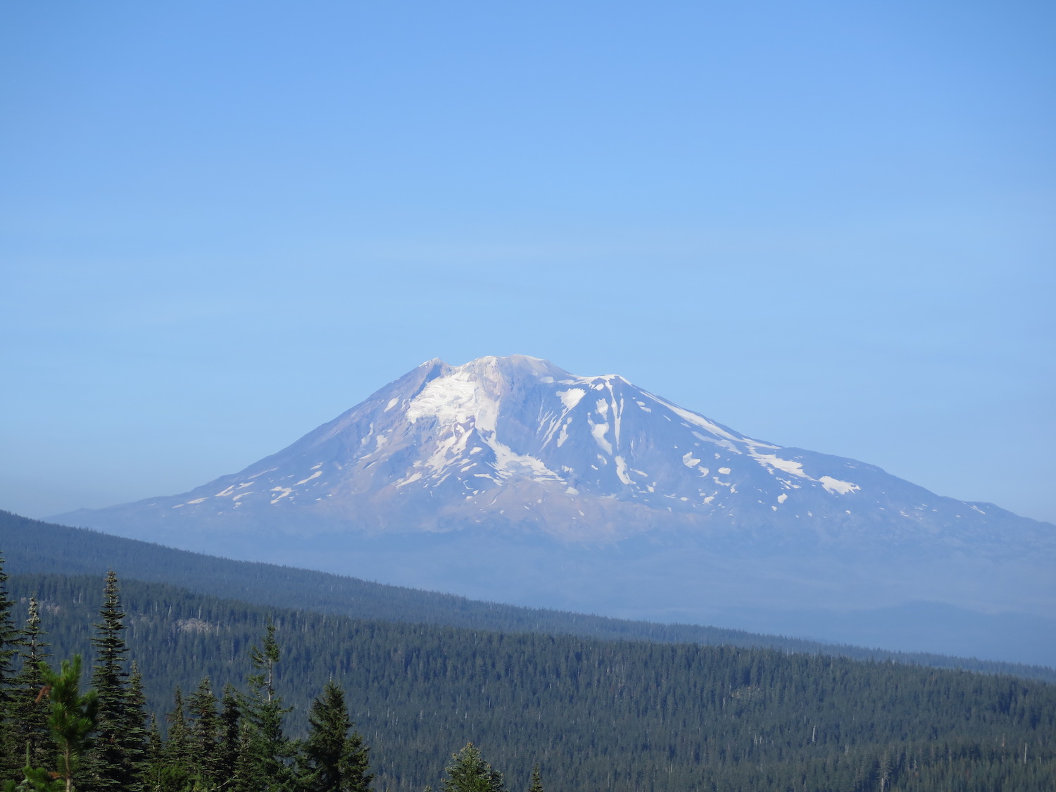
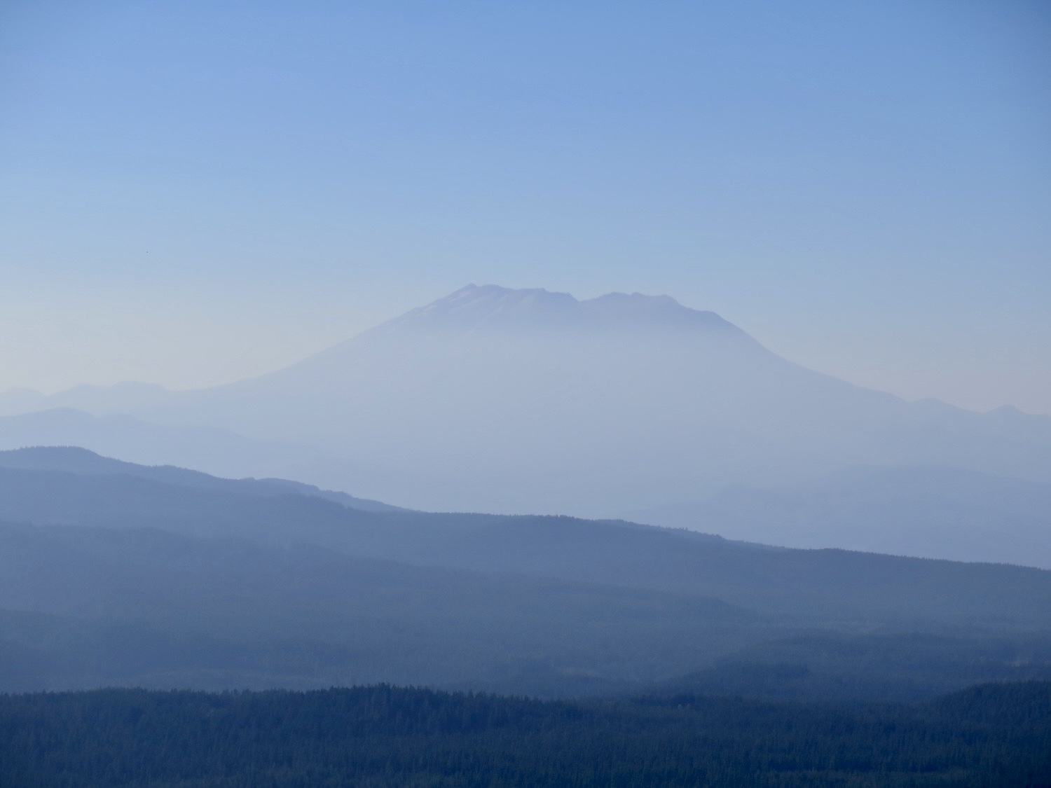
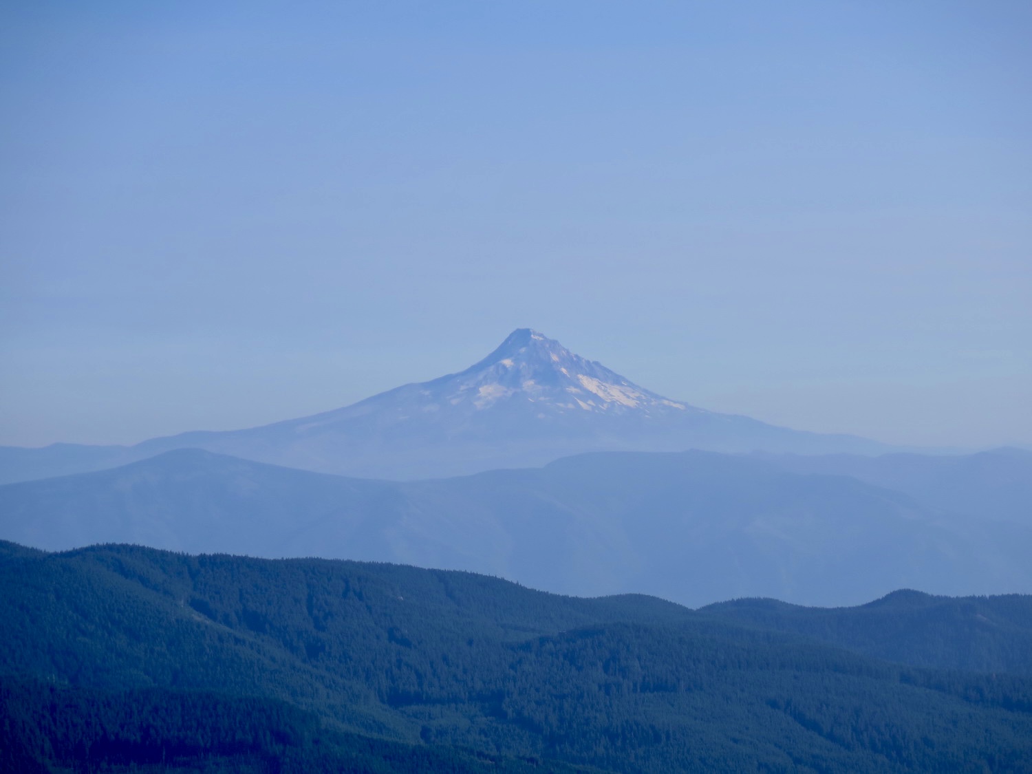
Built in 1959, the current R-6 lookout at Red Mountain is the fourth lookout to have been built on the summit. In 1910, the Forest Supervisor H.O. Stabler stated that Red Mountain was “unquestionably the best lookout point” within the Columbia National Forest, later the Gifford Pinchot. I have to say I can’t argue with his statement because the views of Rainier, Adams, St. Helens, and Hood are spectacular!
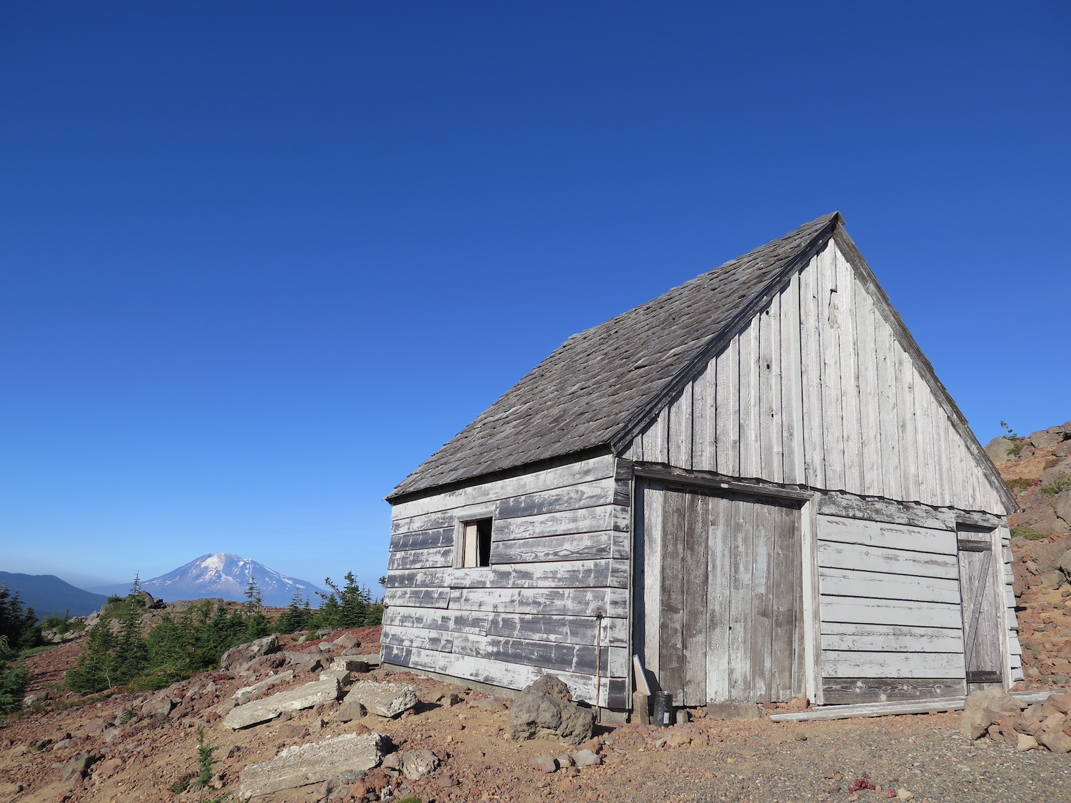
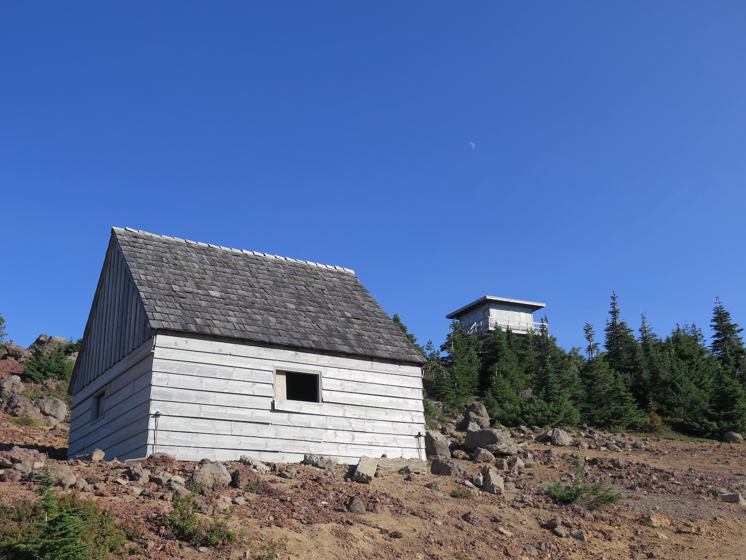
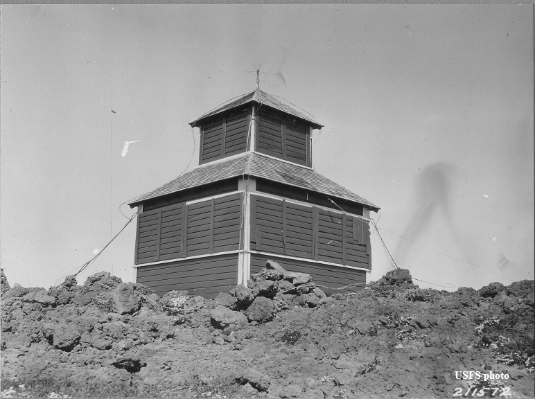
The first lookout structure, an 8’x8′ cedar cab, was built on the summit in 1913. Around 1919 the crude cab was replaced by a D-6 cupola, then in 1935 with an L-4. A garage was added in 1938 and converted to living quarters in 1942 when the lookout was staffed 24 hours a day in World War II as an Aircraft Warning Station. The Cub Creek 2 fire outside Winthrop in 2021 burned the ground house on First Butte, also used as an AWS living quarters, leaving only two similar structures still standing: the one at Red Mountain and another on Big Hill in the Okanogan-Wenatchee.
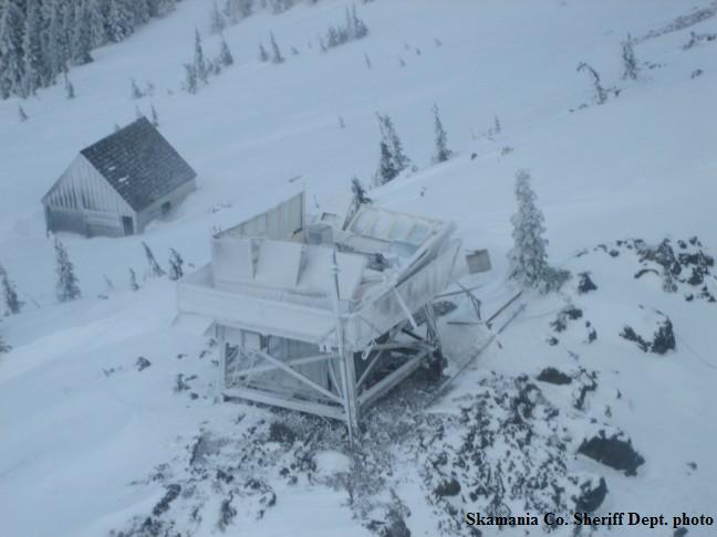
The current R-6 lookout, built in 1959, followed standard Forest Service plans. A violent windstorm in December 2006 severely damaged the lookout, blowing the roof and walls apart as well as the radio communication facilities for the Skamania County Sheriff’s Department.
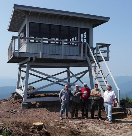
During the summer of 2007, Matt Haldeman, a Vancouver-area custom home builder, initiated a volunteer effort to restore the lookout, obtaining donations of materials to rebuild the structure.
Passport in Time volunteers donated labor and expertise for reconstruction efforts in 2007 and 2008. Windows were salvaged from a fire lookout in Oregon and Forest Service employees continued the restoration work, finally completing interior walls and flooring in 2010. In 2010, Mount Adams District Ranger Nancy Ryke said the forest was exploring opportunities for the public to enjoy the lookout, possibly converting it to a rental.
Red Mountain is the last standing fire lookout in both Skamania County and the Mount Adams Ranger District.
The route.
It is possible to reach Red Mountain one of two ways: along the Indian Racetrack trail or hiking a gated access road from the south. Both routes are almost identical in distance and gain, nearly 7 miles round trip and around 1,500′ +- a few hundred feet. For that reason, I would highly recommend hiking the trail versus the road. It’s far more scenic and historically interesting!
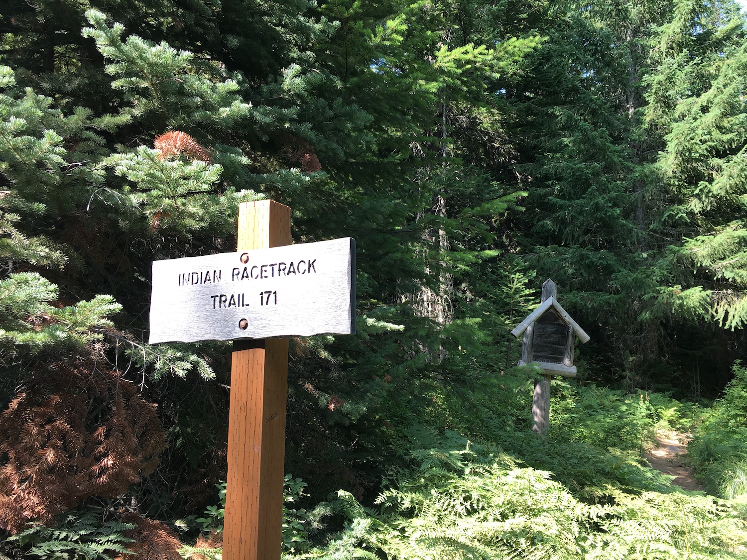
Indian Racetrack trail.
Distance (RT): 6.9 miles
Elevation Gain: 1,580′
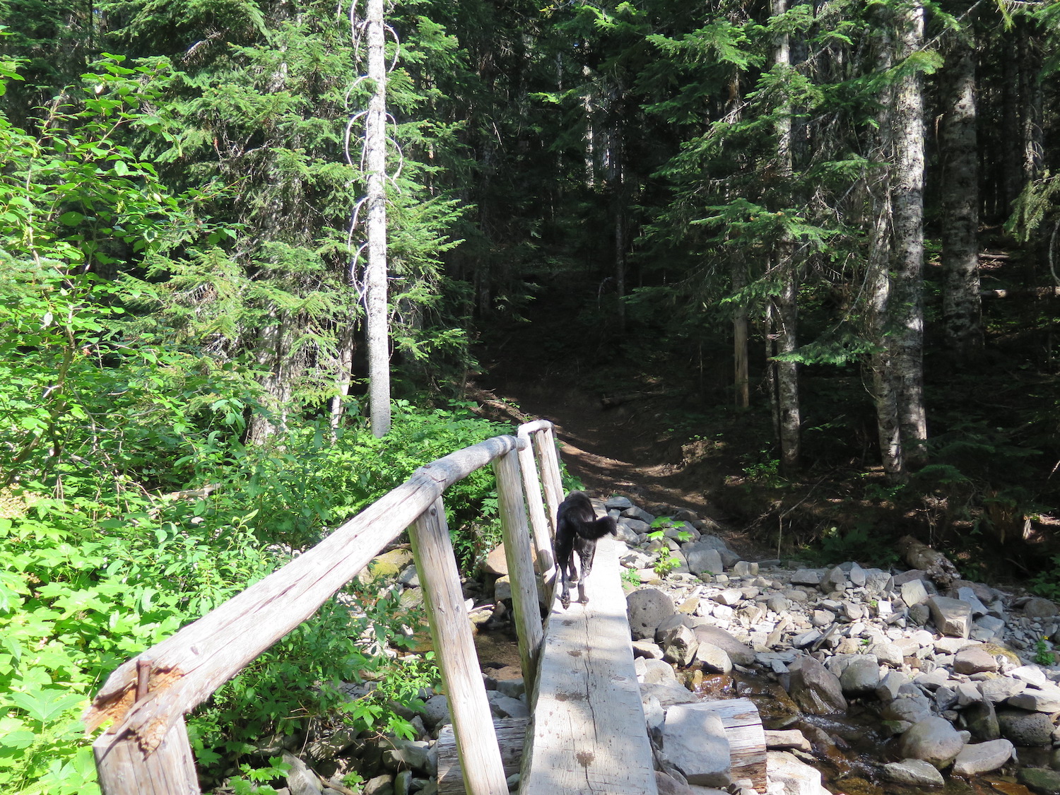
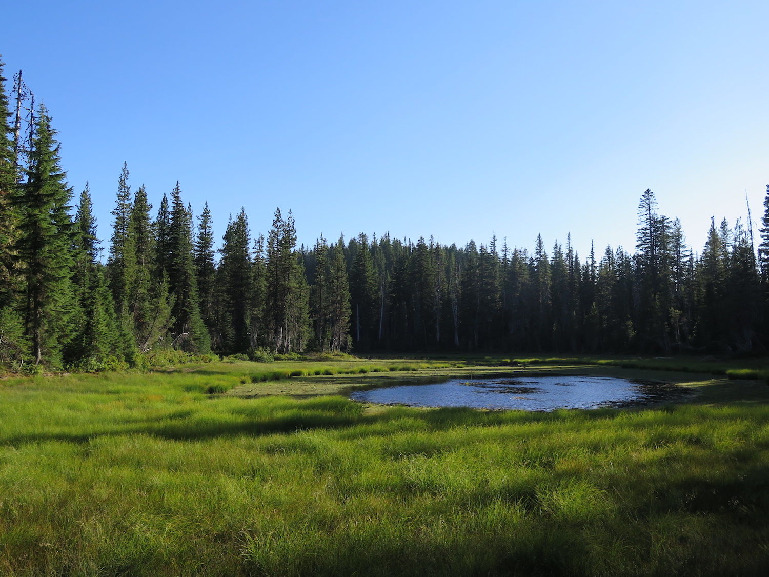
The Indian Racetrack trail heads southeast through second-growth forest, crossing Falls Creek and entering the Indian Heaven Wilderness. The trails climbs uphill through rocky terrain for about a mile before leveling off into beautiful wide meadows. This area is know as the Indian Racetrack, where thousands of Yakama, Klickitat, Cascades, Wasco, Wishram, and Umatilla tribes gathered for 9,000 years to race horses and harvest berries. The track used for pony races is about 10-feet-wide, more than 2,000 feet long, and can still be seen in the meadow.
At the south end of a small tarn in the meadow is the junction with trail 171A, which heads east to the PCT. Continue south on 171, which climbs to a road just north of the Red Mountain summit. Follow the road uphill to the right for a short distance to the summit and the lookout. From the junction, it’s about one mile and 700′ up to the summit.
Red Mountain has beautiful views of Mount Hood, Adams, Rainier, and Mount St. Helens.
6048 road access.
Distance (RT): 6.6 miles
Elevation Gain: 1,470′
Getting to the lookout via the road access is roughly the same directions as from the Indian Racetrack. From Highway 14 follow the Wind River Highway north from Carson about 5 miles, then turn right onto Panther Creek Road (NF-65). In 11 miles, turn right onto Carson Guler Road (NF-60) and in 1.5 miles reach a gated road on the road (6048). Hike the road about 3.3 miles to the summit.
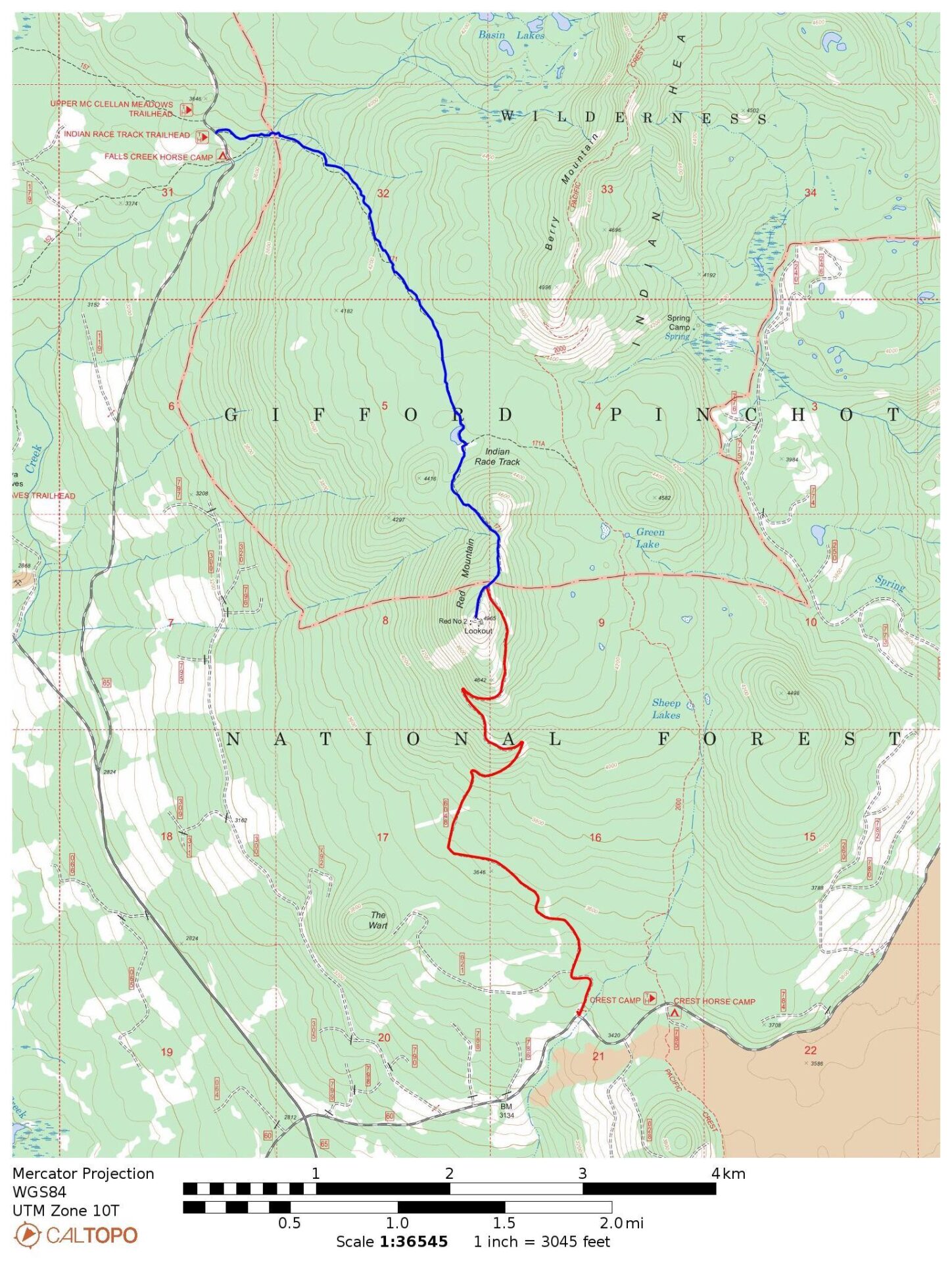
Red – Road 6048 access.
Directions.
(To Indian Racetrack Trailhead): From Highway 14 follow the Wind River Highway north from Carson about 5 miles, then turn right onto Panther Creek Road (NF-65) and follow it 16 miles to the Indian Race Track Trailhead just north of the Falls Creek Horse Camp before reaching Upper McClellan Meadows.