Southern Cascades | Mount Rainier Area
Location: 46.8341389,-122.0194109
Summit Elevation: 4,877′
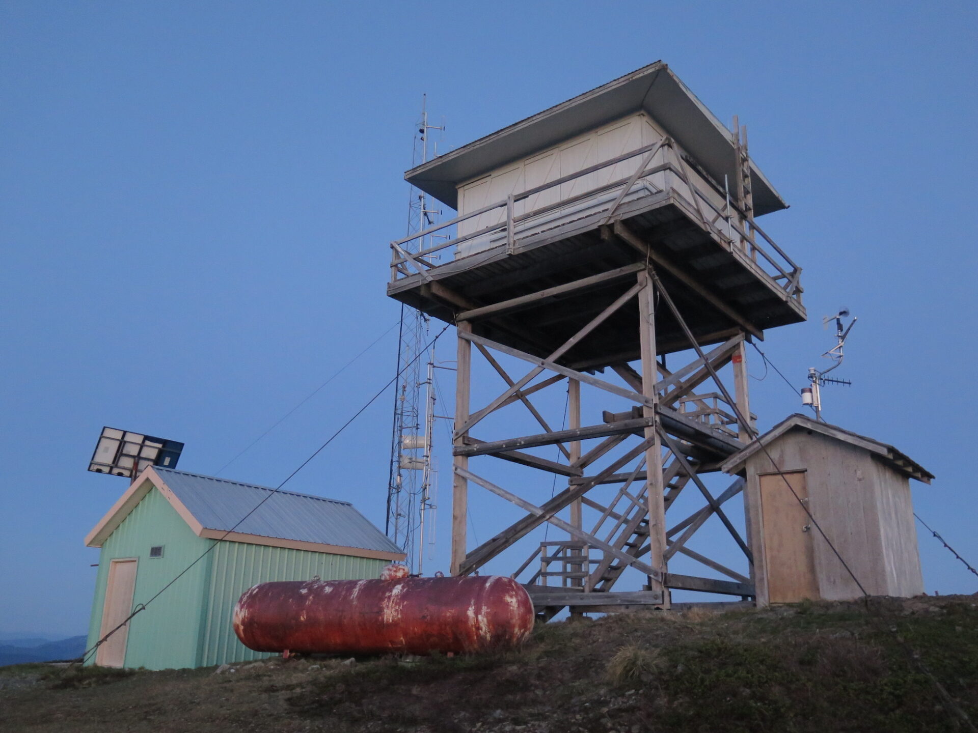
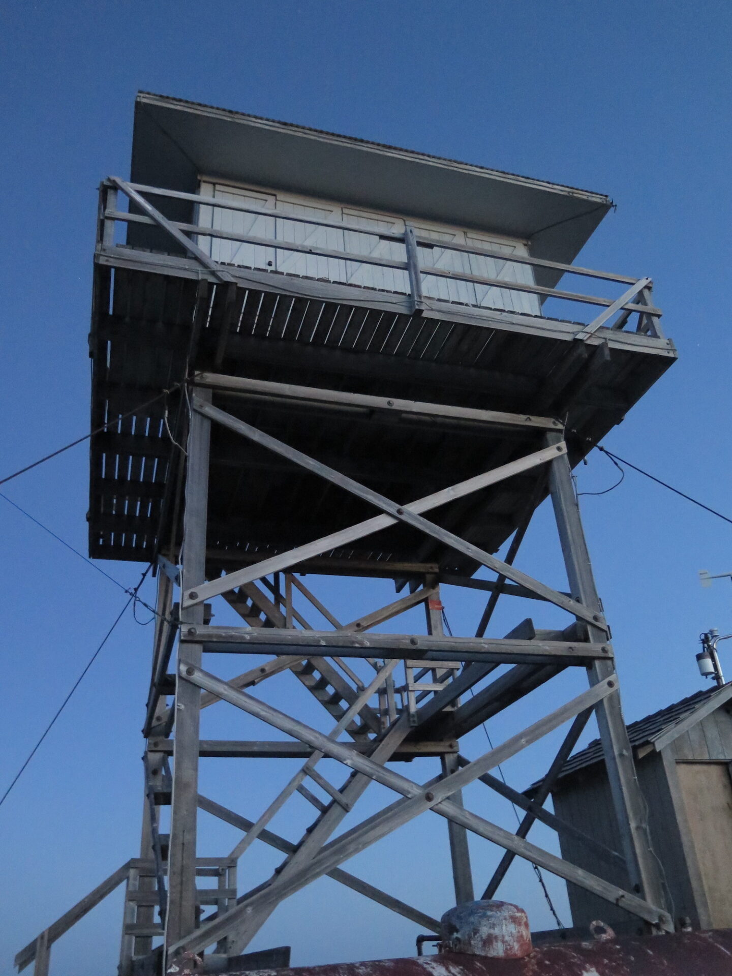
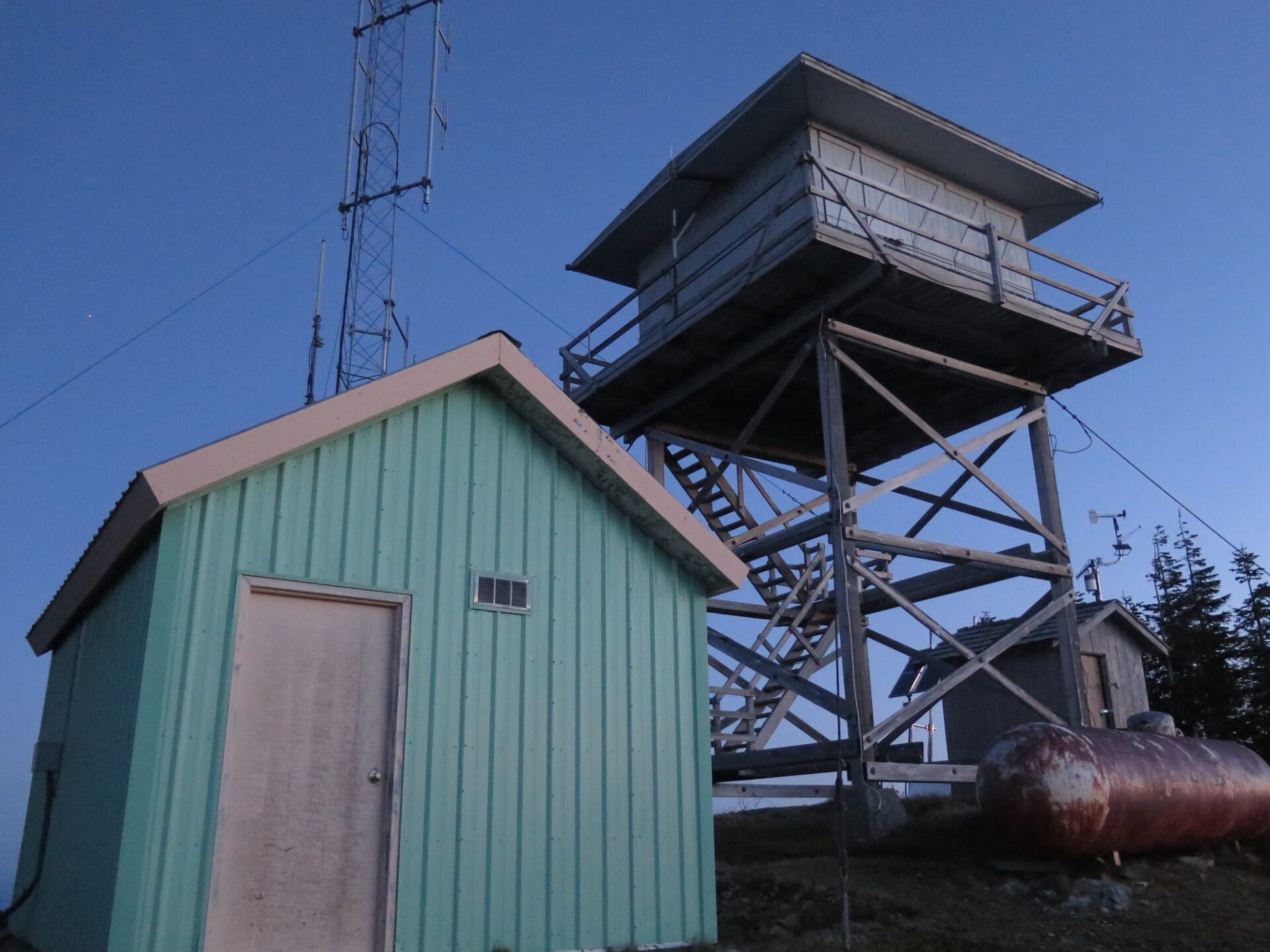
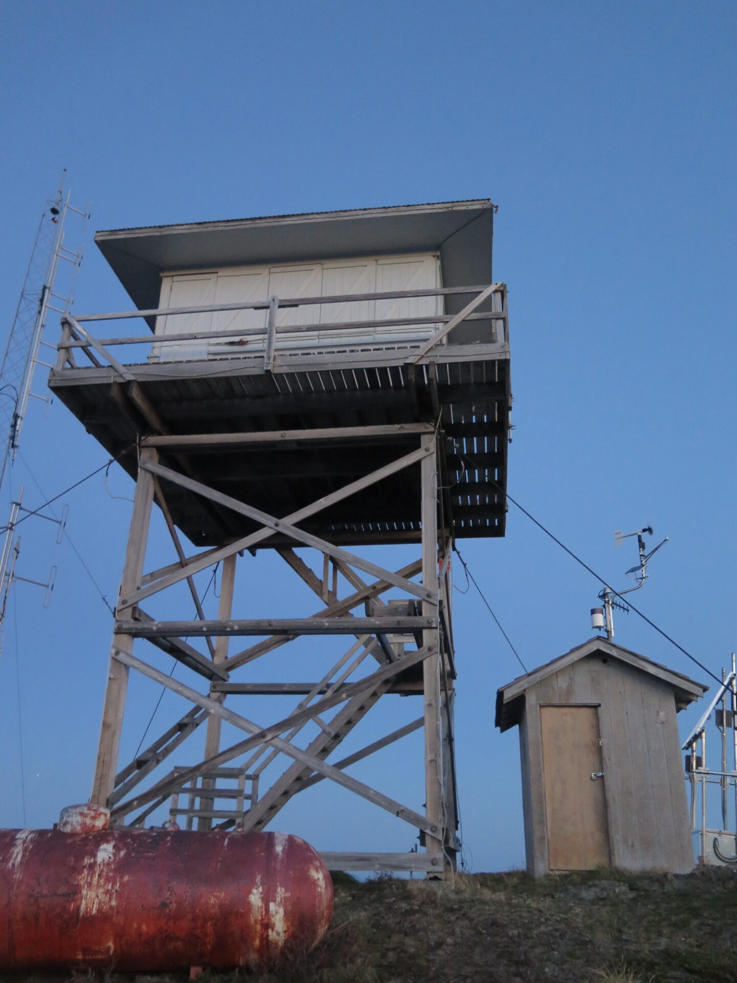
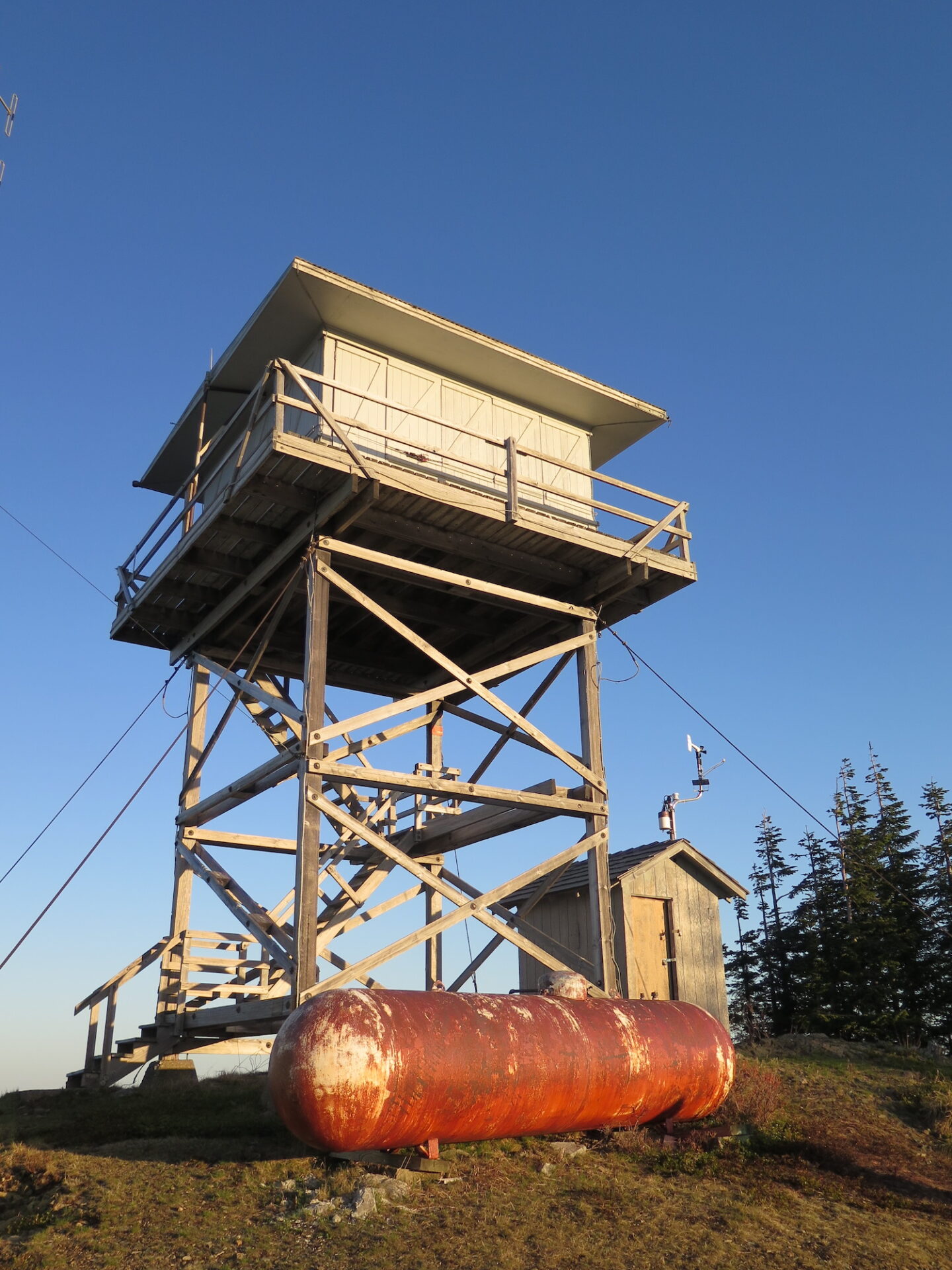
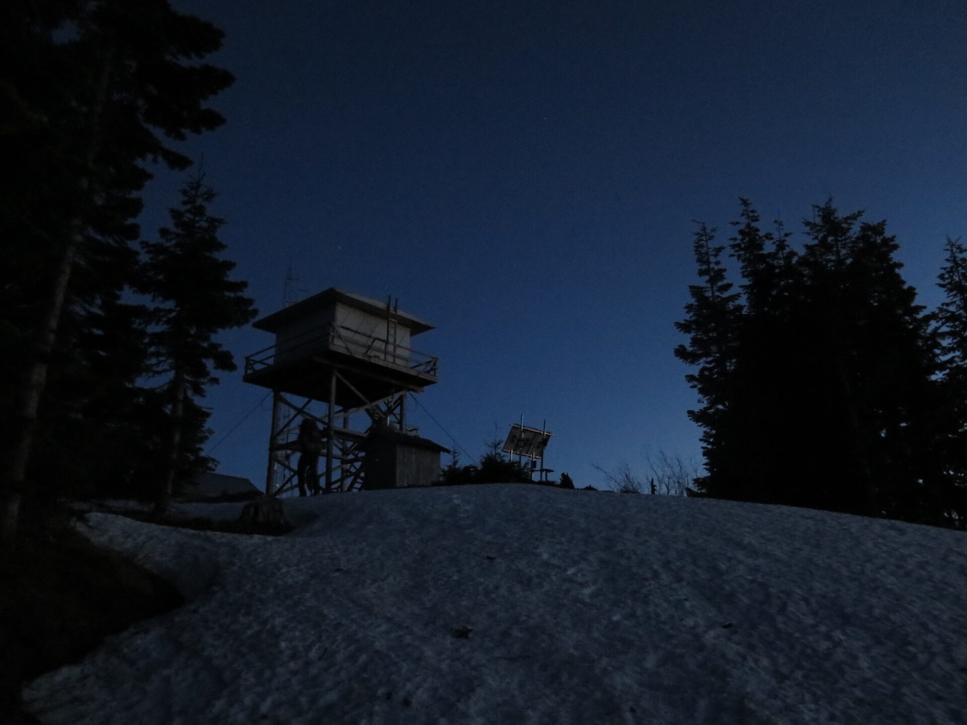
Lookout Type: 20′ DNR wooden tower with 14’x14′ flattop cab
Site Established: 1964
Current Structure Built: 1964
Date Visited: 04/18
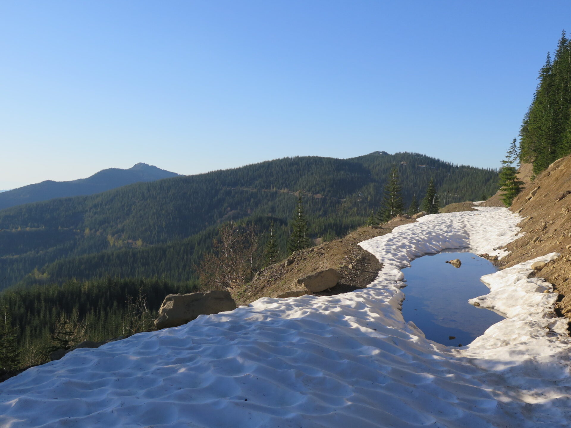
Puyallup Ridge Lookout is a fantastic relatively unknown gem, mostly due to complicated access issues. It wins an award for being the most obscure lookout with the shockingly best views of not only Mount Rainier, but also Mount St. Helens and Mount Adams.

Photos from 2018 visit.
History.
Built in 1964 by the Washington State Department of Natural Resources, this lookout was perhaps one of the last constructed in Washington State and has seen limited use. The structure was slated to be moved to the Pierce County Museum but instead the Museum received the Salmon River Lookout, located 3 miles northwest of Lake Quinault.
In 2017, landowner Manke Lumber Company granted permission for the Forest Fire Lookout Association to do a number of work parties to stabilize and restore the Puyallup Ridge lookout under the direction of Rick Eades.
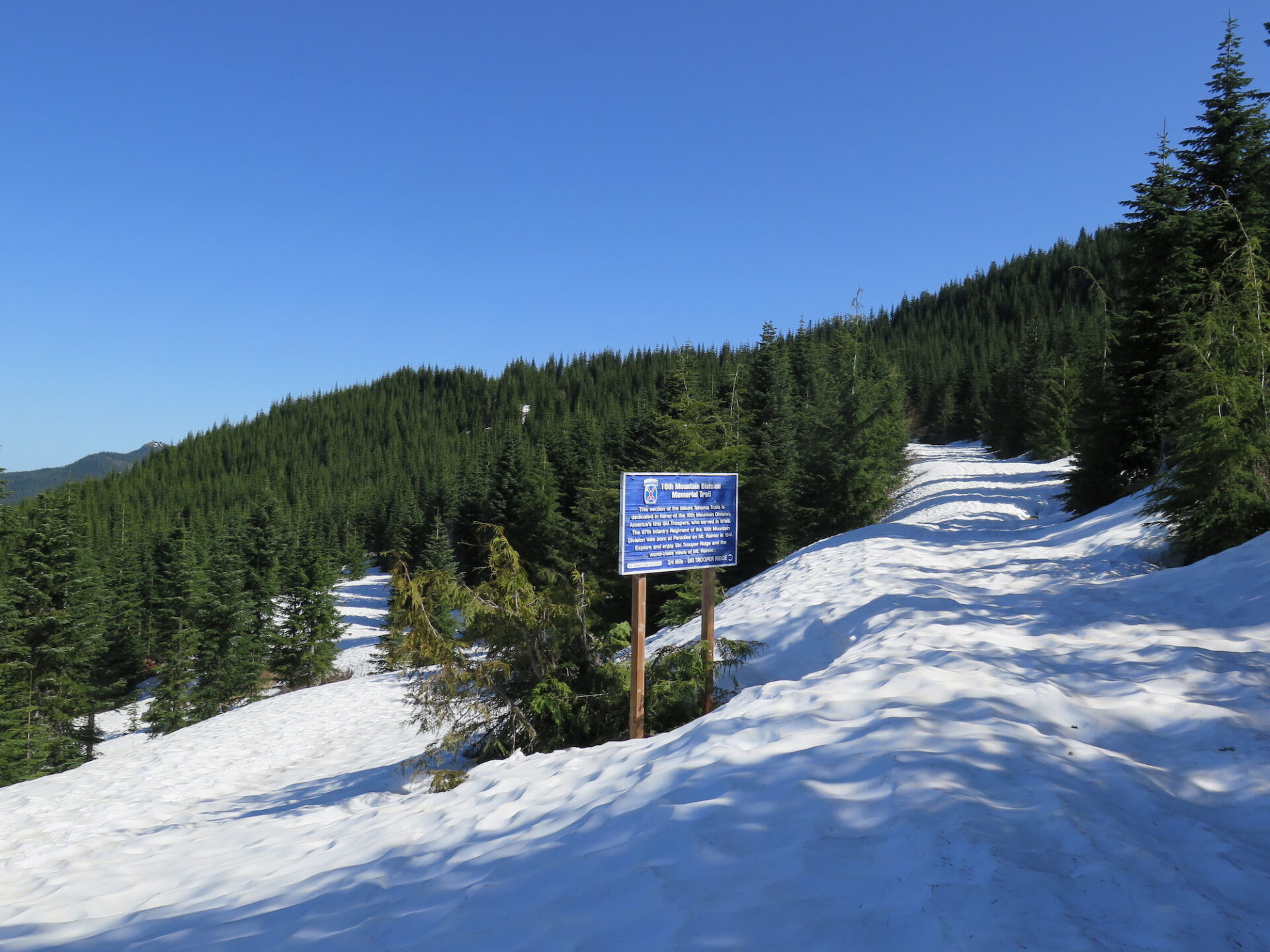
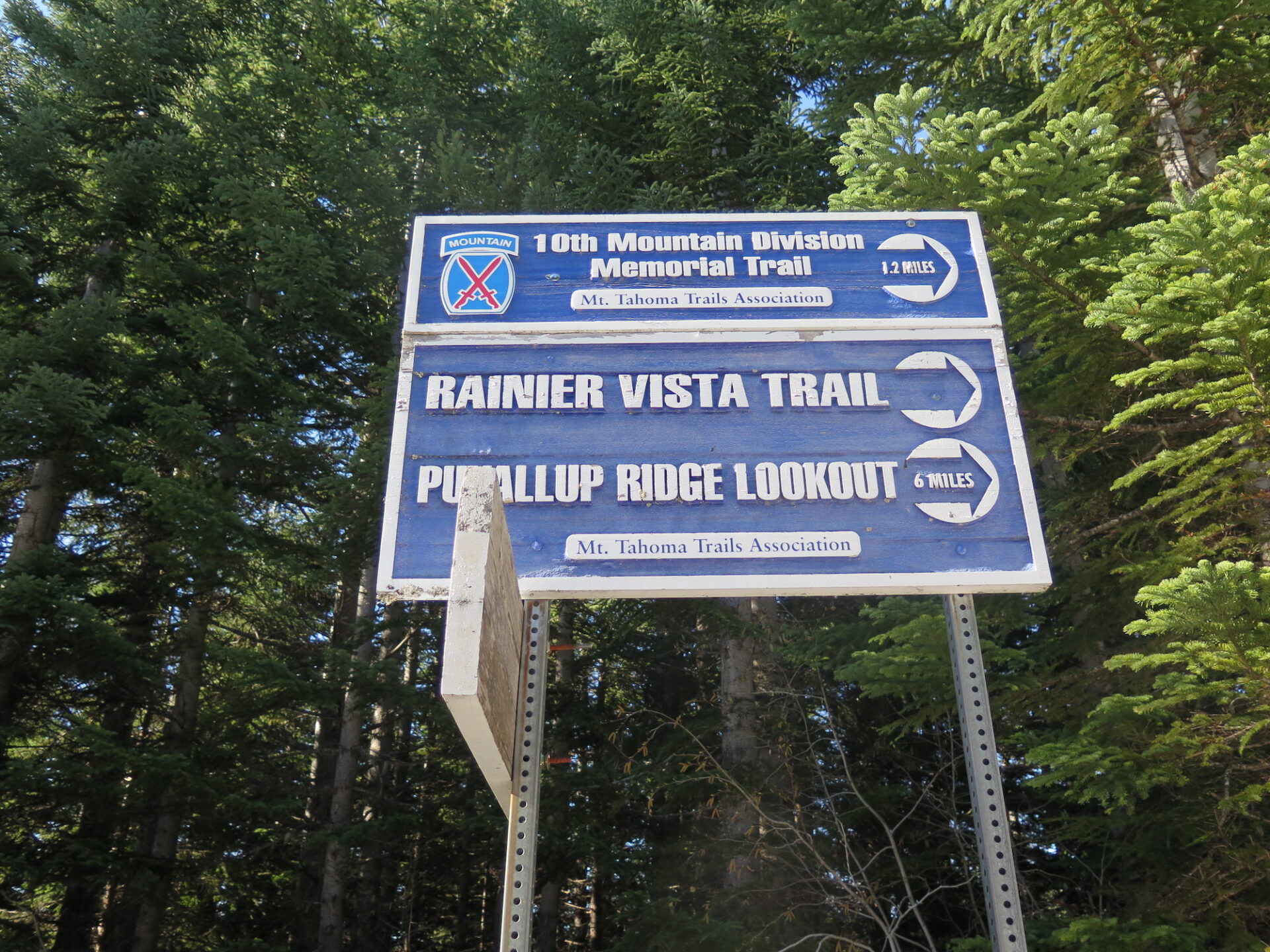
Approximately one mile above the Copper Creek Hut along the route to Puyallup Ridge, consider a short detour to Trooper Ridge on the 10th Mountain Division Memorial Trail. This trail was built in recognition of the men who fought in one of World War II’s most famous mountain combat units and trained on the slopes of Mount Rainier. The unit was the only of its kind in the US and members later went on to shape the US ski industry, opening over 60 ski areas across the nation.
The route.
Distance (RT): 21 miles
Elevation Gain: 2,500′
Summit Elevation: 4,877′
Getting to Puyallup Ridge is a complicated endeavor since most of the surrounding area is inside the privately owned Kapowsin Tree Farm. Permits can be purchased through Hancock Forest Management but are expensive and do not allow motorized access to the summit.
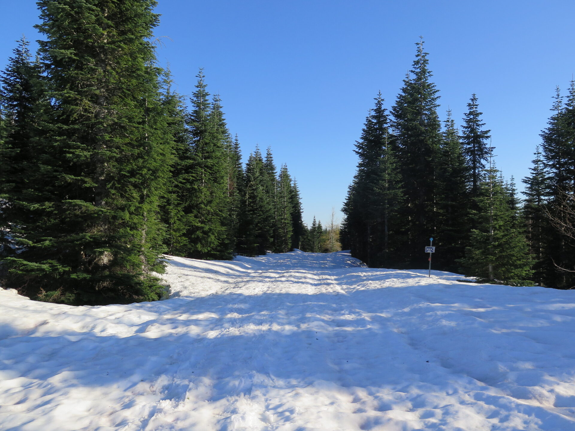
Though there are some creative cross country ways to access Puyallup Ridge, the best route with the least resistance is in winter from November to April, when the Mount Tahoma Trails Association (MTTA) maintains snowshoeing and cross country ski trails to the Copper Creek Hut, approximately 6 miles from Puyallup Ridge.
Because of the long distance and short winter days, it’s often more realistic to make overnight reservations at the Copper Creek Hut and turn Puyallup into a multi-day snowshoe or ski adventure.
The Copper Creek Hut is serviced by three Sno-Parks off Forest Road 92. Depending on snow conditions, the route to the Hut is either 4.5 miles with about 1,000′ of gain or 5.5 miles one way with 1,600′. The first 1 to 1.5 miles to Copper Creek are well signed. At the “Cooper’s Loop” junction there are two paths to the hut, so bring a map.
Though the route to Puyallup Ridge is relatively straightforward, there are numerous junctions that aren’t well marked, so bring a map or GPS. Trails past Copper Creek Hut are also not groomed, so come well prepared with gear for variable conditions.
Notes: Dogs are not allowed in the North District. If snowshoeing, please stay to the sides of the groomed ski tracks.
The MTTA North District trails close each year from April 15 – November 15 to protect sensitive breeding habitats in the surrounding wildlife refuge.
Day use is welcome at Copper Creek Hut, but reservations are required to stay overnight and can fill fast in winter months. Check the MTTA website for more information.
Type 2 fun, the best kind!
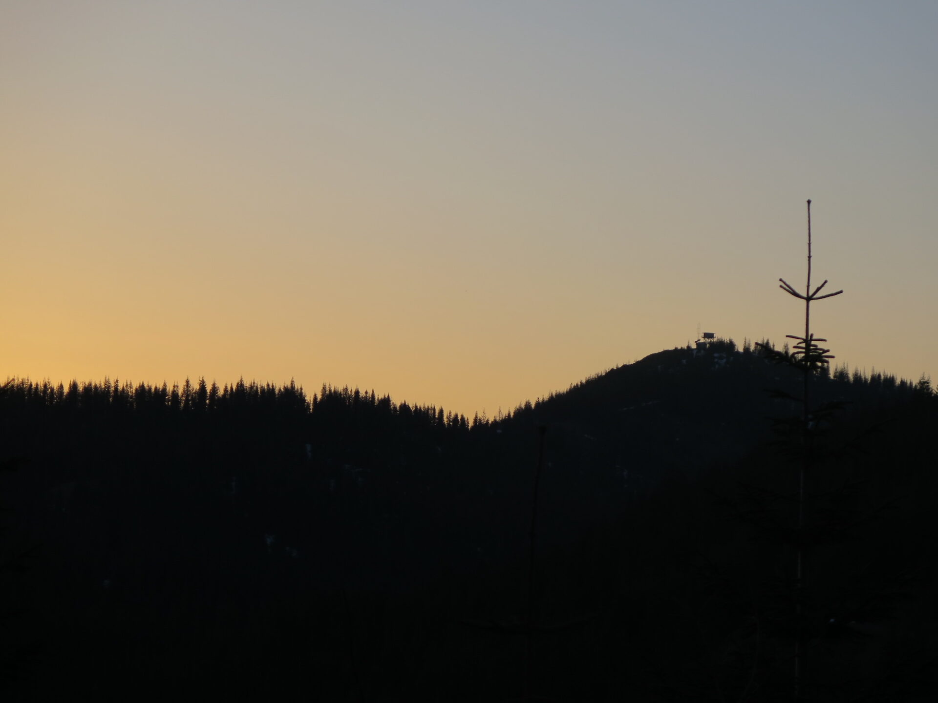
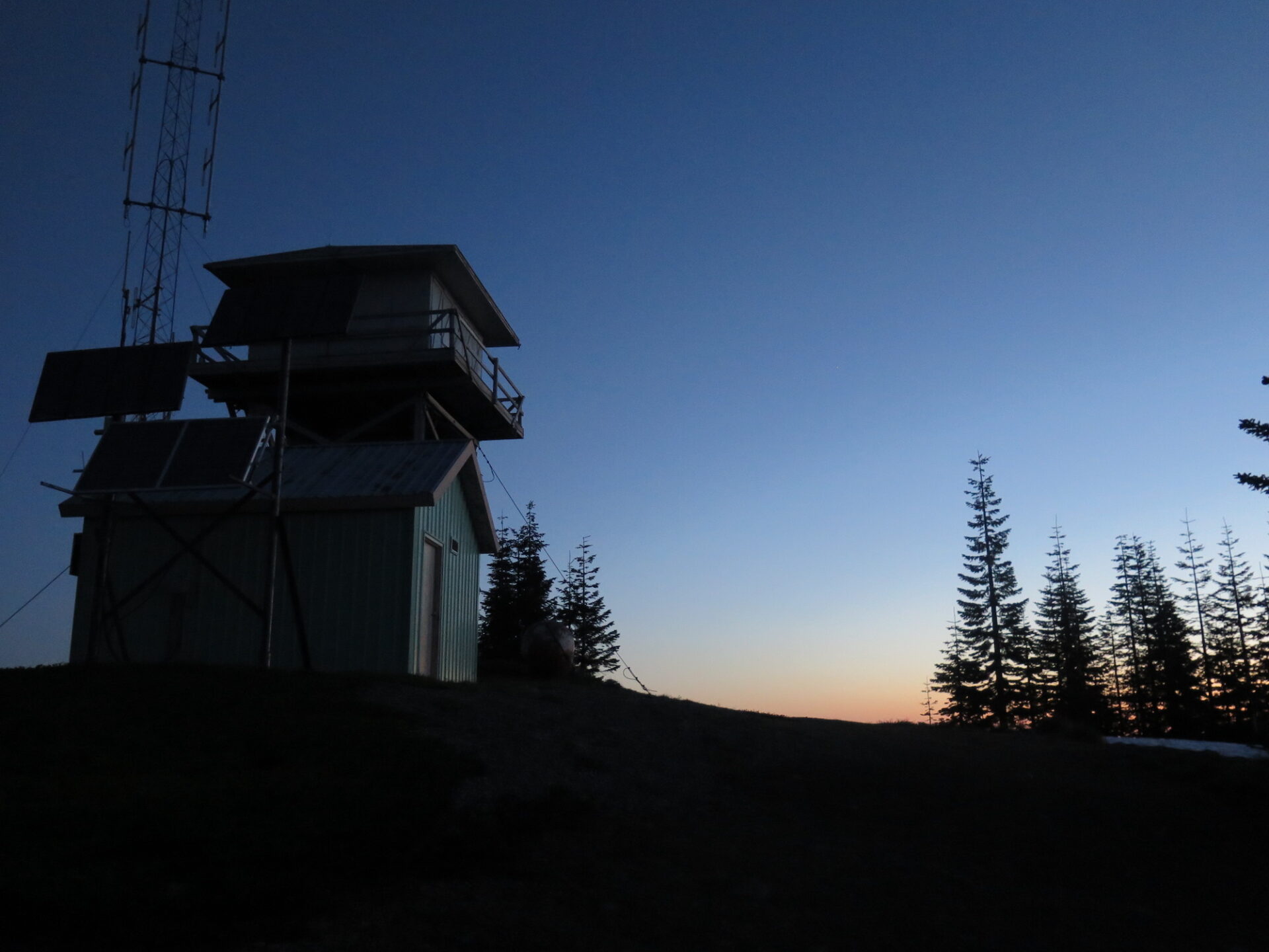
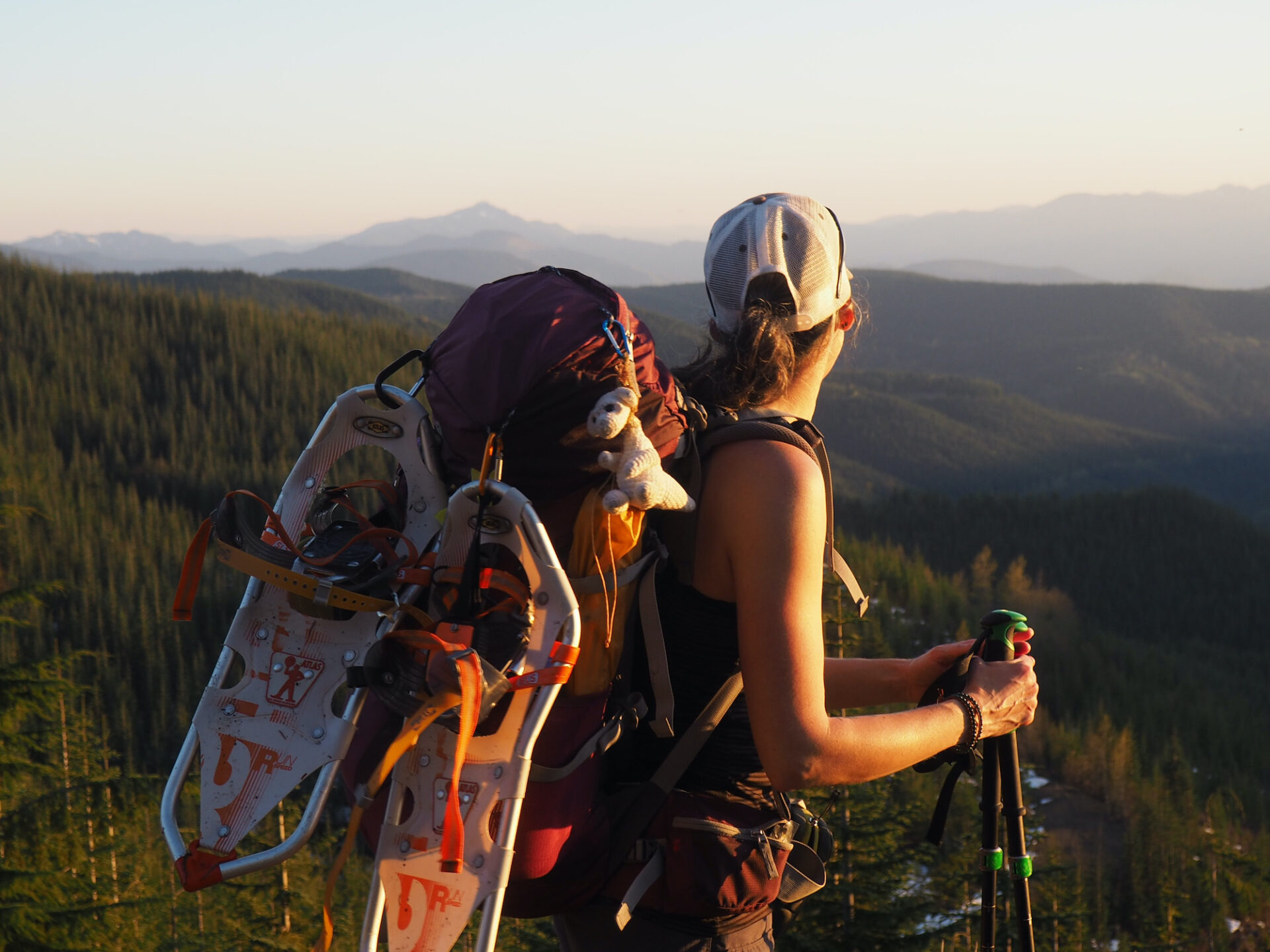
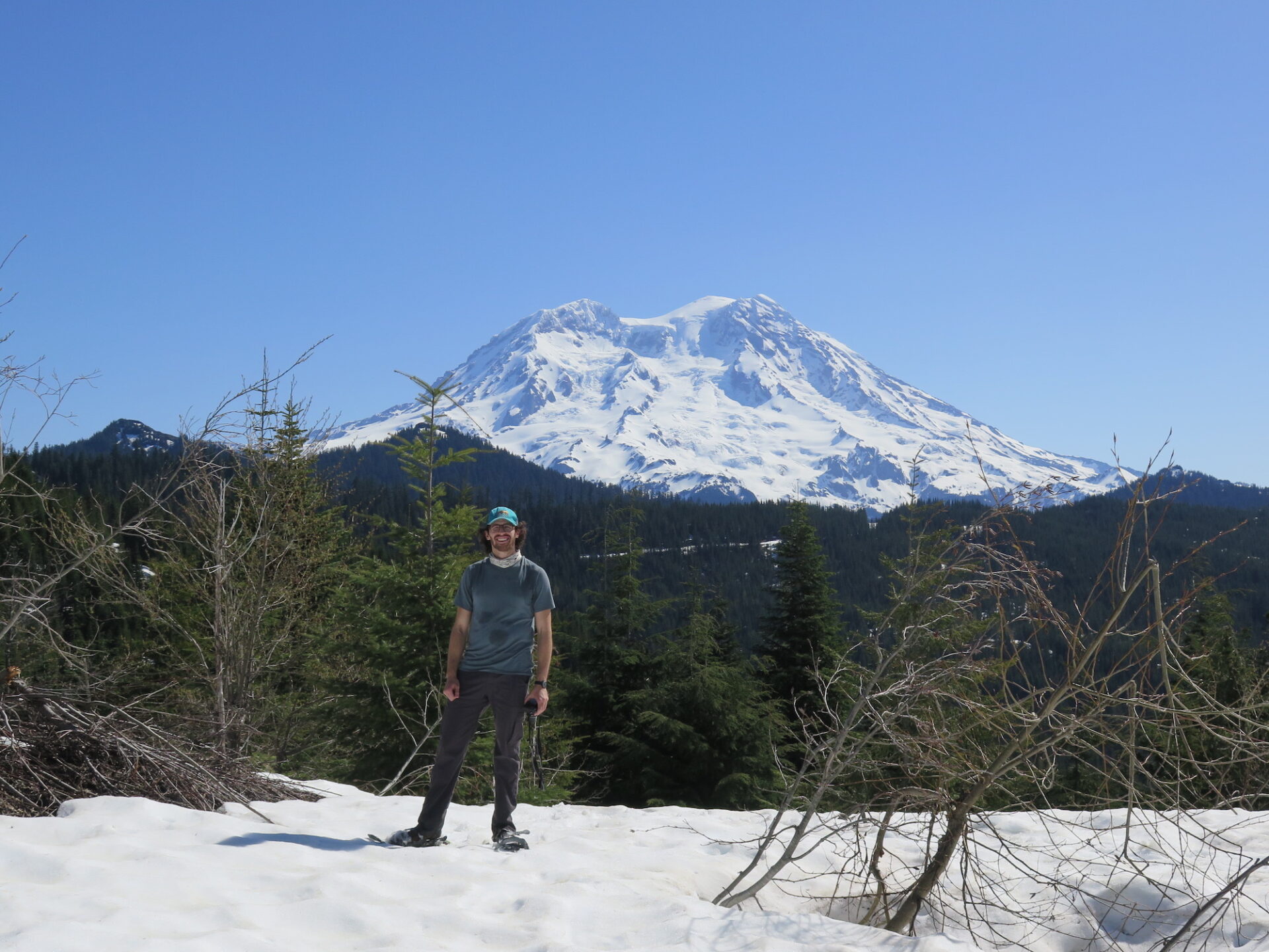
My visit to Puyallup Ridge in early April 2018 was the perfect kind of type 2 fun and Puyallup solidly earned a spot on my “top 10” lookout adventures. A friend who joined me has somehow survived several of my infamous death marches and he still counts Puyallup as solidly special.
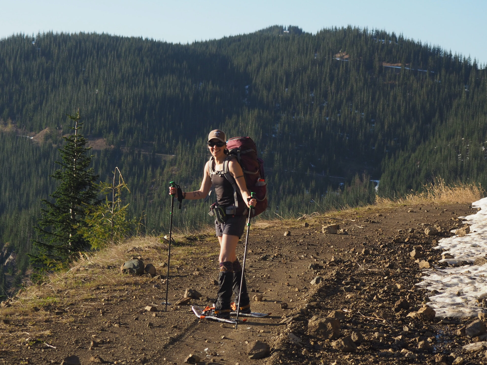
I chose to visit Puyallup at the very end of the MTTA season, thinking with slightly longer days and less snow, we could pull it off in a very long day. I much prefer skiing to snowshoeing, but with snow melting out in some spots, snowshoes were the most logical, but cumbersome choice. After bare roads down low, we finally hit snow and then were faced with infuriately short stretches of melted out road followed by infuriately long stretches of deep, punchy snow, turned mashed potatoes in the sun. After growing weary of constantly taking our snowshoes on and off, we gave up and just kept hiking in our snowshoes.
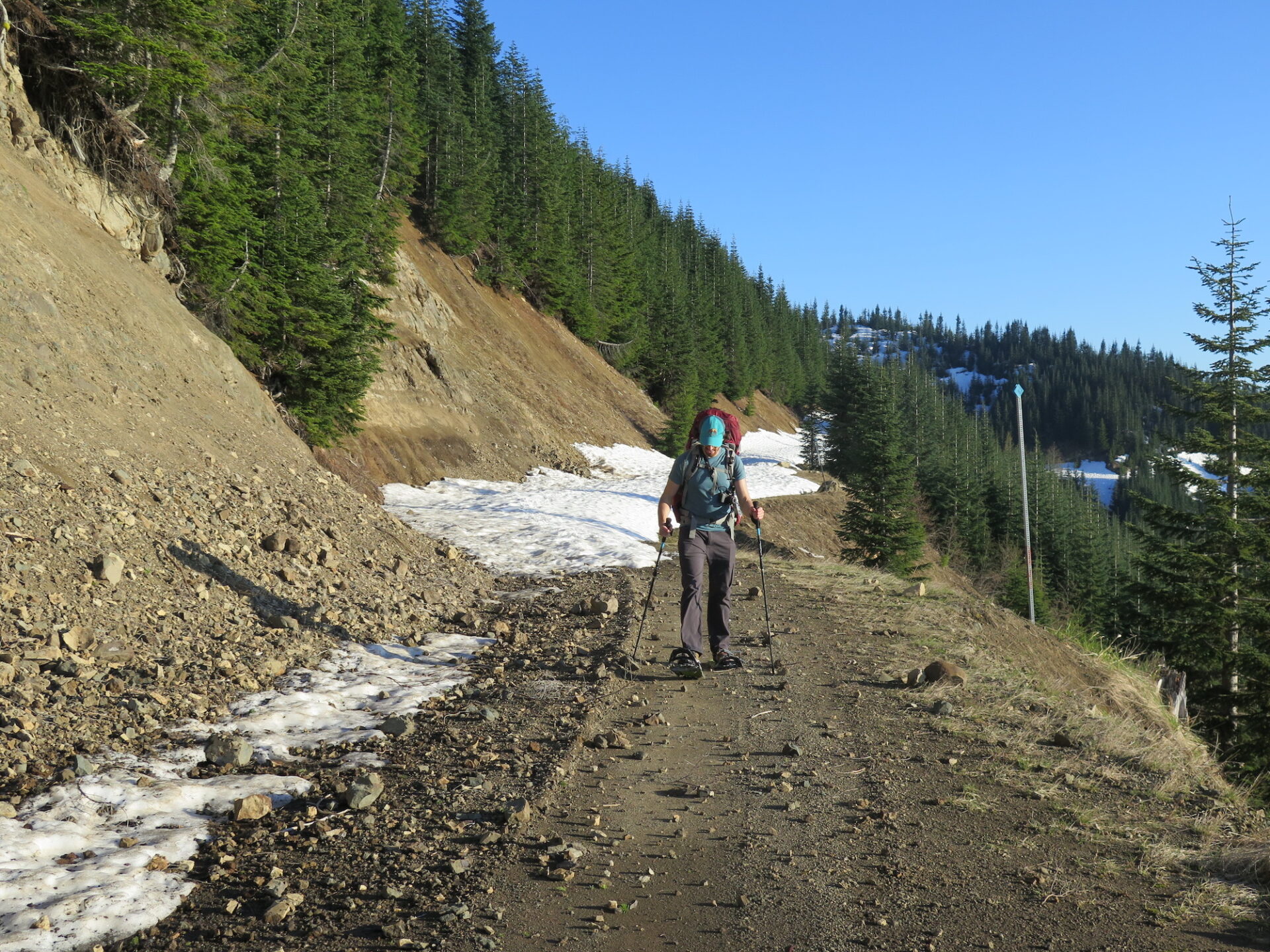
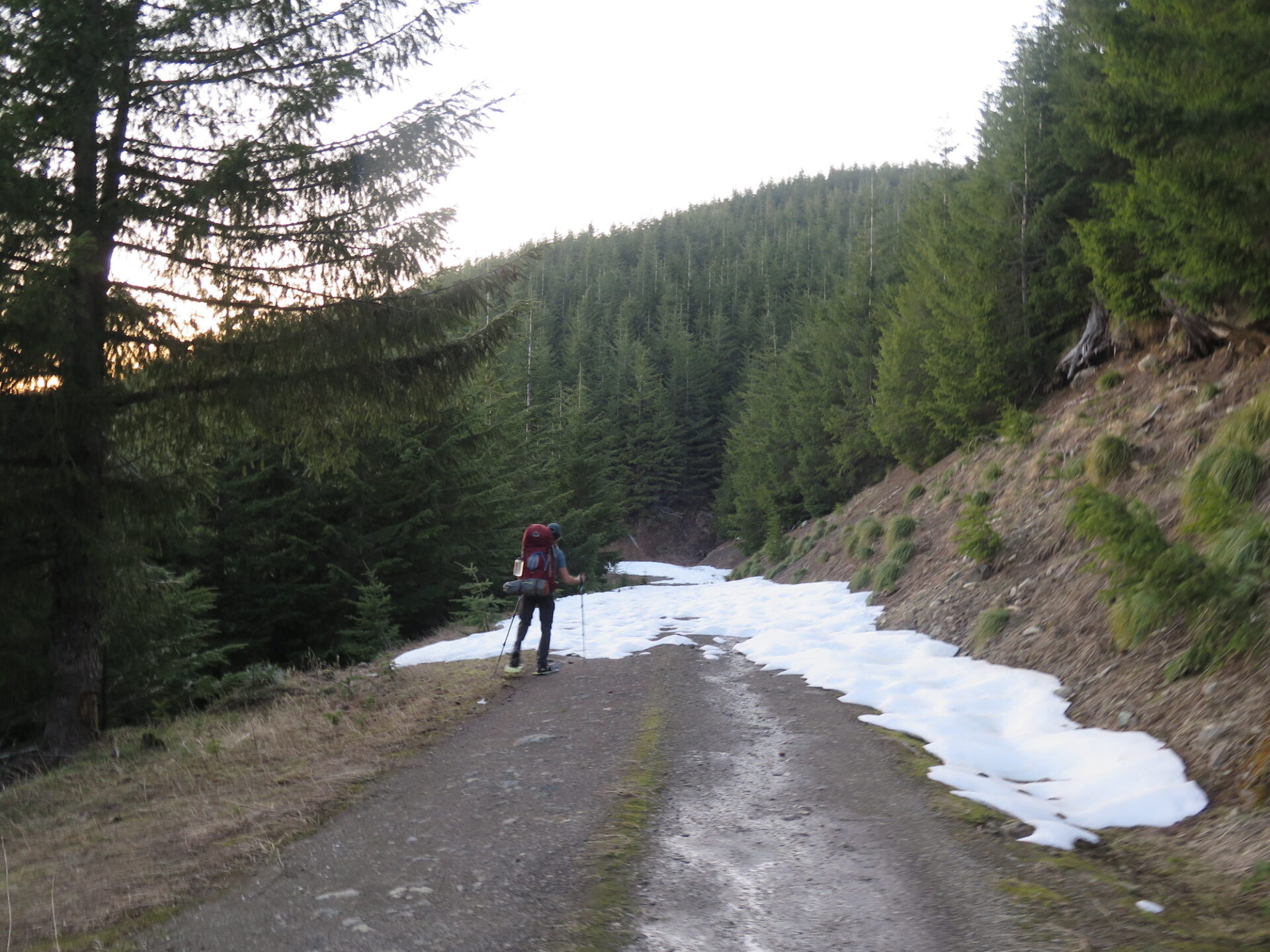
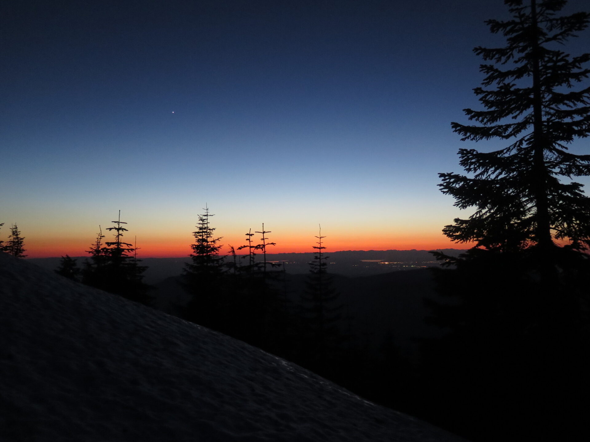
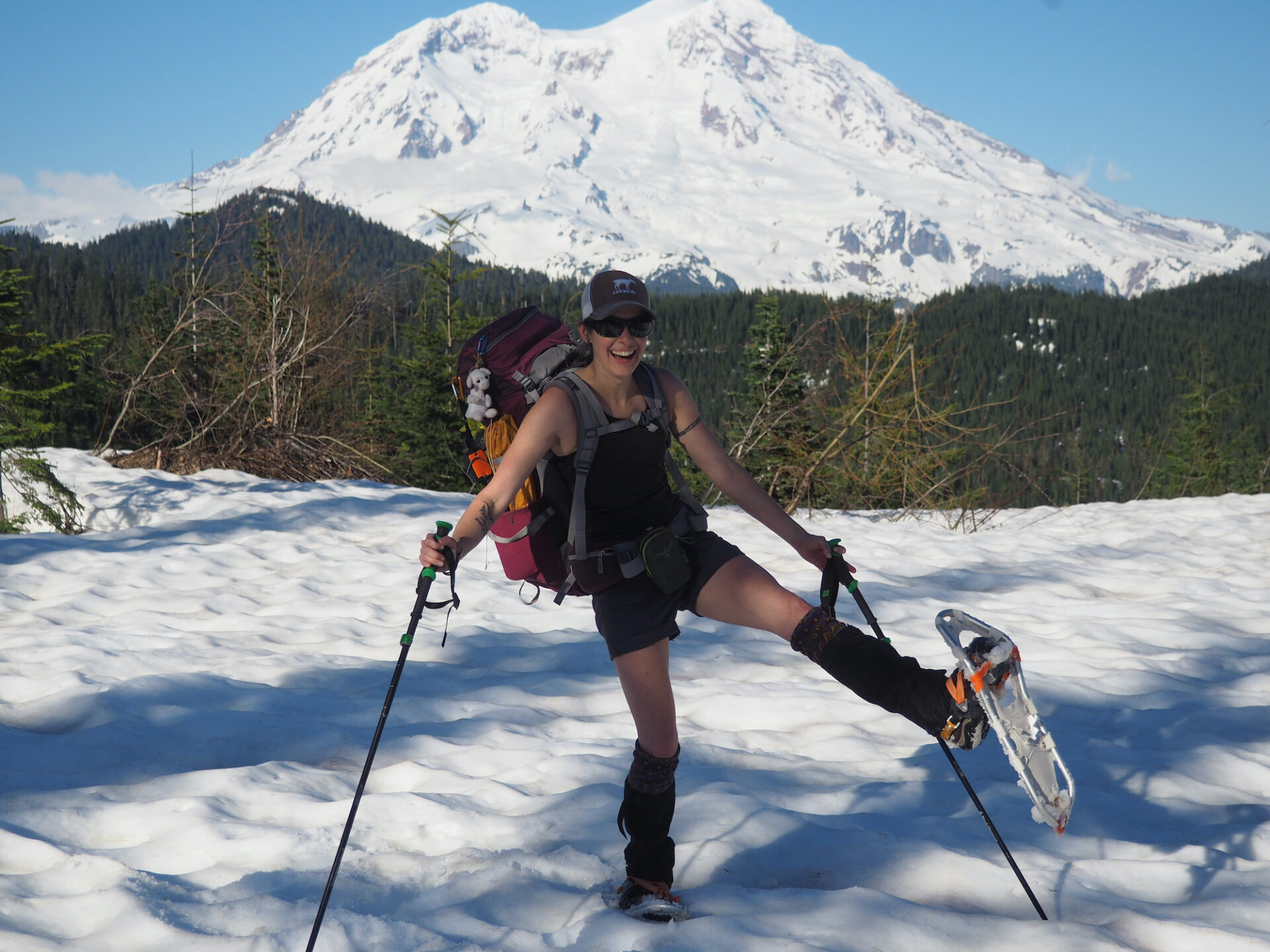
This was absolutely, hands down, one of the most ridiculous and arduous approaches I’ve ever had. Our clonking around in snowshoes led to a slow, painstaking slog and we finally arrived at the summit of Puyallup at sunset. I’m not sure I’ve ever done 10 miles slower!
We had at least packed accordingly though and might have bent the rules a bit by enjoying a short bivy on the summit in warm sleeping bags with hot dinners before heading back down for a long, but slightly faster, hike out in the dark. This time, with the sun set, we could boot glissade down on the short stretches of snow thanks to the colder, firmer conditions!
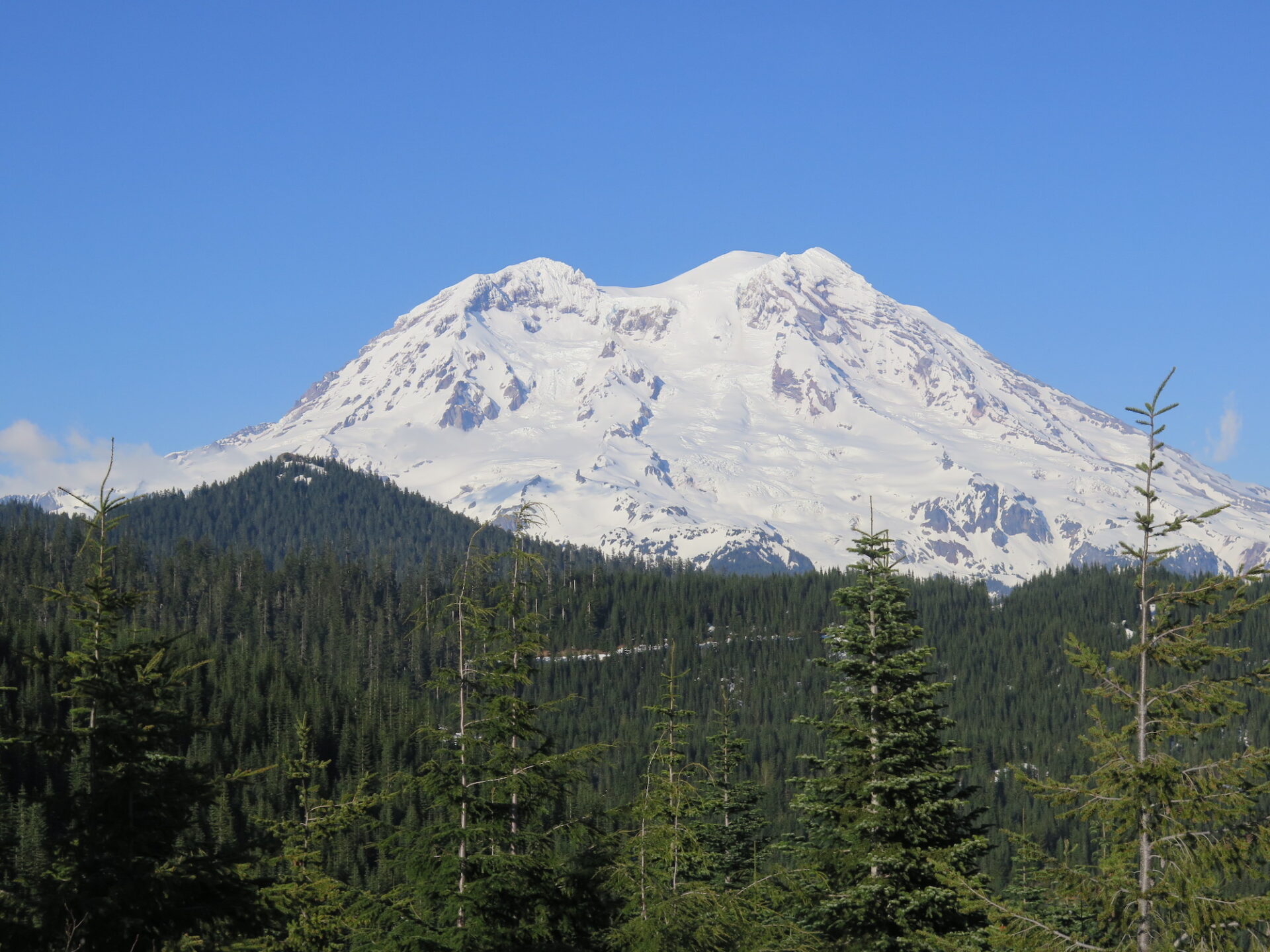
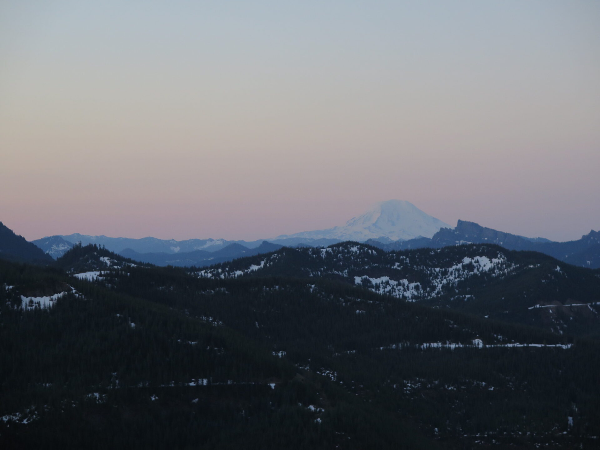
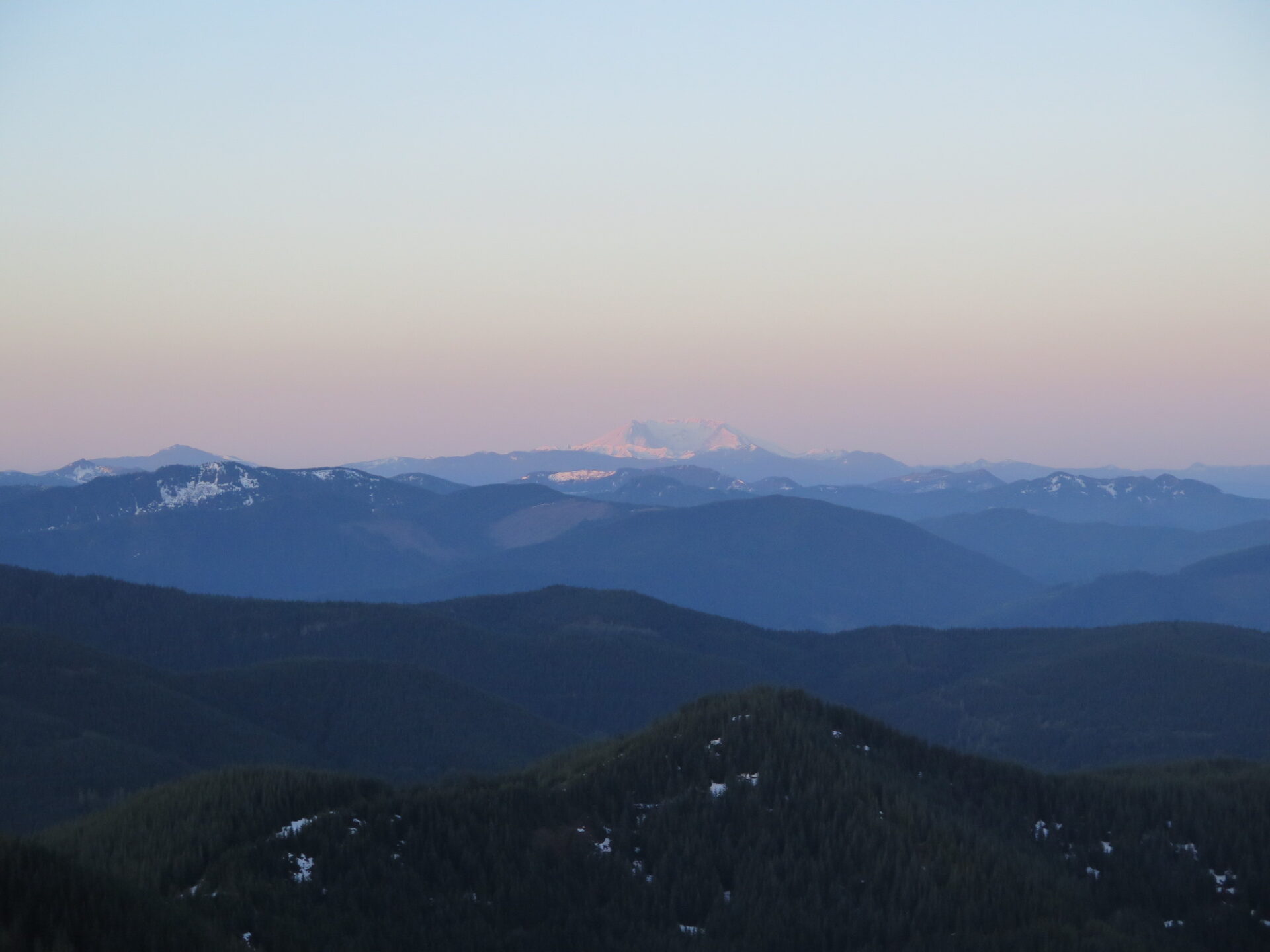
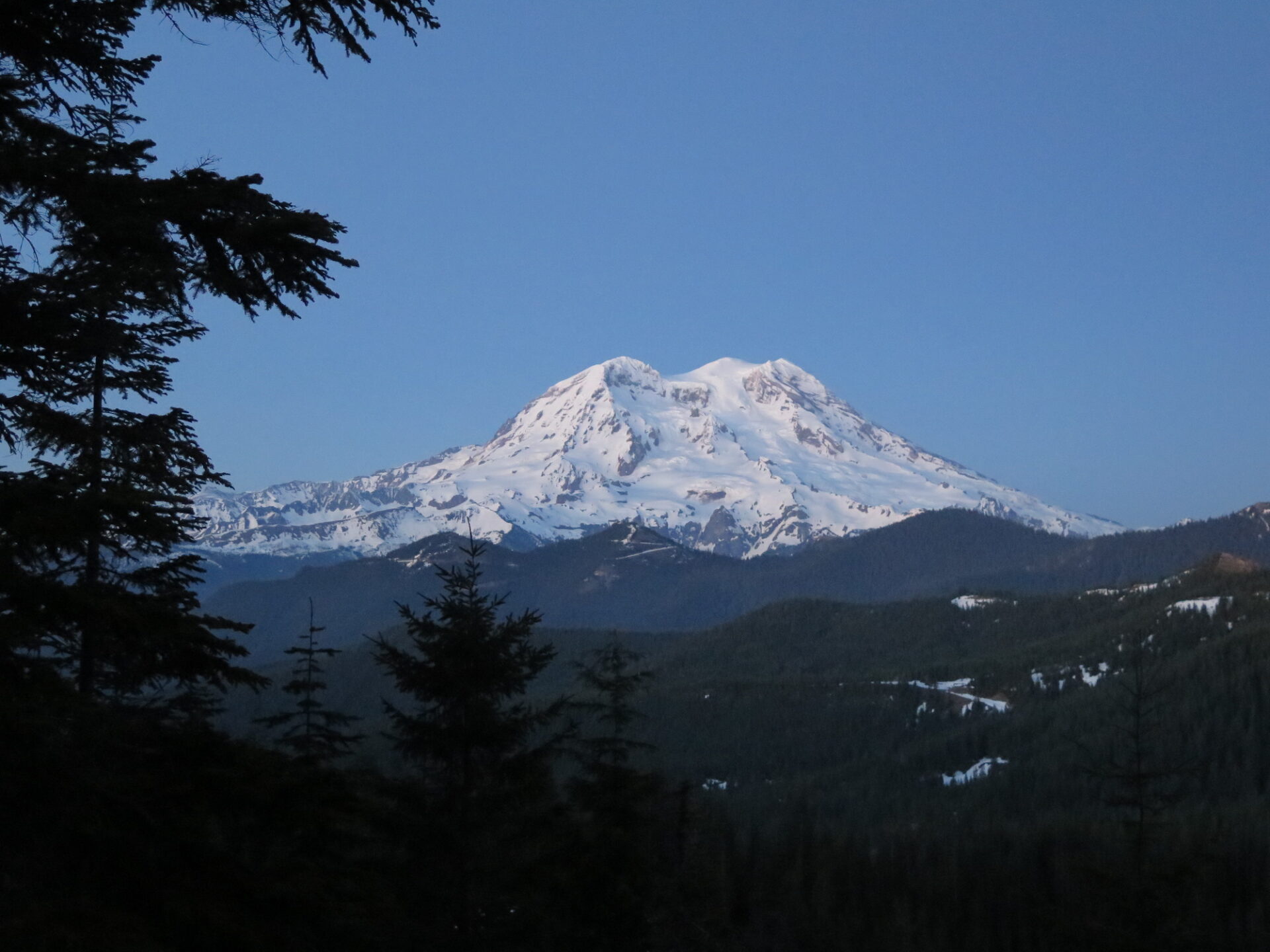
Sometimes though, adventures like this turn out to be the very best. Had our approach been faster, we would have missed out on this spectacular summit sunset show. The views of Rainier, Adams, and St. Helens were stunning and one for the memories. A huge thanks to my always willing friend Ian for joining me on this crazy slog!
Directions.
From I-5 near Tacoma, take Highway 7 south to Elbe. Turn left towards Ashford and Mount Rainier National Park, then make a left onto Forest Road 92, located at mile marker 6 just west of Ashford. There are 3 Sno-Parks on this road that service the North District depending on snow conditions. The highest park is approximately 4.5 miles up the road, but in deep snow conditions, you may need to park lower and ski or snowshoe further.
Washington non-motorized Sno-Park permits are required.