North Cascades | Skagit Range
Mount Baker-Snoqualmie National Forest | Mount Baker Wilderness
Location: 48.7165278,-121.8586609
Summit Elevation: 5,440′
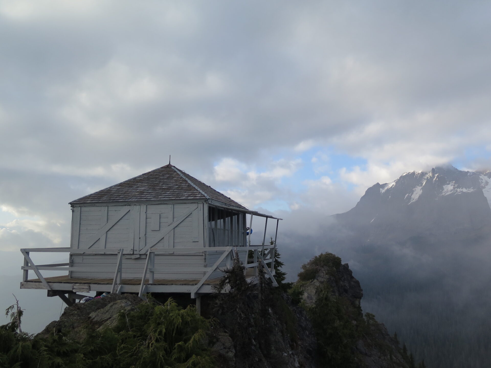
Lookout Type: 14’x14′ L-4 cab
Site Established: 1926
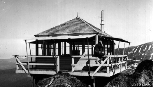
Current Structure Built: 1932
Date Visited: 9/23/17
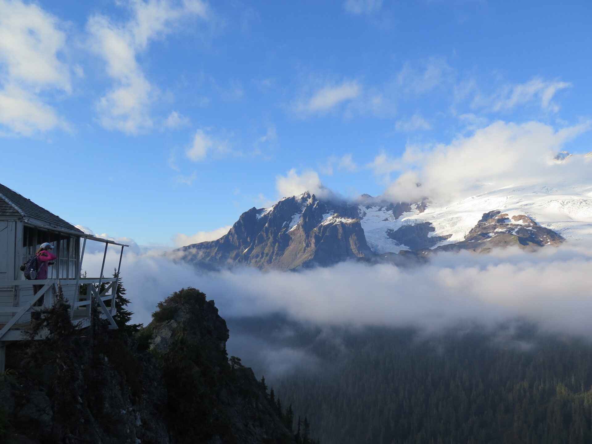
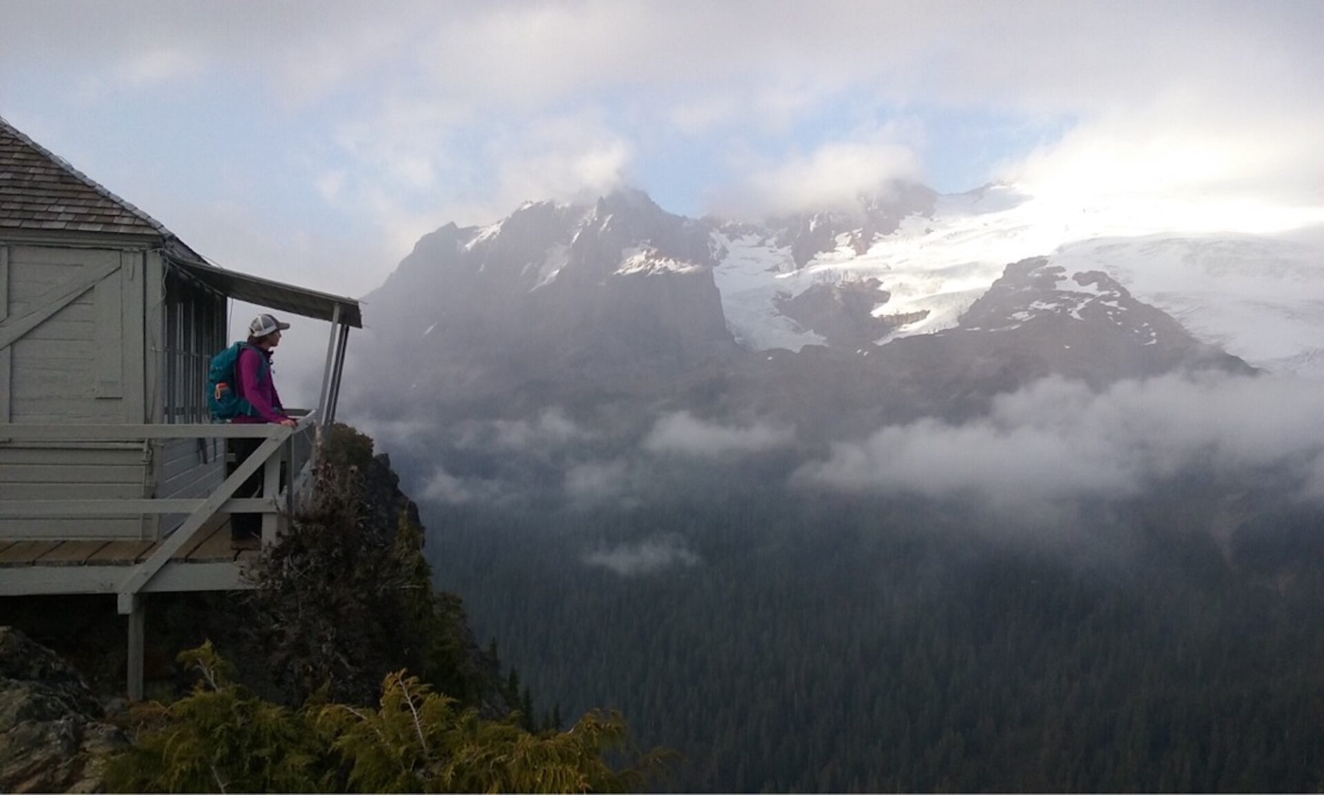
The trail to Park Butte is a relatively easy effort for tremendous views of Mount Baker! The lookout is also one of the few available for first come, first served overnight stays and in the 70s was used as an observatory for volcanic monitoring of Mount Baker.

Photos are from a 2017 visit.
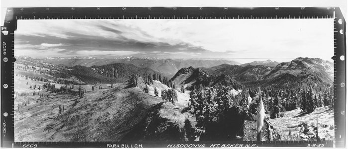
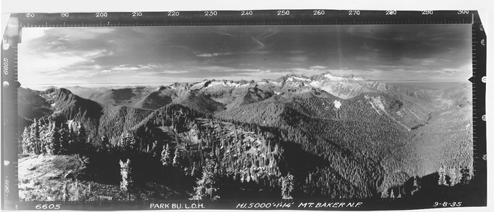
History.
The Park Butte lookout was originally established in 1926. A fire guard camped in a tent below the summit and climbed a large tree on site to look out. Although the tree was removed when the current structure was built in 1932, its roots still remain, supporting the access stairs.
The current lookout was built by a small crew of Forest Service personnel, including C.A. Larsen and William Thompson, both of who worked as fire lookouts. Their names are imprinted in concrete pads in the foundation of the lookout. Pre-cut construction materials from the Aladdin Company in Portland, Oregon were shipped to Concrete, then hauled by truck to the Baker River Ranger Station. From there they were moved with a team of 7-8 pack horses by Roy Evans, a Forest Service packer who helped transport materials for four other lookouts built between 1932 and 1934.
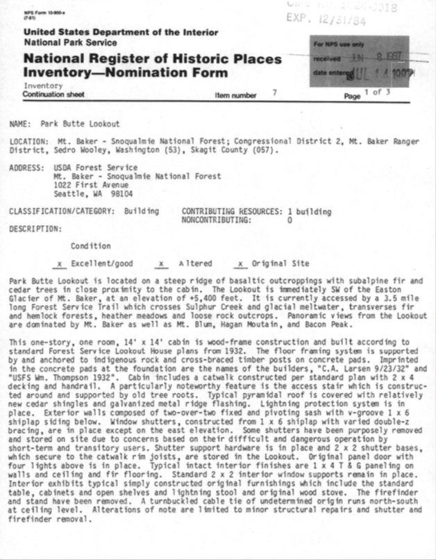
Park Butte remained in service until 1961. Since then, the Skagit Alpine Club has actively maintained it. The lookout was used as an observatory for volcano monitors during the 1970s when Mount Baker threatened volcanic activity. Park Butte is on the National Register of Historic Places as well as the National Historic Lookout Register.
The lookout is open for first come first serve overnight use. Its gorgeous views make it popular, so expect to share the lookout with others if you plan to spend the night.

The route.
Distance (RT): 7.5 miles
Elevation Gain: 2,200′
The trail to Park Butte is impeccably maintained and with its gradual elevation gain, is a relatively easy/moderate outing for most. Once out of the parking lot there is a junction with the Scott Paul trail to the right. Continue left and enjoy a nice stroll through meadows on an elevated boardwalk. During the fall you may find yourself making slow time because wild blueberries and huckleberries are everywhere for the picking!
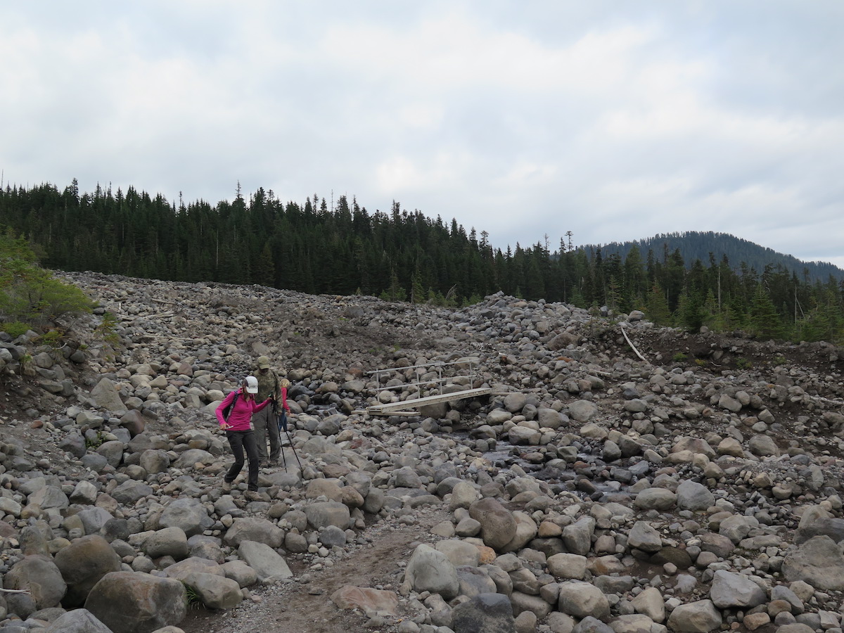
In a little over a mile you’ll reach the crossing of Rocky Creek, which can be challenging after periods of rain or during snow melt. Take your time to scout the route, there are cairns or obvious boot paths that lead you through the crossing. A ladder bridge, which may be removed late in the season, marks the crossing of the main channel.
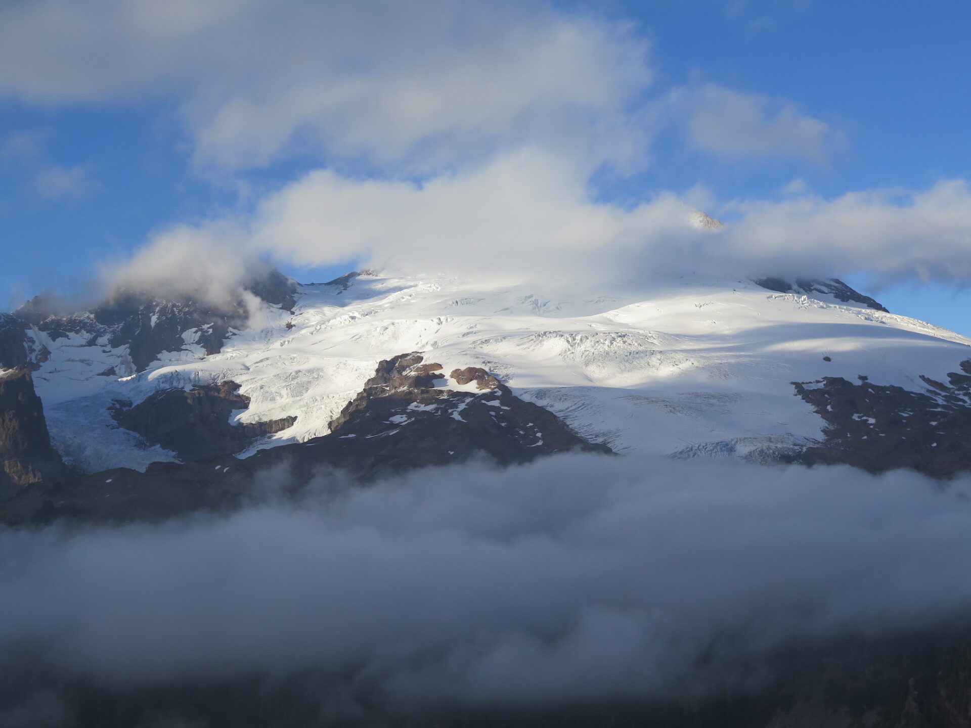
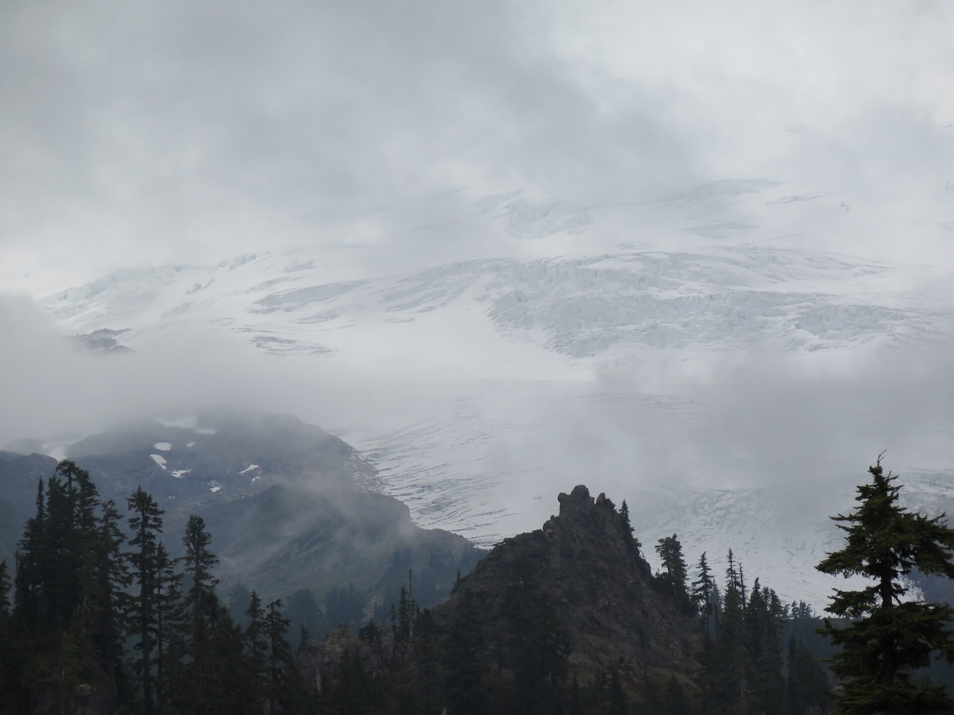
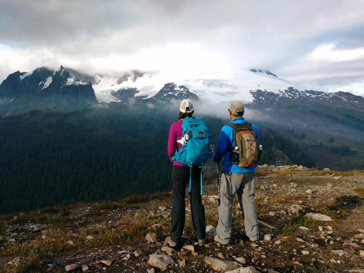
After Rocky Creek, the trail enters beautiful old growth forest and at 2 miles you’ll reach another junction with the Scott Paul trail. Head left through Morovitz Meadow and if the weather is clear, Koma Kulshan (aka Mount Baker) will suddenly appear, towering over meadows of wildflowers. The views are incredible!
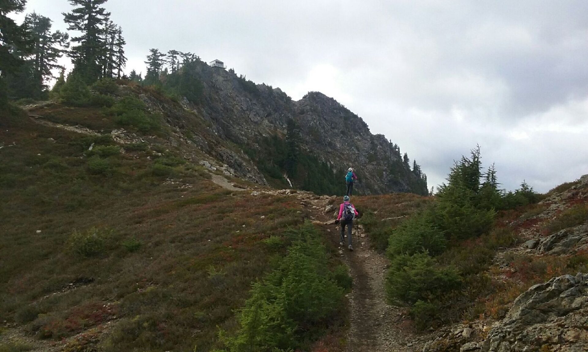
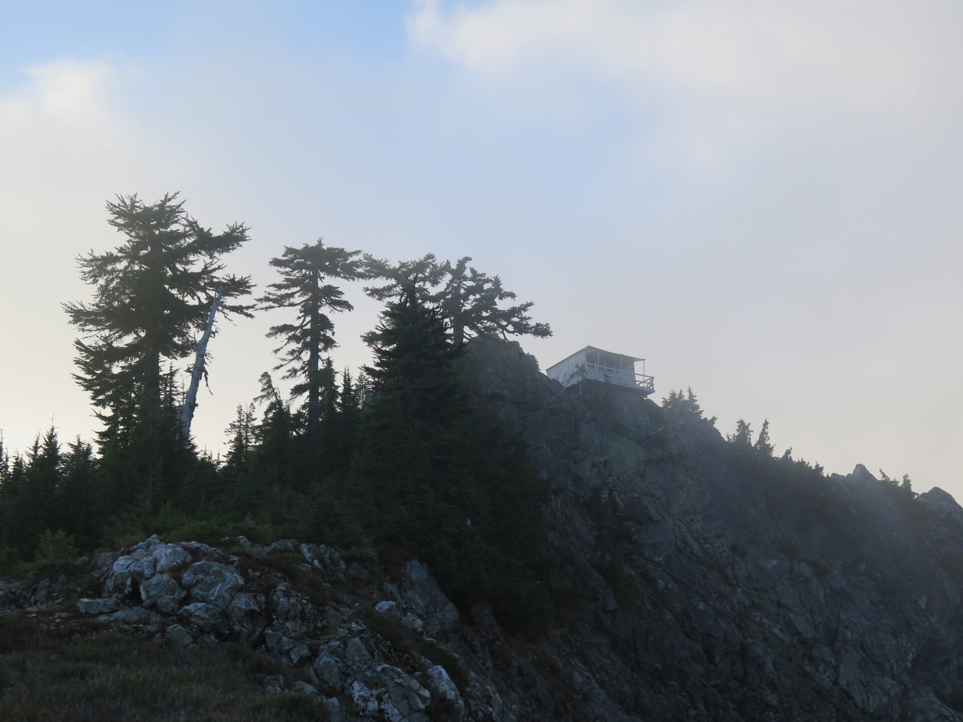
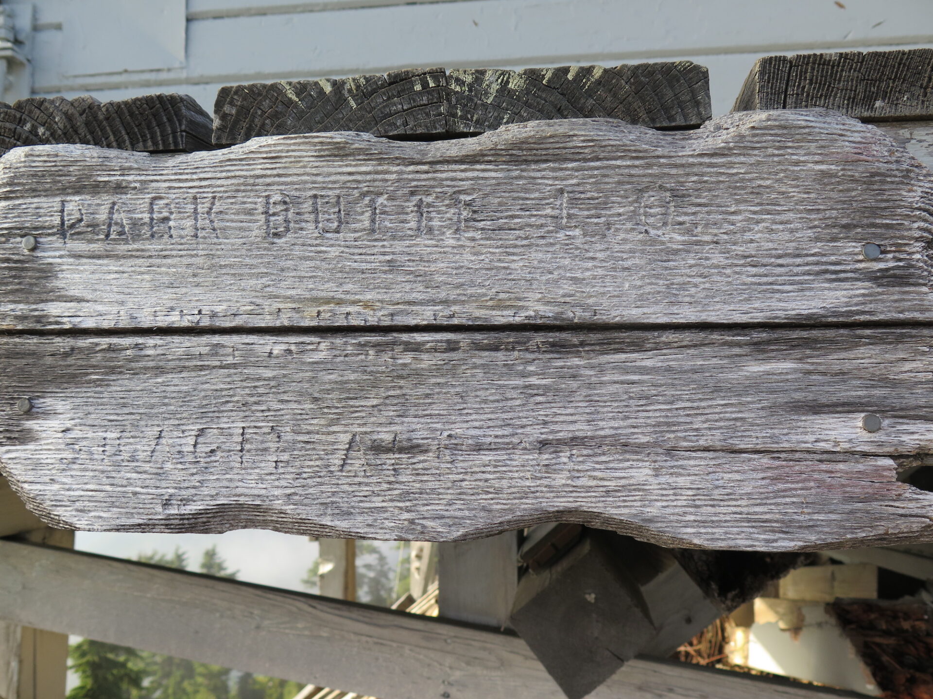
Barely a half mile later is another junction with the Railroad Grade Trail that leads to the Easton Glacier, a frequently used climbing route. Consider a little detour for some extra views! For Park Butte, stay to the left, descend to Bell Pass Junction and then follow the trail past picturesque tarns. You should be able to see the lookout ahead of you perched high on the ridge.
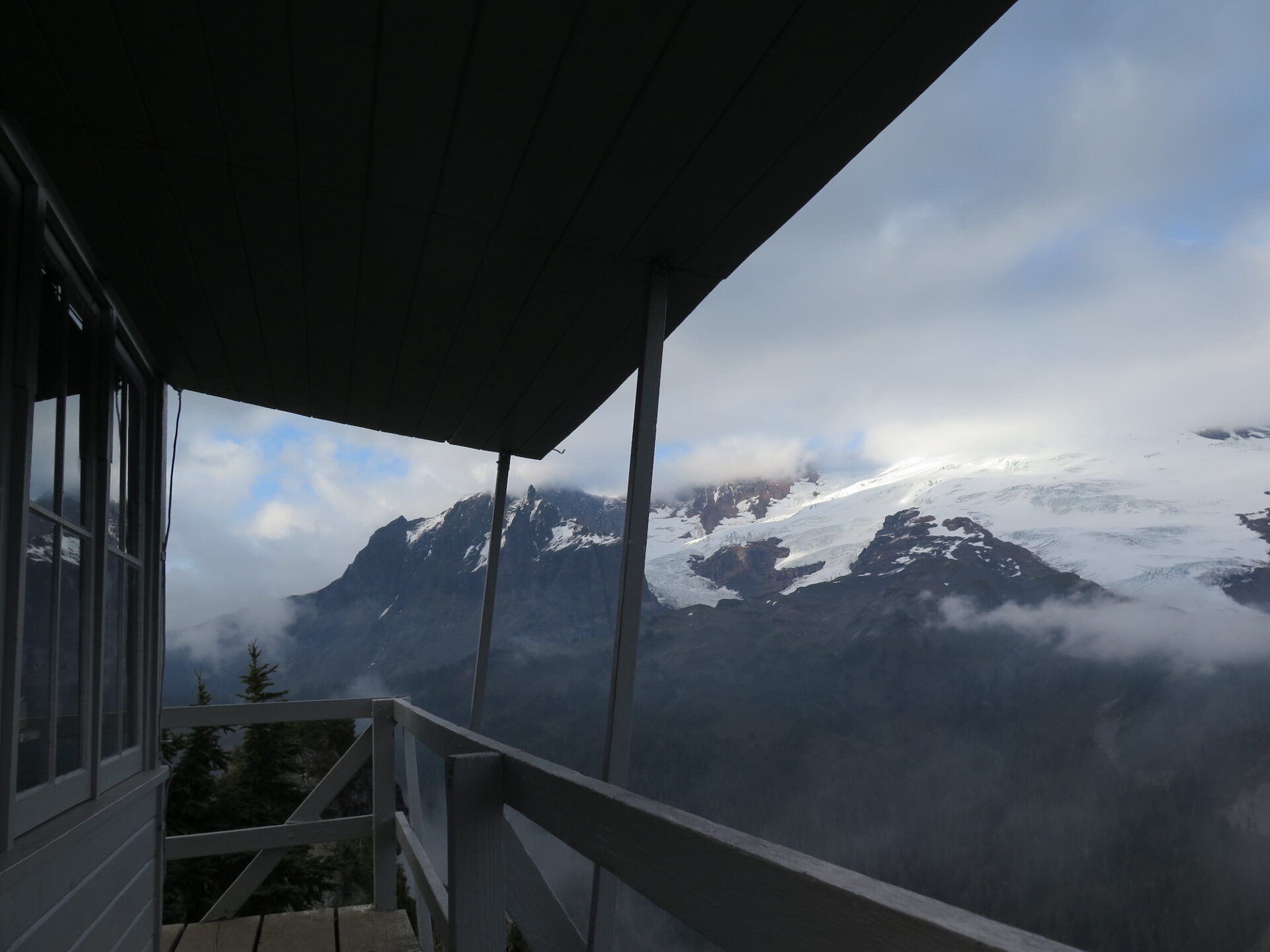
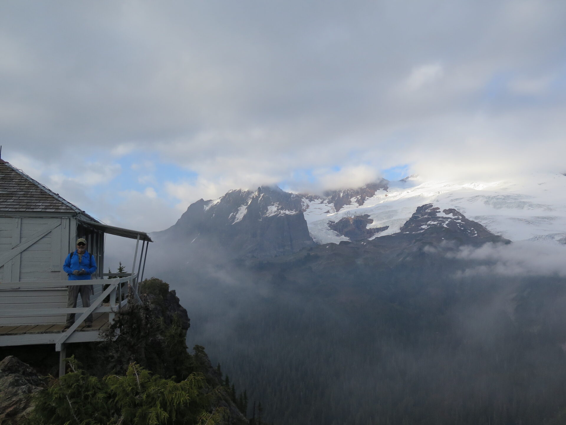
The trail winds around and approaches the lookout from the backside, culminating with a final small scramble up to its rocky perch. From there, enjoy the incredible in-your-face views of Koma Kulshan, Pocket Lake far below, and Shuksan, Glacier, and Sloan in the distance. It’s easy to spend a few hours here!
I made my trip to Park Butte in September 2017 with my dad and stepmom, who were in town visiting and eager to join me on some fire lookout outings. The forecast for the day was for late clearing clouds, so we purposefully got a late start, hoping both crowds and clouds would clear. By the time we reached the lookout, the clouds parted just for us and we enjoyed phenomenal views with only two other people. Just as we started to head down, the clouds rolled back in. It was like Kulshan put on a show just for us! Truly incredible and so glad I got to experience this one with my dad and stepmom Diana!
Without steep elevation gain, the hike goes quickly and overall it took just under 5 hours to make the round trip, an hour of that spent on top with at least another hour spent berry picking and marveling at the views. Give yourself ample time to enjoy this one.
Directions.
Drive Highway 20 14.5 miles east from Sedro-Woolley to the Baker Lake Road. Drive 12.3 miles, then make a left on Forest Road 12, marked by a sign at the bridge just before the turn. Follow for another 3.7 miles to a junction, then turn right onto Forest Road 13. Continue another 5.3 miles to the trailhead parking area, which accommodates around 40 cars and has vault toilets. Party size is limited to 12.