Southern Cascades | Mount Adams Area
Private
Location: 46.013208, -121.412039
Summit Elevation: 3,621′
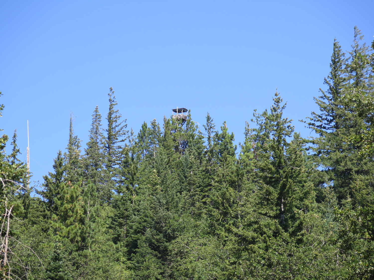
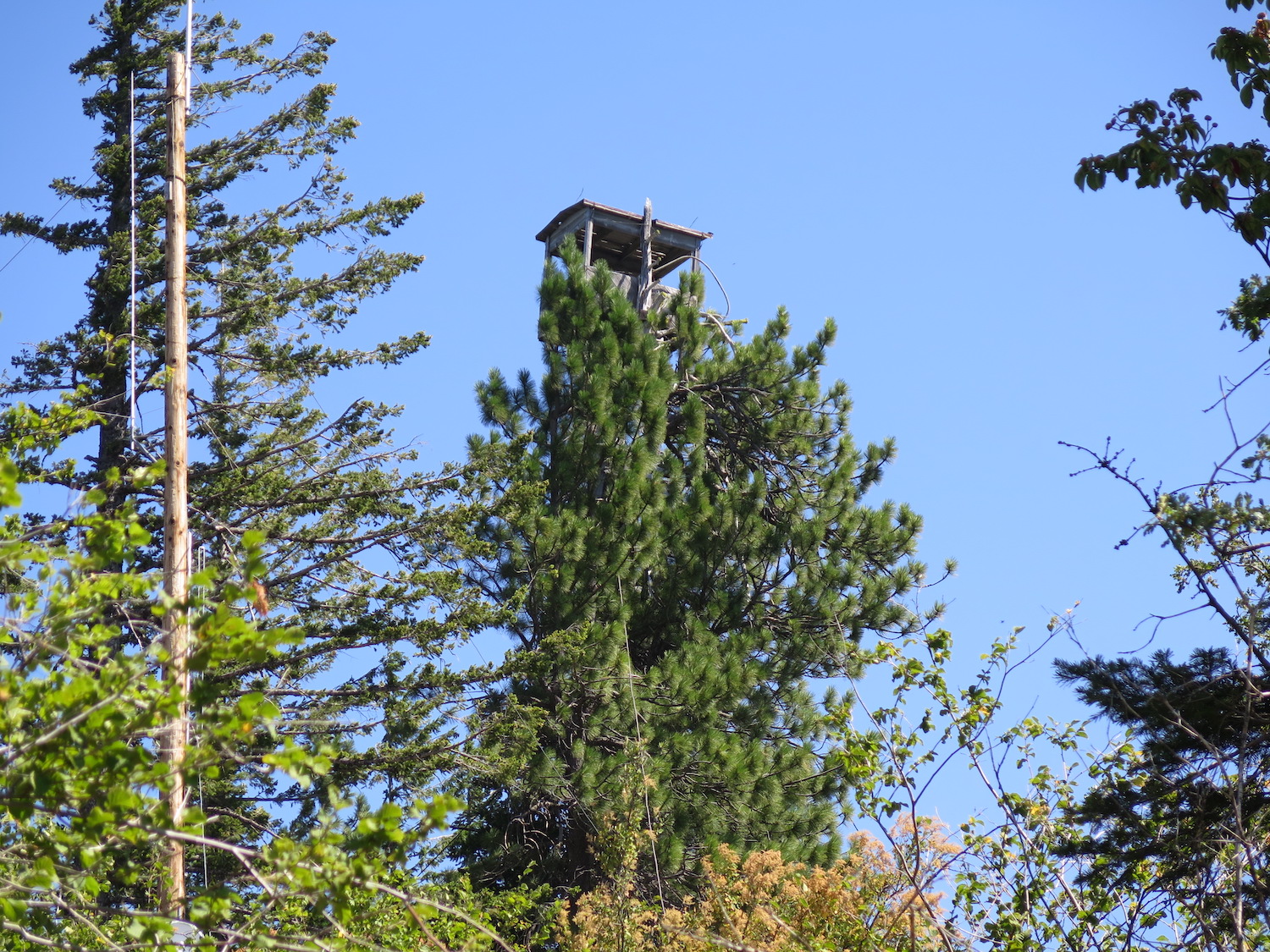
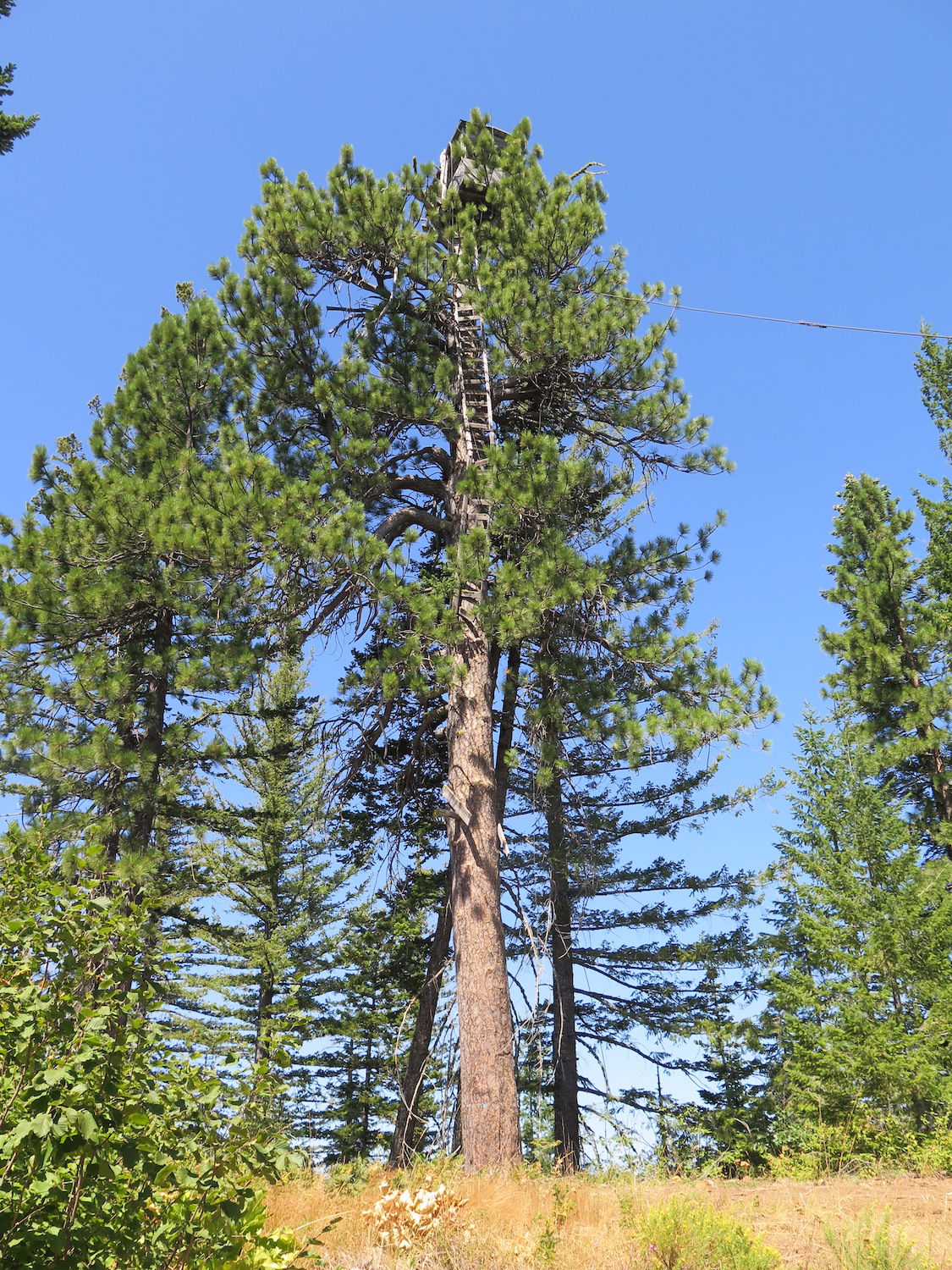
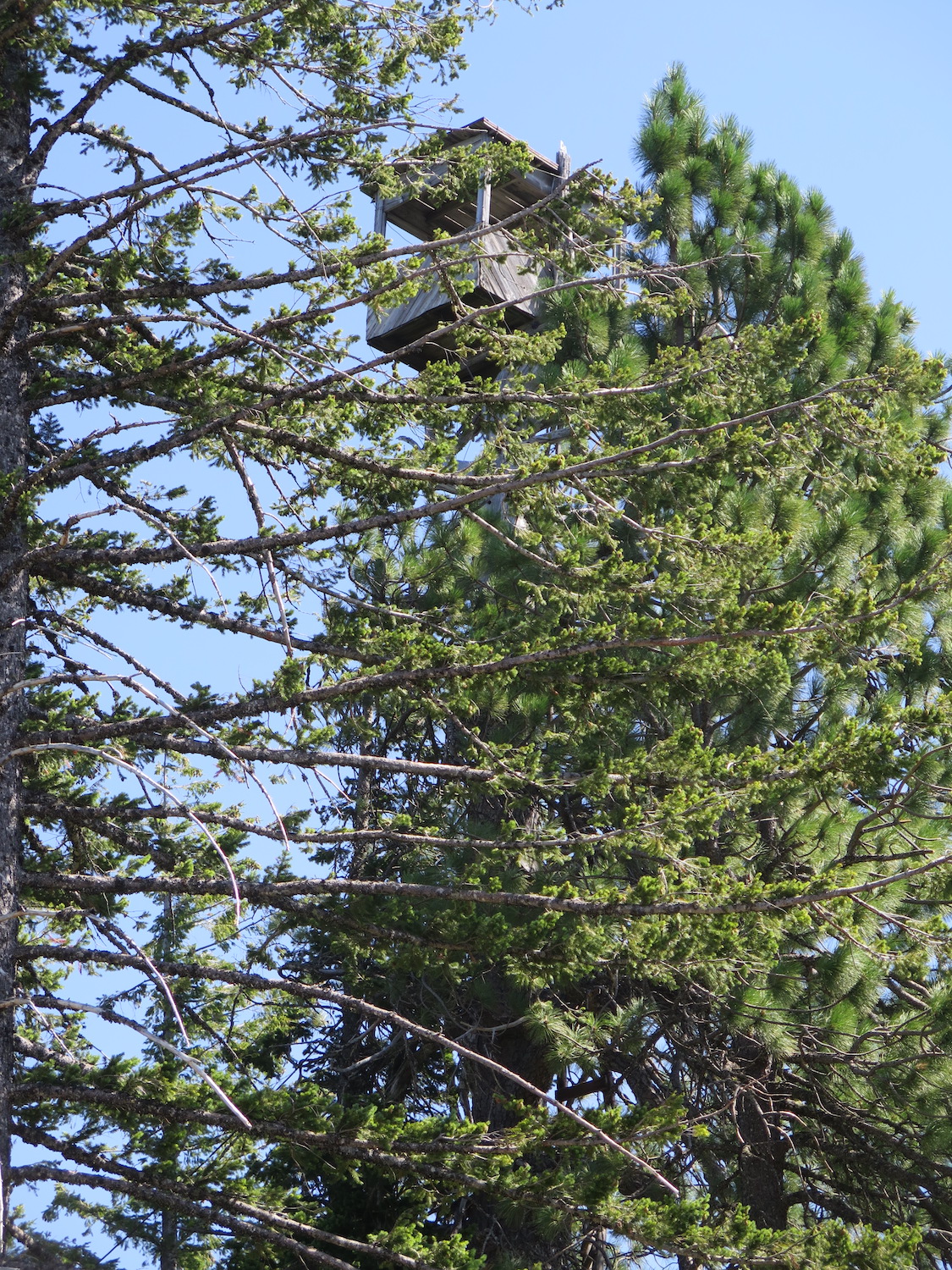
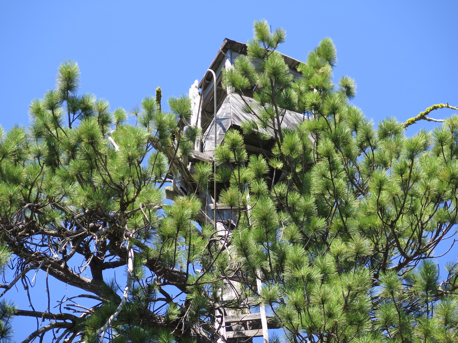
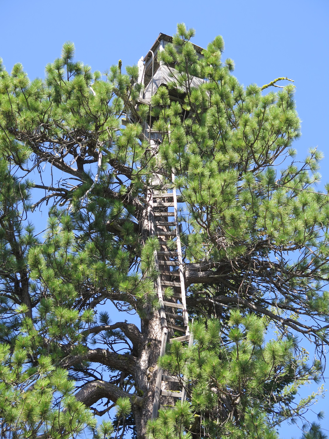
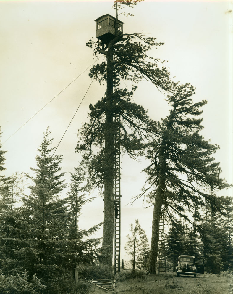
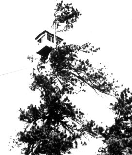
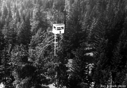
Lookout Type: 86′ tree cab
Site Established: 1940s
Current Structure Built: 1940s
Date Visited: 8/18/18
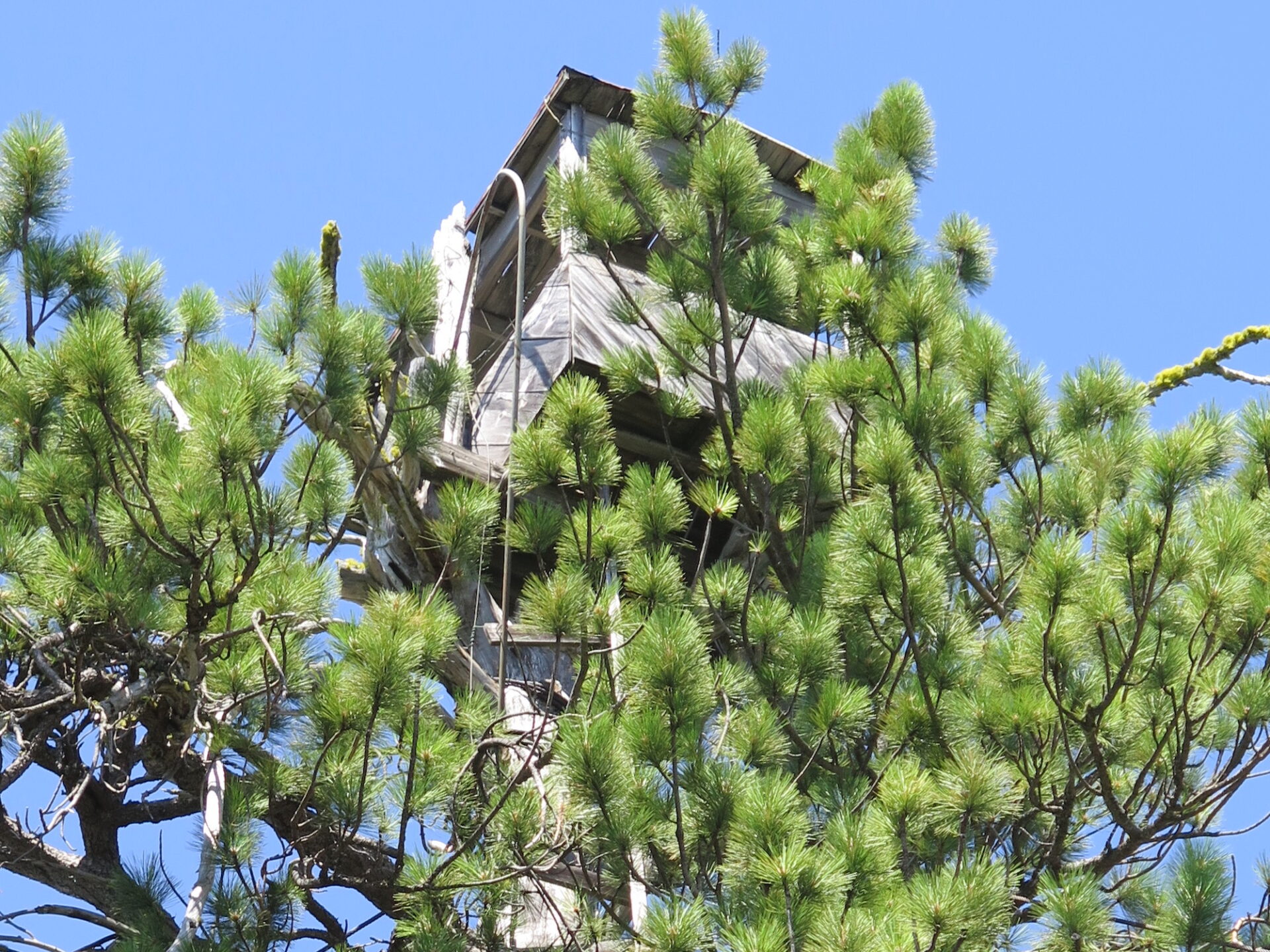
The tiny crows nest cab at Meadow Butte with its nearly 90′ ladder is one of the more unique Washington State fire lookouts and was staffed by many female lookouts in the 1940s.
Photos from 2018.
History.
This tiny crows nest cab was constructed in the early 1940s primary to watch over railroad logging operations. Built atop an 86′ pine tree, the site utilized a tent cabin for living quarters. The Division of Forestry took ownership of the lookout in 1944, outfitting it with a fire finder and radio. The lookout was abandoned in 1958 but the structure still remains.
News clippings found by Ron Kemnow indicate Meadow Butte had several female lookouts including Miss Delores Coate, Nancy Pierson, Barbara Schmid, Juanita Ward, Dorothy Lewis, and Kathleen Ladiges. I particularly enjoyed this one:
November 18, 1948: “A feminine member of the clan, comely Nancy Pearson, drew nation-wide attention four years ago when she manned the Meadow Butte lookout in the top of a Ponderosa Pine tree near Glenwood in the course of her duties she navigated an 80-foot vertical ladder, up and down, five times a day, seven days a week.” (The Goldendale Sentinel)”
The route.
Distance (RT): 6.8 miles
Elevation Gain: 980′
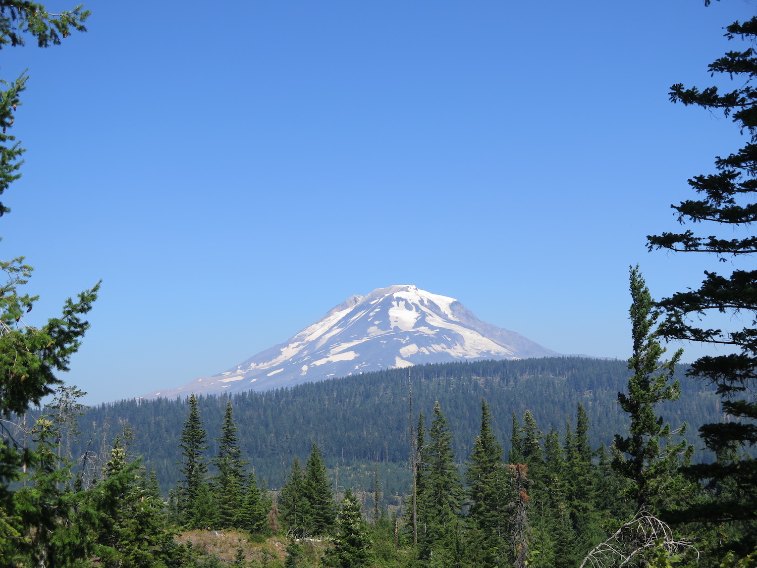
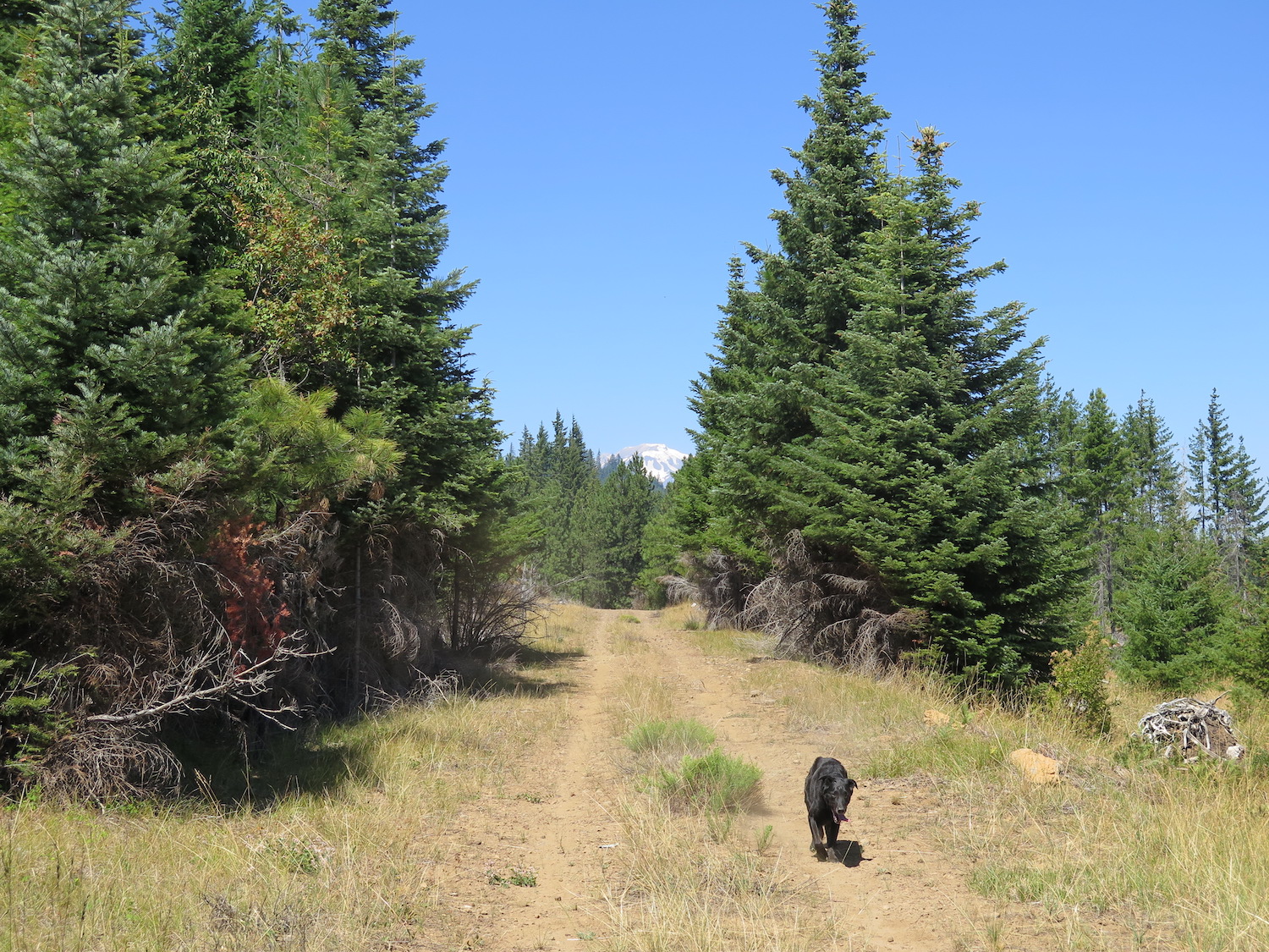
From the berm, the route is a bit overgrown, but once through the overgrowth, the road opens up into a logging road with spectacular views of Mount Adams and the surrounding country. Follow the main road north for about 1.7 miles, then head left at a Y. The road climbs up on the south side of Meadow Butte, eventually disappearing a bit on its west side. At this point it’s easy to hike up to the summit on the path of least resistance.
Directions.
From Trout Lake, take Sunnyside Road east toward Glenwood and in about 8.5 miles turn left onto S-1400. Follow S-1400 for about a mile to a 5-way junction. Continue north across the junction on S-4210. Stay north through any road junctions and follow the road a short distance to a berm with a few parking spots. The lookout is a three mile hike up an old logging road.