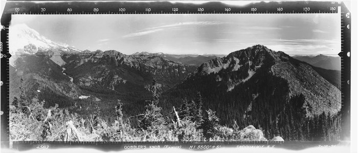
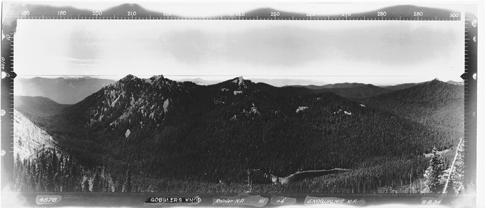
Southern Cascades | Mount Rainier Area
Mount Rainier National Park | Mount Rainier Wilderness
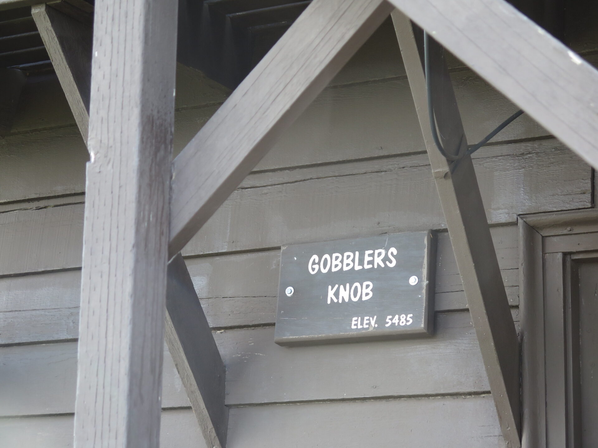
Location: 46.7942222,-121.9166331
Summit Elevation: 5,485′
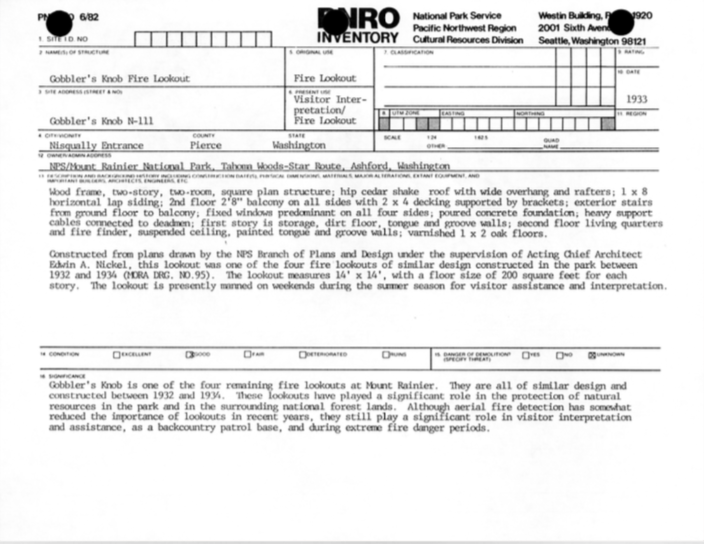
Lookout Type: 14’x14′ National Park Service style cab
Site Established: 1933
Current Structure Built: 1933
Date Visited: 8/30/17
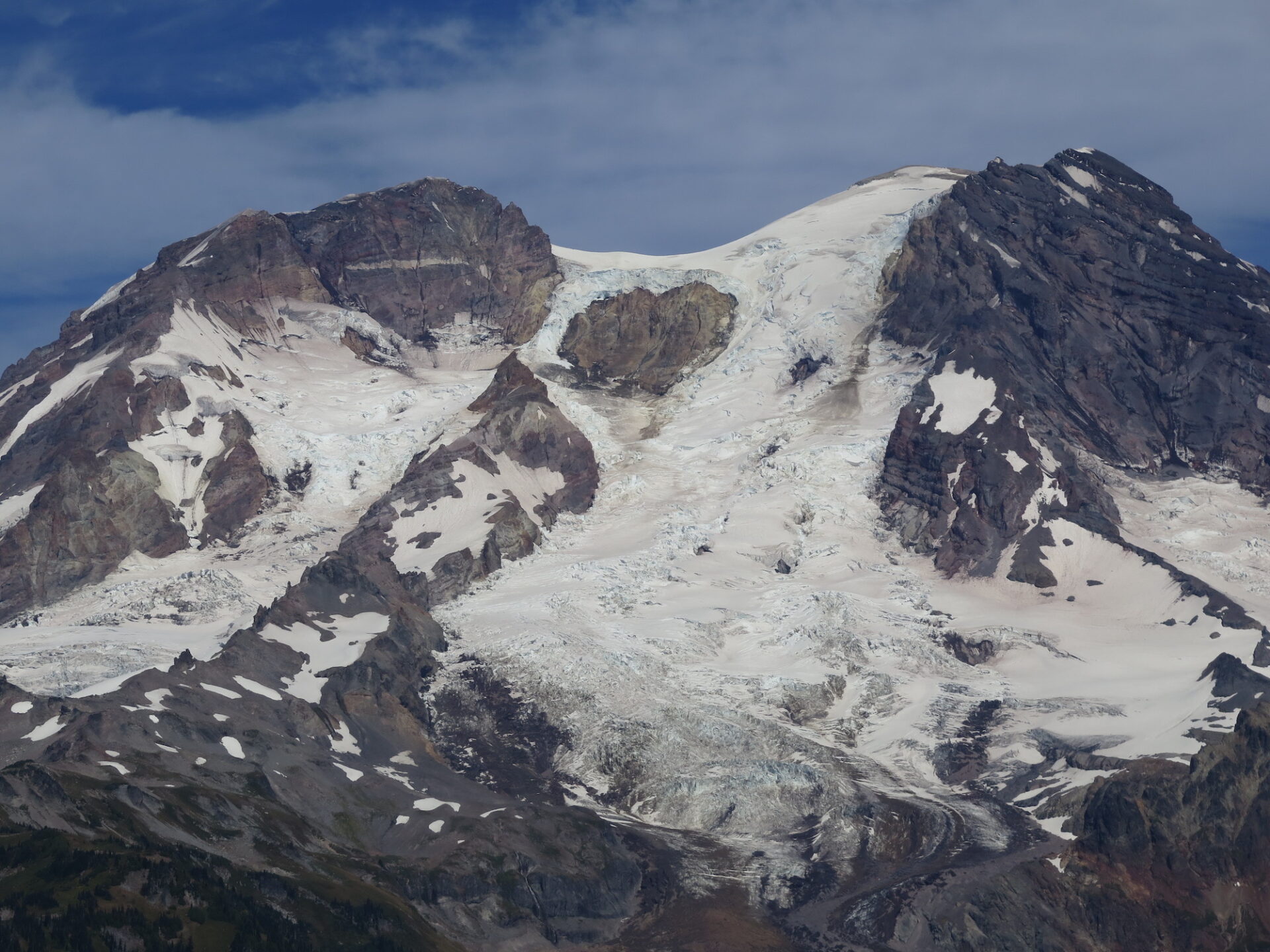
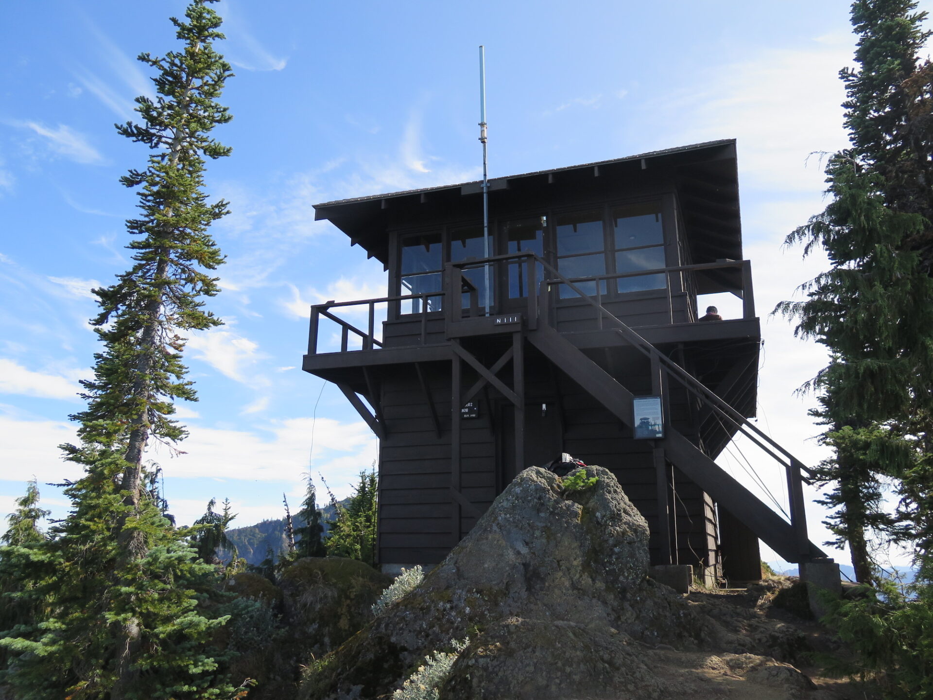
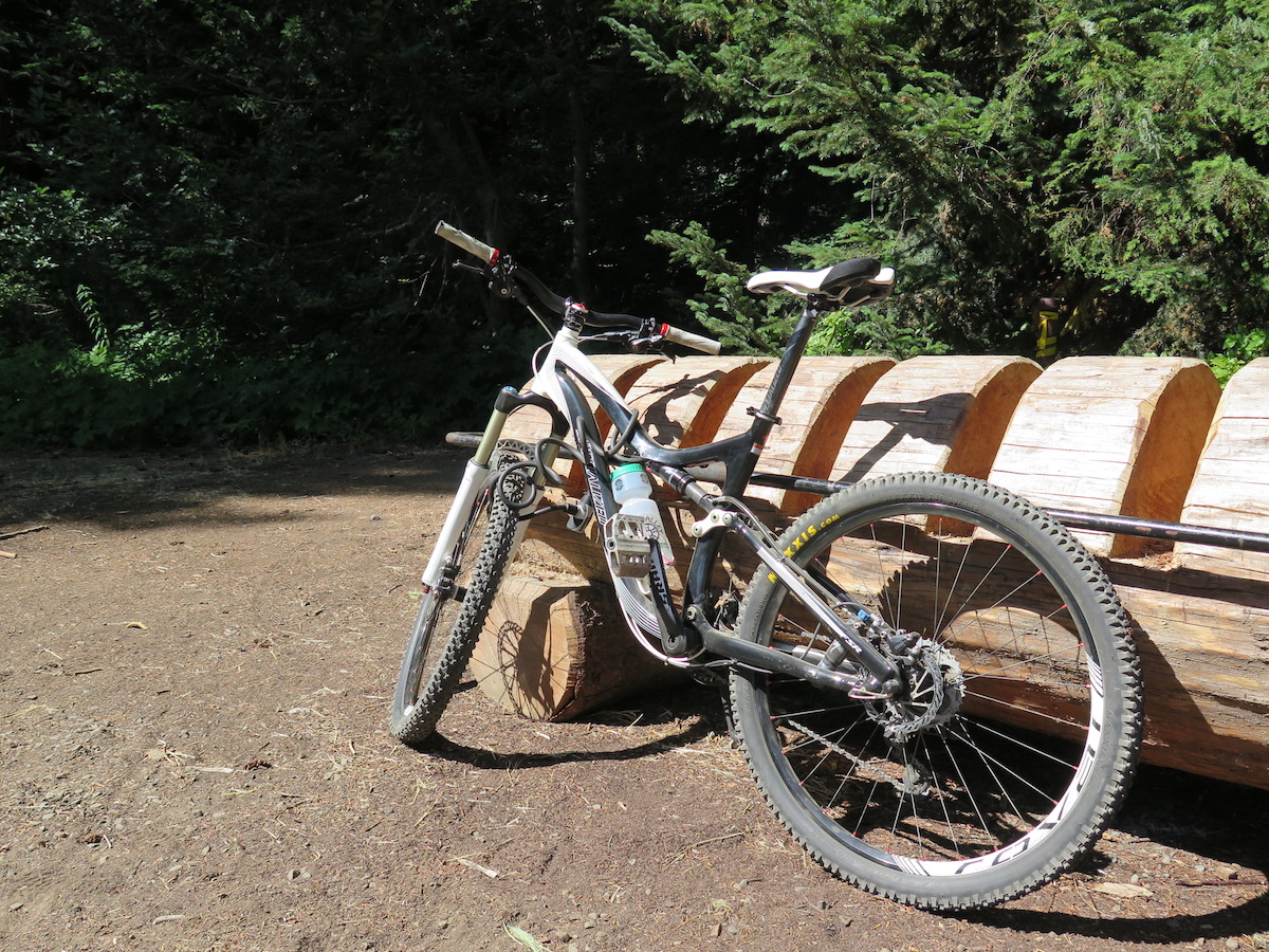
Gobblers Knob is one of four remaining fire lookouts inside Mount Rainier National Park. The lookout is the lowest elevation but also closest to the mountain. This is also one of the few lookouts that affords a bicycling opportunity as you can ride part way on the still closed Westside Road.
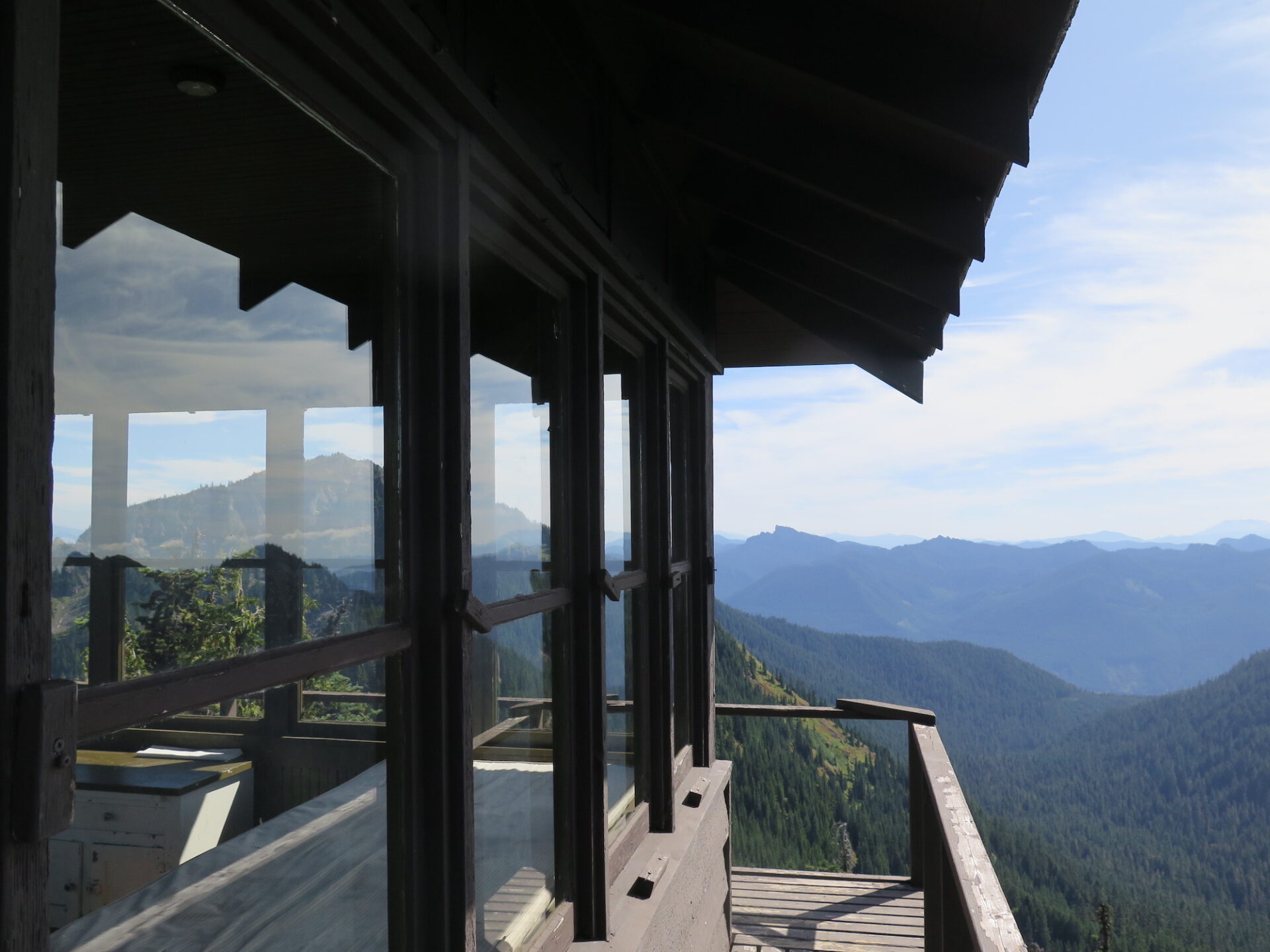
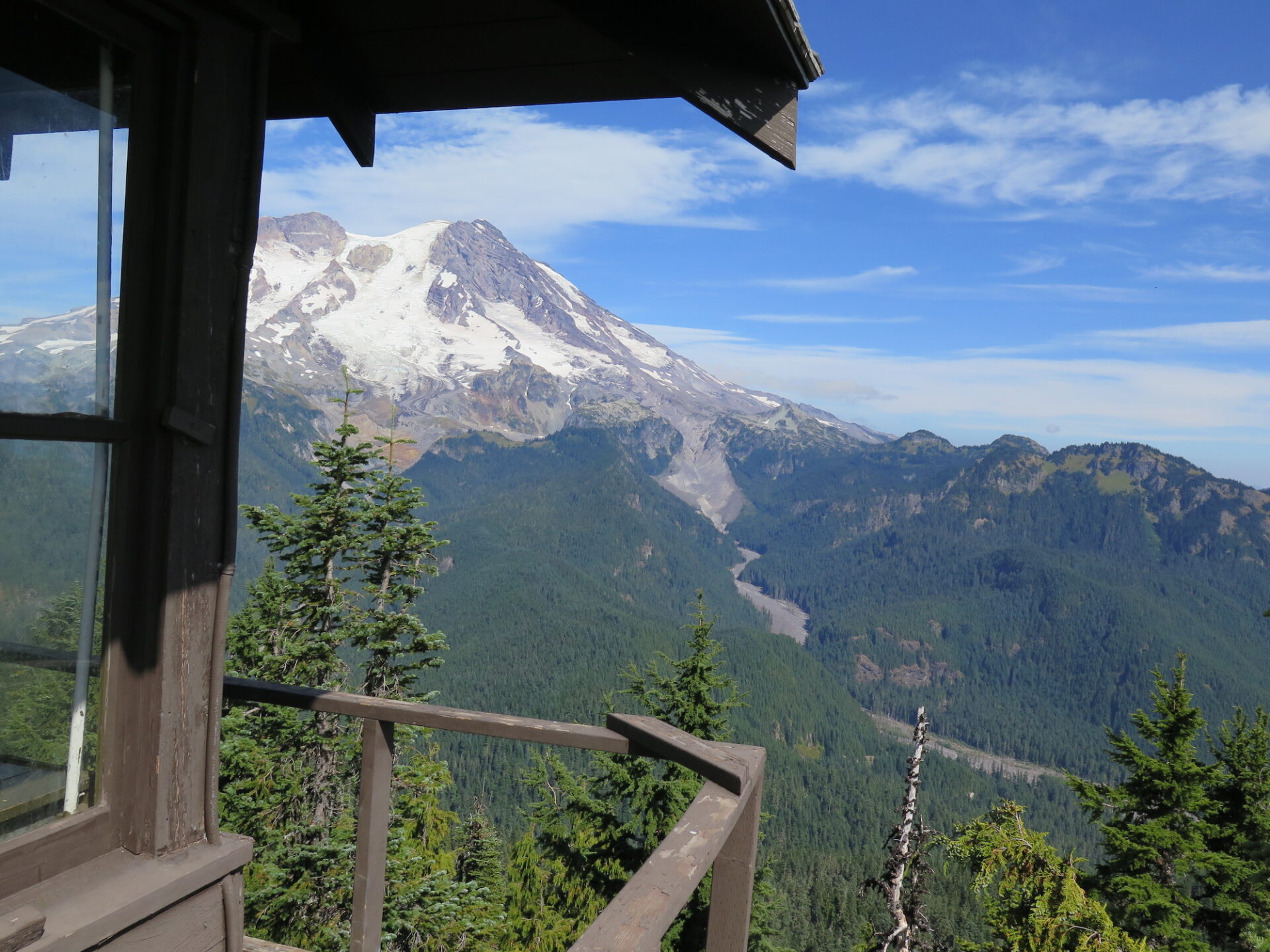
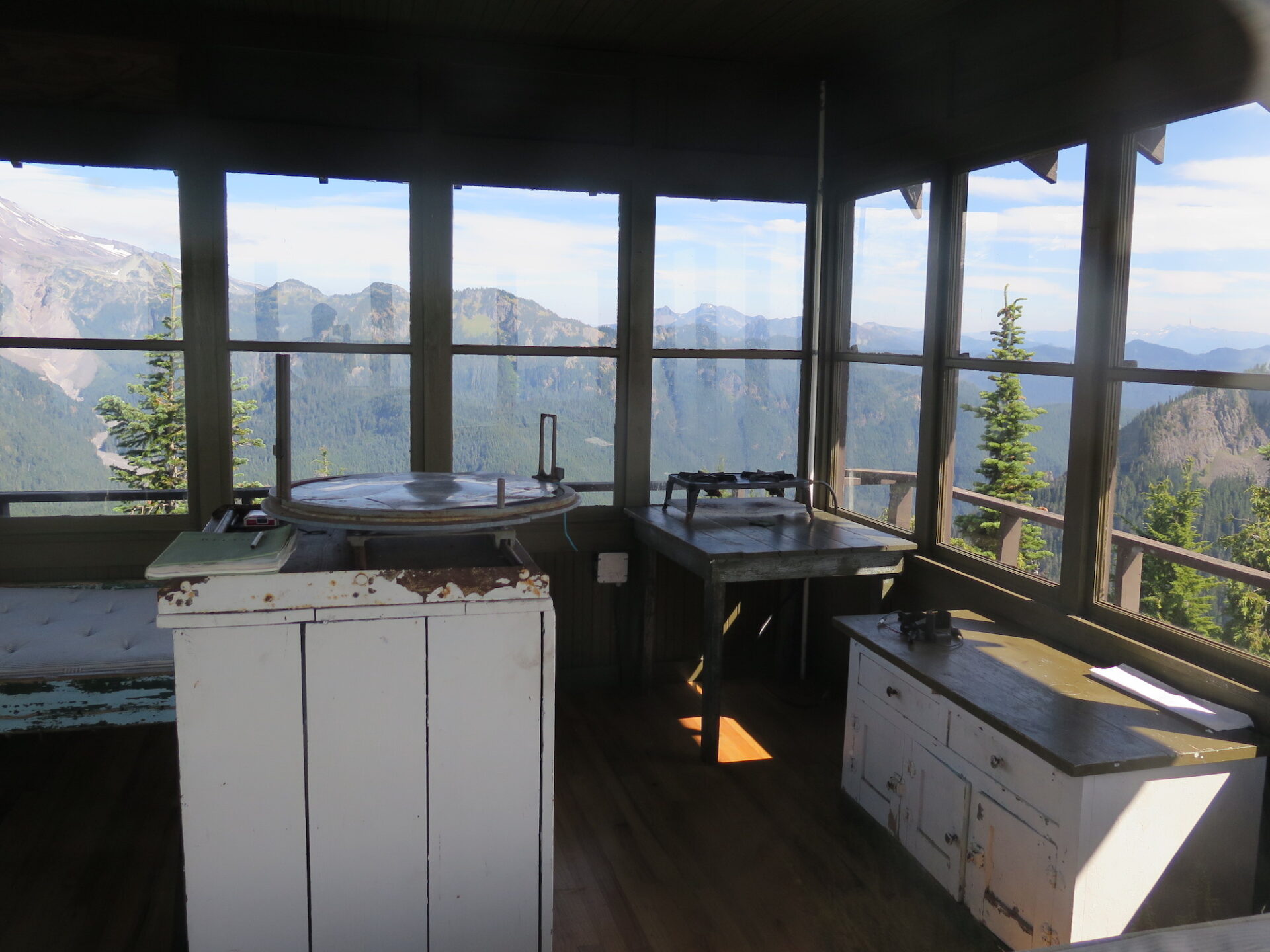
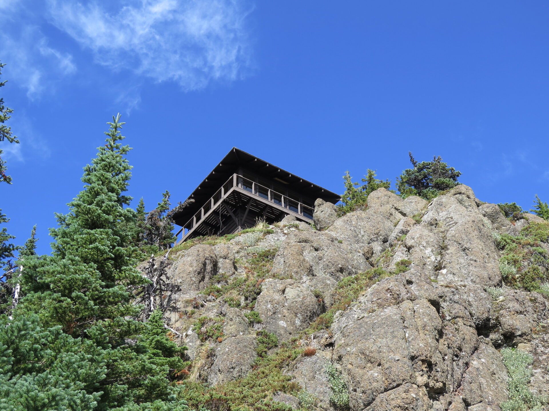
Photos from 2017 visit.
History.
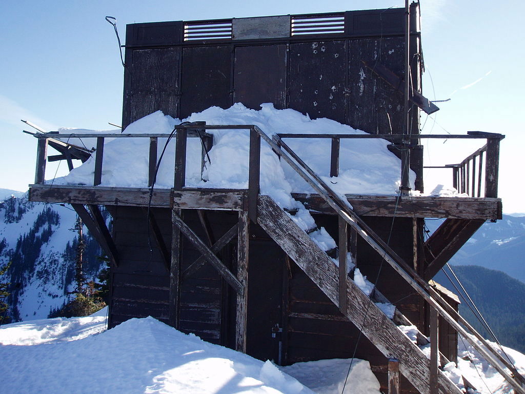
Gobblers Knob was built in 1933 according to the National Park’s standard lookout design. Storms damaged the roof of the lookout in 2006, but it has since been repaired. It’s often staffed on summer weekends by park service rangers or volunteers and was placed on the National Register of Historic Places in March, 1991.
The route.
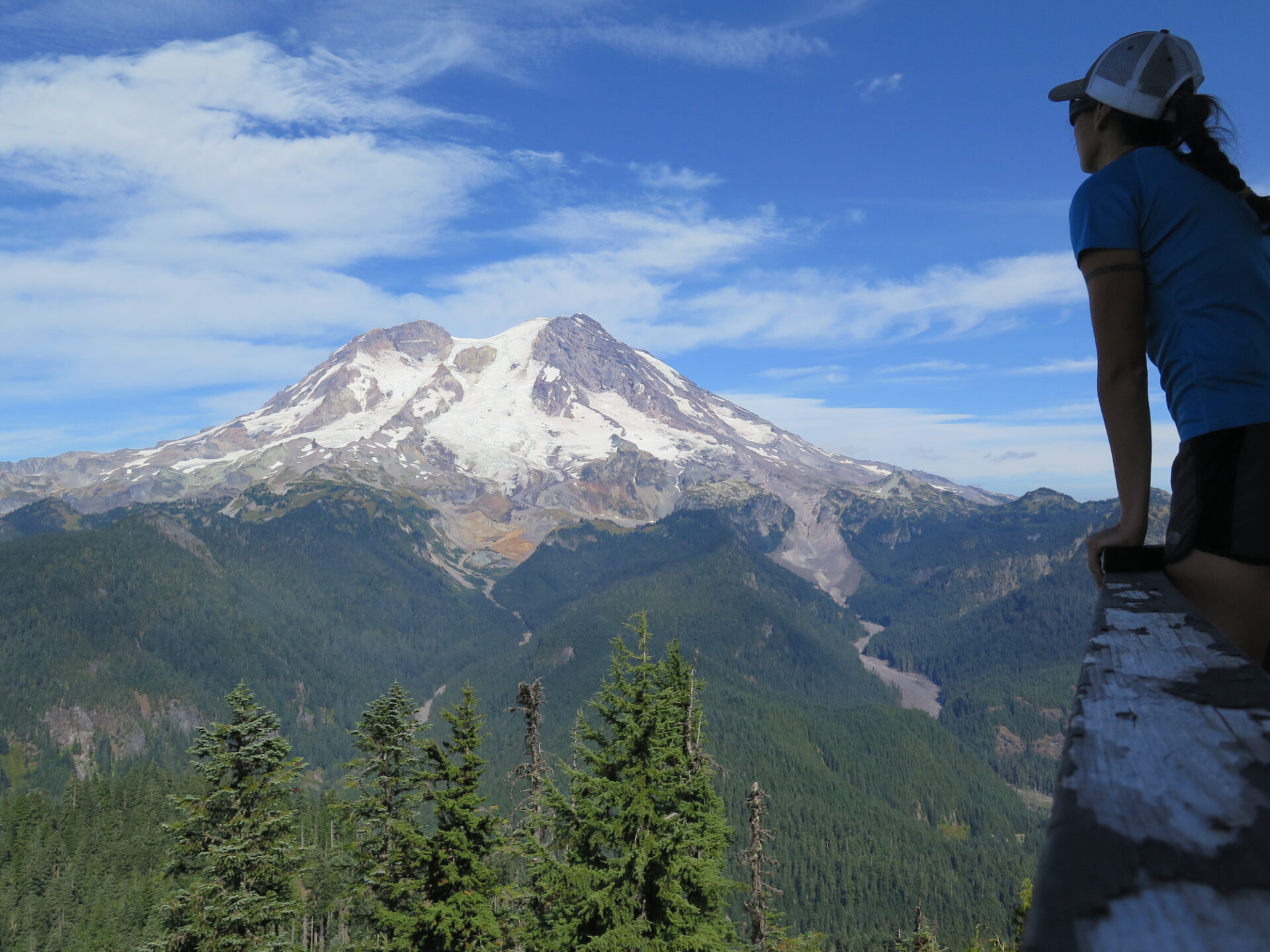
Gobblers Knob is reachable from both the Westside Road or the Glacier View Trailhead. The Westside Road is still closed 3.5 miles from the Lake George Trailhead due to road damage, but is usually open to both foot and bicycle traffic. It’s often prone to washouts and glacial outbursts, so I’d highly recommend checking road conditions at Mount Rainier before visiting. Whichever route you choose to visit Gobblers, I guarantee you’ll stay a while to enjoy the dramatic views of the Mountain. They’re incredible!
Westside Road.
Distance (RT): 12.5 miles
Elevation Gain: 2,660′
You can walk the Westside Road but bringing a bike for the first 3.8 miles will certainly make the trip a little quicker. I’ve ridden the road on both a mountain bike and cyclocross bike with skinnier tires and both were fine. The gravel road is generally in good condition and if you’re a biker, the climb is very similar to the old Tiger Mountain road climb up to Preston: a good workout but not unrideably steep. When I visited Gobblers Knob in 2017 there was active construction on the road but the road crew was friendly and waved me through. Be sure to yield to any construction vehicles and make sure they see you coming.
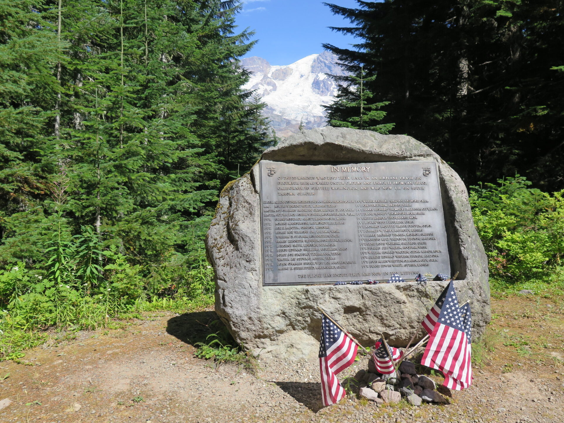
3.8 miles up the road you’ll come to the Lake George trailhead on your left, which is the way to Gobblers. A log by the trail offers a place to park and lock up your bike—brilliant! Before you stop at the trailhead though, consider going a quarter mile further to Round Pass. There you’ll find a peek-a-boo view of the Mountain and a sobering memorial dedicated to 32 men who lost their life in a 1946 Marine aircraft crash on the South Tahoma Glacier of Mount Rainier.
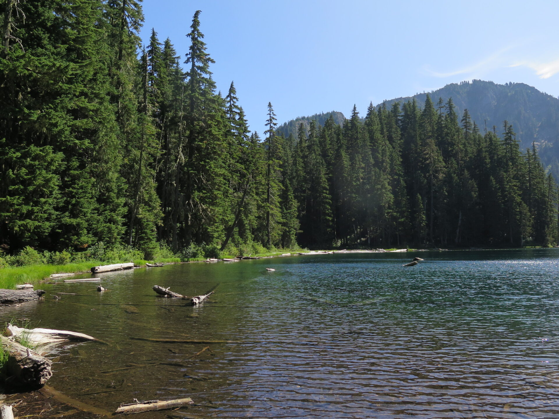
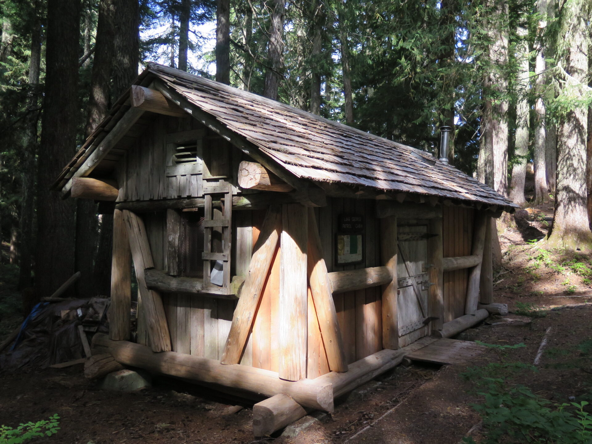
Once on the trail you’ll enjoy a quiet 2.5 mile hike through old-growth forest until you reach Lake George and one of Rainier’s 10 backcountry patrol cabins. Built in 1934, the cabin is listed on the National Register of Historic Places and is a great place to stop and take a break. There is also camping available at the lake by permit if you want to turn this adventure into an overnight. From the lake, the Gobblers Knob lookout is an 800′ climb in just under a mile.
Glacier View.
Distance (RT): 7.2 miles
Elevation Gain: 1,800′
This trail starts outside Park boundaries. About 100 yards after the trailhead, take a right at a T-junction towards Goat Lake and Gobblers Knob. The trail enters the Glacier View Wilderness with glimpses of Rainier’s west face. About a half mile in, the trail descends to Beljica Meadows and then around the north edge of the meadows. 2.5 miles from the trailhead, Goat Lake makes a great overnight destination if you secure camping permits.
From Goat Lake, the trail climbs up the woods about 1,100′ over 1.5 miles, entering Mount Rainier National Park, and finally topping out at Gobblers Knob on a spur trail near the top.
Directions.
Westside Road: From Tacoma, drive east on State Road 7 to Elbe, then turn left onto State Route 706 for 14 miles to the Nisqually Entrance of Mount Rainier National Park. Just under a mile later, turn left onto Westside Road and drive 3.2 miles further to where the road is gated and closed due to storm damage in 1990. Gobblers Knob is a 3.8 mile road walk, then another 2.5 miles by trail.
Glacier View Trailhead: From Tacoma, drive east on State Road 7 to Elbe, then turn left onto State Route 706 towards Ashford. 3.8 miles past Ashford, turn left onto Forest Road 59 (Copper Creek Road), then continue 9 miles to the trailhead on the right. Forest Road 59 can be rough, so consider a high clearance 4×4.