One of these days I’m convinced I’ll go on a hike with easy trails, big obvious signs, and warming huts that offer coffee, pastries, and maybe even massage. Ok, maybe there’s not as much fun in that but I sure wouldn’t complain about the occasional warming hut with coffee!
My friend Scott has lived in North Bend for many years but has never been up to Teneriffe Falls, so he suggested we venture up there last Saturday and then tag the summit of Mount Teneriffe. I checked a few trip reports on the WTA website and the hike to the falls seemed pretty straight-forward: 2 miles on a mostly flat easy approach before you climb about 800 feet in the last mile to the falls. Then it was just a matter of heading the rest of the way up to the summit. No prob!
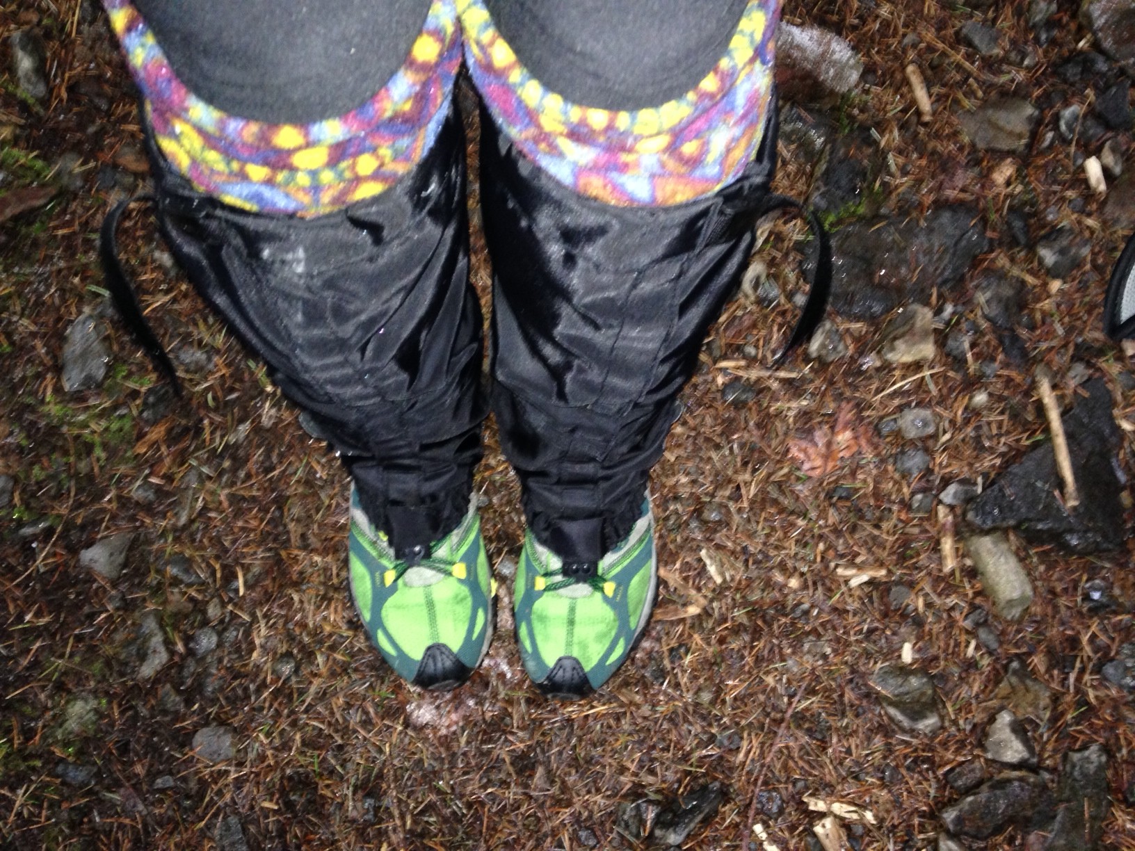
I finally retired my nearly 13-yr old Vasque hiking shoes so I thought this was a perfect easier hike to try out the comfy new pair of Merrell Grasshoppers I just scored at REI. The hike follows the Kamikazee trail, which should have been my first indication this trail probably doesn’t have warming huts and isn’t a flat walk in the park. With our 8:45ish start I figured we’d be able to see the falls, summit, and hit the North Bend Bar & Grill midday for a nice post-hike refueling. Oh how hindsight is 20/20.
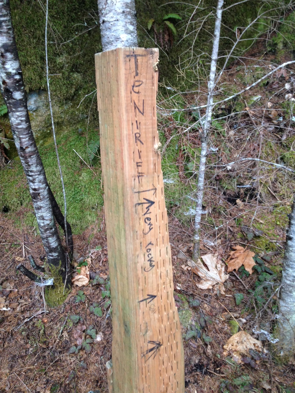
We set off from the trailhead at the end of Mt Si Road with our two dogs and enjoyed the easy cushy fire road to the Teneriffe Falls turnoff. Already I was loving the Grasshoppers! The trail junction sign was just a wood plank stuffed into the ground with the words “very rocky” scrawled on it.
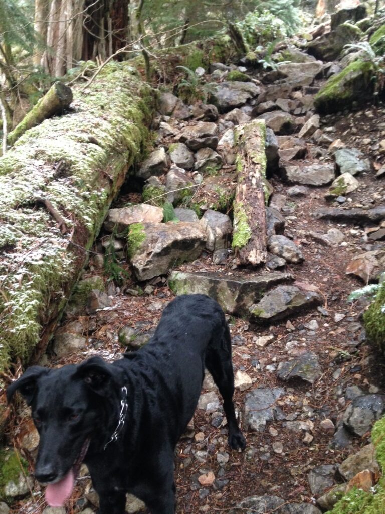
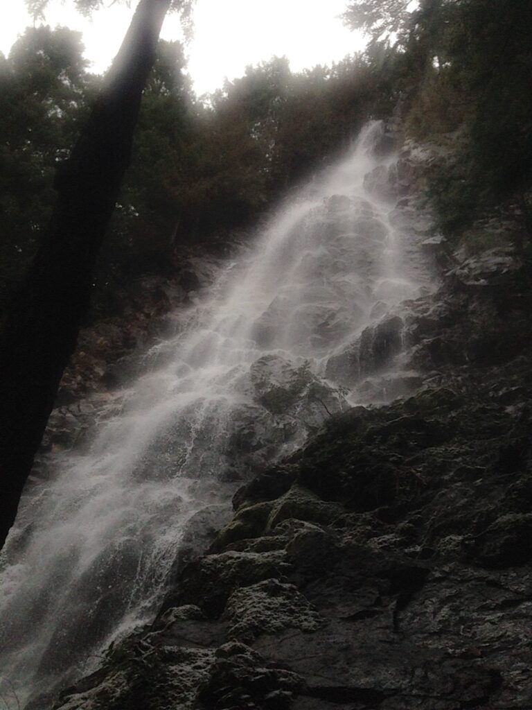
The trail was indeed rocky but fairly easy going if you watched your step. After what seemed like 100 small switchbacks we ended up at the base of the unexpectedly large and beautiful Teneriffe Falls. Neither of us could believe we hadn’t ventured up here before! A week or so ago it was frozen solid which I’m sure was quite the sight to see.
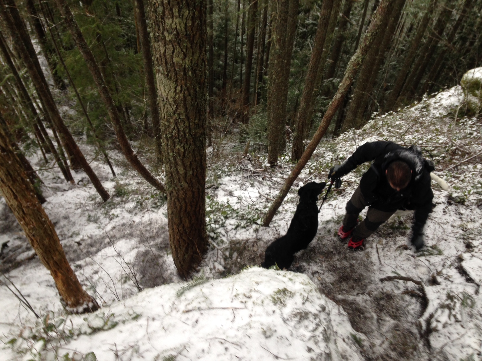
After a quick stop we looked around and weren’t sure where the trail went. It dead-ended into a rock face beside the falls. Scott started to scramble up a bit but there was clearly no trail. A few other folks behind us said if we backtracked a bit, we’d see a boot track heading up the mountain between 2 large fallen trees. I’m not sure we found that exact boot track but after a little hunting around we did find shoe prints so straight up we went with our dogs, clambering over some steeps rocks and roots. I laugh now as we looked straight up and saw a lot of sky and thought to ourselves, “Hey, the summit isn’t far off!”
A few steps up the trail there was a dusting of slick snow so we slipped on the MicroSpikes and continued skywards. The summit indeed wasn’t far off but what we didn’t know was that this trail took direct to a new whole new level. This little boot track climbed 2300′ in a mile, straight up the southwest flank of Teneriffe. Scott had good reason to say multiple times “Wow, I can’t believe the grade of this trail!” Yeah, 2300′ over a mile turns out to be an average 43% grade. Wowza. Bring your A-game for this one. With parts of the trail bordering on being a scramble it’s definitely not for the inexperienced hiker OR the inexperienced dog! We watched the dogs closely on a few exposed sections but they handled it like the pros they are – probably better than us!
Every time we ascended one steep section we looked up only to see another steep pitch ahead, and another, and another. This trail was unrelenting and we started to realize that coming down might be a lot slicker and trickier than going up. Scott mentioned that there was a fire road that leads to Teneriffe and though it would add miles to the return, we could hopefully locate it once at the summit and save ourselves the steep descent.
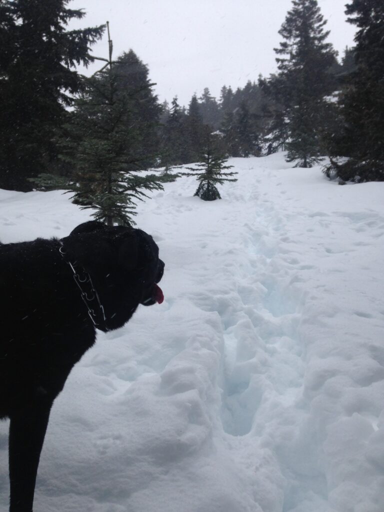
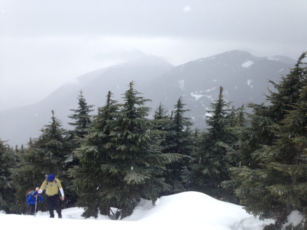
We pushed out into a clearing with fantastic views over to Si just as some snow started coming down. The snow in this section was a crusty hardpack with 12-16″ deep boot tracks and the occasional hole to Hades. Stepping through the snow sometimes worked, but every 3rd step we’d post hole thigh-deep. Stepping into the deep boot tracks was a bit awkward but definitely the easiest solution. It was tricky and slow.
We finally reached the summit with a party of about 6-8 other people and stopped for only a brief time to take in the views and rest our legs. The wind was strong and with some light snow falling I knew we’d start to get cold quickly. The summit was a small exposed ridge with a pretty spectacular drop on the other side. I was surprised some people in the other party were daring enough to sit right up on the edge. Maybe in the summer – but in the winter with snow up there? No way! Call me conservative but one wrong slip and it was likely the fastest ride down, though not one you’d be able to write a story about since you’d probably be dead.
I think it’s safe to say that Scott and I were both hoping to find a rather nice paved forest service road obviously cutting across the summit with a sign that said “Descend here and enjoy warming huts and coffee!” I know, I’m really stuck on this warming hut thing. But alas, there was no fire road to be found. We asked a few people in the other hiking party and no one seemed to know where exactly it was. I broke out my Green Trails iPhone app and could see where we needed to go, so Scott and I decided to head off down the snowy slope in search of fire road paradise. Hey, we had GPS. What could possibly go wrong!?
Not a surprise I’m sure but after spending probably an hour trying to make our way down a steep, very snowy slope we finally gave up. Without snowshoes we were making slow time, post holing everywhere, and had no idea what kind of terrain we would get into. Although the GPS located us very close to the Mt Teneriffe trail, we didn’t see tracks anywhere, maybe for a reason. With snow starting to fall we made the safe decision to backtrack and go down the way we came.
Potential disaster #1 averted.
If anyone is looking for a business venture by the way… I think 1-800-CHOPPER has $$ written all over it.
Just as we turned around I noticed Jake lying in the snow in a peculiar way amidst a few drops of blood. I’m not sure what’s scarier: him managing to lodge a stick lengthwise across the roof of his mouth or me recognizing that was likely what happened because he’s done this trick before!? So here we are, stuck on a crazy snowy slope, trying to pry Jake’s jaws open so we can get a stick out from his mouth. Does this happen to other people or is this just a typical hiking trip for me?
I’m glad to say we dislodged the stick and 2 seconds later Jake had completely forgotten about the incident and was bounding around in the snow.
Potential disaster #2 averted.
We safely backtracked and it turns out that although the descent was a bit rugged and slick it wasn’t nearly as bad as we had expected. We took it slow and easy and things were going along fairly well until later down the trail we accidentally kicked loose a fairly large rock. The problem with a 43% grade is that gravity isn’t in your favor. Jake was only a few feet ahead on the trail but a few feet ahead also meant a lot of feet below. I yelled at him to stop as I saw this massive rock bounding down the trail headed straight for him. Luckily he stopped and just as he turned his head to look up the trail at us the rock went whizzing within inches of his snout. We both let out a sigh of relief and then couldn’t help but laugh at our always entertaining adventures.
Ok, disaster #3 averted! We might make it out alive!

We were pretty happy when we finally stepped back onto the “normally steep” rocky trail close to the falls. Though it was now covered in a dusting of slippery snow we managed to pick our way through with only a few funny slips but mostly without incident. All in all I’d call it a great day! We managed to get both dogs up and down a brutal trail in one piece (and ourselves too!). We dislodged a stick from Jake’s mouth, he narrowly avoided a huge falling rock, we didn’t get lost in the snow, and after a few beers and good food my knees forgave me the next day. Oh yeah, and we even managed to rescue a hiker who was stranded at the trailhead when his hiking party drove off without him.
As is usually the case I said I’d never do this hike again but now I’m already planning to go back. My GPS had some issues today but I mostly was able to map the route. Funny enough it’s only about a 6-6.5 RT trip though it feels much longer. One thing is for sure: Teneriffe must eat Mailbox for breakfast. This trail is crazy. If you need a new challenge put this one on your list!
And by the way, considering what a crazy trail I threw at the Merrell Grasshoppers I’m happy to report they were not only amazing, but kept my feet dry and warm! I guess there’s no better way to test a new trail shoe than to throw them directly into something crazy like this. Merrell and Kahtoola got my unconditional love today for making awesome products!
Stats
Round Trip: 6.5 miles
Elevation Gain: ~3800′
High Point: 4788′
Hiking Time: 5:30 – 6:00. BRUTAL!
GPS Tracks
The first time we did this hike my GPS hiccuped, so this is a track from a later ascent when it was actually 60 degrees!