Earlier this month when I finished visiting all of Washington’s lookouts, everyone kept asking me “what’s next?” Lookouts will always be a love of mine, so there’s no question I’ll be returning to some of my favorites, helping with work parties, and continuing to visit former lookout sites. As far as what’s next?
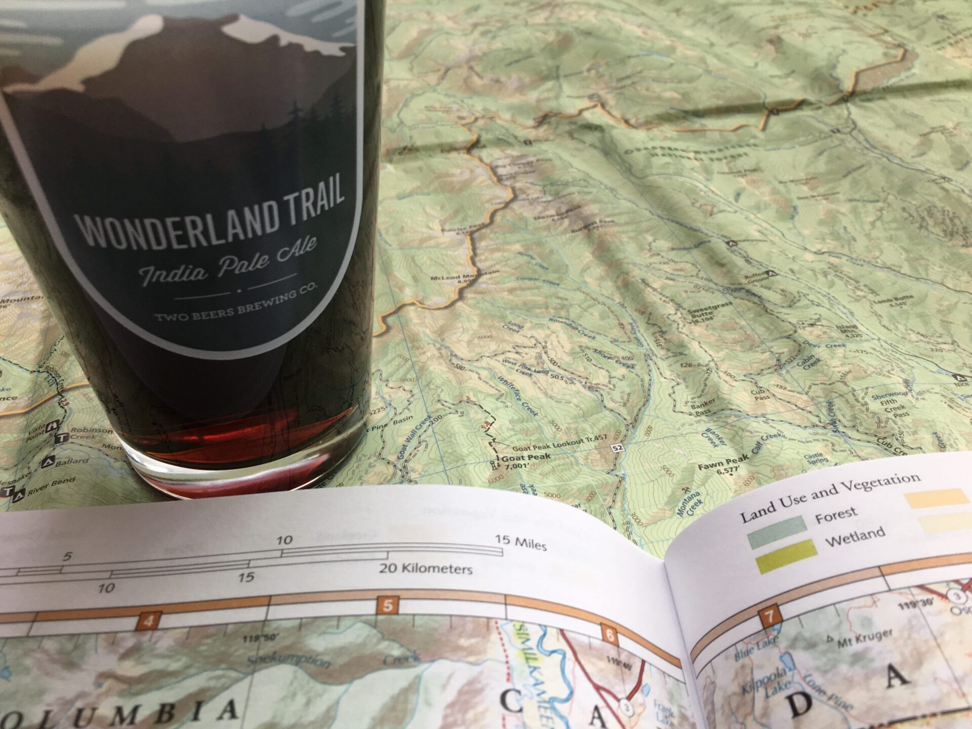
I’m a map geek always looking for interesting routes and I’ve compiled a long list of 30-60+ mile point-to-point and loop hikes that I’m eager to enjoy. This summer I’m excited to dust off the backpack for some extended time in the backcountry.
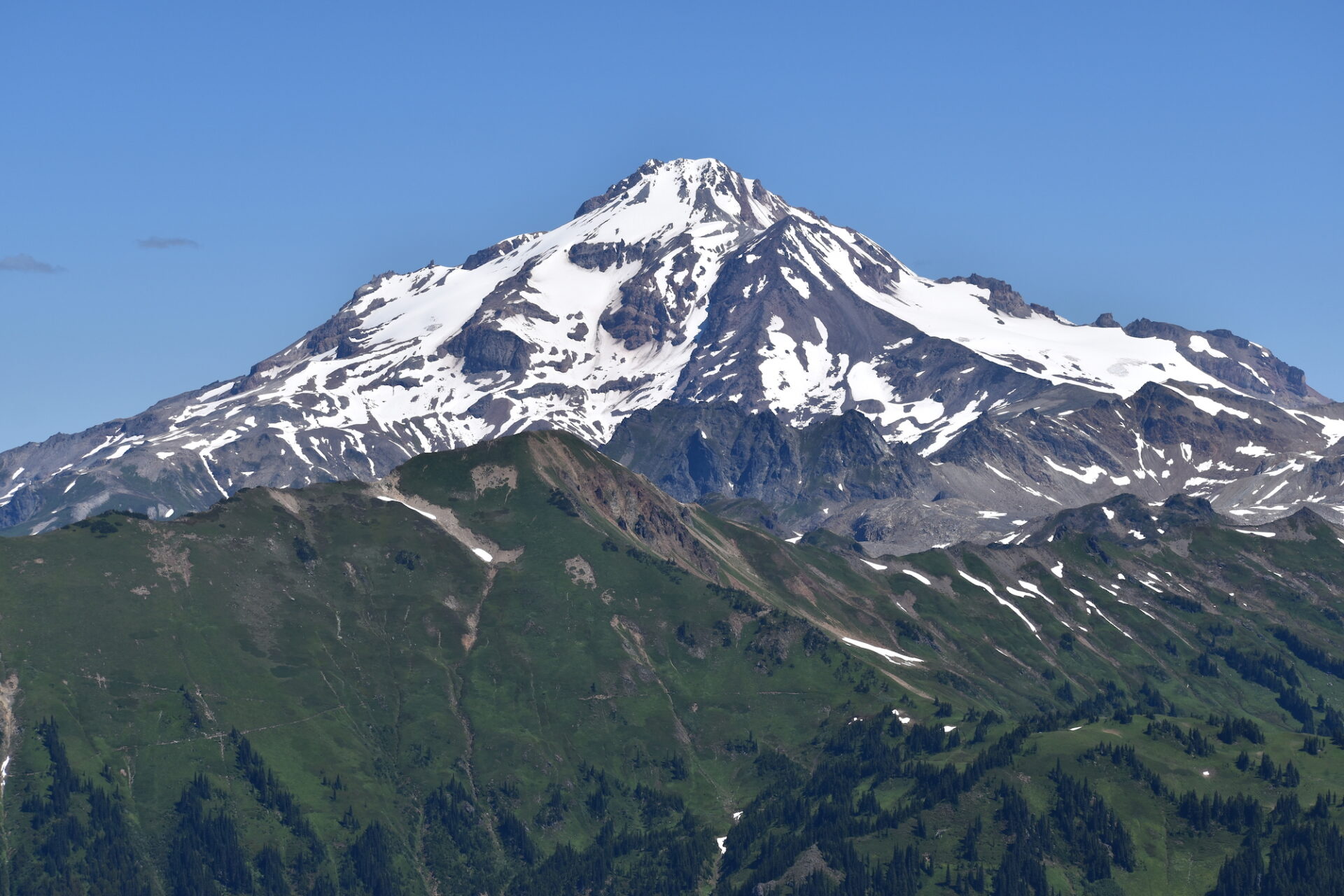
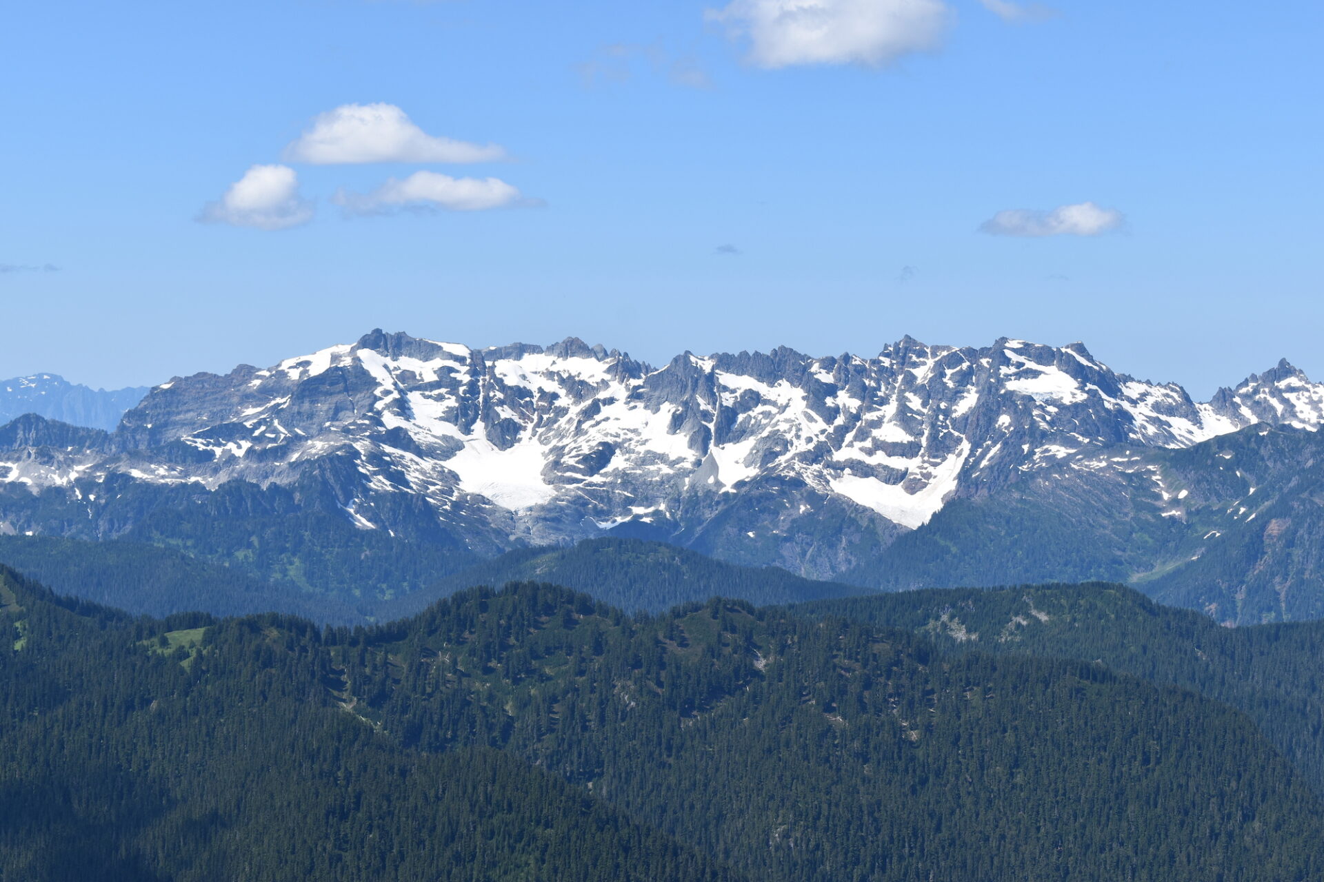
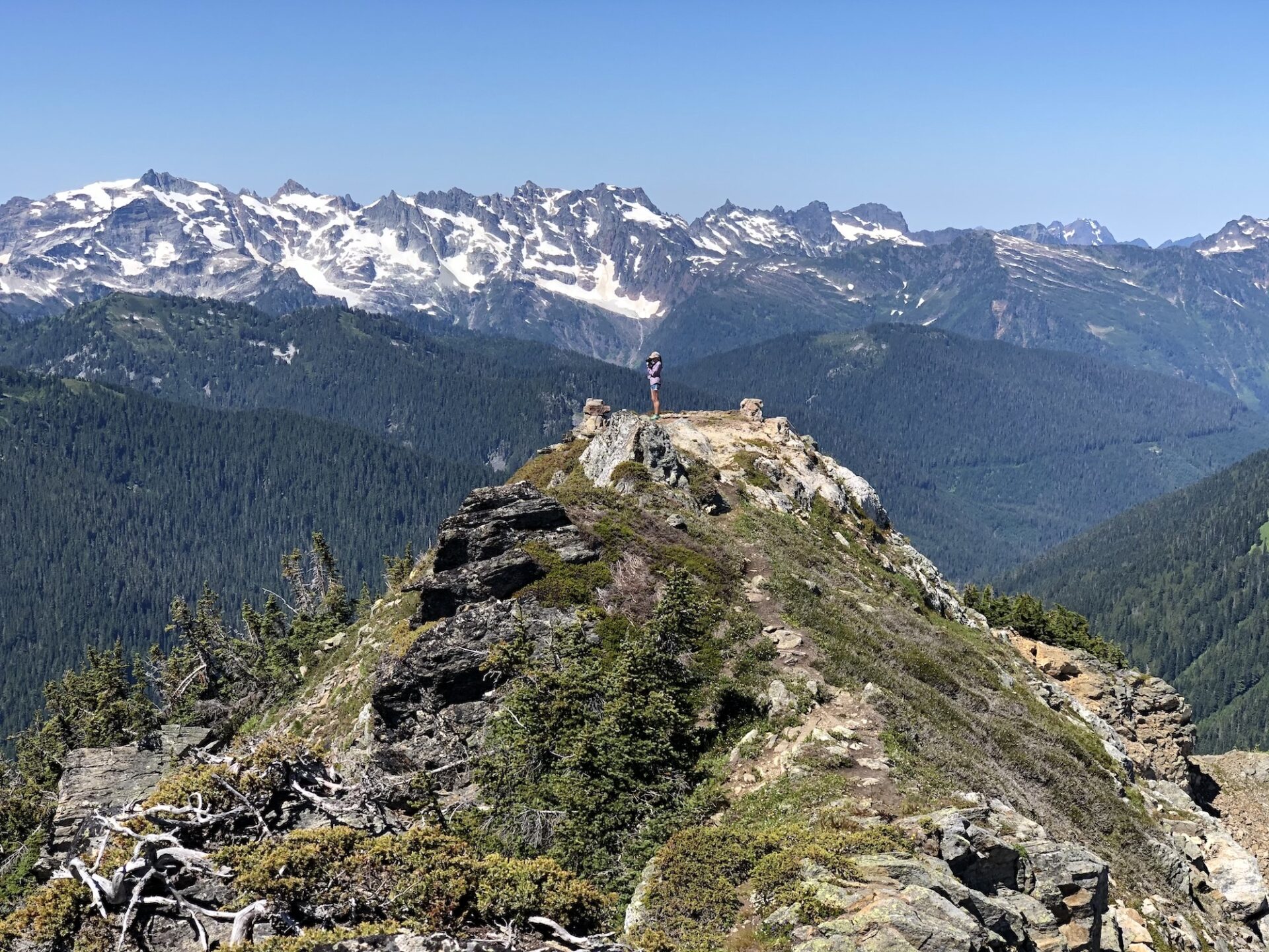
I was so enamored with the Glacier Peak Wilderness after last year’s overnight to Miner’s Ridge lookout that I couldn’t wait to get back, so I spent three days last weekend backpacking the White Pass/Pilot Ridge loop on Glacier’s south side. The traditional loop is about 29 miles, but I added a few bonus peaks and side trips for a grand total of 41.5 miles and 11.5k feet of climbing. Whew!
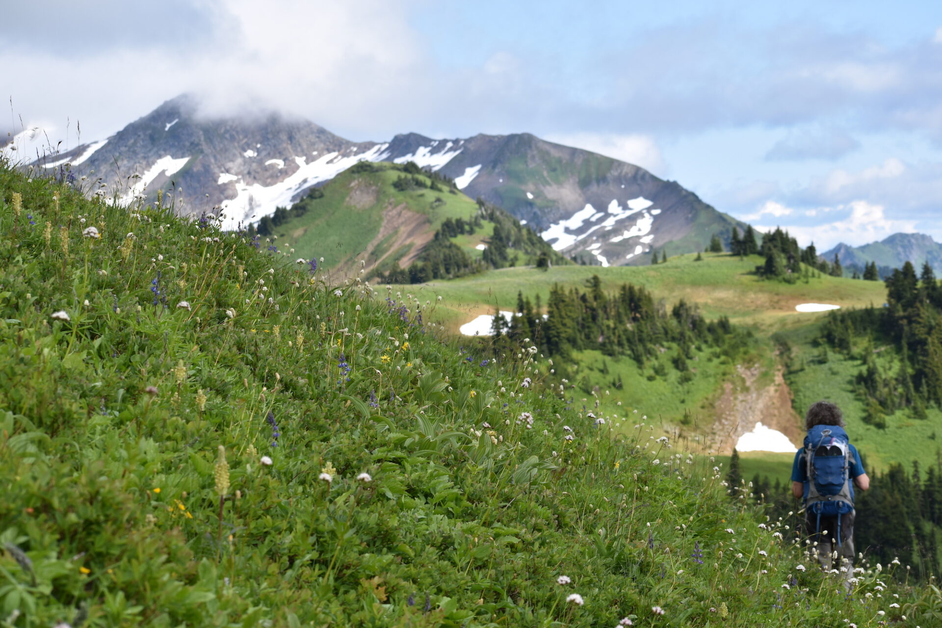
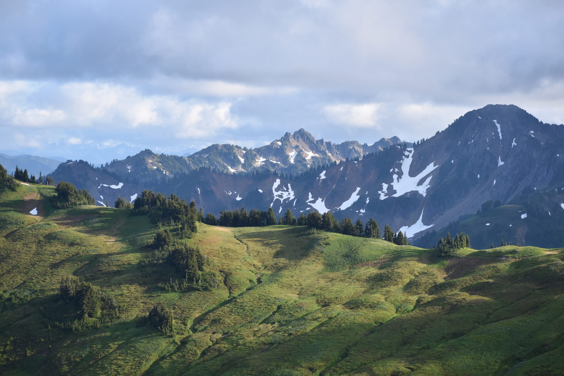
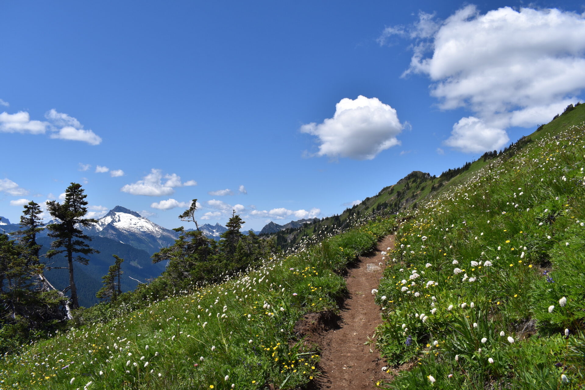
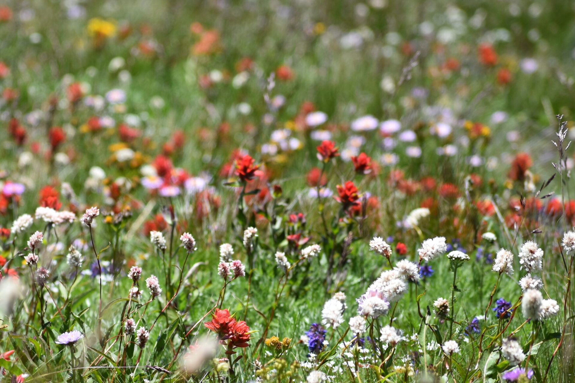
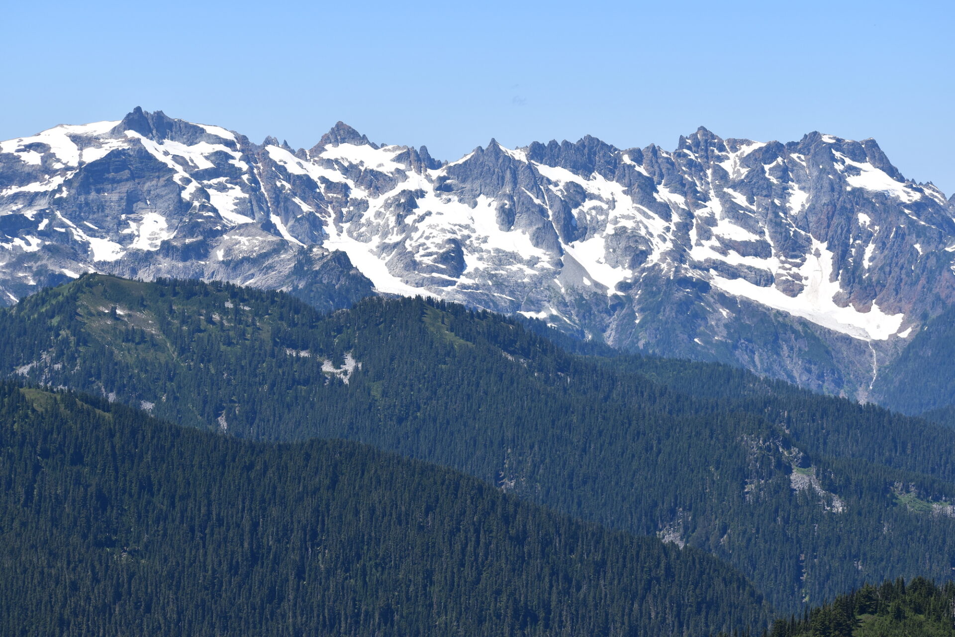
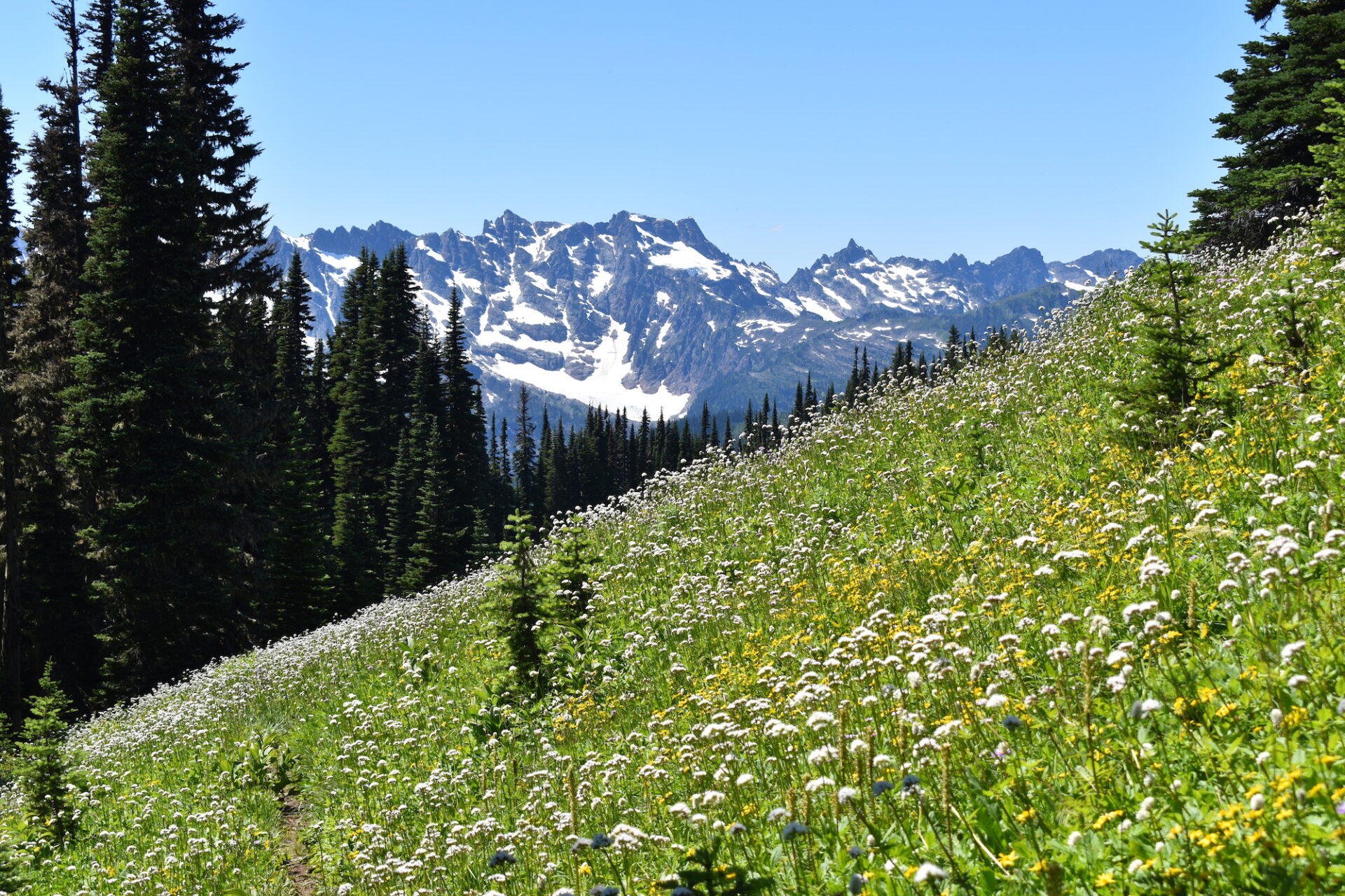
Although my knees might have been a little sore, boy oh boy was the quad busting workout worth it! The journey was stunning with panoramic views of Glacier, fields of wildflowers, emerald green meadows, high alpine lakes, and old-growth forests. Yep. the Glacier Peak Wilderness is pretty darn incredible.
Day 1: North Fork Sauk, White Pass, Foam Creek Trail.
Distance: 10.5 miles | Elevation Gain: 4,800’
A few days before the trip I reconnected with an old acquaintance from my trail running days who was super interested in the loop I had planned. Since I do most of my backpacks solo, I sure didn’t mind the company. With Friday’s weather transitioning from showers to a sunny pattern, we pushed back our departure, hoping to dodge the weather. I didn’t really want to drag up an extra pound or two of rain gear that I likely wouldn’t need!
We arrived at the North Fork Sauk trailhead outside Darrington midday on Friday and since it’s also the starting point for most Glacier Peak climbers, I was a little worried our late arrival would mean challenging parking. Indeed, the lot was pretty full, but we were still able to find a spot to squeeze into. On a busy weekend it might take some creativity or a longer walk.
Despite cloudy, humid conditions that threatened a bit of drizzle from time to time, our late start worked and we enjoyed a cool, dry day.
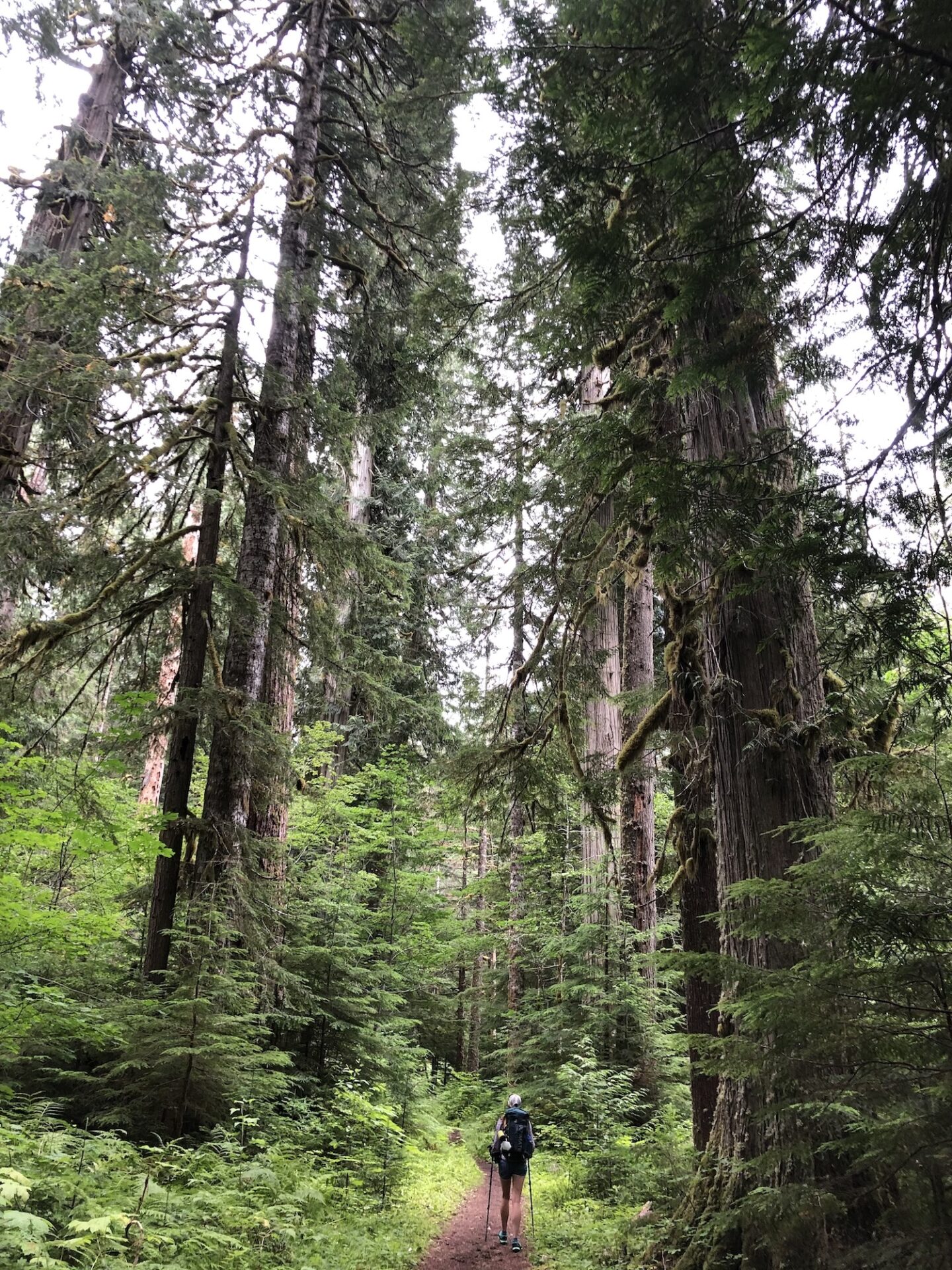
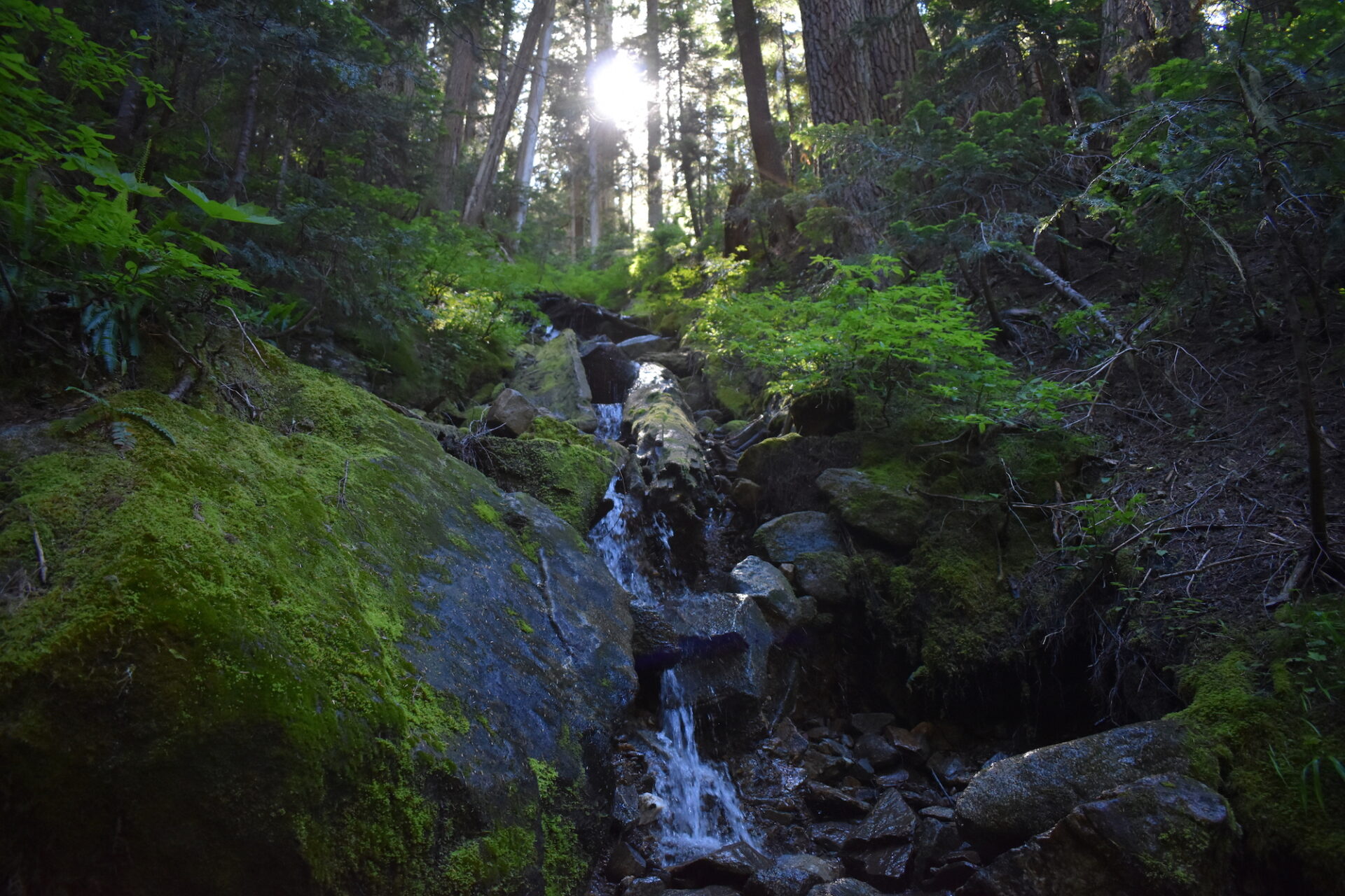
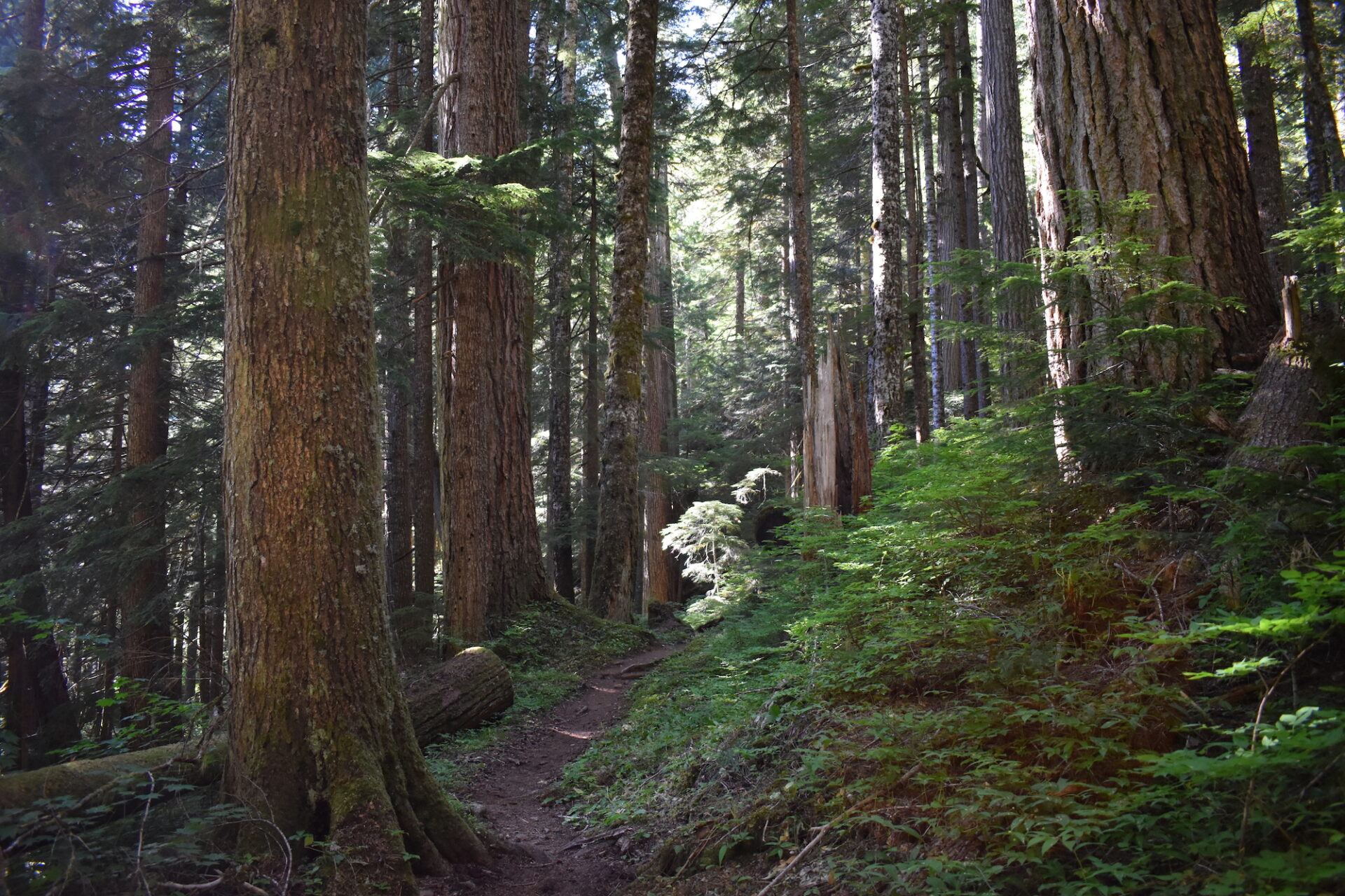
The North Fork Sauk trail starts smooth and wide and almost immediately passes a mile-long spur trail that climbs to the former Red Mountain lookout site. I’ve visited the site previously and it’s a worthy objective for lookout geeks with fantastic views to the south. The main trail continues through beautiful old-growth Cedar and Douglas Fir. I couldn’t help but stop and look up to admire the beauty of these fantastic giants towering overhead.
The first few miles climb steadily, acting as a warm up for what’s ahead. Just shy of 2 miles we passed the junction for Pilot Ridge, where we’d be coming back out on Sunday. As is the usual question with backpacking loops, do you go clockwise or counter-clockwise?
Sometimes there’s an obvious answer, but for this loop, there really isn’t a right or wrong. It does seem like the more common direction is clockwise, though it’s unlikely one way has better views than the other. The mostly forested climb up Pilot Ridge is certainly steeper and I think would be less enjoyable than the open meadow climb to White Pass, but I think anything goes on this one.
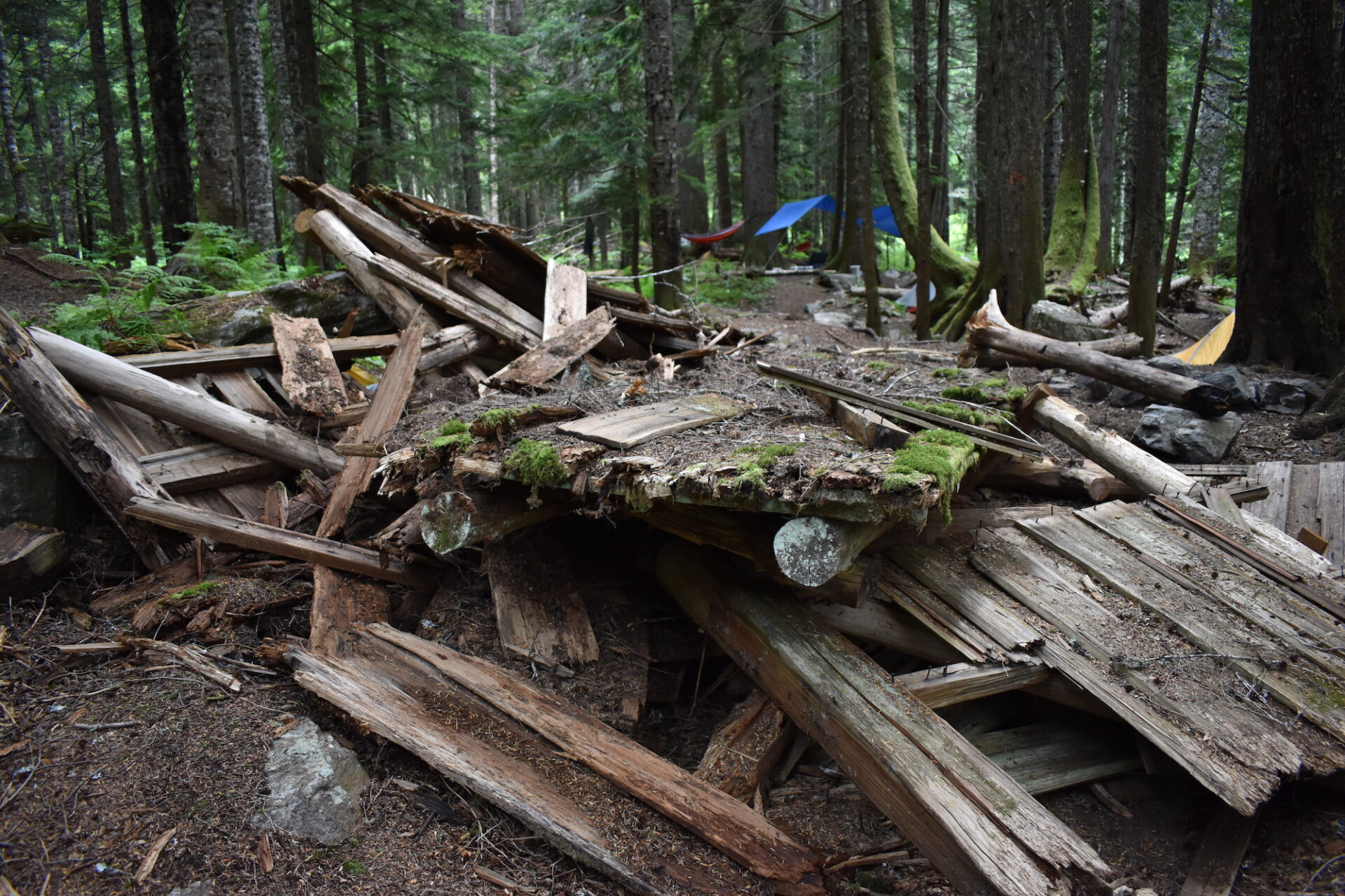
We chose the more traditional clockwise loop and in 5.3 miles reached a large camping area near the now collapsed Mackinaw Shelter. All that’s left of the shelter is a pile of rubble, but it’s still a good place to take a quick break and also the last reliable water source until White Pass.
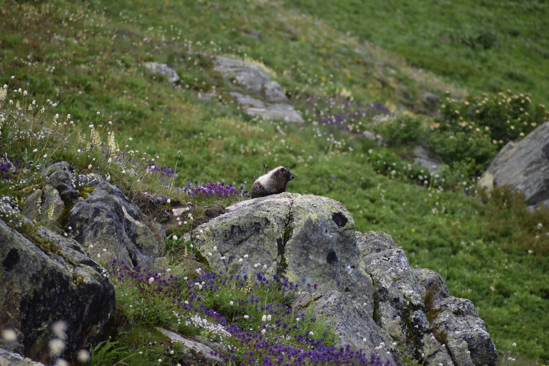
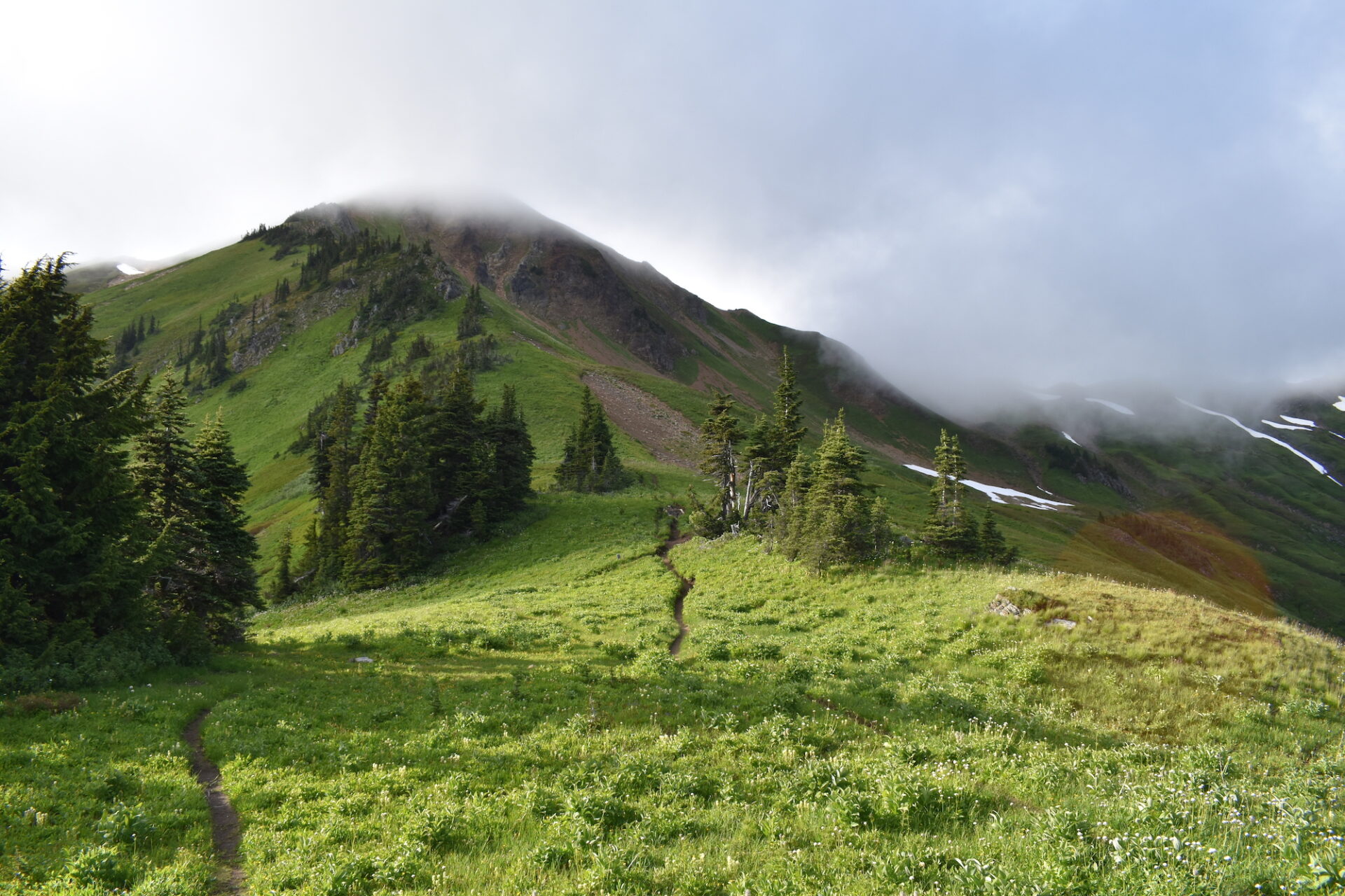
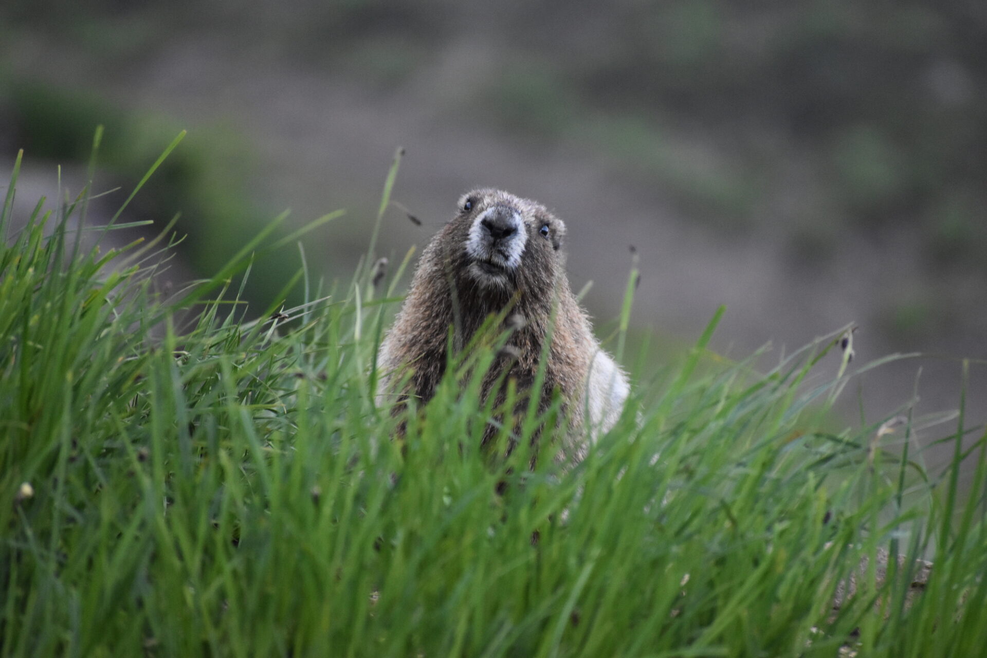
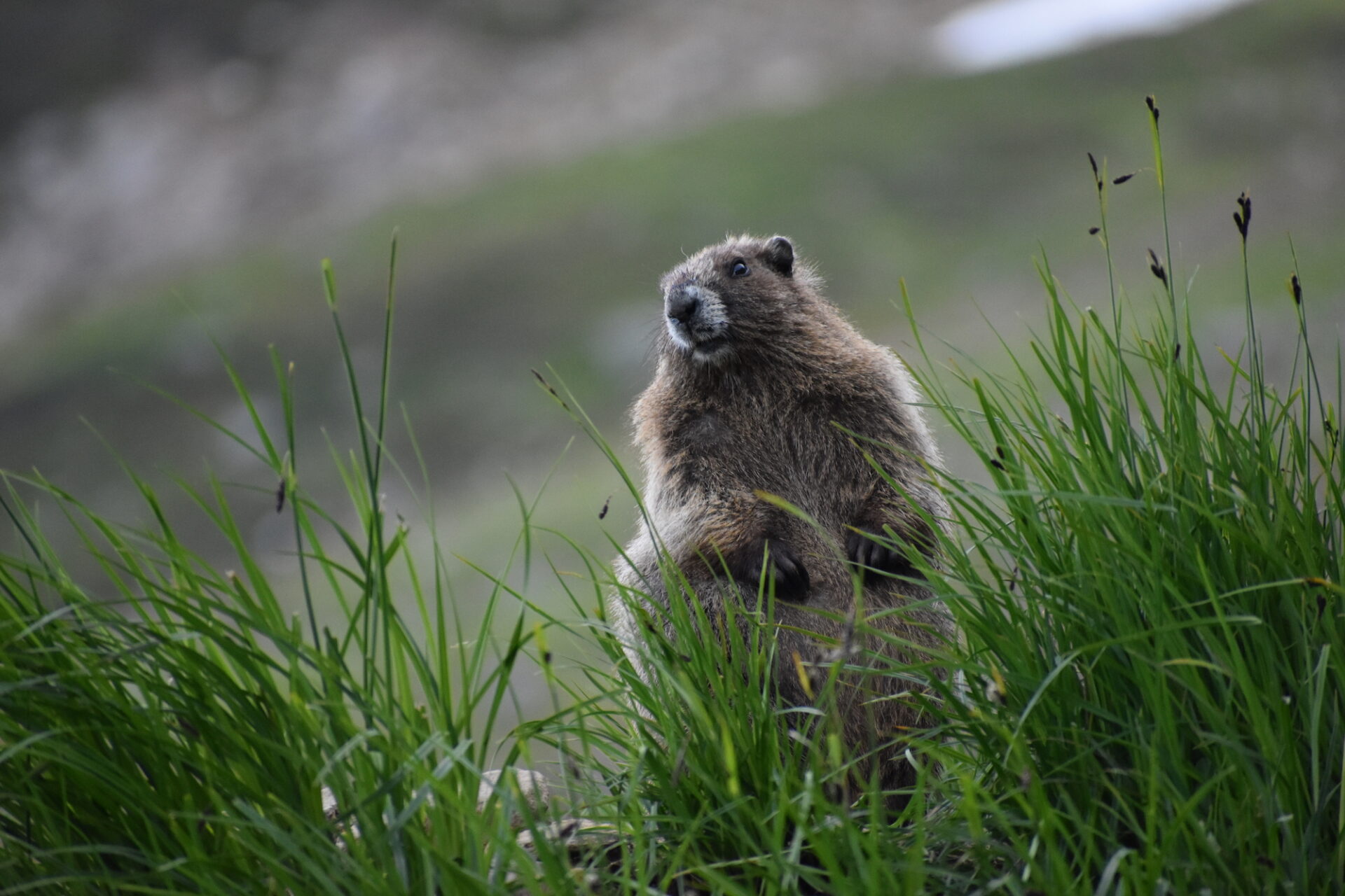
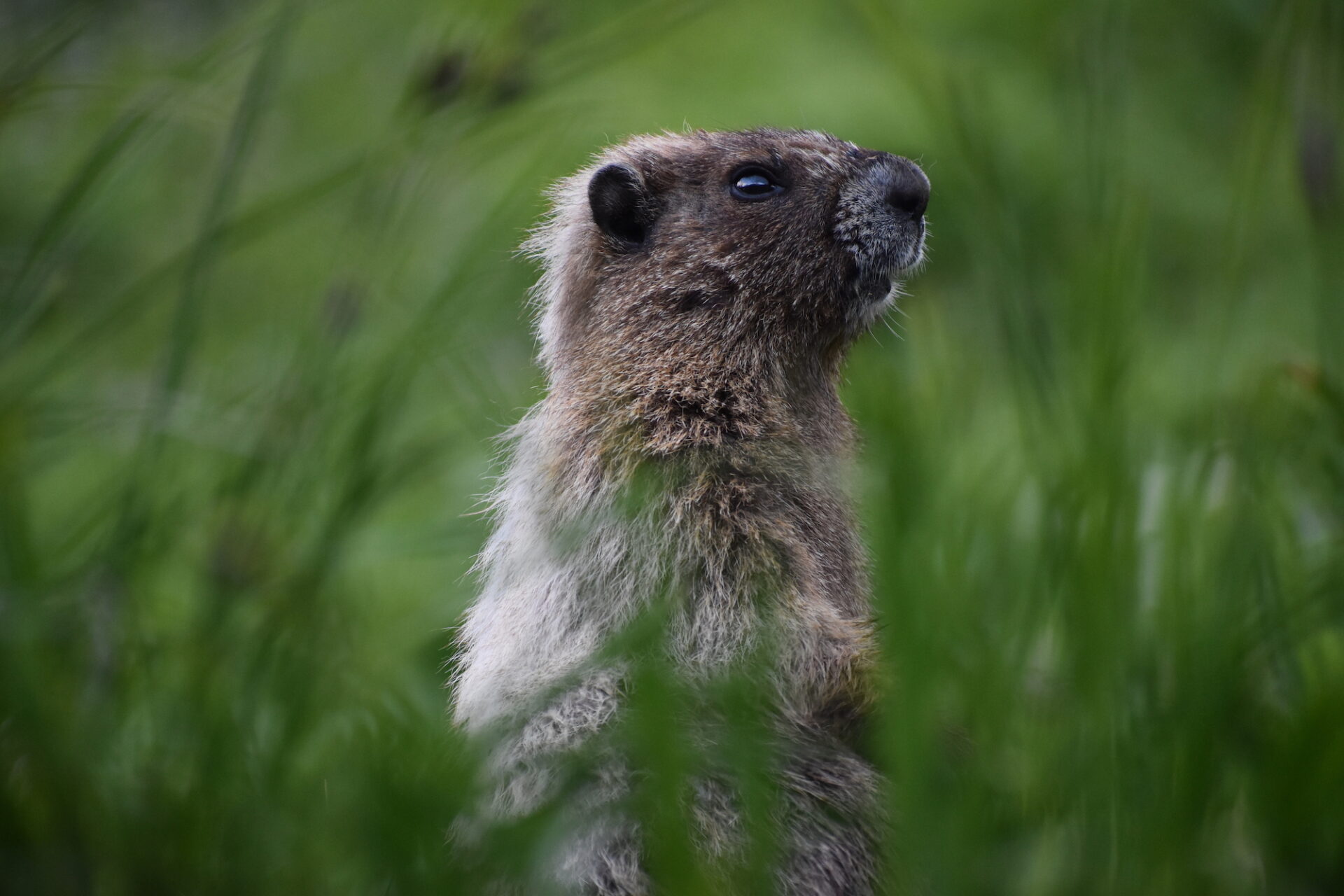
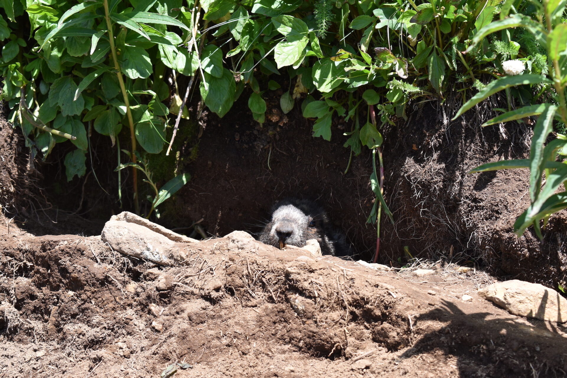
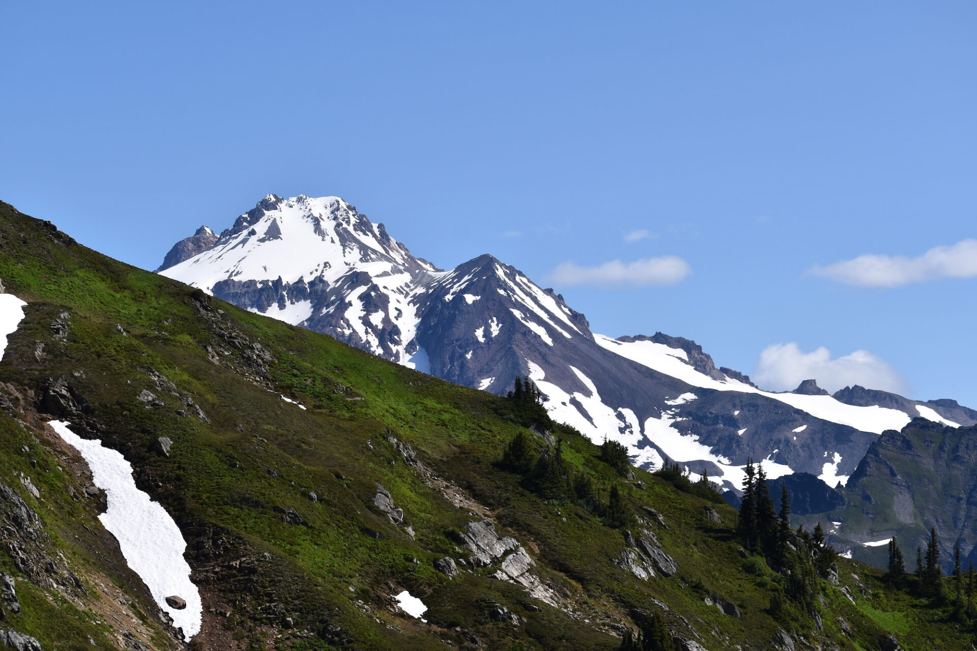
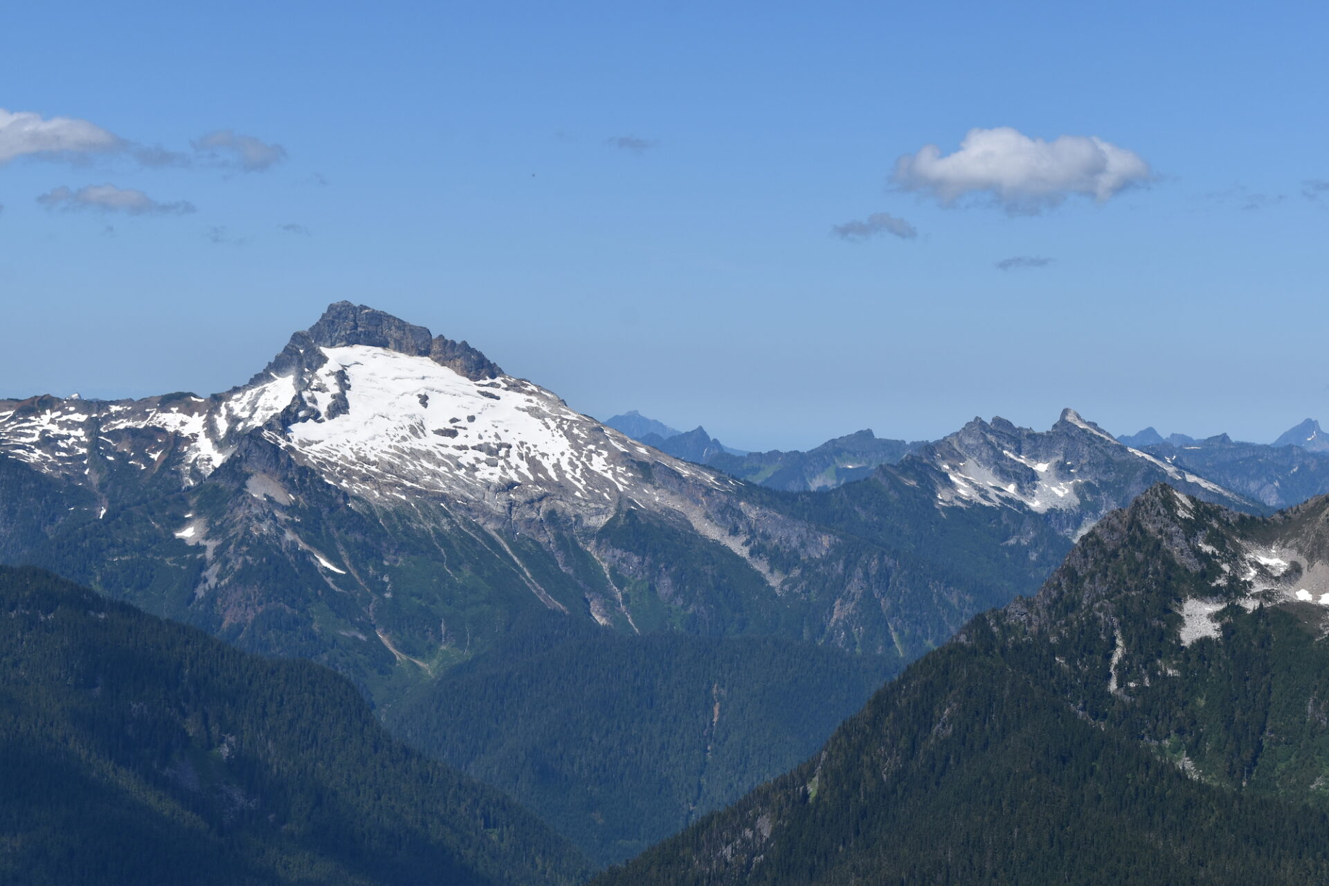
From here, the trail goes straight up, gaining 3,000’ over the next 4 miles to a junction with the PCT at 6,000’. The trail winds up through beautiful open meadows and I stopped far too many times to photograph flowers and marmots as well as Sloan Peak behind us, peaking through the clouds.
Eventually the trail intersects the PCT and leads to White Pass in a short half mile. A steep trail down the ridge leads to a number of sheltered campsites and this time of year a substantial stream feeds most of the sites. We headed down and found a nice camp at the very end with privacy, wind shelter, and close proximity to water.
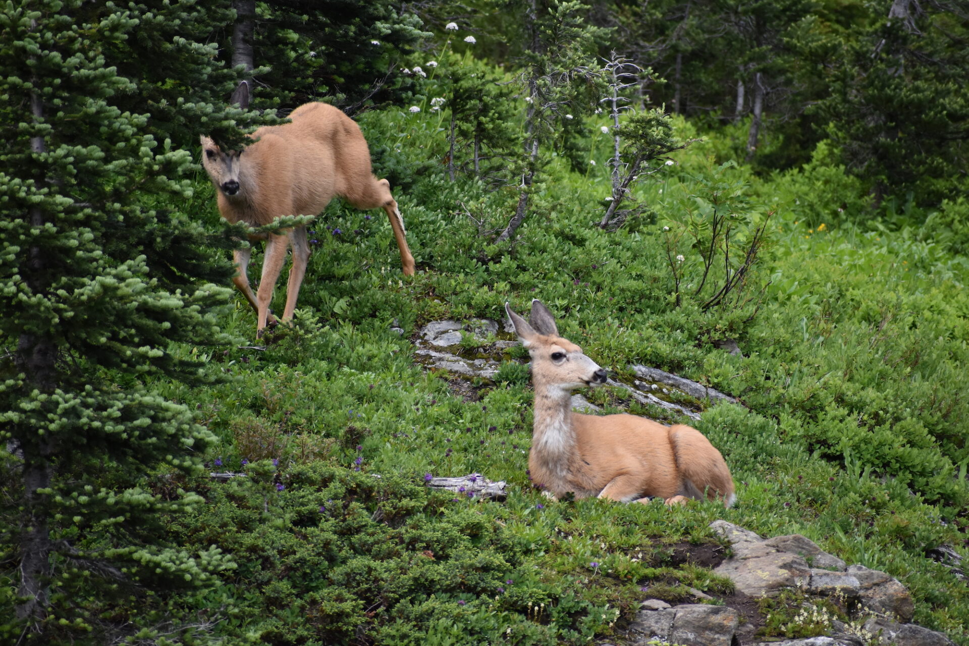
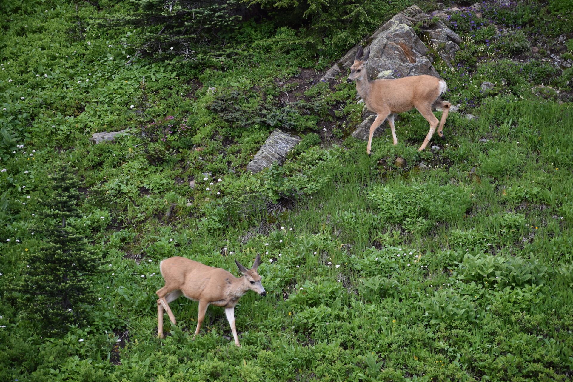
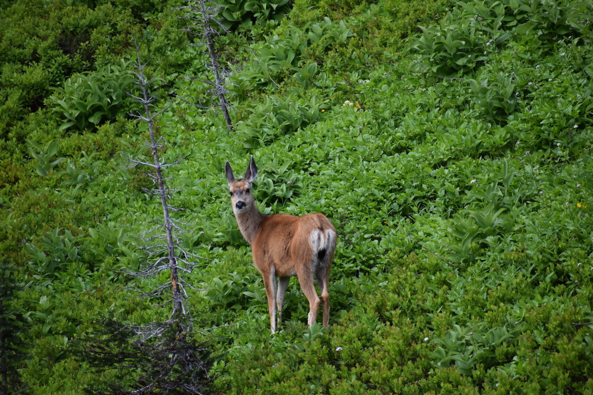
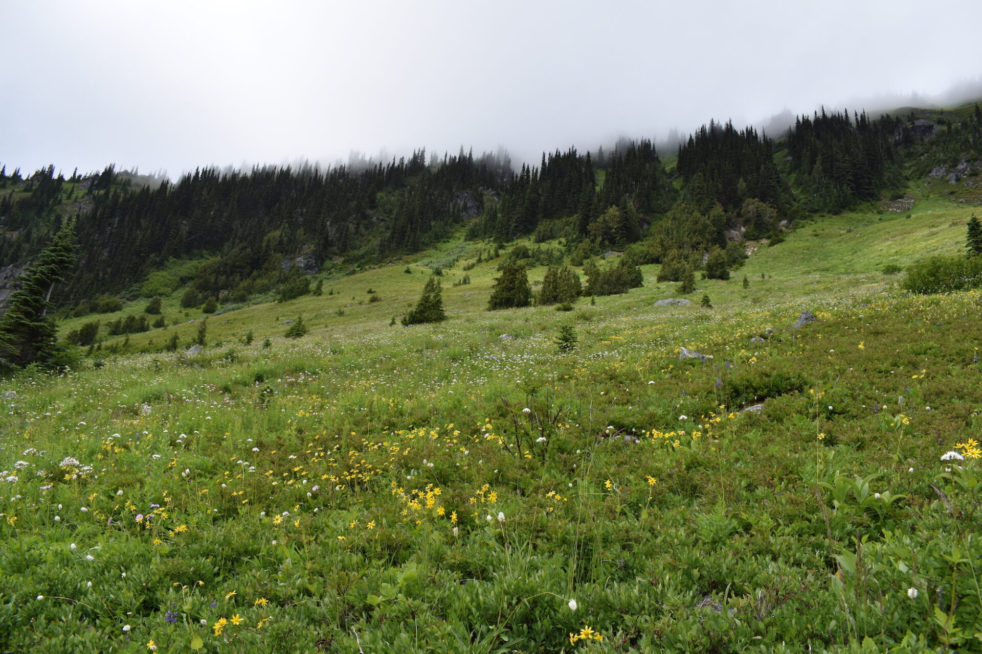
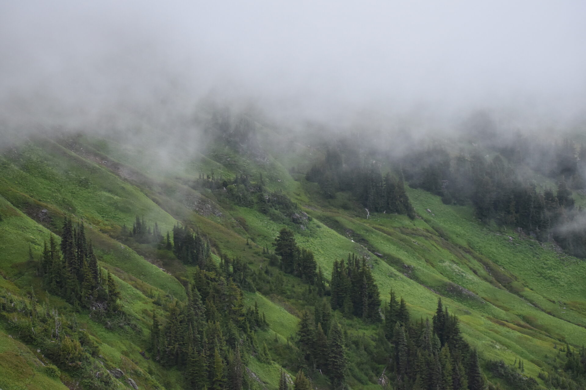
As we set up camp, the shrill whistles of marmots filled the air and a few deer cruised by, not at all phased by our presence. After relaxing for a bit, I hiked back up to White Pass and then up the Foam Creek Trail, which eventually crests a ridge and drops into the White Chuck Basin. Normally it would have expansive views of Glacier, but Friday’s high clouds and fog were obscuring the views. Instead I stopped short of the ridge, enjoying the fog flowing over the tops of the fantastic green meadows as well as the numerous marmots who weren’t the least bit camera shy.
When I returned to our camp, most of the remaining sites had been filled by larger climbing parties and smaller parties hiking the loop. Despite the area being mostly full, it was surprisingly quiet. The only sound I heard during the night? The crinkling of foil coming from my backpack. I suddenly remembered I had left a nutrition bar in my front pocket that an animal must have been investigating.
I grabbed my headlamp, flipped it on, and sure enough, there sat three tiny mice on the top of my pack, staring back at me. After shooing them away and saving my bar, I looked around, noticing the entire little valley we were camped in was enveloped in a thick fog. I knew Friday night would be our coldest night on the trail and indeed, it was freezing out there! I burrowed back into my sleeping bag, sure hoping Saturday’s sunny forecast was going to come true.
Day 2: White Pass, Portal Peak, and Little Blue Lake.
Distance: 15.1 miles | Elevation Gain: 3,016’
I awoke at daybreak the next morning and instantly smiled. Sometime overnight the clouds had finally burned off and it was going to be a beautiful blue bird day! I should have hiked up to the pass for sunrise photos, but it was so quiet and so cold that I spent the morning lazily sleeping, staying warm, and enjoying the peaceful quiet. It was delightful!
Once the sun finally popped over the ridge, we had breakfast, packed camp, and hiked back up the steep trail to White Pass. We stashed most of our gear and then set out with refreshingly light packs for a side trip to Portal Peak, a 6,999’ summit just off the PCT about 2 miles northwest.
Along the way we passed a Forest Service crew doing trail work who was camped up there for the week. We thanked them immensely for their work and wished them well. As we continued, I kept wondering if I’d ever get the fantastic view of Glacier I was hoping for. True to form, Glacier often hides, and indeed, it was hiding right behind the ridge we were climbing. Glacier is sneaky I tell ya.
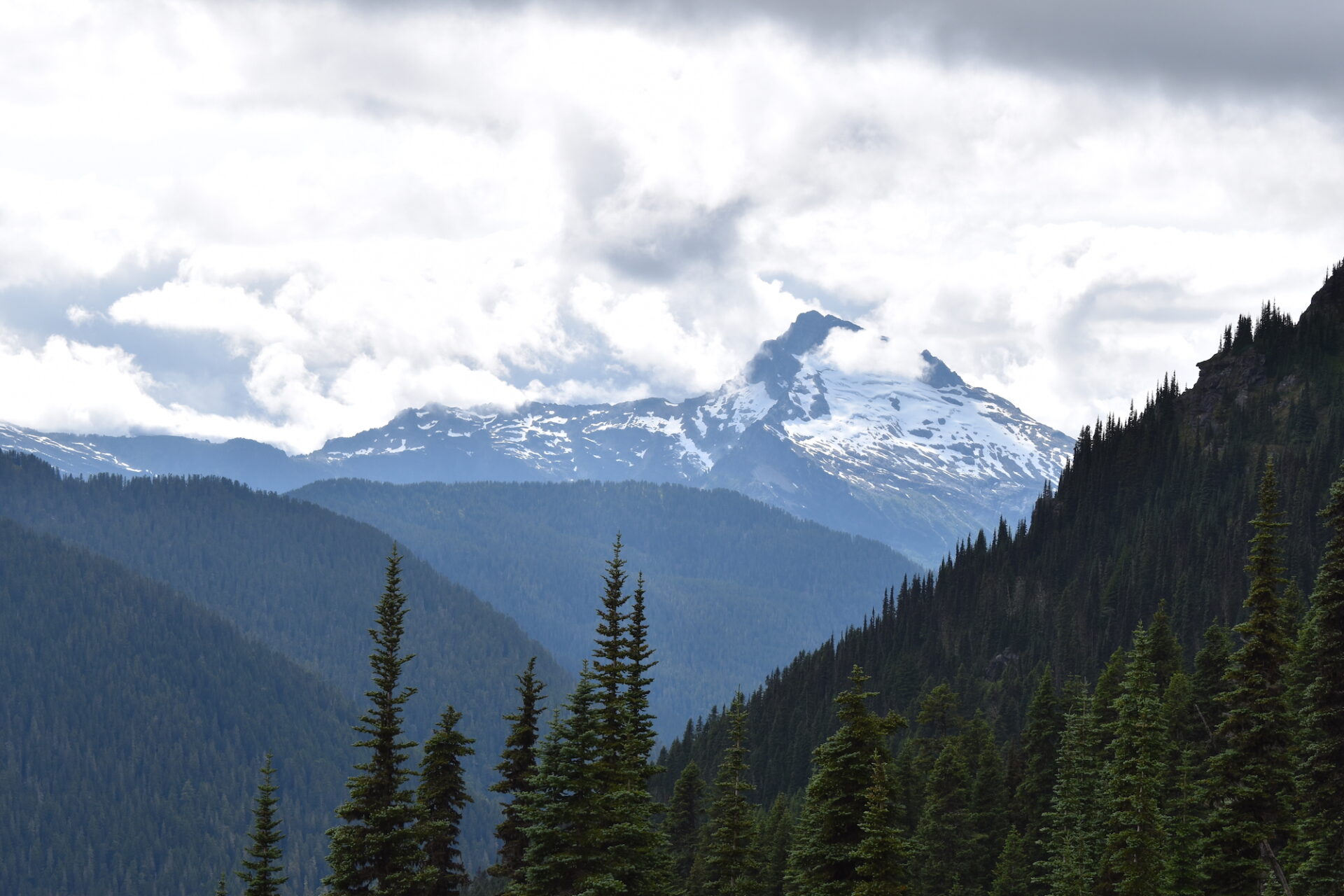
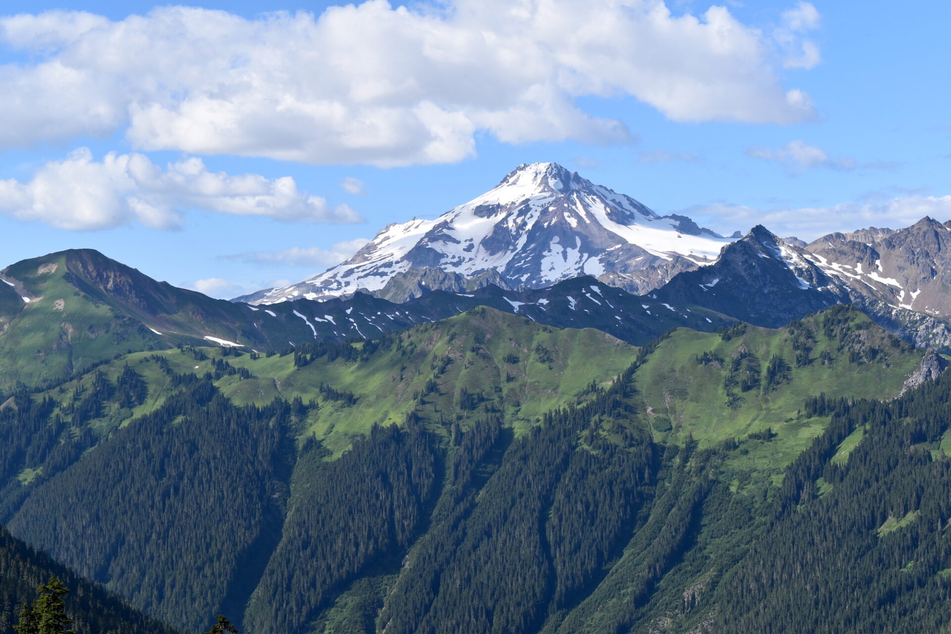
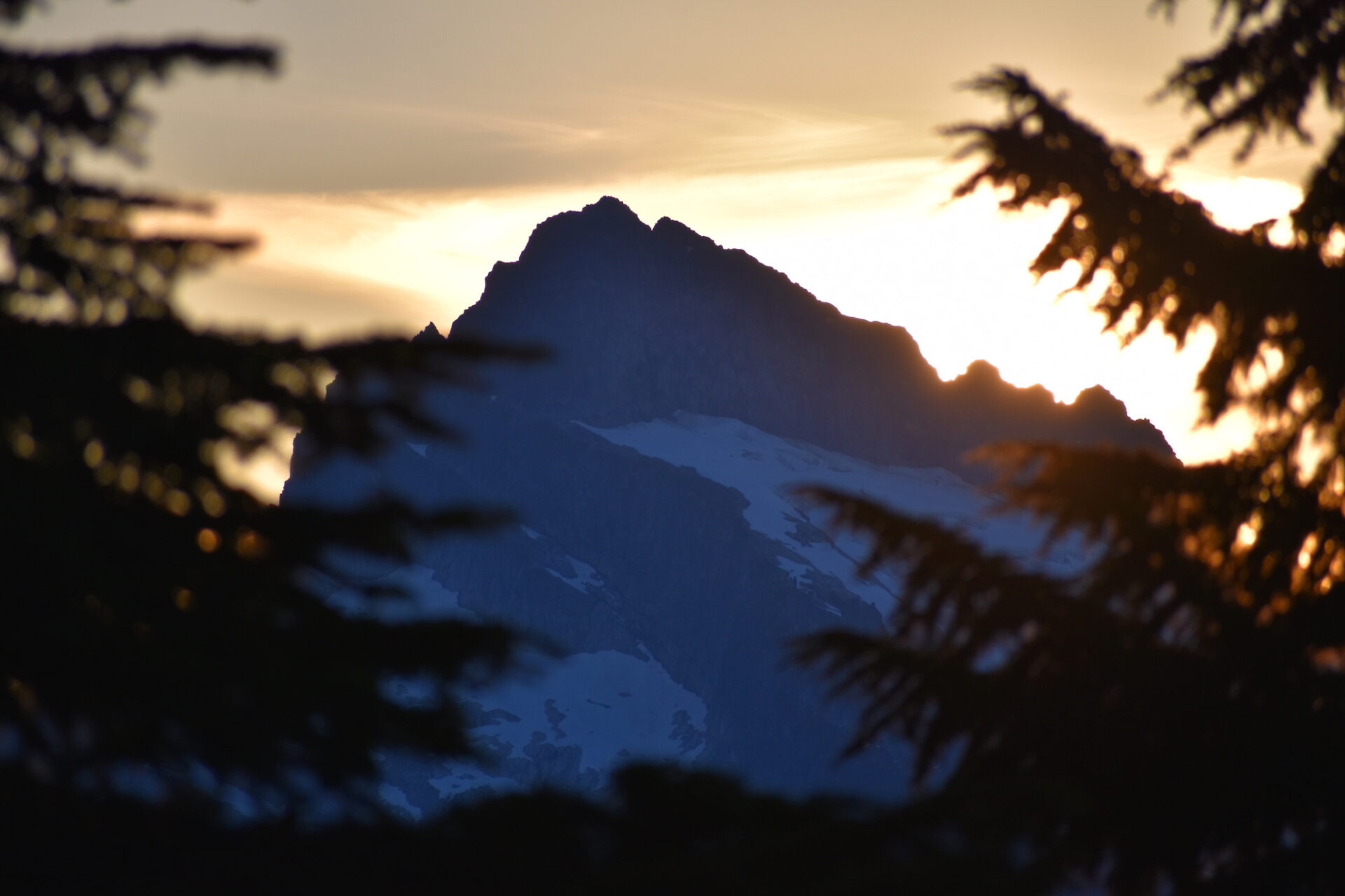
Just before Red Pass, we gazed down on what would have been a spectacular campsite, though a very exposed one, then finally reached Red Pass and voila! There was the tip of Glacier, towering over the gorgeous White Chuck basin. From the pass, the steep flank of Portal Peak beckoned, so off we went for some bigger views.
Although there’s no trail up Portal Peak, there is a pretty well defined boot path that climbs about 500’ in a scant quarter mile. It took us roughly 20-30 minutes to reach the top. The first 200-250’ are the crux and require a bit of rock scrambling up a cliff band. After that, it’s simply a steep hike up solid terrain to a knoll with a breathtaking 360° panorama.

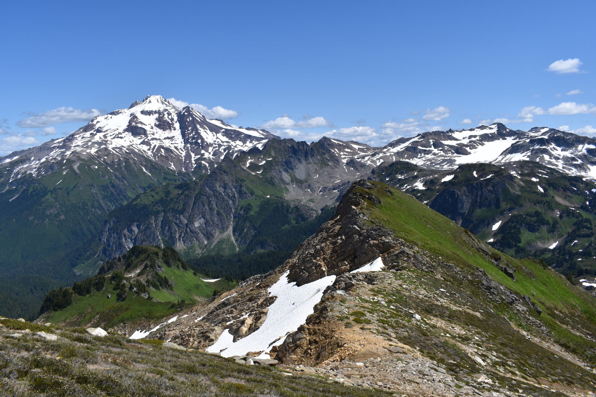
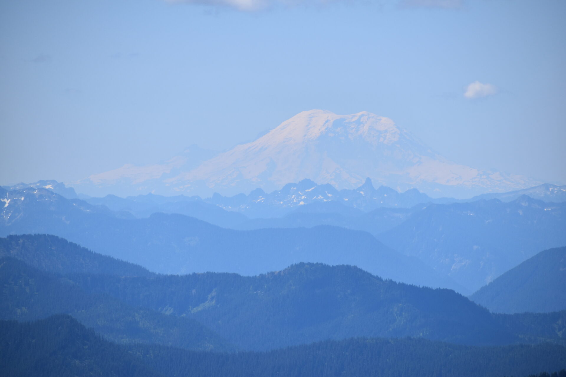
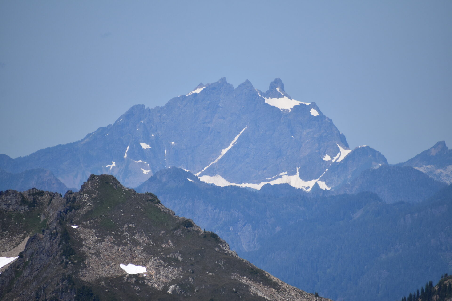
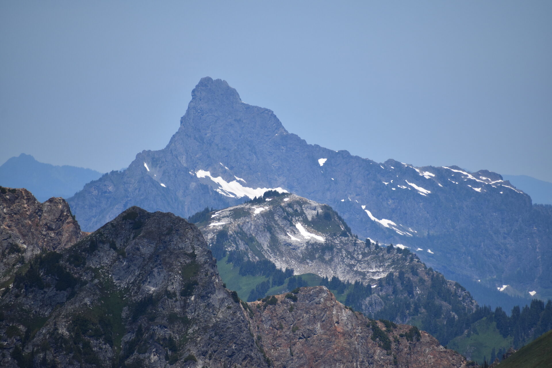
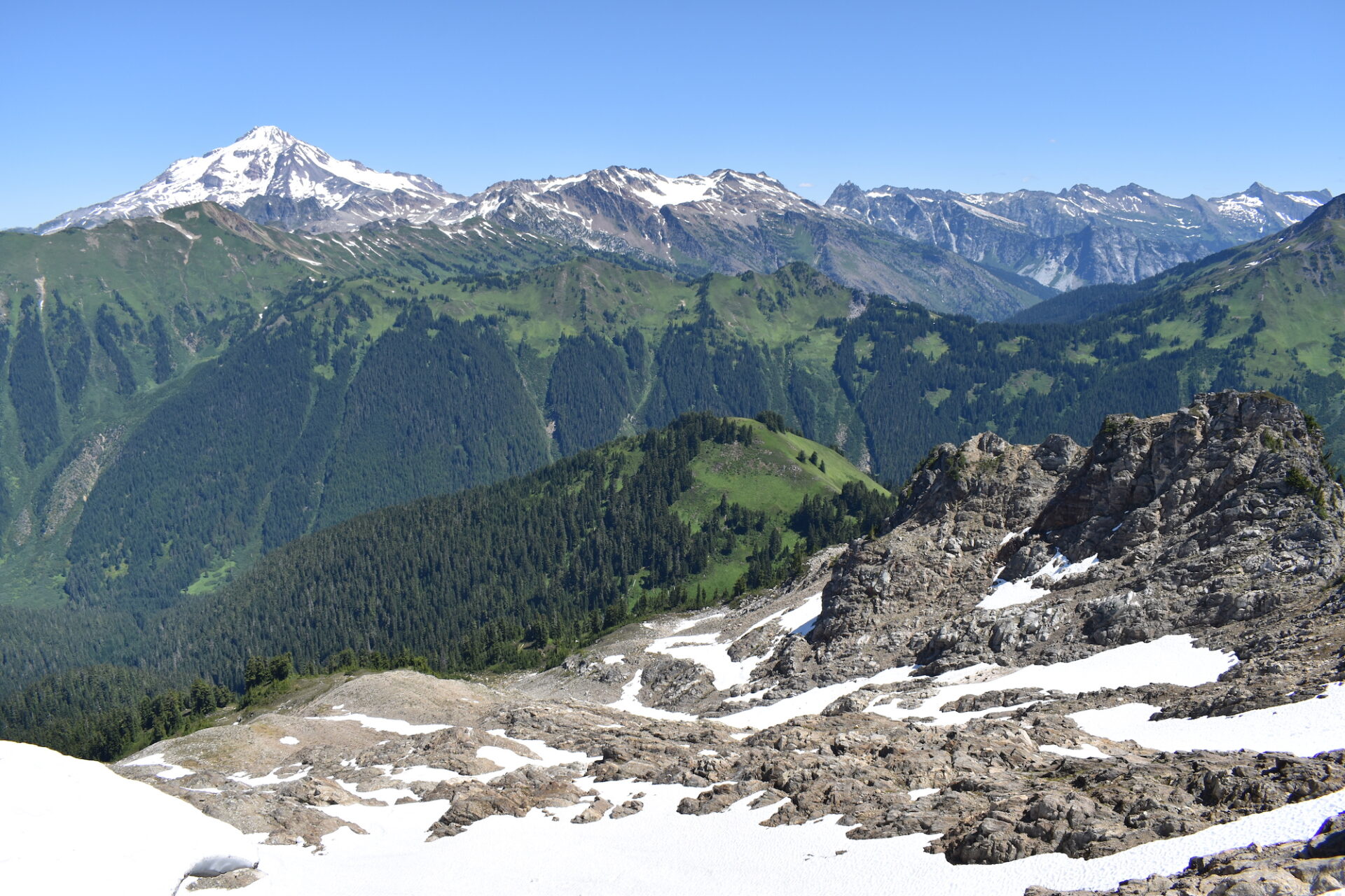
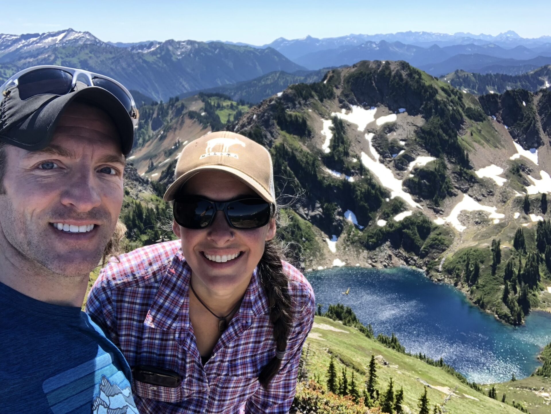
Damon and I enjoyed the summit of Portal all to ourselves for over an hour, taking in the views, the solitude, and soaking up Glacier Peak in all its glory. From the top you can see Three Fingers, Rainier, Stuart, the Enchantments, Eldorado, the Pickets, and even the distant peaks of Chikamin and the Alpine Lakes Region. It is amazing.
Before our descent we were joined by a couple and their dog and chatted about other trails in the area. Damon was healing a broken hand and my knees are crabby with super steep descents, so we chose to descend a slightly different route, going cross country down Portal’s eastern flank as opposed to down climbing the rocky cliff band. I’m not sure if it was easier, but it was a little less steep.
Back at Red Pass we ran into two women who were section hiking from Rainy Pass to Stevens. They had endured days of rain, yet were still smiling from ear to ear and more than excited for a blue bird day with spectacular views.
We hiked back to White Pass, waving at the trail crew along the way, and took a lunch break with a group of backpackers who most likely represented 3 generations of family, all out to enjoy the weekend. After fighter jets suddenly roared low across the valley, the older gentlemen in the group started telling us old war stories and tales of his past Glacier climbs. I realized that as refreshing as solitude is, it’s also really special to meet amazing people out on the trail and there were no shortage of them this weekend.
We headed southeast on the PCT and as we trucked along towards Indian Head and Indian Pass, I kept thinking to myself “where is everyone!?” Sure, we had bumped into several parties along the way, but the trail seemed unusually quiet. We had long stretches where we saw only a few people here and there. It was surprising for such a beautiful weekend.
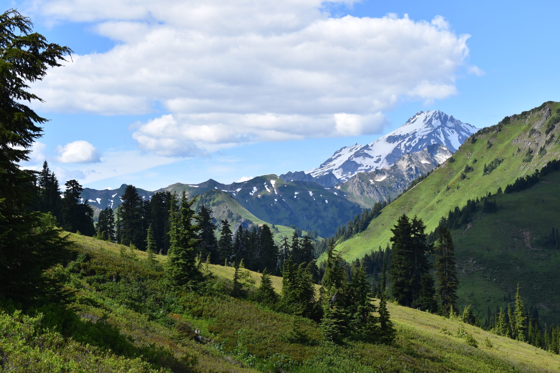
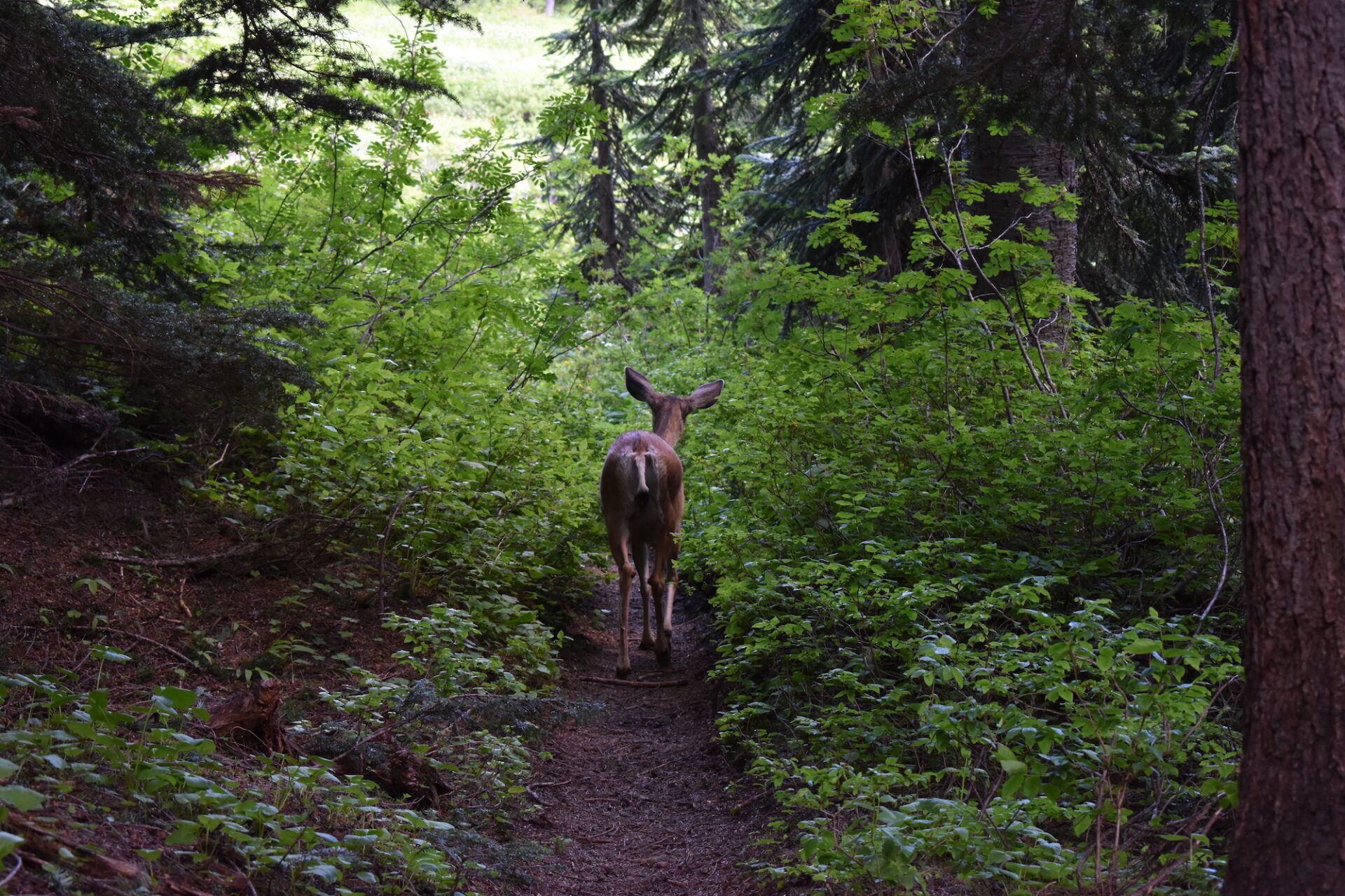
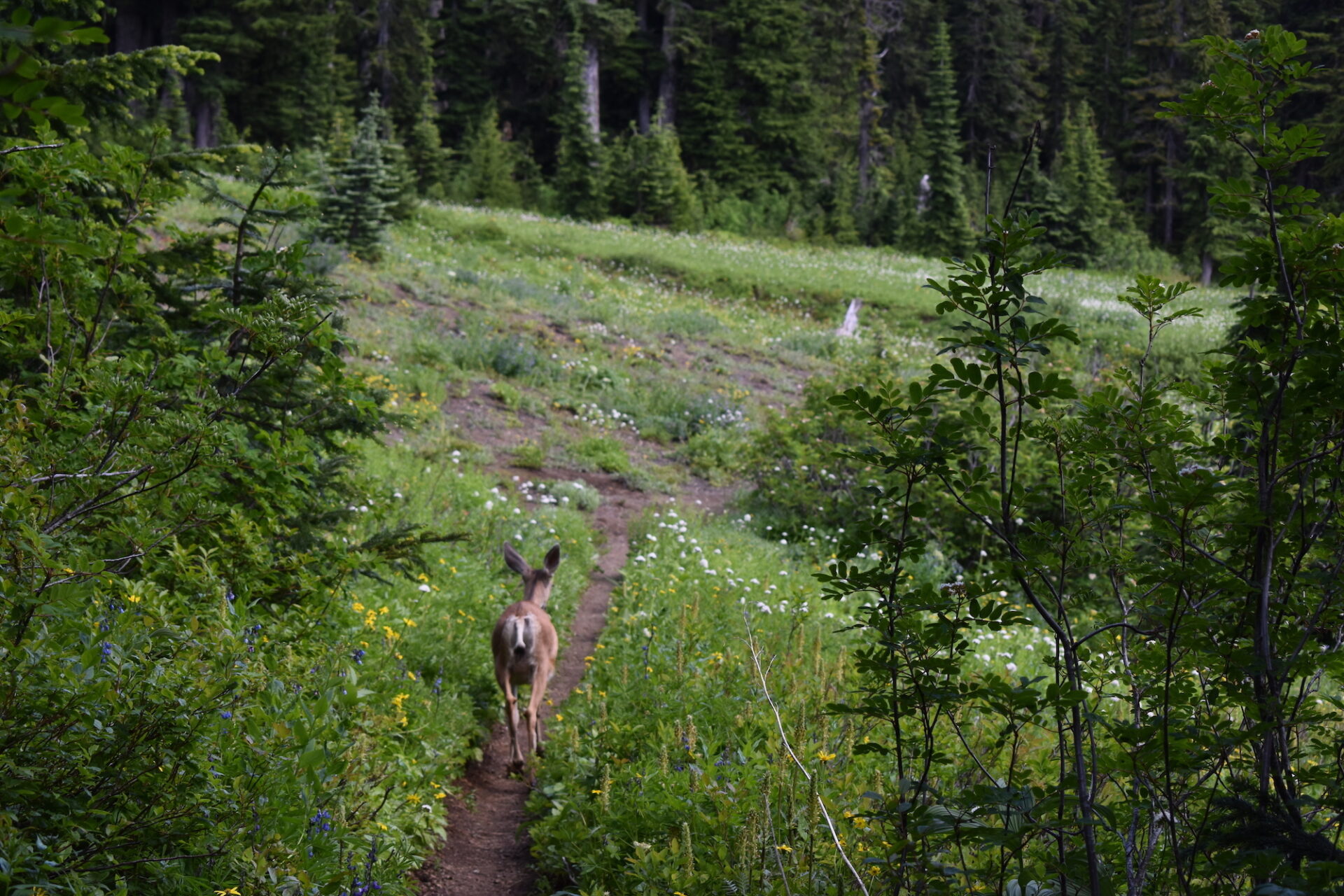
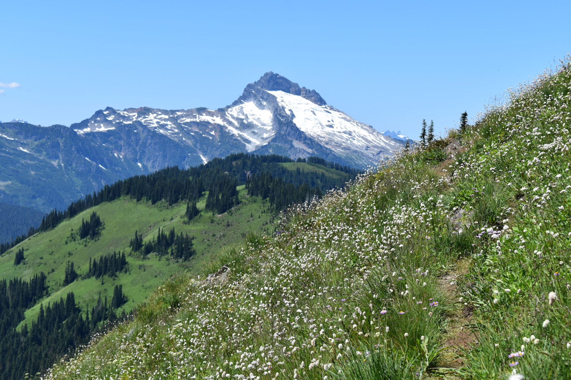
I especially loved this stretch of trail to Indian Pass, with Glacier towering over unbelievably green meadows. Damon and I spent some time chatting, then hiked along at our own paces, thoroughly enjoying this magical scenery. Along the way a deer jumped onto the trail between us and played trail guide, completely uninterested in my presence.
The only downside of the day? The further we hiked the more mosquitos we encountered. It was clear the previous days of rain had kept them away and now that it was sunny, they were out with a vengeance.
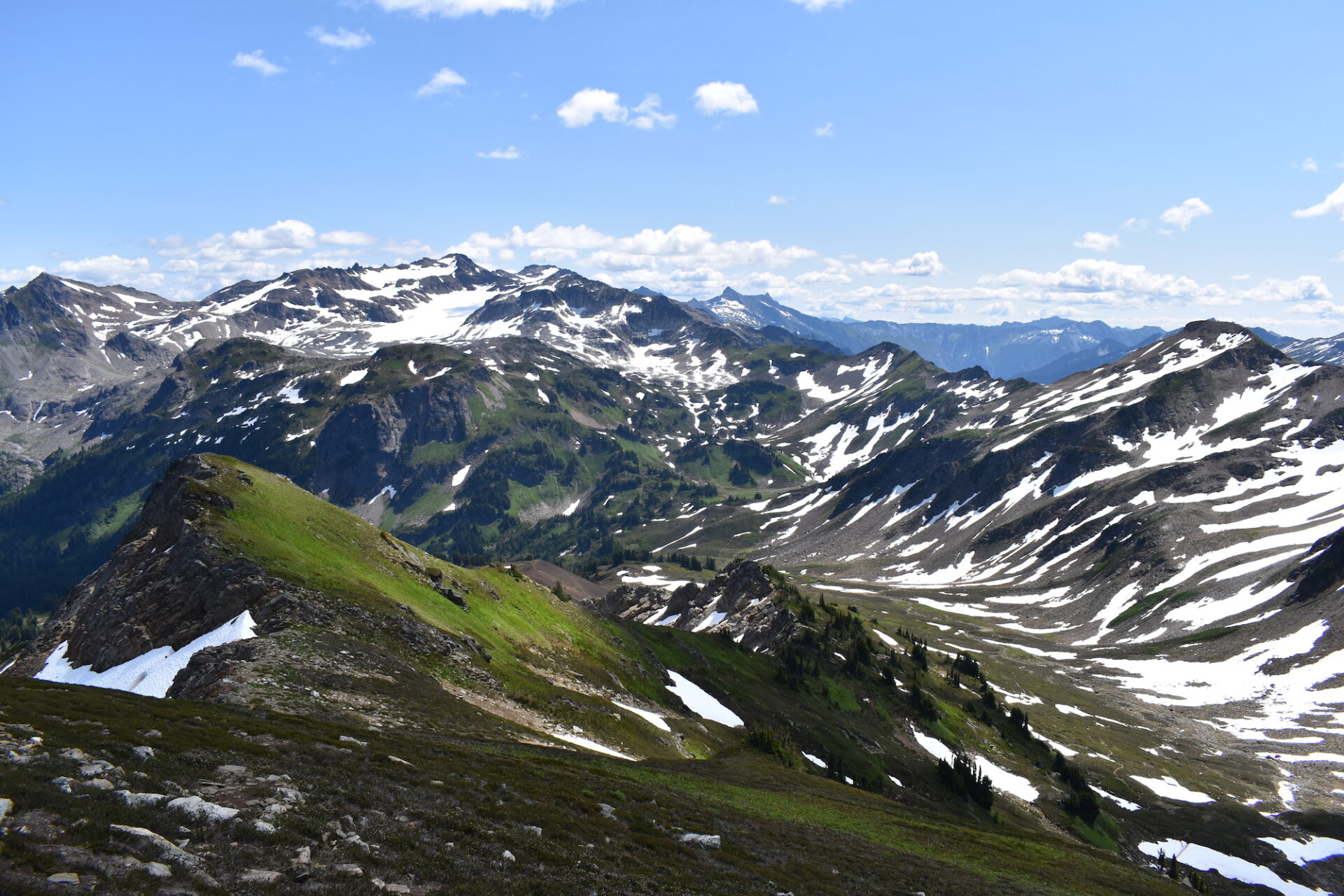
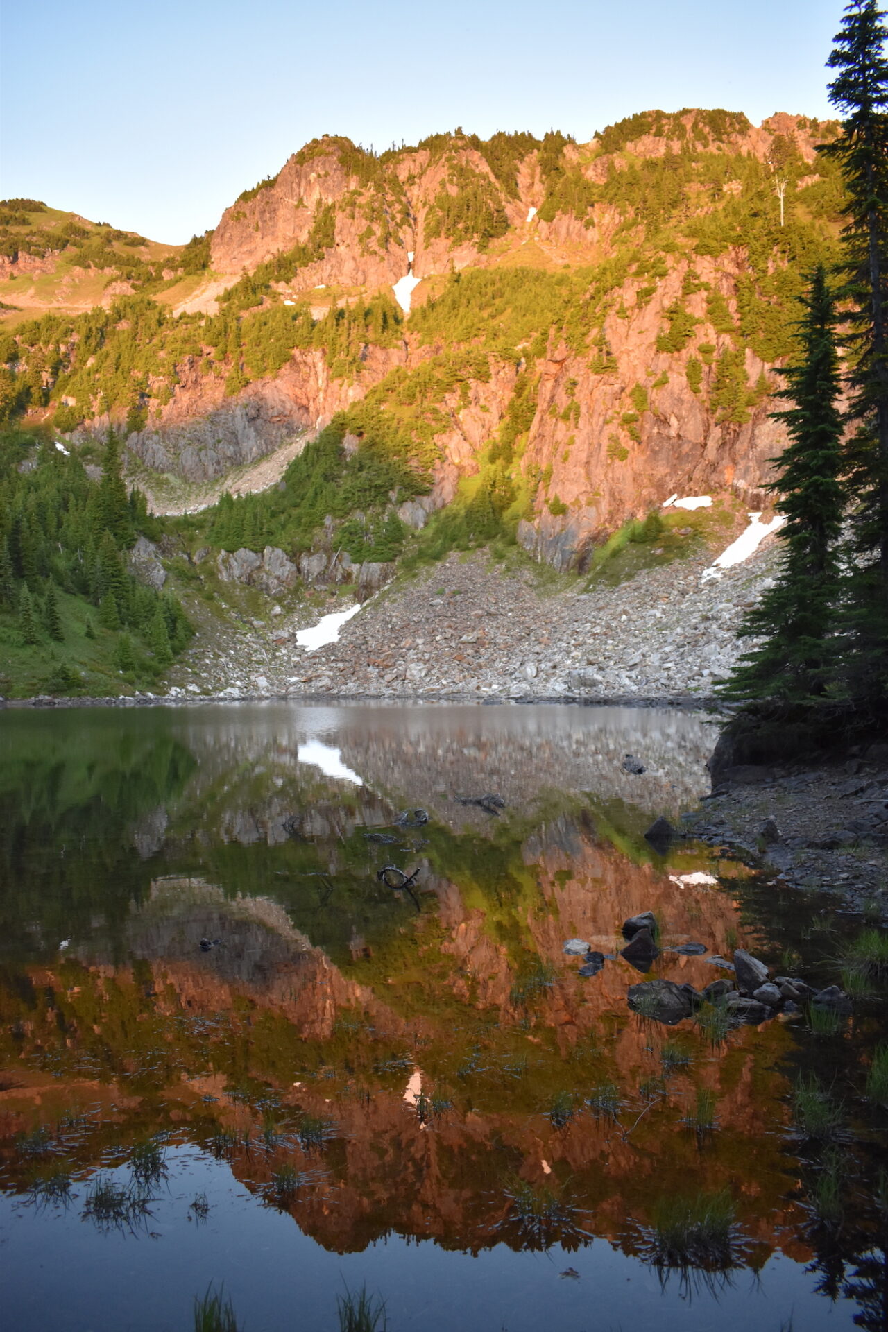
Shortly after Dishpan Gap, the loop turns off the PCT and heads west on the Bald Eagle Trail. In about a mile there is a high route to Blue Lake, a bit of a shortcut that climbs up to the top of a ridge and then descends steeply on scree slopes down to the lake. Alternatively, you can follow the trail around the south side of the ridge, which adds about 2.5 miles and avoids a lot of ascent and descent.
My knees were already cranky and I was uncertain if there would be lingering snow on the north face of that steep descent, so we agreed to take the long way around. It also didn’t put us that far out of the way since our destination for the night was Little Blue Lake further to the south. In hindsight, we probably should have taken the shortcut and enjoyed the views, but the long way was certainly fine. It’s a bit brushy and obviously less frequently used and the descent to Little Blue Lake does seem never ending. I was getting pretty tired and hungry and a little cranky after 15 miles, so I kept checking my map, wondering why the heck we hadn’t reached Little Blue Lake yet.
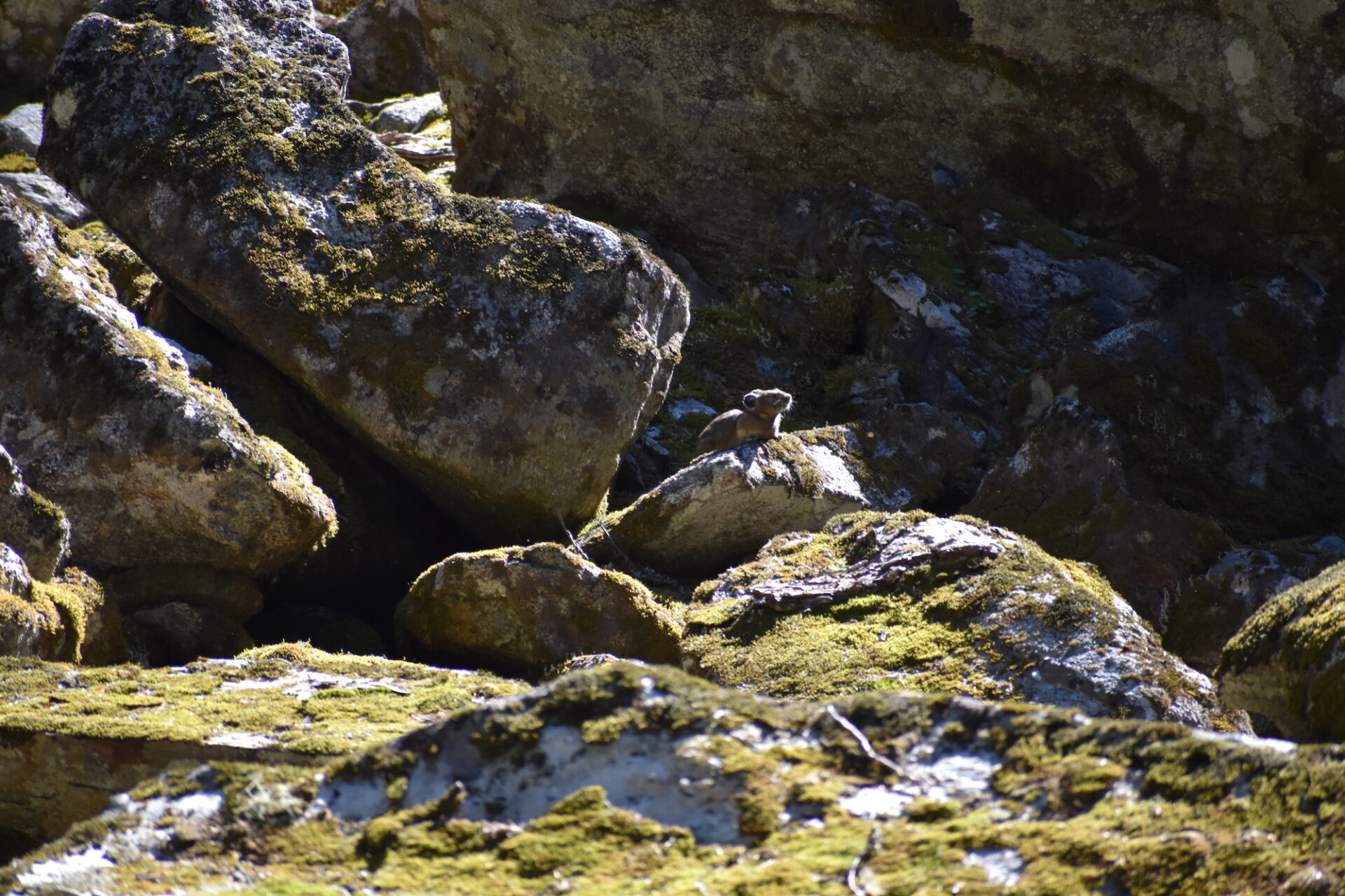
At last, we landed at a small tarn with a fire ring, though a bit boggy for camping. We explored up the trail and found a large flat campsite in the trees with considerably less mosquitoes. Though it wasn’t quite a glamorous lakeside camp, it had great shelter and even better? Other than lots of pika in the rocks nearby, we were the only ones around.
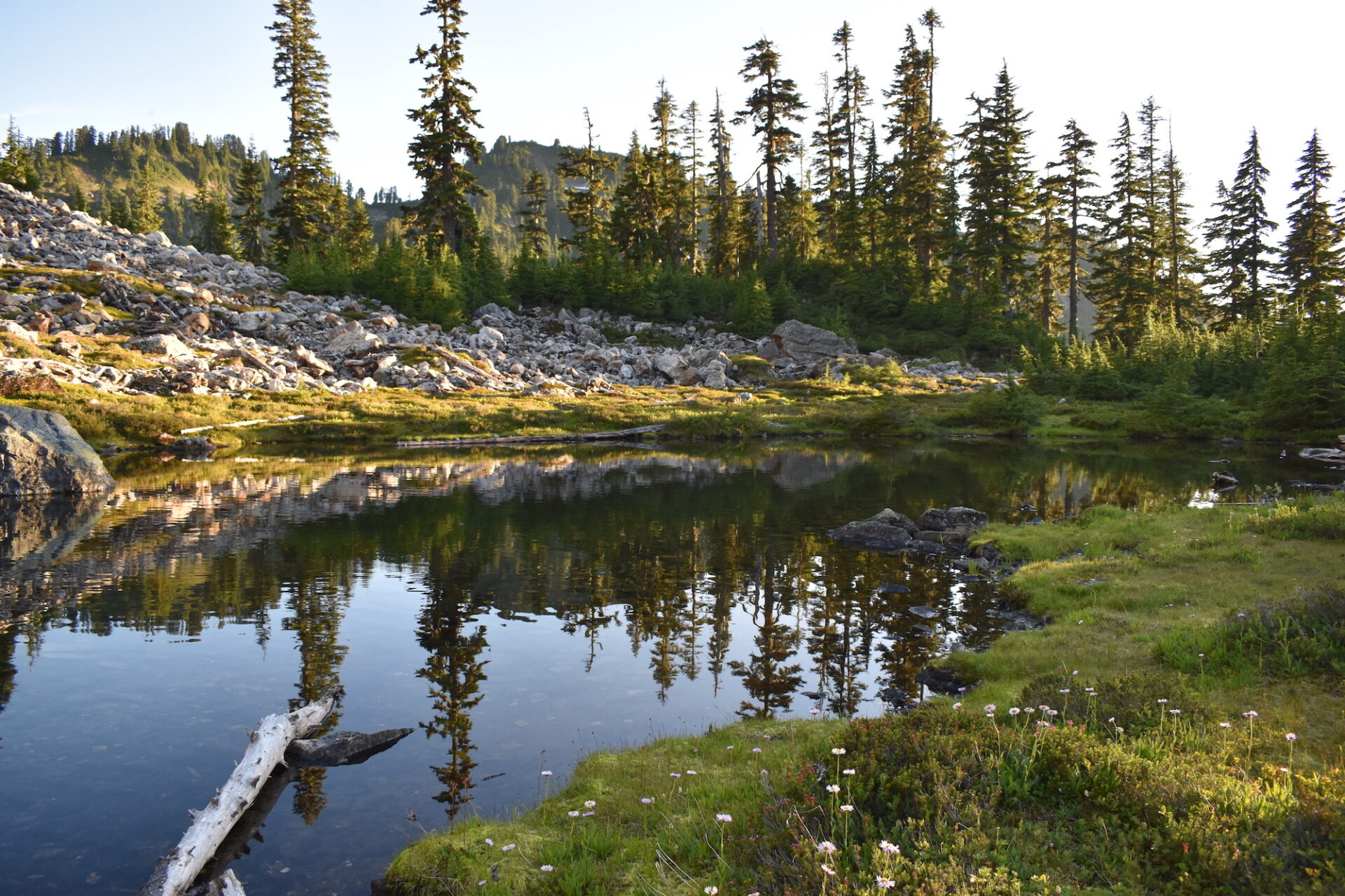
Even with good bug spray the mosquitoes were relentless, so I enjoyed dinner from the comfort of my tent. Just before sunset we took a quick walk up trail and found a larger lake, which we thought was Blue Lake, but it didn’t quite compute. Blue Lake was supposed to be fairly popular with lots of campsites and this lake had none. We hiked up the trail further and there was nothing. Where the heck was this magical Blue Lake!?
After two long days on the trail, I ran out of lake finding energy and promptly went to sleep well before dark. A few hours later I was awaken by the sound of wind ripping through the trees above us. That night I was thankful that again, we had found a nice sheltered campsite because the wind blew strongly all night through the valley.
Day 3: Little Blue Lake, Johnson Mountain, North Fork Sauk.
Distance: 12.8 miles | Elevation Gain: 2,961’
The next morning Damon and I couldn’t believe how strongly the wind picked up overnight. We were both a little worried to be camping under trees but also happy that we were somehow mostly sheltered from the stronger gusts.
We enjoyed another leisurely morning, eating breakfast, relaxing, and thoroughly enjoying the simplicity and solitude of waking up in the mountains. There really isn’t anything in life that is more enjoyable!
We were also eager to get to the bottom of whether a larger Blue Lake was just up trail from us, so we hiked out towards the Pilot Ridge Trail, which would lead us about 10 miles back to the North Fork Sauk and the end of our three day journey.
At the junction with Pilot Ridge we saw a very worn, broken, and nearly illegible trail sign. Had it been legible and had I bothered to check my map, I would have seen that Blue Lake was 0.2 miles to our east. Instead, we headed west up the Pilot Ridge Trail, intent on our 2nd bonus summit, Johnson Mountain, also a former fire lookout site.
Along the climb I stopped to take in the views and chat with a hiker behind me, carrying a backpack and tools, who I assumed was a trail worker. Turns out he was a wildland firefighter based out of Darrington who had been dispatched to Blue Lake for an out of control campfire. He confirmed that yep, we hadn’t quite made it to Blue Lake, but also said it had been overflowing with campers the night before.
Sure enough as we climbed further up the ridge, there was the large, deep blue, sparkling lake below us that we had somehow missed. I caught up to Damon on the saddle ahead and he was already chatting with two other firefighters, who mentioned Blue Lake wasn’t at all sheltered from last night’s strong winds and it had caused a bit of a chaos.
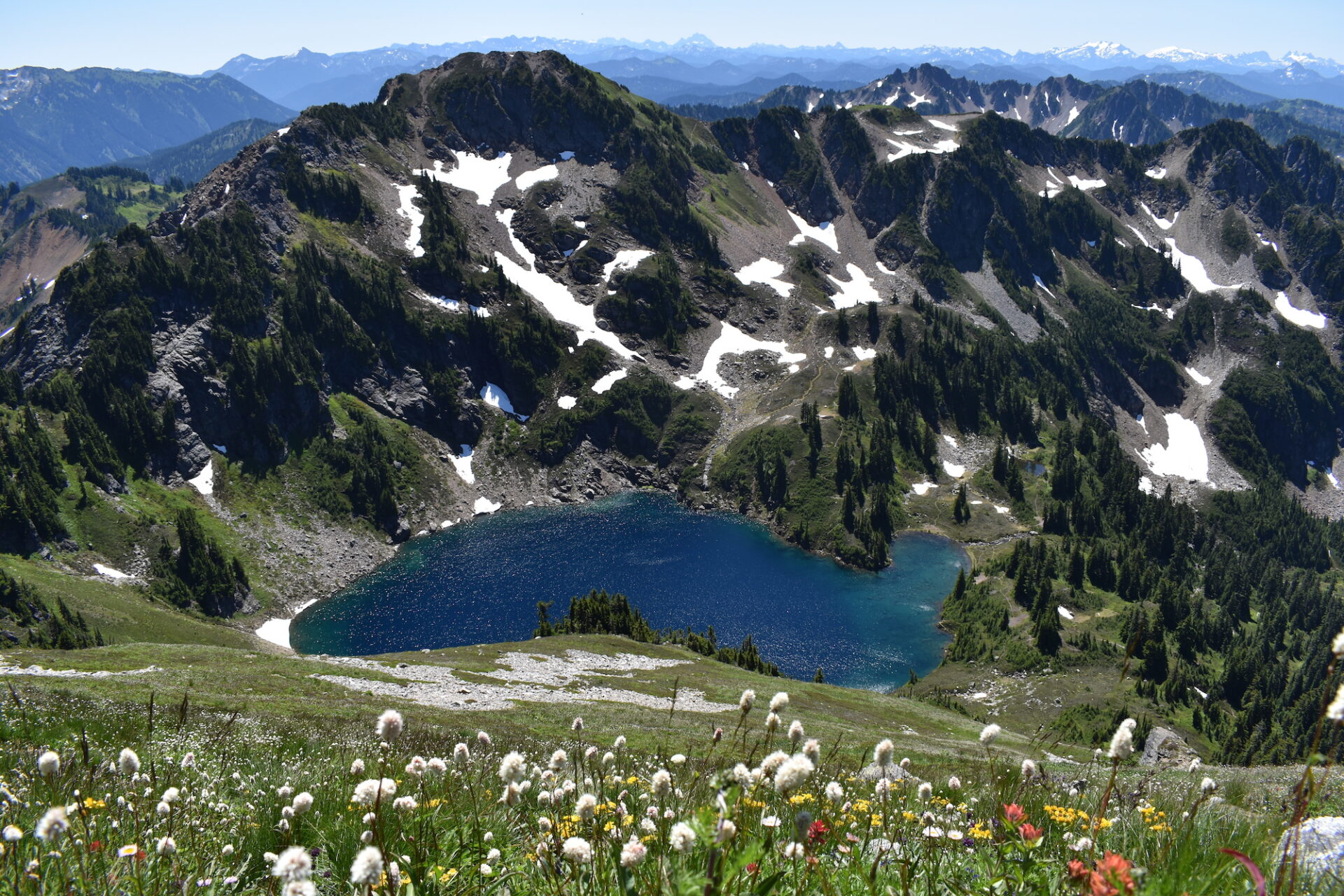
Although we had indeed missed Blue Lake, we were extra thankful now for our camp at Little Blue Lake since we had it all to ourselves and were sheltered from the crazy wind!
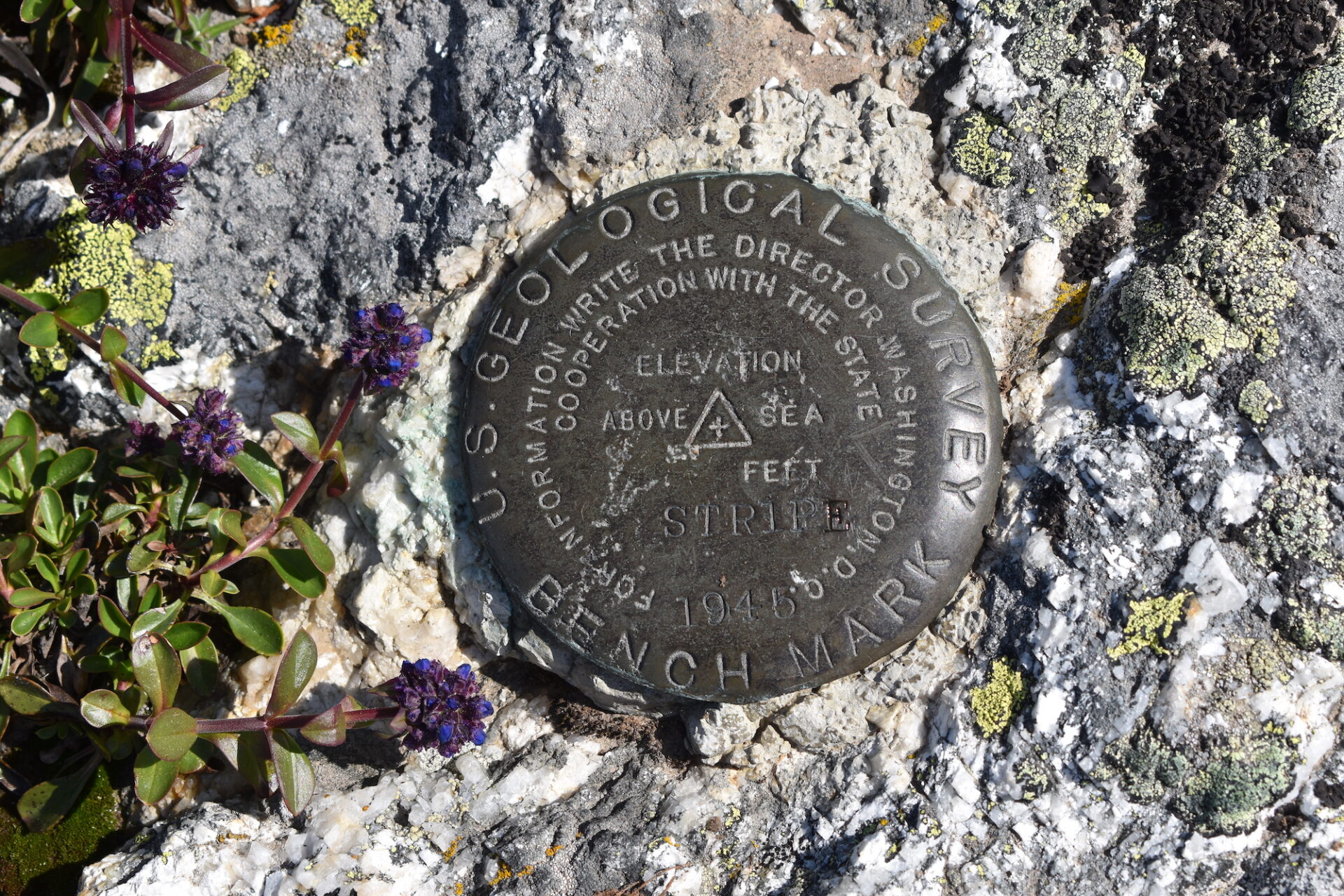
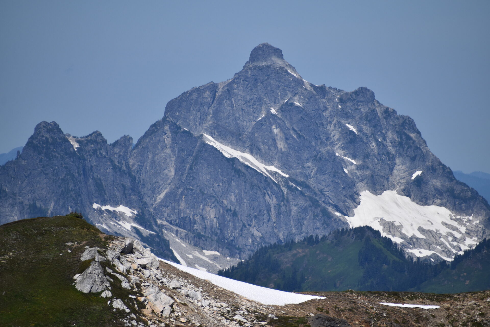
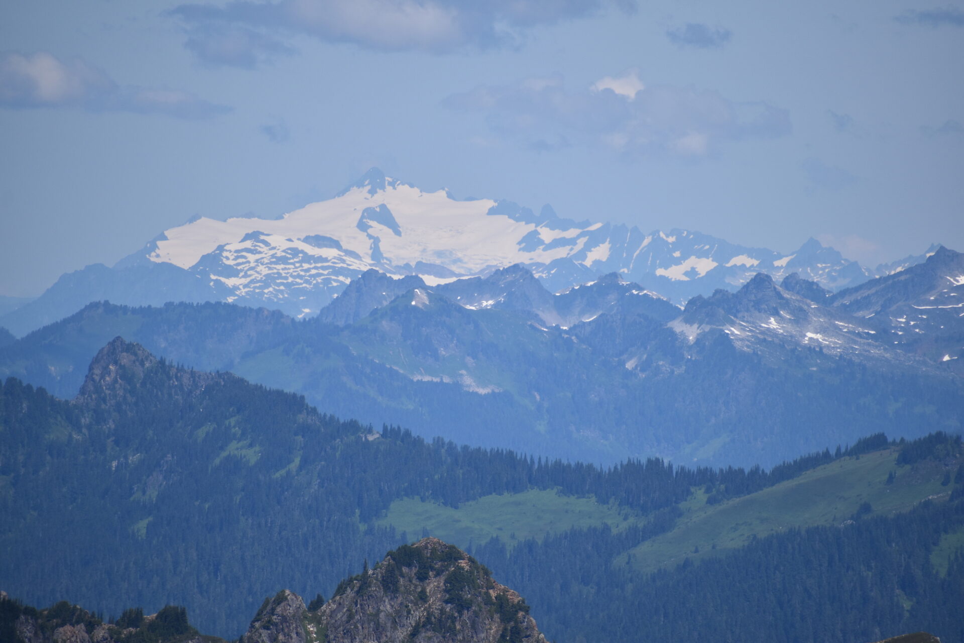
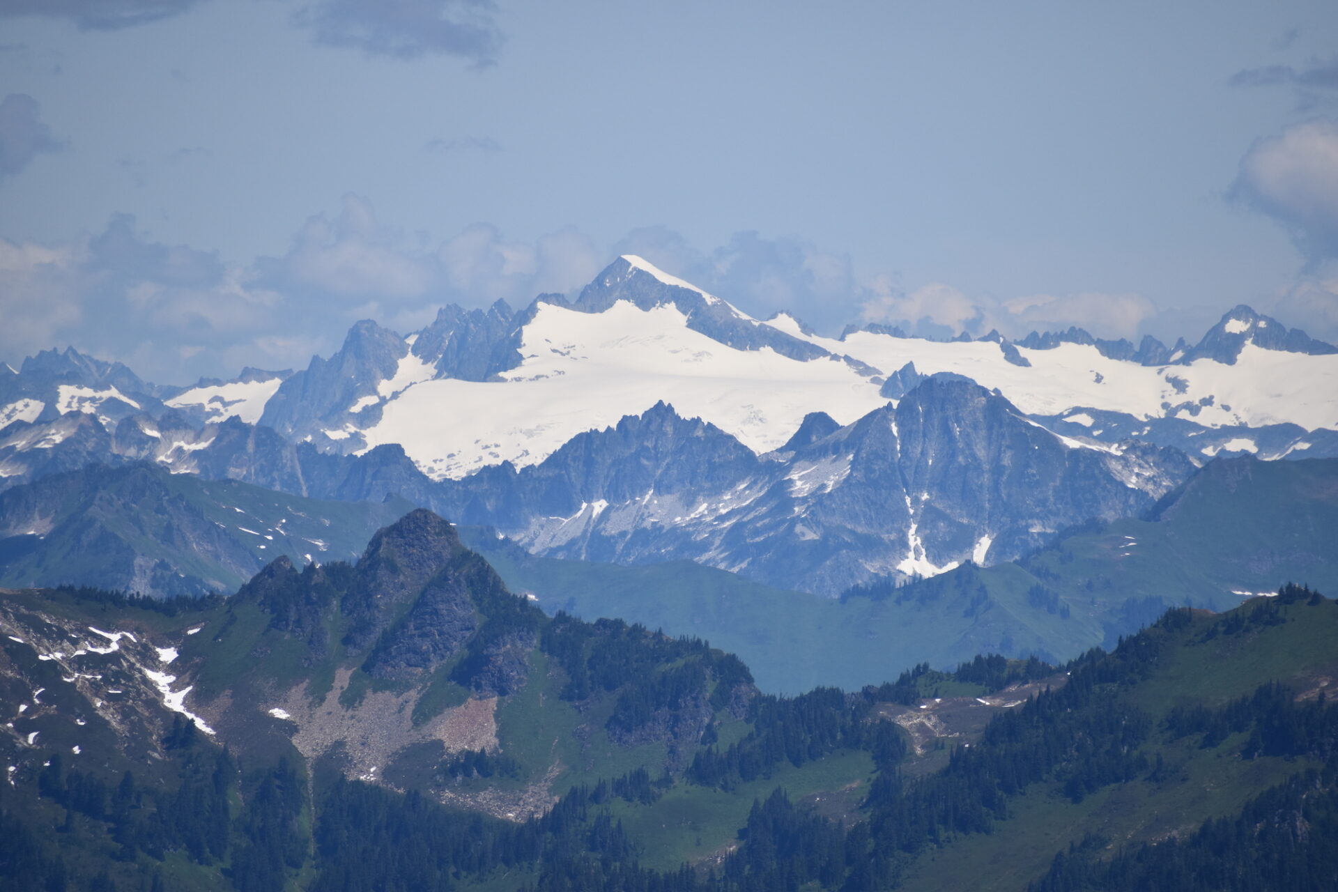
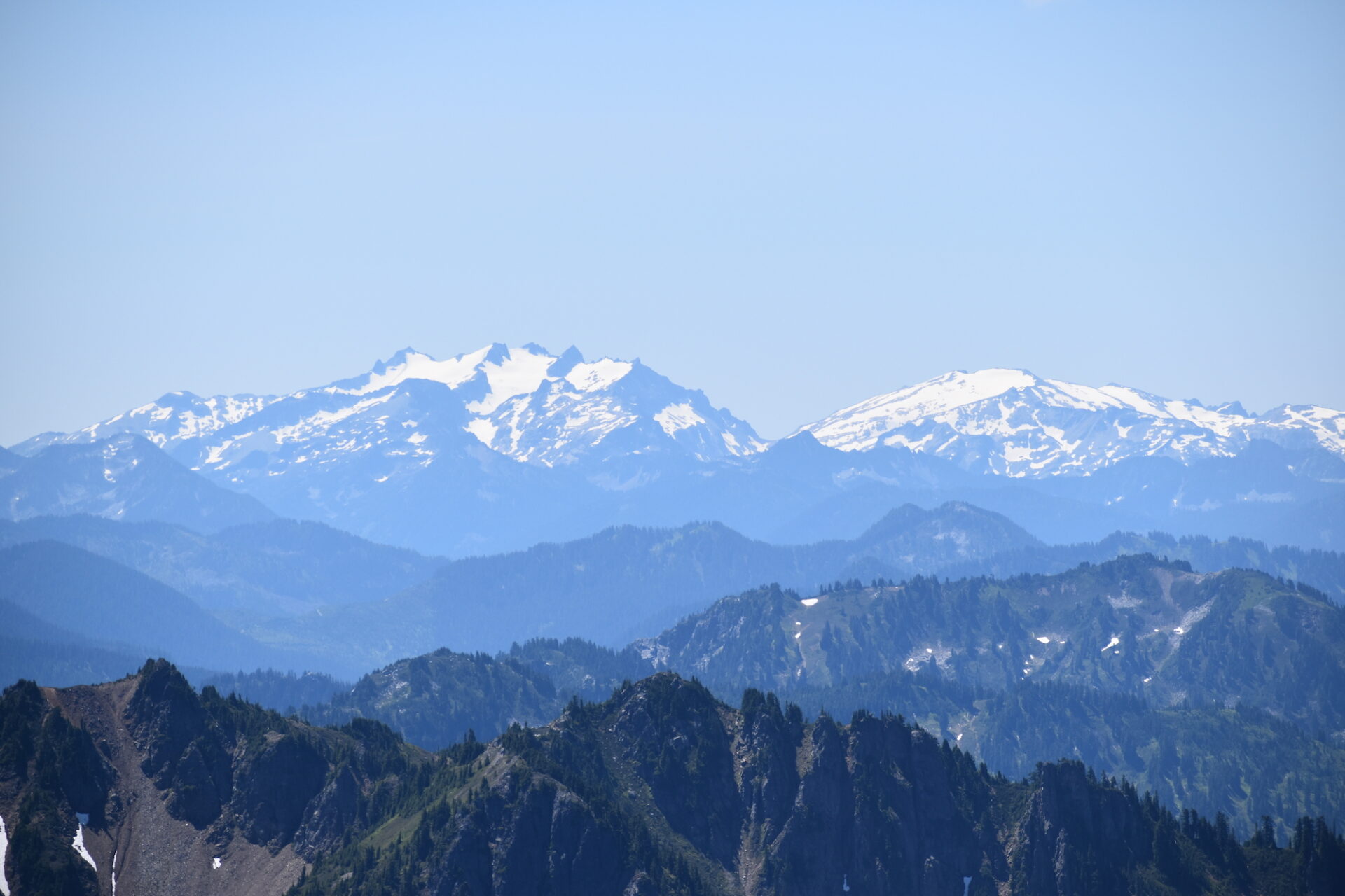
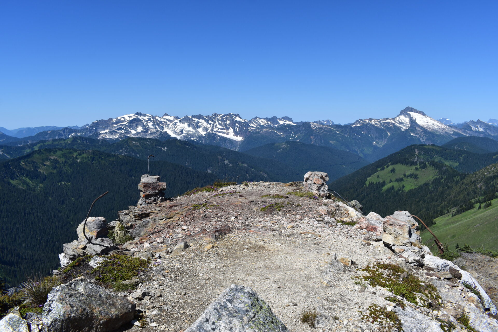
The firefighters headed back down Pilot Ridge for home and we dropped our packs and headed up the short half mile climb to Johnson Mountain. Not surprising for a former lookout site, it had tremendous, strategic 360° views including a beautiful view of Mount Baker.
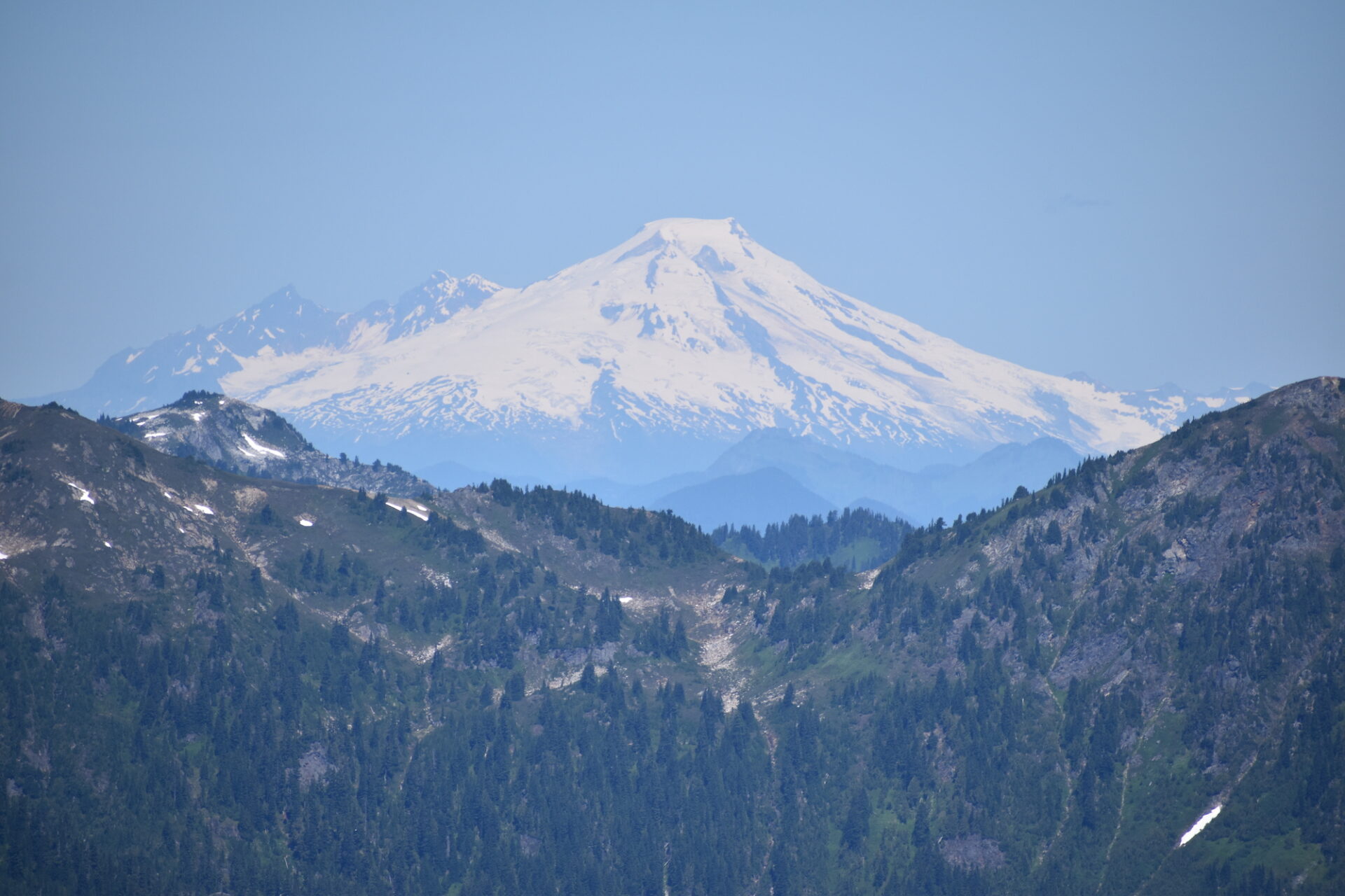

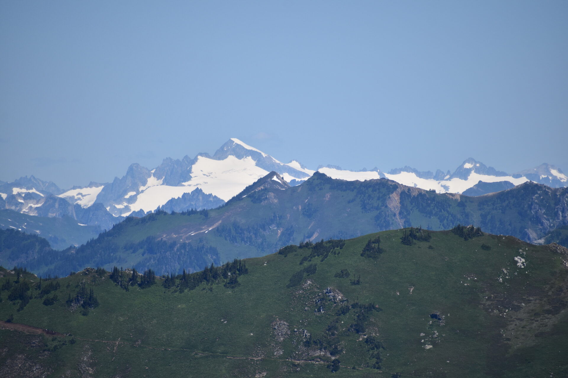
The stone foundations of the old lookout tower remained along with bent steel rebar, a charred piece of wood, and what looked like melted, old lead glass. I wonder if the lookout tower had been hit by lightning? Burned to the ground? All I could find about it was that it was an L-4 cab built in 1938 and abandoned in 1959.
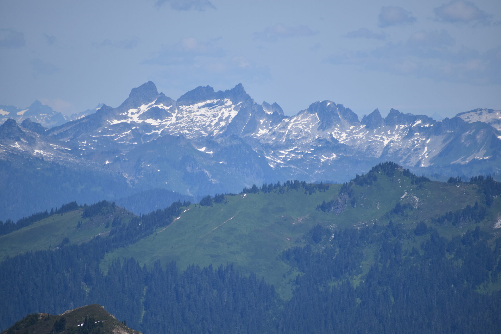
Again we managed to score the summit all to ourselves and thoroughly enjoyed the solitude and wildflowers all around. After a while, we reluctantly headed down, realizing we still had 10 miles to cover.
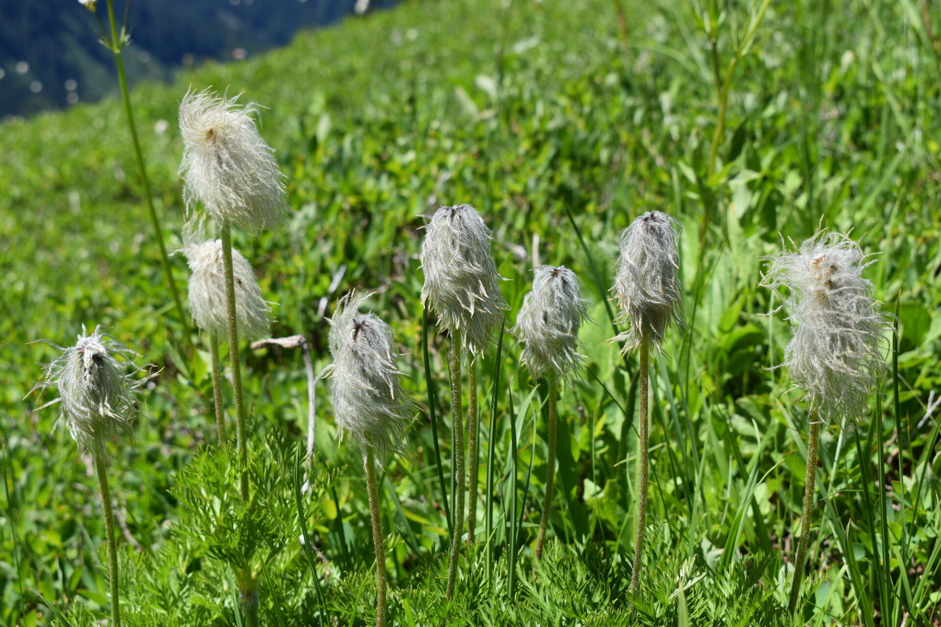
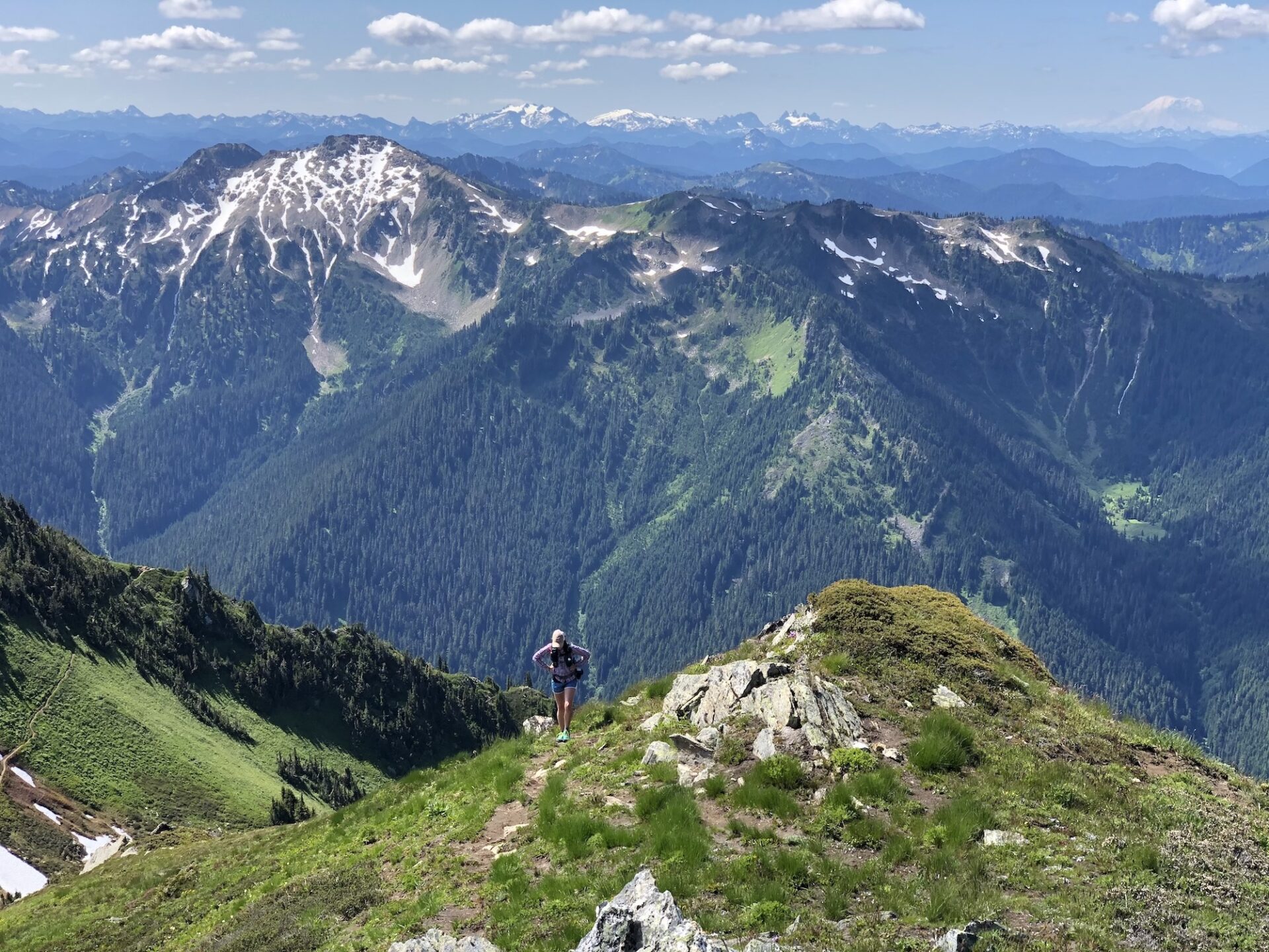
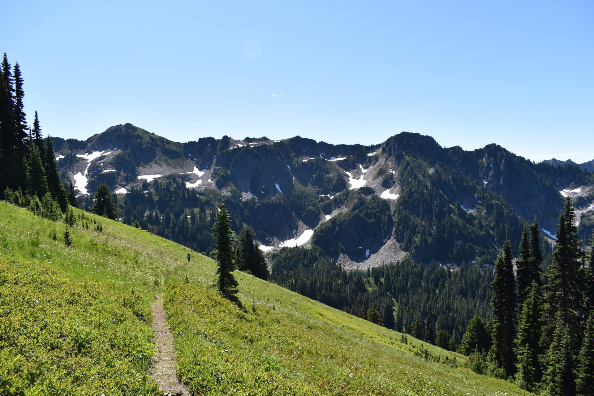
The traverse across Pilot Ridge was full of easy miles and as Damon disappeared ahead of me on the trail, I happily trekked along, stopping a few too many times to take photos of the flowers and the scenery. A few miles later I hit some surprisingly steep, punchy climbs that I didn’t expect, then the trail took a very steep turn downwards.
I assumed we had hit the summit of Pilot Ridge and were starting the descent down to the Sauk. I was wrong.
After that steep descent I ended up climbing relentlessly up again. WTF!? I pulled out my map several times, which was ridiculous since the only place this trail went was back to the Sauk. I was simply trying to understand why I was still climbing to the sky instead of descending and sure enough, the map showed a small climb, though it certainly didn’t look as bad as it felt! Funny how maps work that way sometimes.
If you ever do this loop, be prepared for more climbing than you expect up to Pilot Ridge. Eventually, the trail does turn a corner and say goodbye to the beautiful views of Glacier and surrounding peaks, dropping 3,000’ over the next 2.8 miles straight down to the Sauk. Most of the descent is unremarkable, but then, as I neared the river, I couldn’t help but notice the trail transform into a magical green paradise with towering trees and prehistoric Devil’s Club. It may not have been sweeping mountain views, but this deep green forest is beautiful and magical.
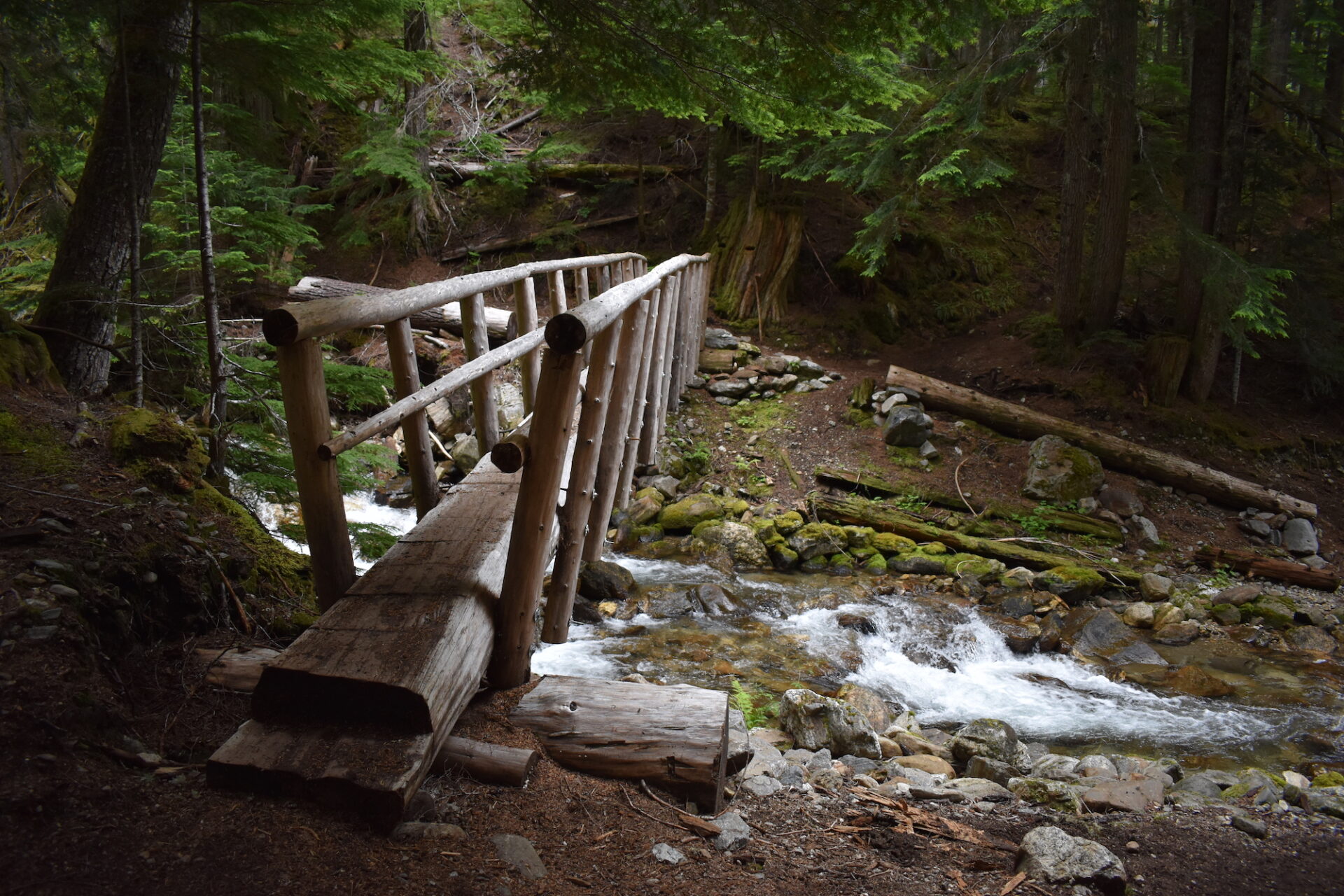
After a long journey down, I finally reached the Sauk, which requires crossing a log to the other side. I hate log crossings, but this one was perfectly fine, so if I can do it, anyone can! There are two options, one to the east that has a few tangled logs and a single log marked with cairns that is wide and sturdy.
I easily reached the opposite site of the bank on the single sturdy log, then faced my next challenge: a yawning chasm before me. The log straddles a rather deep, but short eroded gully, which honestly is a bitch to climb over or out of, even with an ultralight pack.
Three people barely 20 feet away occupied a camp site right next to the log, oblivious to the struggle I was waging, trying to climb out of this silly gully. It was comedic really. Here I had made it nearly 40 miles and I was convinced this gully would be the end for me. Somehow I finally crawled up and out, popping out into their campsite and apologizing for surprising them.
I’ll admit that I was a little confused which way to go after that, which seems a bit ridiculous. I pushed my way up to a junction with a sign pointing “PCT” to the right and “Sloan Creek Road” to the left. I knew left was the way, but the Sloan Creek Road sign confused me a bit, so I checked my GPS more than once to be extra sure.
My tired feet and knees seemed to know I was almost done and they relaxed, allowing me to bound along quickly, a big smile on my face, marveling at the towering trees over my head. A mile from the trailhead I passed an older gentleman with a pack. I stopped to say hi and he told me he was starting the loop I was just completing. “You sure have a big smile!” he said. “Everyone else looks beat.”
Yep, a big smile indeed! It was a fantastic three days in the wilderness!
I shared trail conditions and we chatted briefly before I skipped off, finally reaching the trailhead and reconnecting with Damon, who was fast asleep in the car, hiding from the mosquitoes. On the drive out we turned a corner and saw a bobcat running down the road. We smiled and marveled at the weekend, full of amazing views, surprising solitude, and incredibly rewarding wilderness.
Total: 41.5 miles | 11,500′ gain
Tip: If you do have plans to complete this loop, know that there is no water between Blue Lake and the Sauk. There was a small stream more than halfway down Pilot Ridge, but I doubt it’s reliable later in the season. I ran much leaner on water the 3rd day than I would have liked. Definitely plan ahead!