It was way back in 2000 during one of my early visits to the Methow Valley of Washington State that I first heard about the Pasayten Wilderness. I was chatting with someone in town about great hikes and places to explore and they told me about this huge stretch of wilderness along the Canadian border with over 600 miles of trails. Back then I was only a fledgling adventurer. The thought of entering that kind of vast wilderness was daunting. I’m intrigued by wild places though and it stuck in my head.
A number of years later during one of dozens of trips to the Methow, I booked a stay at the newly opened North Cascades Mountain Hostel in Winthrop. As I sat down at the kitchen table to enjoy dinner and some conversation, I noticed on the kitchen wall, taking up the entire wall, was a map of the Pasayten. Well, it was more like 8-10 Green Trail Maps all taped together because it’s just that big. I poured over the maps, looking at all the trails, seeing all the peaks, and thinking “Damn. You could get lost here for years. I must go!” I can’t explain it. It was calling me.
The seed was planted and my little mental hamster started running a bit faster.
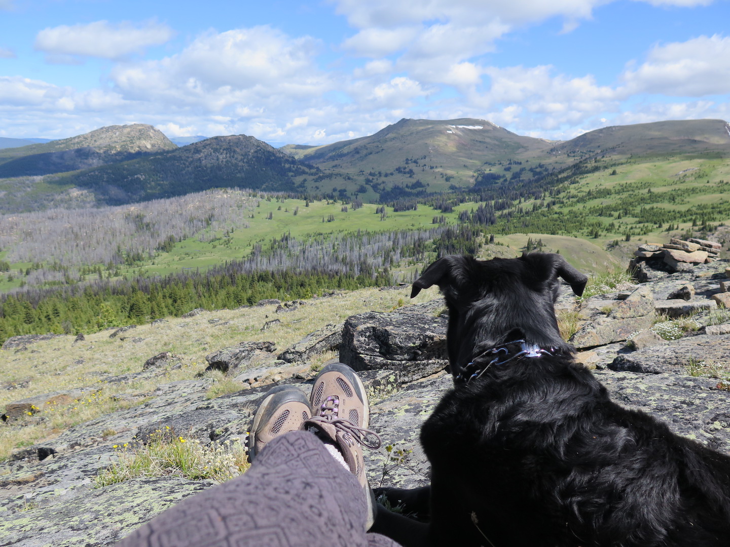
This past 4th of July weekend I finally made my Pasayten pilgrimage come true. I ventured to Horseshoe Basin, far in the northeastern corner of the wilderness, for a 3-day/2-night backpack and peakbagging slam. After some difficulty coordinating schedules with friends I chose to go solo with my best adventure buddy Jake dog.
Years ago I never would have dreamed of backpacking solo! These days though, especially after spending time on the JMT last year, it doesn’t seem the daunting adventure it once was. Sure, I admit to having a tiny bit of trepidation, but once I’m out there it fades quickly. My solo trips are nearly always my favorite. There’s something special about just you and nature (and a dog!) that is like chicken soup for the soul.
The Pasayten Wilderness.
Spanning 531,000 acres and skirting more than 50 miles of the Canadian border, The Pasayten Wilderness is one of the largest wilderness areas in the contiguous US. It contains nearly 150 peaks over 7,500’ in elevation and over 160 bodies of water. It’s home to the largest population of lynx in the lower 48 and deer, moose, mountain goats, wolves, bighorn sheep, and perhaps even the elusive grizzly roam here.
I love places imprinted with history and the biggest allure of the Pasayten is its rugged, raw past and immense solitude. It’s primarily horse country and for over 6,000 years has been a grounds for hunting and mining. Some of its landscape is charred by fires. Dirty mining camps and relics can be found throughout its borders. To the east is high alpine tundra-like meadows unlike anything in Washington State. To the west are the high crags of the North Cascades. It’s an explorers paradise and little bits of history can be found everywhere.
One of the biggest challenges of visiting the Pasayten is simply getting there. Access from the west requires a long trek in from Ross Lake or Slate Peak outside Mazama. The east is reachable via a short hike from the Iron Gate Trailhead outside Loomis, Washington, but the drive will take you 6 hours from Seattle. In fact, it’s a long drive from everywhere! Even from Spokane it’s a surprising 5 hour drive. There are access points in the middle but most require either a long drive or a long hike.
The Tiffany Mountain warm up.
To break up the long drive, I left Seattle on Thursday and headed to the Methow Valley. Somehow after 11 years of crazy adventures with my dog we somehow had never been backpacking together! I couldn’t believe it and decided a test outing was in order before proceeding to the Pasayten.
I’d been to Tiffany Mountain, north of Winthrop, many times and it’s one of my favorite destinations in the area. Its lofty 8,242’ summit is easily attained in only 2 miles and true to being a former fire lookout site, the views of the surrounding North Cascades are tremendous. It would make for a fantastic and quick overnight outing. I rattled my old Jeep up the washboards to Tiffany and arrived at the trailhead around 6:30pm. I felt a bit disorganized as I packed our gear. Dog treats? Check. Dog food? Check. Doggy sleeping pad? Hmmm, need to strap this to my pack somehow. How did a simple one night trip become so complicated!? I simply wasn’t used to backpacking with a dog!

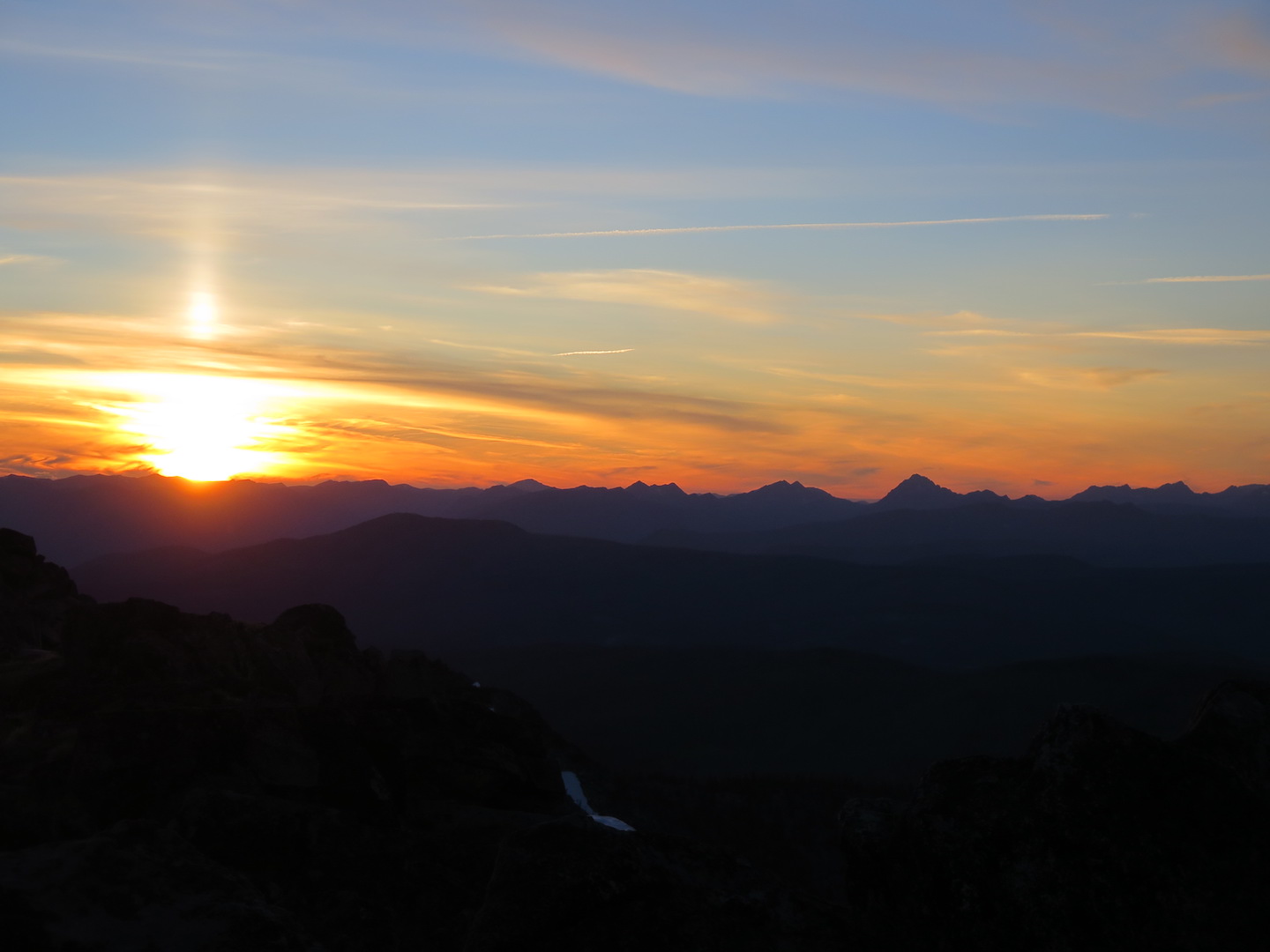
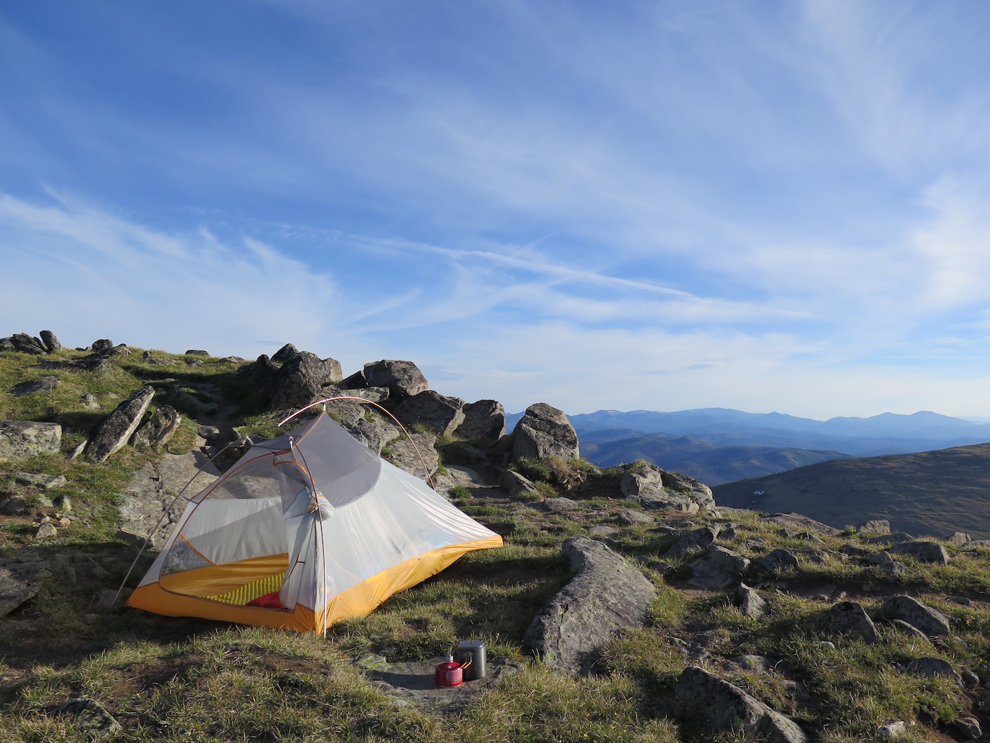
Since it’s a dry trail, I had packed what seemed like a ridiculous 4 liters of water. Despite the extra weight, we made the summit with plenty of time to set up camp and enjoy dinner before a stunning sunset turned the sky a dazzling display of red and orange. Man how I love the North Cascades! I found a tiny bare spot right on the summit just big enough for our tent and Jake dog and I were the only ones around for miles. It was a perfect night of solitude and beauty. How lucky we were!
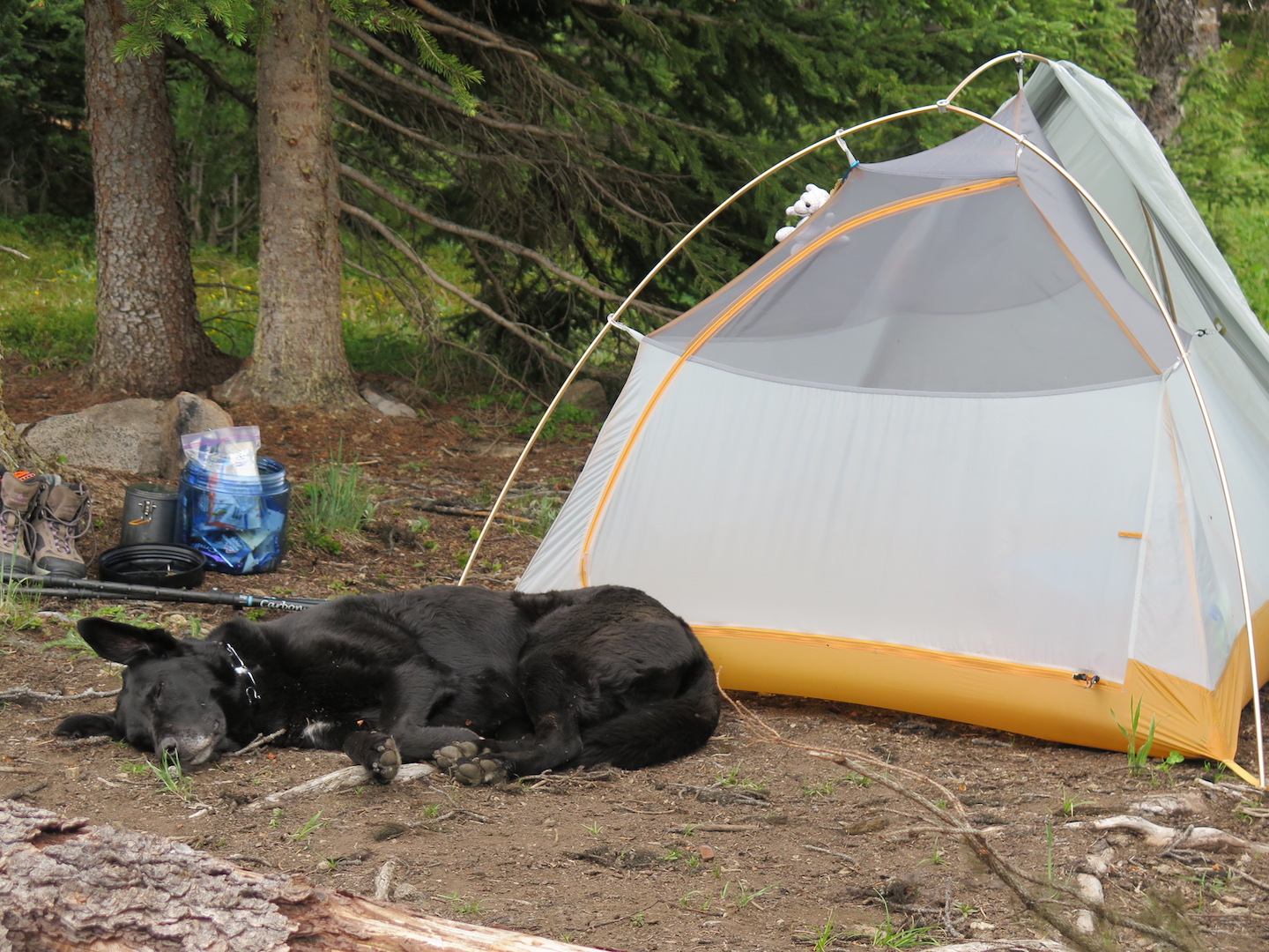
When it was time for bed, Jake jumped into the tent and stayed on his sleeping mat the whole night. I was rather surprised we both fit comfortably in my tiny Big Agnus Fly Creek tent. We had little trouble sleeping despite the fact that it was light out until after midnight! The only downside to North Cascades mountaintop camps in the summer I suppose.
The next morning I awoke to a stunning sunrise, eager for a fresh cup of joe only to realize that somehow we had consumed nearly all 4 liters of water! I made a tough call to forego my morning coffee and breakfast scramble, pack up camp, and head to town. It was only a 2 mile hike out, so it wasn’t a huge deal.
Lesson learned: dry hikes with a big dog require hauling up a water tanker. Thank goodness Horseshoe Basin would have water sources.
On to the Pasayten!
With our backpacking trial a success, we set off for the 3 hour drive to Loomis and the Iron Gate trailhead. About 6 miles from the trailhead the road turns rough and though I saw one or two lower clearance vehicles at the trailhead, I’d certainly recommend a high-clearance vehicle unless you don’t mind beating up your car. I arrived at the trailhead around 1:30pm on Friday to about 8-10 other cars.
Nearly every Horseshoe Basin trip report I’ve read has said that once you arrive, you never want to leave. Looking back, I can’t disagree. It would have been easy to stay a week or more! I went in with enough food for 2 nights, later wishing I had packed for 3.
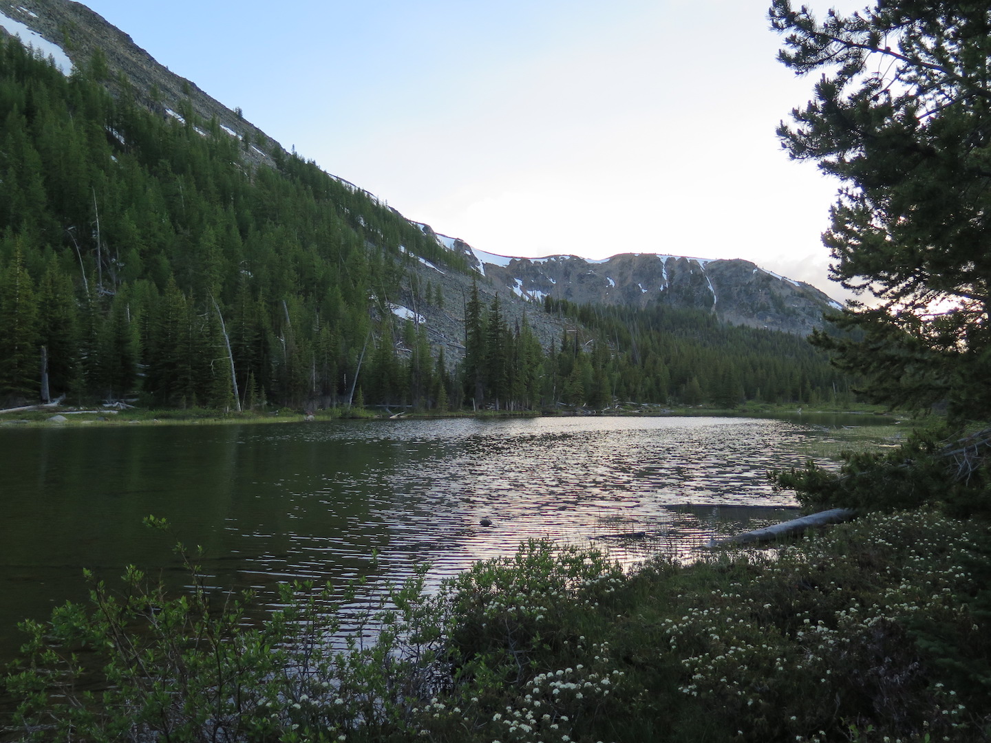
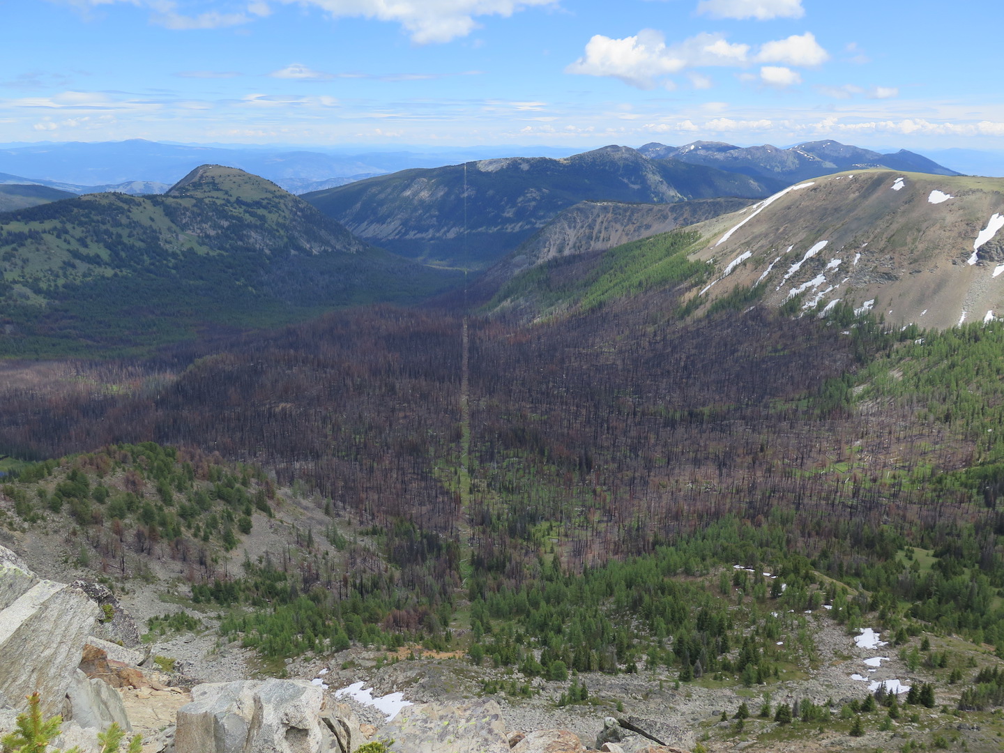
The basin lies at an altitude of around 7,000′ but the trail from Iron Gate is an easy 6 mile hike covering a scant 1,000’ of elevation. Shortly after heading out we were greeted by a stretch of beautiful wildflowers before entering a charred forest of snags. Friday’s weather was overcast and comfortably cool with just a few sprinkles of drizzle. It made for a refreshing hike.
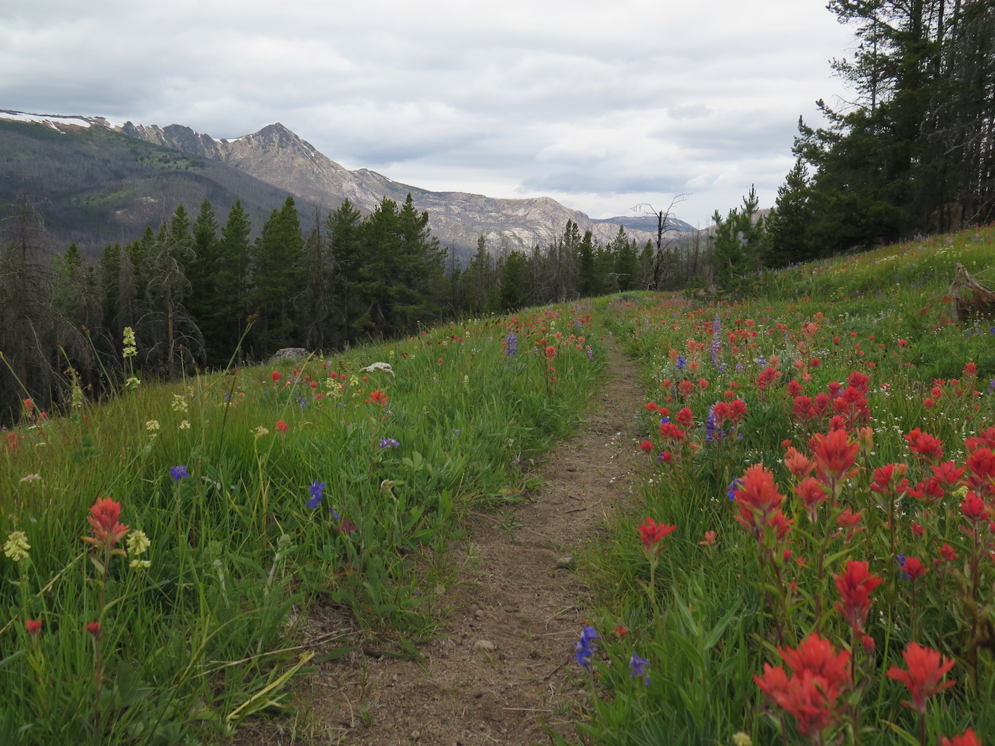
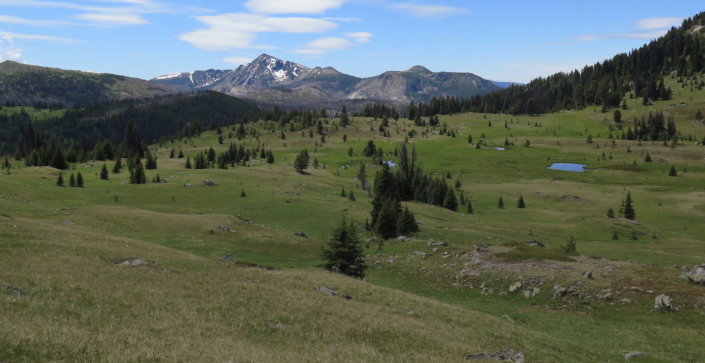
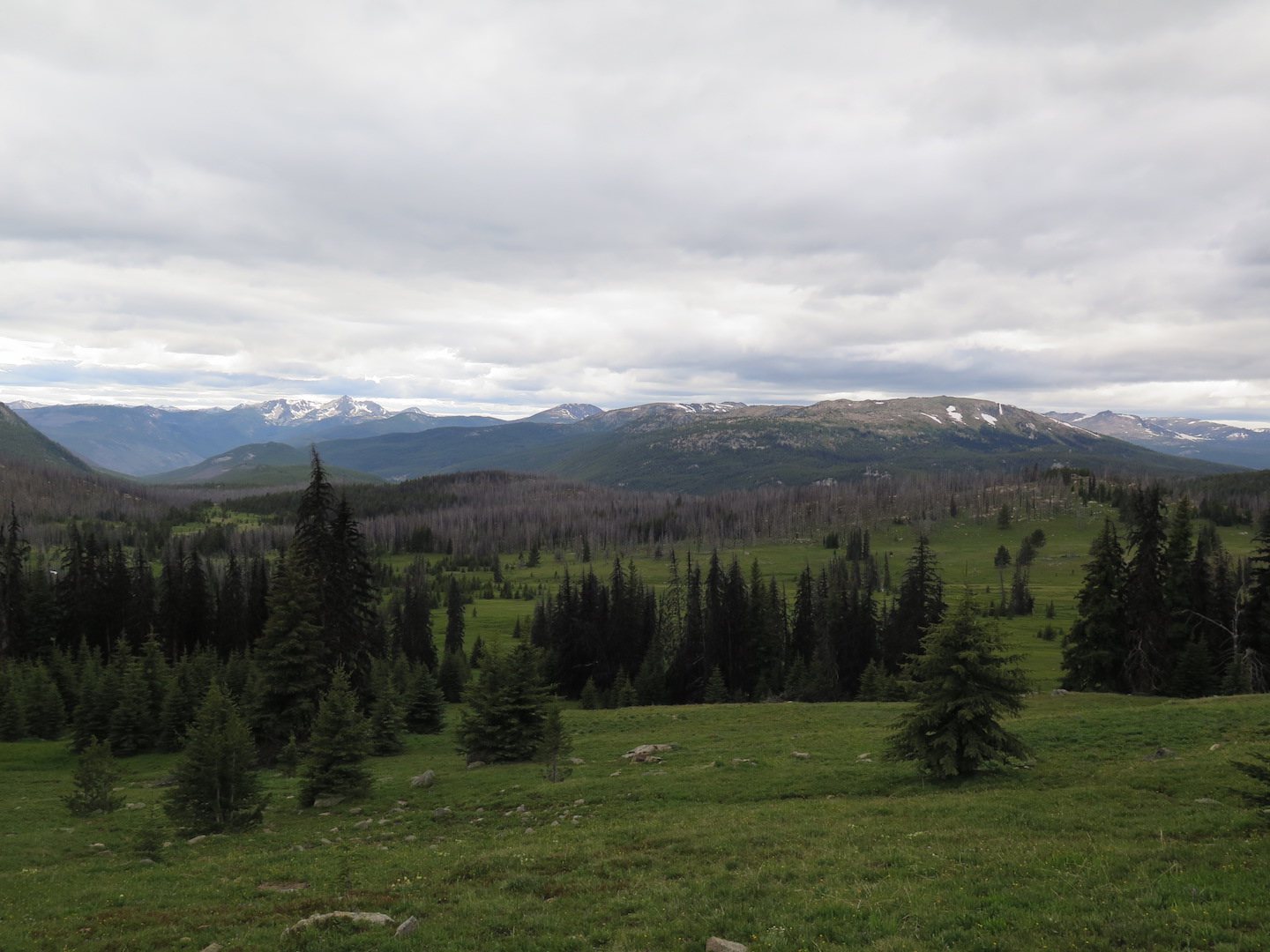
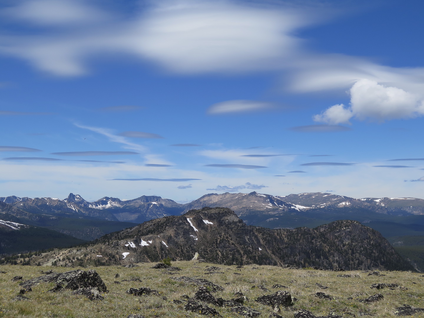
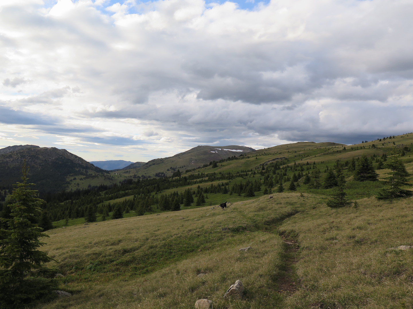
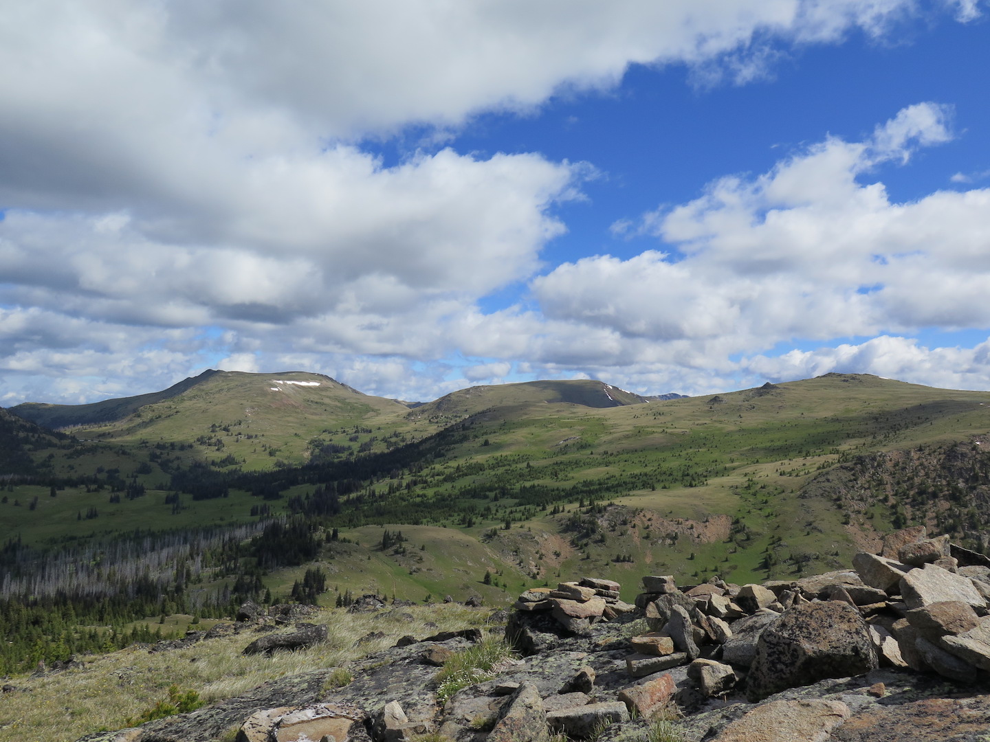
Hiking through burn scars isn’t the most glamorous but the landscape changes drastically once you arrive at Sunny Pass. I was floored by the sprawling alpine meadows, the wide open space, and endless cross-country peakbagging options. As you climb higher the craggy North Cascades slowly unveil themselves as an amazing backdrop.
I took a quick break to admire the landscape and a gentleman setting up camp at the pass waved at me. He introduced himself as the local wilderness ranger and told me I could find numerous great campsites near the junction to Smith Lake as well as up the flank of Arnold Mountain. He said a few parties were already set up at Louden Lake, the more popular spot in the basin. I thanked him for the information and we chatted a bit before I set off again. The scenery just kept getting better and better!
After hiking a mile to the Smith Lake junction I decided to push on another mile to Louden Lake to scope out the camping situation. Indeed, there were about 5-6 tents already there. Strangely though, all this vast sprawling landscape made it feel anything but crowded. The lake would have made a great base camp but there was little shelter or privacy. I backtracked to the junction with Smith Lake and found a fantastic huge campsite tucked away off the trail and near to water. It was perfect!
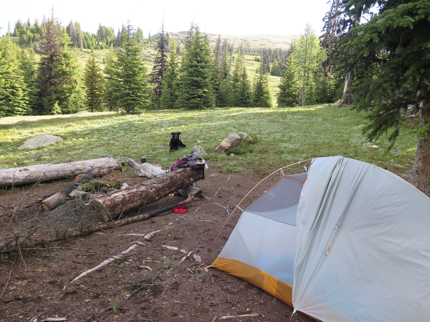
I pulled off my pack, sat down, and was instantly greeted by mosquitoes. Noooooo! There aren’t many things that I truly hate, but when it comes to mosquitoes, I can’t understand why we can’t just nuke the damn things off the planet!!!! As much as I hate them I still can’t bring myself to use DEET so I hosed down with my Herbal Armour and hoped for the best. It did a reasonable job of turning me into a walking citronella candle that mostly kept the mosquitoes at bay. I felt awful for poor Jake. He curled up on the ground and though he didn’t seem to care too much, mosquitoes quickly went for his face, the only place they could get through his thick fur. I sprayed him in Herbal Armour but it didn’t do much good for him. Does anyone even make doggy mosquito repellant?
The bugs were annoying but certainly not the worst I’ve experienced. As long as I stayed moving, they weren’t too bothersome. I took it as a sign that we simply needed to explore so after setting up camp Jake and I took a hike to Smith Lake, about a mile to the east of camp. I discovered a fantastic little campsite right at the end of the lake and nearly considered packing up and moving! I’ll certainly remember it for next time.
That evening as both Jake and I slept soundly, the clouds cleared out and we awoke to a beautiful sunny morning! My goal for the day was to climb some of the nearby peaks, especially Armstrong Mountain, which is dotted with two large obelisks marking the US-Canada border. Walking across is at your own risk. I’ve heard reports of Blackhawks patrolling overhead as well as border patrol agents on foot and on horse. The wilderness ranger I met at Sunny Pass told me that border agents are in the area from time to time but more frequently patrol to the west. Come on, who can resist simply strolling right over into Canada?!
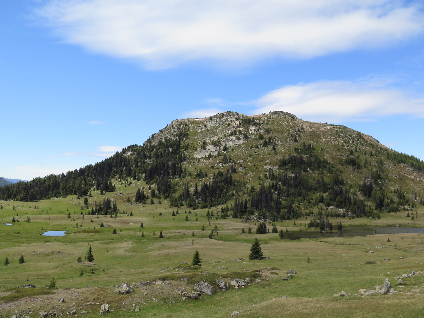
Since Jake had an abundance of energy that morning, I filled his pack with our lunch and snacks for the day and he graciously carried our provisions. We hiked the mile to Louden Lake, dropped our packs, and set off for our first peak: Rock Mountain (7,617’). Located on the southern edge of the lake, it’s an easily attainable yet relatively steep cross-country scramble of 600’ over about a half mile. As we made our way up and arrived at a false flat just to the west of the real summit, I saw something dart across the terrain. It was a coyote pup, not more than 30 yards from us! My immediate instinct was to keep Jake close and look for mom.

It wasn’t long before mom made her presence known, yipping at us from the opposite side of the flat. I’m never one to underestimate wild animals, especially when they have babies, but to get to the true summit of Rock Mountain we needed to skirt by where the pup was hiding out in the rocks. We continued up, giving the coyotes the widest berth we could. Mama coyote finally quieted down when we had moved away from the pup and up the mountain further.
It was an amazing encounter! And a great reminder that keeping your dog leashed or under strict voice command is a necessity when you’re out in remote wilderness. Luckily for me, Jake doesn’t chase and when I immediately told him to stay he obeyed without hesitation. He seemed to have no interest in the coyotes, but if he had chased them, who knows what kind of situation could have unfolded. Coyotes aren’t typically known to be aggressive towards humans but dogs can be seen as competition, a threat, or even prey.
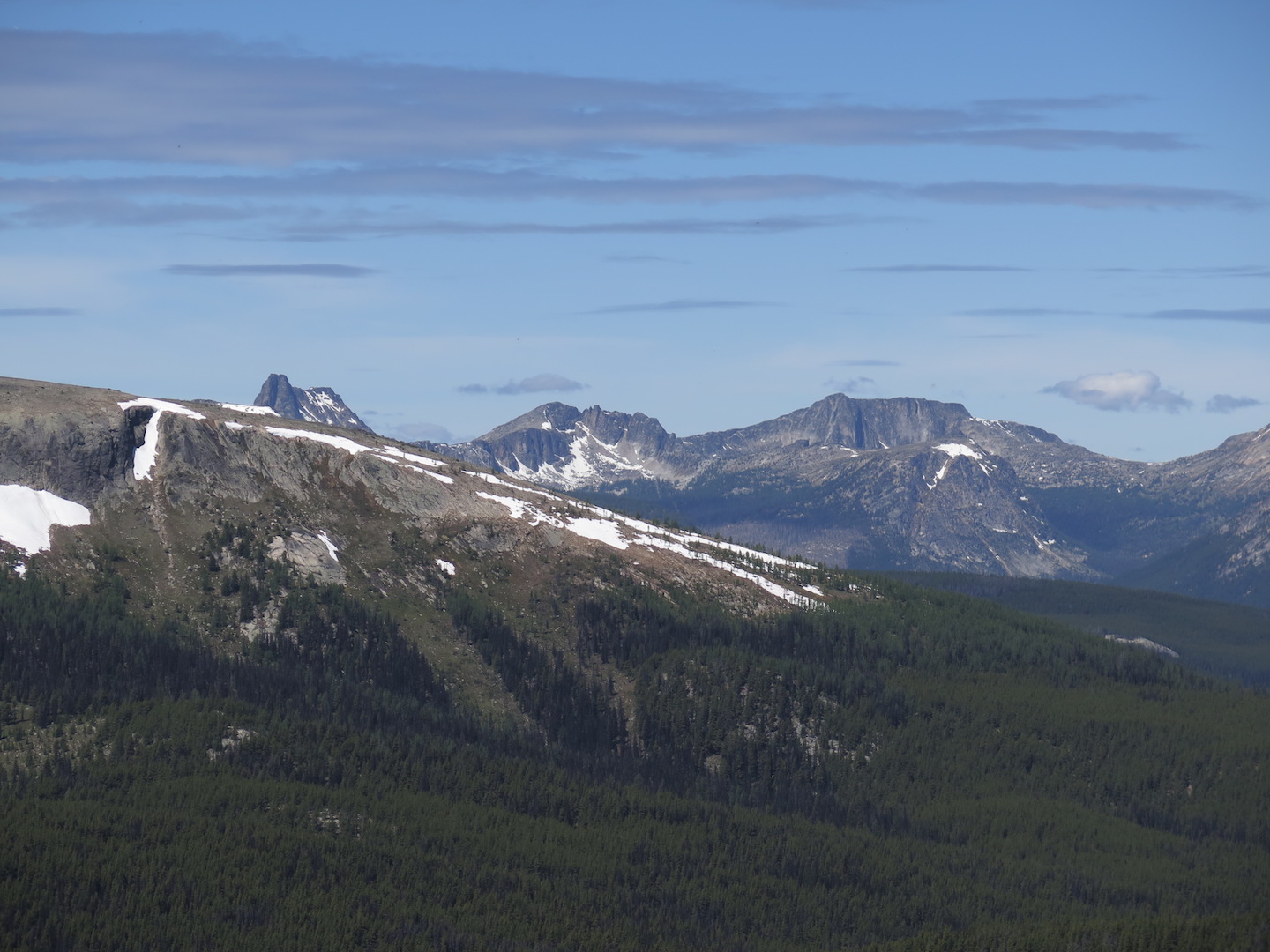
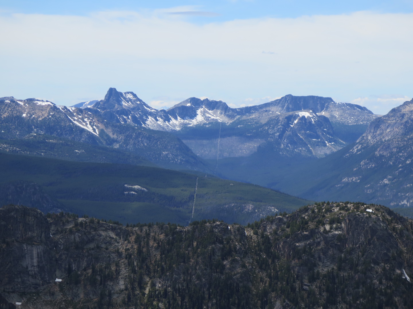
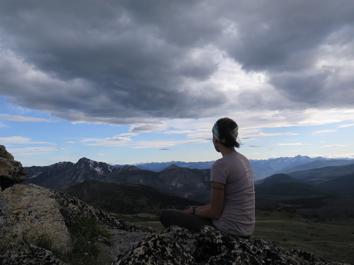
We sat a while on Rock Mountain’s summit to enjoy the views. I tried to name the peaks of the North Cascades in the distance but from this perspective, I was failing badly. I’m sure I was looking at Cathedral, Amphitheater, and Remmel mountain but I couldn’t be sure.
To keep from bothering mama coyote and her pup again, we made our descent down a gully on the northeast side of the mountain. It was a steep way down but the footing was good and before long we were back at Louden Lake.
I saddled Jake up with his pack and set off for Armstrong Mountain directly across from us. The hike is a long 1,000’ climb over roughly a mile or so with a few false summits thrown in for fun. The fantastic thing about the Pasayten is the wide open space. There are no trails up these peaks, you just pick a path and go! I chose to climb the spine of Armstrong to enjoy views in all directions. As I climbed, high lenticular clouds formed overhead as well as amazing swirling formations. I’m such a cloud connoisseur that I had to stop halfway up to admire the views.

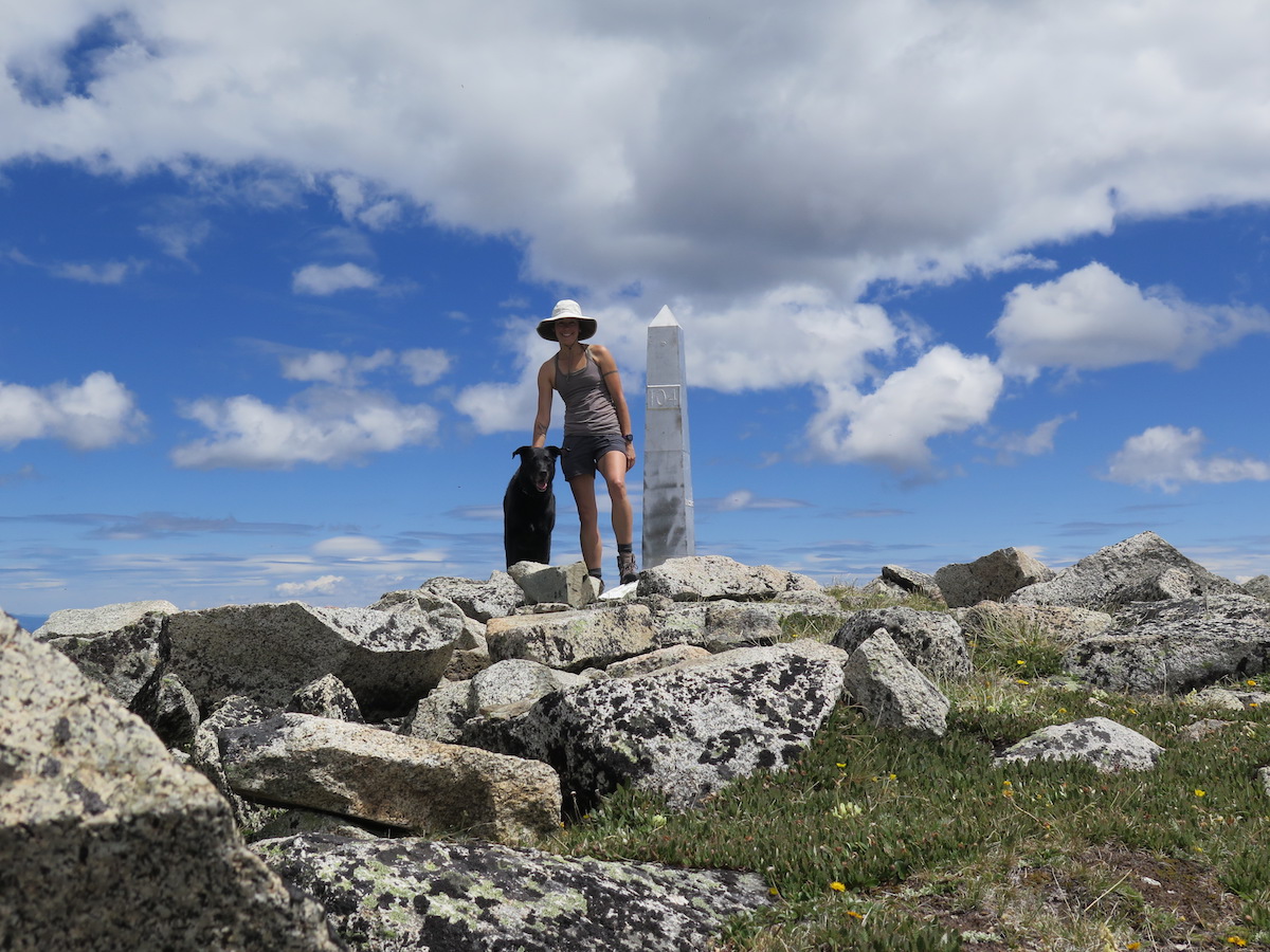
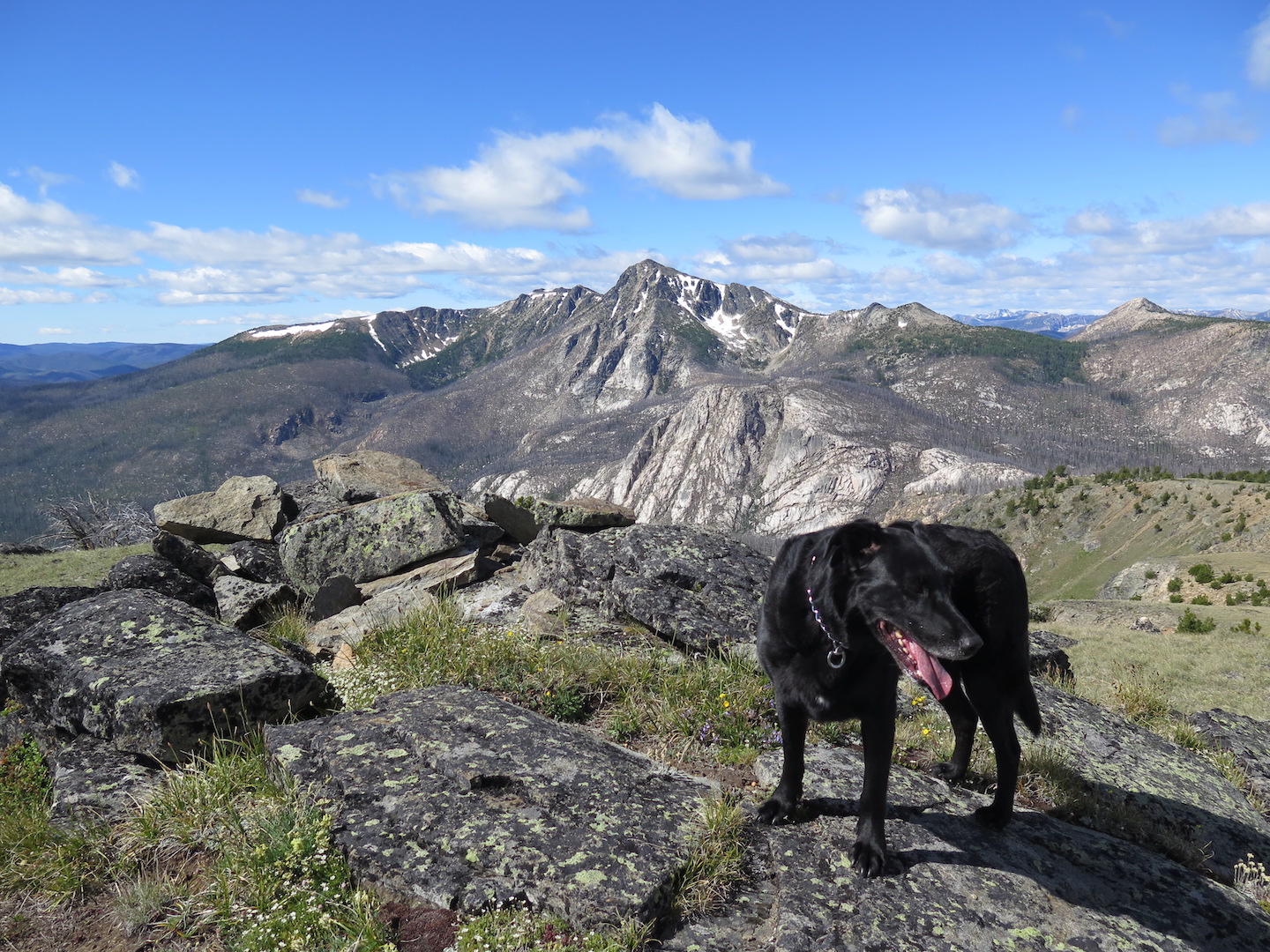
Once on the broad 8,138’ summit we spied the US-Canada border marker in the distance and made our way over. From the top of Armstrong you can look across towards the Snowy Protected Area of BC and over to the jagged peaks of the North Cascades. Some folks have been rumored to hike down to a sparkling alpine lake below, solidly within Canadian territory. I didn’t feel quite so bold, not to mention it would be a steep climb back up! Jake and I instead took a few steps to the other side of the marker and had our lunch in Canada.
Though I saw 5-6 people headed up the mountain ahead of me, we had the entire summit to ourselves. In fact, despite a handful of people camping in the area, the wilderness ranger was the only person I ran into all weekend.
Most impressive from the summit of Armstrong is the huge 20’ clearcut along the forest floor and along every ridge as far as the eye can see. Can you believe this clearcut spans the entire length of the US-Canada border? That’s 5,468 miles! I can’t imagine who in the world maintains it!? It’s a sight to see and every time I looked at it, I could barely believe what I was seeing.
We walked across the flat summit to another border marker, played in a few small snow fields, and then strolled back into Canada to bag what looked like a taller peak not far from the border. I couldn’t resist checking in with my SPOT to prove to everyone that Jake dog had finally made it to Canada!
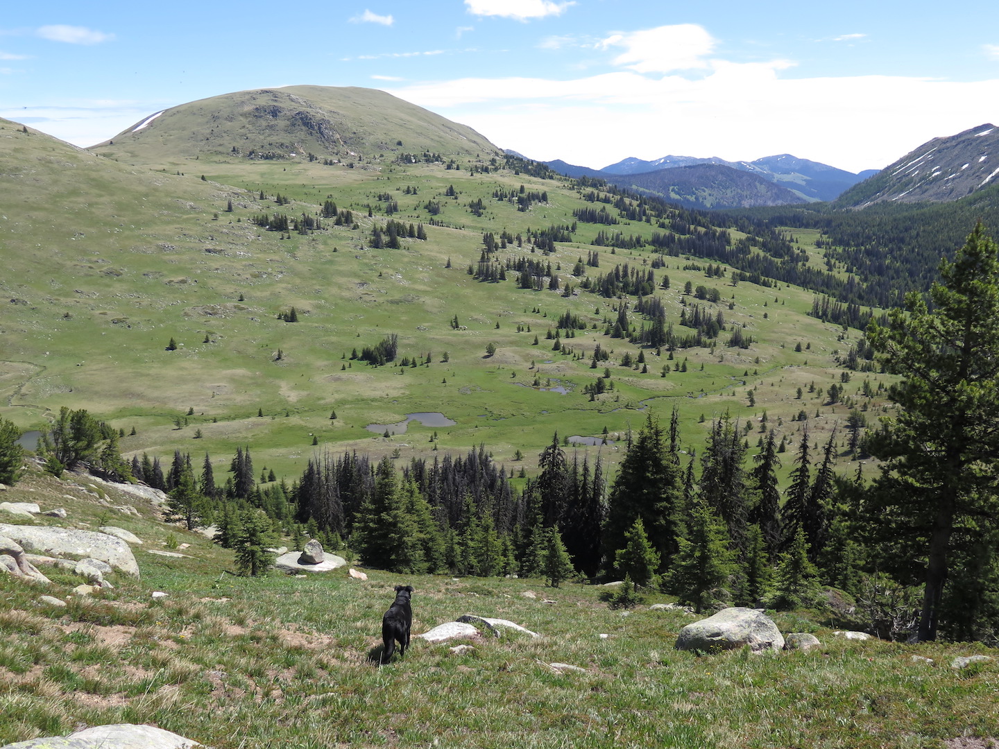
After our summit fun we headed down and returned to camp for a little rest break and second lunch. It was clear the mosquitoes weren’t going away so around 5:30pm Jake and I headed out once again to bag our 3rd peak of the day, Horseshoe Mountain. We hiked out a mile to Sunny Pass, took a left up the Albert Camp trail for roughly a mile, then headed cross country to the top of Horseshoe Mountain’s 7,956’ summit. All of this wide open, trail-free space and scrambling is a dream come true, not to mention the lack of crowds.
We watched clouds thicken from the summit before making our way down and calling it a day. On the way back to camp I passed the wilderness ranger again who told me that high winds were forecast for the evening and that I should make sure to prepare accordingly. Not a surprise given the cloud conditions from earlier. We chatted a bit, me telling him about climbing Rock, Armstrong, and Horseshoe and my coyote encounter, he telling me about how he used to climb these peaks back in the day because it was the only place to get a radio signal to the Forest Service. I can only imagine the stories he has to tell!
Both Jake and I slept soundly that night and it wasn’t until nearly 2am that I heard wind ripping through the trees and down into the basin. Luckily I had found a very sheltered campsite and though winds howled up to 30mph overnight, I felt little of it. I love the wind and Sunday morning I sat outside with my coffee and breakfast, feeling the wind on my face, hearing it rustle the trees, and loving that it was blowing away all the obnoxious little mosquitoes.
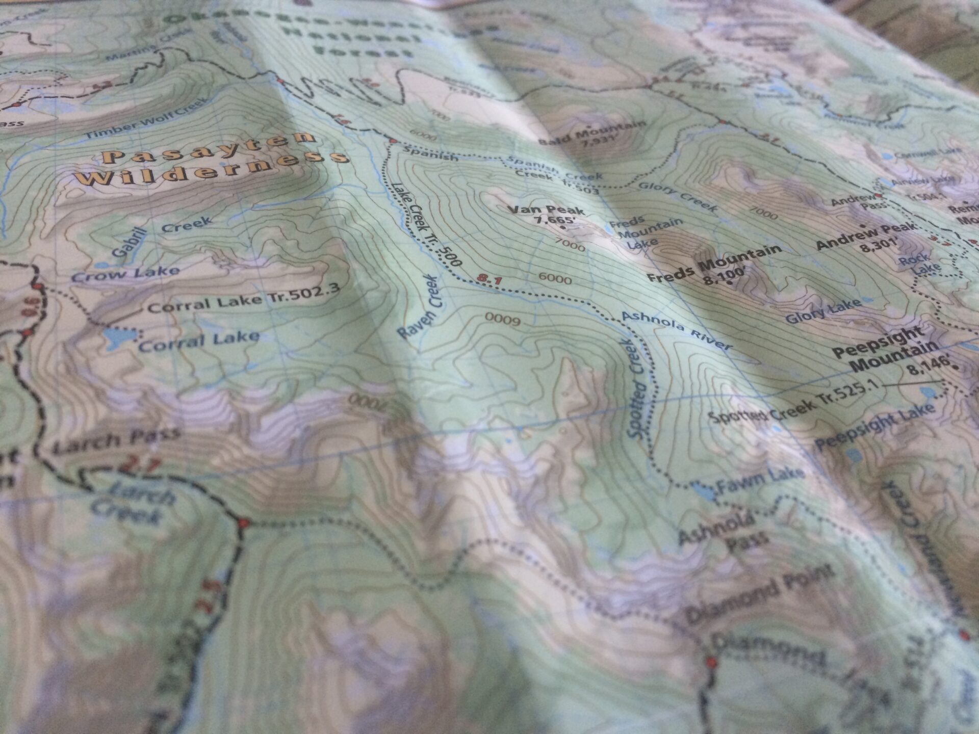
I slowly broke down camp, wishing I had brought another day of food to stay a 3rd night. There was the trail to Goodenough Peak to explore as well as territory beyond Rock Mountain out towards Haig Mountain. Every time I looked at my map there was another peak to climb or another area to explore. It was endless out here!
I had considered hiking back to the trailhead over Windy Peak and taking a short detour to also climb Topaz Mountain, but the ranger let me know that a small bit of snow remaining on the top of Windy made for a tricky crossing. I decided not to risk it and chose to hike out the way I came.
On Sunday morning, Jake and I waved goodbye to the basin and hit the trail back to Sunny Pass, dropping our packs there to easily scramble to our last and 4th peak of the weekend, 7,620’ Pick Peak. Once on top, Pick was my favorite. Maybe it was the basin spread out below, the broad flat summit to explore, the fact that I could see the 3 peaks in front of me I had climbed the day before, or that the rocks were perfectly arranged for lounging. Whatever it was, Jake and I lingered on top for nearly an hour, soaking up the views, the beauty all around, and the epic silence. I watched two separate couples backpacking out on the trail below, wondering if they could see me up there.
What do I love most about climbing mountains? Every one has a unique perspective and a different story to tell. No two are alike. Each of the 4 peaks I climbed over the weekend were separated by two miles at most yet each was completely different from the other. Washington State has such an unbelievable variety of terrain and Horseshoe Basin is a unique gem unlike anything else in the state.
Sometimes I feel conflict when I write about places like this. What makes the Pasayten especially grand is its solitude and isolation. Just look at the PCT as an example. Years ago it was a quiet thru-hike and now it’s become a popular hiking highway. I sometimes wish to keep quiet places all to myself so they never get discovered, but the truth is that secret places don’t really exist anymore. Everything has been discovered. There’s also an excitement I get in introducing people to truly amazing places.
Though I’m sure more people will eventually visit the Pasayten, the fact remains that it’s a long drive from everywhere and it takes a certain ambition to venture into its wilderness. I think the Pasayten invites those more interested in history and exploration than those with an end-to-end goal.
Once you visit Horseshoe Basin you never want to leave, that much is true, and I certainly left a little piece of my heart there last weekend. An explorers paradise, every single peak and meadow of this amazing wilderness has quite a story to tell. I can’t wait to come back and discover more!